Showing posts with label BMW. Show all posts

Saturday, May 29, 2021

Back on the road in 2021

We started our first long-distance motorcycle trip in almost a year today, and it felt fantastic to pack up the BMW and ride 376 miles from our home in Prescott, Arizona to Farmington, New Mexico. It's the first day of a 2-week trip that will take us to the Denver area to visit our sons, South Dakota, and then - well, we're not exactly sure where we'll head next. 

We headed north from home on AZ 89, picking up I-40E for a few miles to Flagstaff where we once again turned the BMW north on US 89. We were a bit surprised to see snow at the north-facing top of the San Francisco Peaks in Flagstaff. Named for the Franciscan friars who were doing missionary work in this area in the early 1600's, the San Francisco Peaks are a volcanic mountain range with the highest point in Arizona - Mt. Humphrey's at 12,633'.


We rode through the Navajo Nation the majority of the day, turning east on US 160 and stopping at a Subway in Kayenta for lunch. Due to COVID-19 restrictions there is no in-person dining, so we found a spot of shade outside and enjoyed our lunch.


We can't remember the last time we rode on 160E past Kayenta, and enjoyed watching the changing scenery and the far-off distant vistas.


We picked up US 64E and then just a few miles further crossed the state line into New Mexico. We're still in the Navajo Nation, which covers over 27,000 square miles in four states:  Arizona, New Mexico, Colorado and Utah. 


 There was almost no traffic on this stretch of asphalt, and we were excited to see the odometer turn over to 30,000 miles. We've had the BMW for a bit over 3 years and are looking forward to many thousands more miles.


We passed a few herds of cattle and saw a small herd of horses off to the side of the highway taking shelter from the mid-day sun under the rock overhang in a wash. There weren't as many motorcycles as we expected, and much of the time we enjoyed the road to ourselves. Riding through the Southwest is a lesson in vast spaces, long distances between often very tiny towns, and lots of open road. Tomorrow we'll head into Colorado and are looking forward to the Rockies.


Sunday, May 26, 2019

224 miles on the BMW on familiar roads with some surprises


I'm going to start by describing the end of our 224 mile trip today, from our home in Prescott to Wickieup, AZ for lunch (there's a surprise here) and home on some of our favorite roads. As we were heading into Skull Valley getting close to Prescott Mike told me he had a surprise:  the largest cottonwood tree in Arizona. To be exact, this is a Freemont cottonwood, named after John Freemont who was an explorer and governor of Arizona in 1878. This particular tree was planted in 1917 along with 3 other cottonwood trees to mark the corners of a 2-acre plot of land. You can see Mike, who is 6' tall, standing in front of the tree with his arms outstretched. This tree is almost 47' around, so it would take Mike and 8 other similar-size people to join hands and circle this tree.

Back to the beginning of our trip. The weather is cooler this year than usual, so we decided to ride in an area that is usually too hot the end of May:  Wikieup in the Big Sandy Valley in the Mohave desert. Wikieup is the Mohave Native American word for shelter or home. It's a small, fairly bleak stopping point on US 93, the major road between Phoenix and Las Vegas. Our reason for riding to Wikieup was to finally enjoy lunch at Lucia's, famous for homemade food and pie. First surprise of the day - Lucia's is closed on Saturdays.

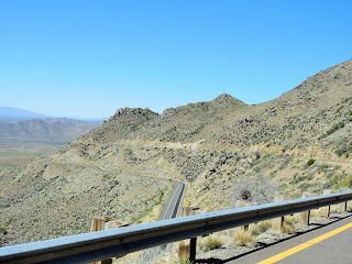
We started our ride heading south out of Prescott, through the Bradshaw Mountain twisties on AZ 89. We were thrilled at the lack of traffic in front of us so Mike could zoom around the hairpin turns. As we continued south we rode out of the pine forest and through rocky countryside.


Even though we're in the desert, because of all the rain and snow this Winter and Spring there is a lot of green and blooming desert flowers and cactus. One of our favorites is the ocotillo, a shrub with spiny stems which is not a surprise because every plant in Arizona seems to have spines or spikes.


Look carefully and you'll see the bright red flowers on the ocotillo.

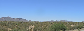
We rode 89 south down in elevation to Congress where we turned onto AZ 71 which took us to US 93 North. We celebrated with a little motorcycle dance when our odometer rolled over to 14,000 miles. Eventually this will be all 4-lane divided highway, but currently there are large sections of 2-lane paved roads. We rode through the Joshua Tree scenic byway where both sides of the highway are covered with the iconic Joshua trees.


The Mormon settlers named these spiny trees because it reminded them of the bearded biblical leader Joshua. Governor Fremont - the same one I mentioned earlier about the cottonwood tree - called them "the most repulsive tree in the vegetable kingdom". We love that they're only found in the Mohave desert and have adapted beautifully to the desert environment.


When we discovered Lucia's was closed on Saturdays, we backtracked to Dazzo's Chicago Style Eatery which Mike thought featured German food. It turns out they feature Chicago-style hot dogs.


We came home on one of our favorite roads, AZ 96 East which is a sweeping 2-lane paved road with several sections of roller coaster hills that make my stomach go up and down. It's been recently repaved, and the riding was fantastic. This part of Arizona is covered with saguaro cactus.

We followed AZ 96E to Yavapai County 15 to Kirland, and then north on Yavapai County 10 through Skull Valley and more twisties in the Prescott National Forest. I lost count of the number of cattle guards we rode over; you know you're on little-traveled roads basically in the middle of nowhere when cattle guards are a regular feature.

We love to ride to new places and explore areas we've never seen, but it's also fun to enjoy a ride close to home on familiar roads. You never know what surprises might lie around the next bend in the road.


Follow our route here:  https://drive.google.com/open?id=1VjDGSYOt630NB0ktEeSOb9qJrzgfIw5M&usp=sharing  To find the cottonwood tree, in Skull Valley turn east onto Old Road N at the railroad tracks, and the tree is about 1/2 mile down the road.

Sunday, July 1, 2018

BMW ride on a hot day for pie

We decided the hot weather - temperatures in the high 90's today in Prescott - wasn't going to stop us from riding the BMW. The question was:  where to go? Flagstaff, at 7000' feet elevation is cooler, but we didn't have enough time today. Going south to lower elevations where the temperatures would be well over 100 degrees simply wasn't option. We decided to ride on familiar roads to a new destination:  pie in Wikieup.

Bright, Arizona blue skies and twisty 2-lane paved roads with almost no traffic made this a zen-like ride. Usually we see several groups of motorcycles on this route, but today we saw only one other bike, a Harley, which we quickly passed.


We headed west on Iron Springs road out of Prescott, riding through the Prescott National Forest. We're currently in Stage II fire restrictions which basically mean we can't do anything that might cause a spark:  campfires, charcoal fires, outdoor smoking, operating equipment like chainsaws, and even our town's 4th of July fireworks have been cancelled. All the vegetation is various shades of brown, with a few green bushes scattered around as a reminder that once the monsoon rains start, the desert will come to life again.

Iron Springs road becomes Yavapai County Road 10, and we periodically ride across cattle guards. Instead of miles of fences to keep cattle off the road, cattle guards are basically a series of metal pipes laid across the road over a ditch. When cattle (or people with smaller feet, like me) try to cross, their legs fall into the openings between the pipes and they are stuck. Cattle learn not to cross cattle guards, and I've learned to walk around them.

In Kirkland we turn right onto AZ 96 west, with the highway snaking through the mountains. It seems like we would be climbing higher in elevation, but actually Prescott is at 5500' and we descended through Skull Valley at 4260', Kirkland at 3900' and Hillside at 3850'. A few miles past Hillside we turned onto AZ-97 south for about 14 miles. This is one of our favorite motorcycle roads, reminding us of a roller coaster as we zoom down hills through areas marked 'do not enter when flooded', then zip back up the next hill. There are no straight stretches of road here, and we see only one car over the 14 miles of up and down, twisty fun.

AZ-97 takes us to US-93, a 4-lane divided highway which is the main road between Las Vegas and Phoenix. Luckily we only have about 30 miles to ride through the Big Sandy Valley in the Mohave Desert to Wikieup, a town of less than 200 residents. Wikieup is a Mohave word for 'shelter' or 'home'. In the winter, hundreds of RVs make their home here, but today it was 102 degrees and there were no RVs in sight.

We stopped at the Cool Water Cafe, part of the Hidden Oasis RV Park for lunch, sort of on purpose. I had heard that there was a great restaurant in Wikieup with amazing pie, and when Mike googled restaurants in Wikieup he found the Cool Water Cafe advertising pie and thought this was it. After all, how many restaurants can there be in the tiny town of Wikieup? (apparently there are 5). I saw a sign for Luchia's 4 miles down the road and realized THIS was the restaurant I'd heard of. It was hot, we were hungry, and the Cool Water Cafe had pie. We made a quick decision to stop and enjoyed our lunch of a sub for Mike and panini for me, with homemade blackberry pie for dessert. We were the only people in the Cafe and chatted with the owner about the numerous solar-powered bobble heads on the window sill next to our table as she made our lunch.


After cooling off with ice cold water and lemonade in the air-conditioned cafe, we retraced our route, climbing from 2000' elevation in Wikieup back to the cooler 5500' elevation in Prescott.


At one point today Mike said it felt like he was riding through hot air powered by a hair dryer, and I said it felt more like a convection oven. We're not about to let the heat stop us from enjoying the BMW and the Arizona countryside. Especially when there is pie involved.


Sunday, September 17, 2017

Local, familiar rides

We spent 5 days riding a BMW in Ireland last month, and while we thoroughly enjoy riding and exploring new places, this weekend we decided to ride a familiar loop near home. The summer monsoons have ended, and while a few puffy white clouds gathered over the Mogollon Rim, we had clear weather for the afternoon. The end of summer monsoons also means cooler temperatures, so instead of wearing my vented light-gray motorcycle pants and a cooling neck wrap, I opted for standard black motorcycle pants and both warm layers to my motorcycle jacket.

We rode a favorite loop:  north on I-17 for a few short miles to the General Crook Trail exit, where we hooked up with Arizona 260 heading west. General George Crook fought for the Union Army during the Civil War, and after that war, like so many career soldiers, was stationed in the southwest. In 1871 he established a supply route that connected forts Verde (Camp Verde today, where we exited the interstate), Apache, and Whipple (now home to the VA Hospital in our town of Prescott).

When we exit I-17 and turn onto 260 West we're treated to views of the Mogollon Rim, an escarpment of limestone and sandstone that rises 4,000 feet over the landscape to the south. Route 260 winds and climbs onto the Rim, with the temperature dropping 20 degrees as we gained elevation. We sometimes see bighorn sheep on the hills alongside the road, but today our primary company were several groups of motorcycles heading to an event in nearby Cottonwood.

We turned northwest onto 87 for a short distance, and then headed more directly north onto Lake Mary Road. We passed several trucks carrying quads used in hunting, and even saw a couple of elk in the back of pick-up trucks. Mostly we rode through forests with open meadows carpeted with green grass from the summer rains.


One of the grassy meadows is technically Mormon Lake, but the only water today was a large puddle perhaps the size of our house's footprint surrounded by boggy grass. Mormon Lake is the largest natural lake in Arizona, which says a lot about the water supply in our high-desert home.

Lake Mary, on the other hand, always has enough water for fishing and boating. That's because it's a reservoir, actually two reservoirs, built in the early 1900's for drinking water to supply Flagstaff.


We didn't realize that there is a significant paving project on Lake Mary Road, and passed the time while we were stopped on the now one-lane road talking with another motorcycle rider. We swapped stories about the amount of time we've spent stopped for construction, riding in the rain and hail, and favorite local roads.


Lake Mary road eventually became a busy road when we reached Flagstaff, where we stopped at Tourist Home Urban Market for a fantastic lunch which included wild blueberry pie and a large loaf of pizza bread that we brought home.

The best part of the trip over, we chose the fast way home, riding south on I-17. At least the scenery is some of Arizona's finest - the red rock formations of Sedona framed by the white sandstone and limestone cliffs that I-17 climbs and winds through.

We've ridden this way several times, and each time I'm awed by the wide-open views, hawks lazily circling on the updrafts in the sunny blue sky, and the winding highway that leads us through scrubby high desert into the ponderosa-covered mountains. Every day we're on the BMW is a day to be treasured, even a familiar ride close to home.

Tuesday, July 5, 2016

Riding the Pacific Coast Scenic Byway

After spending the weekend in Portland, Oregon, we started on our trip home today. To get out of Portland quickly, we took 405 to Interstate 5 south, turning onto 99 West past several of the more than 400 wineries in the Willamette Valley wine region. The traffic thinned out and as we rode through rolling hills in western Oregon.


We started the day with cool temperatures in the low 60's and overcast skies, which was a welcome change from the hot days we've experienced so far with temperatures in the 90's. Part of Route 18 winds through the Van Duzer Scenic Corridor, where the 2-lane road twists and curves up and down through the pine forest.


When we turned onto 101 South, the Pacific Coast Scenic Byway, the sun came out and the clouds vanished, but the winds off the Pacific kept the temperatures in the 60's. Route 101 stretches for 363 miles along the coast of Oregon, but we bypassed the most northern portion, starting in Lincoln City where we were excited to see our first views of the Pacific Ocean.


Route 101 hugs the coastline, sometimes on top of high cliffs, and at other times heading inland winding through the pine forests. We stopped at one of many scenic lookouts to get an even better view of the waves crashing onto the rocks.


We crossed several bridges on Route 101, with one of the most beautiful the Yaquina Bay Bridge, built in 1936.


Much of this area is thickly forested, with Route 101 twisting through the Siuslaw National Forest and the Cape Perpetua scenic area that begins at Waldport and extends for 40 miles south.


We stopped in Florence for lunch, and as soon as we were south of town were stopped for 45 minutes by a paving project that had traffic backed up for miles. I counted 291 cars waiting for their turn to pass through the one-lane construction area. This area is part of the Oregon Dunes, where the sand dunes can be 500' tall and stretch 2.5 miles inland.


101 Winds further inland, running between Coos Bay and the Pacific Ocean. Coos Bay is home to 6 marine terminals able to handle deep-draft, ocean-going ships. Many of the ships carry wood products from the local forestry industry.

We ended our trip today once again riding along the coast, watching the spray from the crashing waves fill the air with mist to our right as the road hugs the cliffs to our left.


We're spending the night in Gold Beach, where had a fantastic dinner at Spinner's Seafood Steak and Chophouse, and ended the evening watching the sun set from the beach outside our hotel.


Wednesday, June 29, 2016

Green hills in Montana

It's the 7th day of our BMW motorcycle ride from our home in Prescott AZ to Portland OR. We decided on a shorter route today, starting from Bozeman, MT and ending 265 miles later in Missoula, MT. We started on Route 191 South, then turned west onto route 84, riding through irrigated green fields with white-capped mountain ranges in the background.


Turning onto Route 287, we rode through MacDonald Pass at 6312' on the Continental Divide west of Helena. Originally known as the Frenchwoman's Road because it was a toll road run by the wife of a French Canadian, today it's the primary paved road through the area.


In Townsend, Route 12 joined Route 287. We crossed over the Missouri River, and then along Canyon Ferry, where the Louis and Clark expedition traveled. As we rode along, I like to imagine that not much in the scenery has changed since this expedition over 100 years ago.


Traveling in the Southwest means covering sparsely populated long distances, It was after 1pm before we found a place to stop for lunch, the Dinner Bell in Gold Creek. Run by a local Mennonite family, the Dinner Bell deli offers a variety of sandwiches on homemade bread and a picnic table on the porch outside to enjoy lunch.


We finished today's ride with temperatures in the mid-90's as we made our way through numerous stoplights to our motel in Missoula. The odometer on the BMW rolled over to 42,000 miles today, and we easily have another 2000 to travel before this trip ends.

Tuesday, June 28, 2016

Twisties and sweepers through the Rocky Mountains

A long day on the BMW is worth it when we get to ride through hairpin turns and long sweeping turns in the Rocky Mountains in Colorado.


We started the second day of our trip in Farmington, NM and quickly crossed into Colorado near Durango. We stayed on US Route 550 heading north, winding and twisting our way on the Million Dollar Highway that runs through Silverton to Ouray.


The 2-lane, narrow road, lack of guardrails, steep drop-offs and jaw-dropping scenery make this one of our favorite rides.


Gold was mined here in the San Juan Mountains with 13 peaks that top 14,000'. This area likes to call itself the "Switzerland of America" because of the steep, forested, and snowy peaks.


Once we passed through Ouray we continued north on Route 550 into Montrose, passing through a wide, green valley along the Uncompahgre River.


In Montrose, we turned east on US Route 50, a ride we've done several times. Route 50 runs along the Gunnison River and the 20-mile long Blue Mesa Reservoir.


We rode through steep, craggy gorges that opened up into wider valleys, and spotted several rafts zooming down the rapidly running river.


We twisted our way up and over Monarch Pass on the Continental Divide in the Sawatch Mountain Range, with panoramic views as we descended down into the valley and along the Arkansas River.


We chose a new route for the final miles north to Denver, starting with 9 North just west of Canon City on the Gold Belt Scenic Byway that runs along the western slope of Pike's Peak where gold was discovered in 1890.

Riding on winding, sweeping, 2-lane paved roads with almost no traffic, we enjoyed views of steep, wooded hills, snowy mountain peaks, and rushing streams.


To get into Denver, we rode the final miles of the day on highways packed with later Friday afternoon traffic. From Denver, you can see the snow-topped Rocky Mountain Peaks that we rode through earlier in the day.

We're spending the weekend in Denver with our kids, and will get back on the BMW on Monday, heading north into Wyoming.


Thursday, April 7, 2016

Three days through the Mojave and Colorado deserts

What do you do when a bee flies up your motorcycle jacket sleeve and stings your upper arm when you are riding about 80 mph on Interstate 10 in southern California?

Luckily we were heading onto the off-ramp in Indio, CA as I hit Mike on the shoulder, took off my jacket, and started shaking it to get rid of the bee. Mike pulled over to the side of the road, the bee flew away, and we finished up the first day of our 3-day trip.

The day started on a much better note:  clear skies, 60 degrees, and we were off on our first overnight trip on the BMW in over a year.


We wound our way south through the twisties on 89S passing through Skull Valley, Yarnell, and into Congress where the temperature climbed into the high 70's as we descended from 5500' elevation in Prescott to 3000' in Congress. We continued southwest on Arizona 71, turning onto Arizona 60 where we stopped for lunch in Salome.


The highway passes through valleys with craggy, rocky mountains on either side. This time of year the dessert seems to come to life, with bright green leaves on the shrubby bushes, orange-red flowers blooming on the tips of the tall ocotillo, and bunches of yellow flowers periodically lining the
highway.


Eventually we had no choice but to turn onto the 4-lane Interstate 10; there simply aren't any other paved roads that head west. We saw narrow 4-wheeler tracks to the side of the interstate that threaded their way through the mountains or at times paralleled the highway, but otherwise there is nothing but wide-open desert.

We crossed the Colorado River into California, and the landscape changed abruptly from dessert into irrigated green fields. As we continued west away from the river, the desert took over once again, now with stands of palm tree trunks with their tops cut off, a barren and disturbing sight.


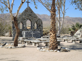
In Chiriaco Summit we pulled off the Interstate to visit the General Patton Memorial Museum, located within the WWII Desert Training Center where over 1 million soldiers trained to be prepared for warfare in northern Africa. We wandered through the indoor exhibits and then outside among the tanks and a small chapel.


A little further west we reached our destination for the night: Indio in the Coachella Valley in the southern California section of the Colorado Desert. According to our Garmin, the elevation was 12' above sea level - no wonder it was in the mid-90's! Even though it's in the desert, due to irrigation there are bright green fields of watermelon, cantaloupe, peppers and eggplant.


The next day we rode into the Joshua Tree National Park, where the Mojave and Colorado deserts meet. Joshua trees, which are actually a type of yucca and not a tree, only grow in the Mojave desert between 2000' and 6000' elevation.


Nearly 558,000 acres of the national park are designated as a wilderness, and we could look for miles across the desert to the mountains without seeing any roads or buildings.


We rode through the park to Keys View where we looked over the Coachella Valley and the San Andreas Fault where the North American and Pacific tectonic plates meet.


Keys View is at 5185' elevation, and as we wound our way north and down through the park, ending up in the town of Twentynine Palms at 2000' the temperature rose from the high 60's to the mid 90's. According to the legends, gold miners in the 1850's named this area after 29 palm trees that grew around the oasis.


From Twentynine Palms we followed Route 62 east, passing a sign at the edge of town that stated "no services for 100 miles" as we rode through the Mojave desert, passing a few abandoned houses scattered along the side of the road.


100 hot and dusty miles later, we crossed the Colorado River into Arizona at the town of Parker, and headed north on Route 95 into Lake Havasu City, our final destination for the day. Lake Havasu was formed by the Parker Dam on the Colorado River in the 1930's to supply water to southern California.


We had about 45 minutes once we checked into the hotel before we left on a 3 hour sunset cruise on the lake, motoring into secluded coves, spotting a coyote along the rocks that line the lake, and watching the sunset.


The last day of our trip we followed Route 95 north to a short ride on Interstate 40 east, then south on Route 93 through the Big Sandy Valley. We passed by the tiny town of Wikieup, a Mojave word for shelter or home. Just south of Wikieup we turned east on Route 97, a 2-lane blacktop road that winds and twists for a few miles through numerous washes and hills, making the road seem like a gentle roller coaster.


We're getting close to home when we reach Hillside and retrace our route from two days ago back to Prescott. Most of this trip was spent in the Colorado and Mojave deserts with a constantly changing landscape depending on elevation and water sources both natural and man-made. At some points the sand along the road reminded me of roads along Lake Michigan in northwest Indiana; we saw several types of cactus and yucca with some blooming in vivid pink, red or yellow flowers; rocky granite boulders pushed up out of the earth by volcanic activity centuries ago; and always the mountains all around us.


 As we unpacked the BMW, we started talking about our next motorcycle trip. We won't let another year go by before we head out again.