Showing posts with label Arkansas River. Show all posts

Saturday, July 22, 2023

Colorado mountains and rivers

 We started the first of a 3-day motorcycle trip today, riding east from Pagosa Springs on US 160E, riding over Wolf Creek Pass in the San Juan mountains over the Continental Divide. We rode this route in reverse last Sunday, so check out that post for photos of the twists and turns up and over the mountains.

Once in Del Norte we turned north on CO112, riding through the San Luis Valley, one of the largest high altitude (about 8,000') valleys in the world and home to ranches and farming.


It's the end of July, but riding at this altitude the temperature is comfortable in the mid to high 70's. When we reached Saguache (derived from a Ute word that means sand dunes, referencing the nearby Great Sand Dunes National Park) we turned onto US 285, continuing to head north through the San Luis Valley.

We rode over Poncha Pass, at just 9,010' one of the lowest passes in Colorado. Winding down the north side of Poncha Pass we came into Poncha Springs, and stopped at the Flamingo food truck for lunch just as it started to rain. This is a do not miss stop - delicious food and friendly people. Luckily there is an indoor place to eat, and by the time we finished lunch the rain stopped.


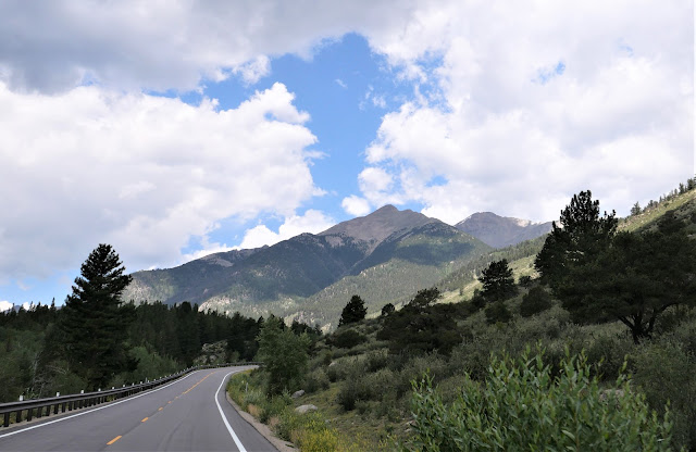
We turned east on US 50 to ride through Bighorn Sheep Canyon along the Arkansas River. This was our first time riding the BMW through this area, and the twisting road along steep rocky cliffs and clear water was a ton of fun - even though we didn't see any sheep.


Just past Parkdale we left the Arkansas River and turned north on CO 9 and climbed out of the river valley into South Park, one of three high altitude basins in Colorado. 


We rode 280 miles today, twisting over mountain passes and through river valleys, ending up on a straight road at over 9,000' elevation with views of snowy Rocky Mountain peaks in the distance. Our stop tonight is in Fairplay, founded in 1859 as part of the Pike's Peak Gold Rush. You can still pan for gold in the Middle Fork of the South Platte River that runs through town. We've ridden through Fairplay several times, and this will be our first time staying here.

Tomorrow our route will take us over more mountain passes through the heart of the Rockies. We're looking forward to it!


Saturday, August 1, 2020

Riding over the Continental Divide - twice! - on the BMW in Colorado

Our 6th day on the BMW was all in Colorado for another day. We started in Yampa and wound our south through a wide, green valley on Colorado 131.


Soon the road started climbing in elevation and the wide, sweeping turns became tight twisties.


After climbing to over 9000' we descended down more twisties, with the Colorado River to one side.


131 ends at I-70, and we rode east on the Interstate for about 20 miles before we turned south on US 24, part of the Top of the Rockies Scenic Byway We started climbing again, twisting around the tight hairpin turns up Battle Mountain. We saw dozens of bicycle riders grinding their way up, or zooming down, the steep mountain grades.


We crossed the Continental Divide at Tennessee Pass at 10,424' and continued downhill to Leadville at 10,152'. Leadville is an old silver mining town, and in the late 1800's it was the second largest city in Colorado, after Denver. Today it's home to about 3,000 people but is often filled with mountain bikers, hikers, and runners.

US 24 south of Leadville has more wide, sweeping turns than tight, narrow twisties as it descends along the Arkansas River.


We stopped for lunch at a food truck in Buena Vista and ate sitting  our delicious meal at a picnic table at a shady park in the center of town. Rested and fueled, we headed out county route 306 to Cottonwood Pass, the highest paved road over the Continental Divide.


We twisted and zoomed through the hairpin turns, rising over the treeline to 12,126' at the Continental Divide where we looked out over the Rocky Mountains. The descent toward Altmont was more sweeping turns than twisties and it was a lot of fun looking down the mountain at the winding road in front of us.


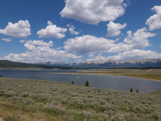
County route 306 intersections with county route 742 at the Taylor Park Reservoir. This is more open range country, and once again we saw a cow and her calf next to the side of the road.


The Taylor Park dam was built in 1937 to provide a consistent source of water for ranches and farms. Today it's a mecca for fisherman and boaters.


We followed the Taylor River as we continued to descend from 9,000' at the reservoir toward Gunnison, our stop for the night.


Gunnison is a town of about 6,000 people at 7,700' elevation on the Western Slope of the Rockies. We spent almost all of the day above 7,000' and rode past some of the highest peaks in the Rockies. We're off again tomorrow to explore more of this gorgeous state.

Tuesday, June 28, 2016

Twisties and sweepers through the Rocky Mountains

A long day on the BMW is worth it when we get to ride through hairpin turns and long sweeping turns in the Rocky Mountains in Colorado.


We started the second day of our trip in Farmington, NM and quickly crossed into Colorado near Durango. We stayed on US Route 550 heading north, winding and twisting our way on the Million Dollar Highway that runs through Silverton to Ouray.


The 2-lane, narrow road, lack of guardrails, steep drop-offs and jaw-dropping scenery make this one of our favorite rides.


Gold was mined here in the San Juan Mountains with 13 peaks that top 14,000'. This area likes to call itself the "Switzerland of America" because of the steep, forested, and snowy peaks.


Once we passed through Ouray we continued north on Route 550 into Montrose, passing through a wide, green valley along the Uncompahgre River.


In Montrose, we turned east on US Route 50, a ride we've done several times. Route 50 runs along the Gunnison River and the 20-mile long Blue Mesa Reservoir.


We rode through steep, craggy gorges that opened up into wider valleys, and spotted several rafts zooming down the rapidly running river.


We twisted our way up and over Monarch Pass on the Continental Divide in the Sawatch Mountain Range, with panoramic views as we descended down into the valley and along the Arkansas River.


We chose a new route for the final miles north to Denver, starting with 9 North just west of Canon City on the Gold Belt Scenic Byway that runs along the western slope of Pike's Peak where gold was discovered in 1890.

Riding on winding, sweeping, 2-lane paved roads with almost no traffic, we enjoyed views of steep, wooded hills, snowy mountain peaks, and rushing streams.


To get into Denver, we rode the final miles of the day on highways packed with later Friday afternoon traffic. From Denver, you can see the snow-topped Rocky Mountain Peaks that we rode through earlier in the day.

We're spending the weekend in Denver with our kids, and will get back on the BMW on Monday, heading north into Wyoming.