Sunday, August 20, 2017

Hiking the Dingle Way in Ireland

The primary reason for our 2-week trip to Ireland was to ride motorcycles with Celtic Rider to discover the winding back roads of the countryside. After 5 days sitting pillion on a BMW, I was ready for a different means of transportation - walking. We thoroughly enjoyed a 4-day walking trip with Wonderful Ireland on the Dingle Peninsula in southwestern Ireland.

Our walking trip was just what we love - miles of gorgeous paths through stunning countryside carrying only a daypack; accommodations pre-arranged in small inns or B&B's complete with the Irish breakfast we've come to depend on to jumpstart our day; bag lunches packed by the inn owners; and the day stretching out in front of us. We chose to walk part of the Dingle Way, one of over 30 long-distance walking paths in Ireland.


Day 1: travel from Dublin to Dingle

We took the efficient Irish Rail, or Iarnrod Eireann from Dublin to Tralee and were picked up by taxi for a 1-hour drive over Conor Pass, at 1496' the highest paved mountain pass in Ireland, to Dingle and Emlagh House, our first inn.


We walked around Dingle, a small, lively tourist town on the Atlantic Ocean in the afternoon and enjoyed a seafood dinner to complete our first day.


Day 2:  Dingle to Dunquin, about 15 miles

We knew starting off today would be a long day, so we started off early, walking through the empty streets of Dingle that the day before had been crowded with tourists. Our route today took us on 2-lane main roads, smaller paved minor roads lined with brilliantly colored flowers and bushes, even narrower boreens (grassy paths that are often boggy and muddy, especially when also used by local cattle), and sometimes on single-track through hedgerows so tall I couldn't see over them.


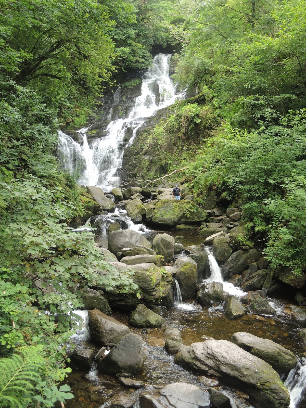
This is a mountainous, rocky peninsula with views of the Atlantic Ocean and the many harbors and bays that dot the jagged coast that made it difficult to choose between watching my footing so I didn't slip in the mud and cow dung, or exclaiming over the ancient stone walls that cover some of the hills, the ever-present sheep, and the views.


A highlight was a 1.5 mile walk along the sandy Ventry Harbor where we watched a few people swimming in the Atlantic while we sat on a rock with our bare feet in the water.


Our route took us on steep climbs over ridges on the shoulder of Mount Eagle where there are seemingly hundreds of clochans, or beehive stone huts, scattered around the brilliantly green fields defined by ancient stone walls, some as tall as I am. We watched the tour busses navigate the narrow 2-lane highway that hugged the coast and were very glad that we were walking high above the road.


We arrived at the B&B in Dunquin after 8 hours of walking, tired and muddy yet excited about everything we experienced. Our host prepared dinner for us since there are no restaurants in Dunquin, and the only pub, operated by an elderly woman, is open only at her whim.


Day 3: Dunquin to Ballydavid, about 12 miles

The wind was so loud during the night that we could hear it thundering against the B&B, and we watched rain coming down hard sideways while we ate breakfast. Luckily, we encountered very little true rain, and mostly sea mist that swirled around us as we set off down a very boggy, muddy and wet path through flowering hedgerows before we joined a narrow paved road.


Our route today took us along a 3-mile stretch of hard-packed sand at Smerwick Harbor, where we could clearly see Ballydavid, our destination for the evening, on the far side of the bay. Even though it was very windy with dark, cloudy skies and rain threatening at any moment, we watched several people happily wade into the ocean and splash around in shoulder-deep water.


Our route today was much flatter so we finished walking earlier than we expected, which of course meant we had time to enjoy local cider at Tigh TP, one of two pubs in this small town that hugs the coast. The building that housed our lovely B&B is also home to the local post office, and at breakfast the next morning we watched the horse next door and the ocean out the front the window.


Day 4:  Ballydavid to An Bothar guesthouse, about 6 miles

Our last day walking is a shorter day so that we can catch the 3pm train back to Dublin. We walked along a grassy path high above the cliffs that border Smerwick Harbor, watching the waves crash against the rocks far below us.


The mud wasn't finished with us, and in fact seemed to be deeper than ever as we slipped and sloshed our way through fields, climbed stiles from one field to the next, and waded through armpit high grass.


The entire 4-day walking trip we rarely saw other people on the path, and waved to local people walking, riding bikes, or running along the paved roads. Today we watched a farmer feed his sheep, guarded by the watchful sheepdog who seemed to dare them to try and get out the open fence gate.


We made it to An Bothar guesthouse with a couple of hours to spare, so Mike and I continued walking down the paved road to the creek where St. Brendan the Navigator supposedly set off on a trans-Atlantic voyage around AD 512-530 with 14 pilgrims to discover the Garden of Eden, which ended up probably being Canada.


We walked into a stiff headwind back to the guesthouse where we enjoyed yet another bowl of Irish vegetable soup and brown bread for lunch before the taxi picked us up for the ride back to the train station in Tralee.

This was our final full day in Ireland, taking us from a quiet narrow path along the coast to loud and boisterous Dublin. We fit quite a lot into our two weeks here and are already planning a return trip in a few years to explore northeastern Ireland and possibly Scotland. There are miles of road in front of us, just waiting to be explored.

Tuesday, August 15, 2017

Finding the craic in Dublin

We're back in Dublin for 2 days before we start part 2 of our Ireland adventure - hiking! While we love riding a motorcycle, it's fun to include something more active as part of our vacation.

Saturday we spent 2 incredible hours at EPIC, The Irish Emigration Museum.  It's only been open about 18 months, and features 20 interactive galleries that explain why millions of Irish emigrated over the years, and how the Irish emigrants influenced other countries, including our own. Mike, Wayne and Colleen have Irish ancestors, and watching the stories of people who decided to leave Ireland due to famine, economics, or lack of opportunities was both heart-wrenching and inspiring as we learned how they created incredible lives for themselves out of often horrible circumstances.

Outside the museum is a group of bronze statues depicting people during the potato famine in 1845-1850 when 1 million Irish died from hunger or disease, and another 1 million emigrated. In 1840 there were about 8 million people in Ireland, and by 1871 after the famine and emigration there were only 4 million residents. The population has been under 8 million since 1840, with current population at about 6.6 million.


Sunday was a busy day with the Rock n Roll half-marathon for me and the 10K for Mike, Wayne and Colleen - the first race ever for Wayne and Colleen! We ran through the streets of Dublin with a band playing about every mile, finishing in Phoenix Park which at 1762 acres is the largest park within any European city. It was established in 1662 as a royal deer park, and there are still deer living within the park. The Irish president and US ambassador to Ireland live within the park, and the park also contains statues, monuments, and the Dublin Zoo.

On our way back to the hotel after the race, we stopped for lunch at the Brazen Head, Ireland's oldest pub. It was established in 1198 and is a delightful warren of low-ceilinged, dark rooms with advertising memorabilia from centuries of beer, whiskey and other types of alcohol on the walls.


In the afternoon we took a tour of Kilmainham Gaol, built in 1796 as the Dublin County Gaol and operating until 1924. It depicts the history of the Irish struggles for independence from Great Britain, especially during the 1916 uprising where 16 of the leaders of the rebellion were executed within Kilmainham Gaol. The uprising and executions eventually led to Ireland declaring independence and the treaty in 1921 that established the Irish free state and Northern Ireland.


We immediately recognized the interior of the Gaol which was used in the original Italian Job movie, and could imagine Mr. Bridger walking down the stairs to the cheers of the inmates. 


We ended Sunday and the weekend with the fantastic Celtic Nights traditional Irish music and dance show at our hotel, where we learned 'lilting' as we attempted to sing along with the musicians and finally figured out that 'craic' (pronounced 'crack') is the Irish term for fun, gossip, and entertainment.

Tomorrow is an early start on the train to southwestern Ireland where we'll hike for 4 days on the Dingle peninsula. We thoroughly enjoy the frenetic pace of Dublin, and are looking forward to some quiet time hiking.

Friday, August 11, 2017

Last day on the BMW in Ireland

The last day of a motorcycle trip contains so many conflicting emotions. We're sad to see the end of our fantastic 5 days on a BMW motorcycle rented through Celtic Rider who put together a brilliant itinerary that took us on the Wild Atlantic Way around southwestern Ireland. We're also looking forward to 2 more days in Dublin before we hike for 4 days on the Dingle Peninsula, a bit further west from our motorcycle trip.

We started our trip 5 days ago on a rainy day, and we ended the trip with equally cloudy skies but with less rain. In fact, it was more of an annoying drizzle and not really rain; it's interesting how my view of 'rain' changes the longer I spend in Ireland.


We wound our way west from Killarney through farm country, seeing more tractors on the roads than we have during the previous days of our trip.


The last 120 miles of our ride today was on M8 and M7, motorways that are generally 2 lanes traveling in each direction, with limited access similar to the interstate system in the US. Before we reached the motorway, we enjoyed the winding, bending, sweeping curves of the local roads, including a few sections where the trees and bushes grow high over the roadway, forming a living tunnel above us.


We pulled into Celtic Rider and were welcomed by Paul, telling him stories about our trip and reliving the highlights. The end of the trip went by so fast - unpacking the bike, packing the suitcase, saying good-bye to Paul and Liam from Celtic Rider. This was our second self-guided trip in Ireland with them, and we're sure it won't be our last. There are still miles of mountains and coastline to explore!

Ring of Kerry on a BMW motorcycle


Image result for king puck statue


Image result for king puck statue


Image result for king puck statue

Today we rode the iconic Ring of Kerry, a 120 mile loop around the Iveragh Peninsula in southwestern Ireland. Yesterday we enjoyed bright blue skies, but that type of weather doesn't last for long in Ireland and today we were thrilled that we didn't need raingear as we rode under cloudy skies.


N71, N70, and N72 are the 2-lane paved, mostly narrow and sometimes really narrow roads that comprise the Ring of Kerry. We road counterclockwise starting and ending in Killarney, with views of the mountains on one side and often the Atlantic Ocean to our left.

Our first stop was the Torc Waterfall in the Killarney National Forest. The waterfall itself is beautiful, but what really struck us were the moss covered trees. We expected a leprechaun to jump out and start dancing around us at any minute.


Soon we were climbing through Moll's Gap, named for Moll Kissane who ran a small pub, or shebeen, during construction of the road in the 1820's. She was popular for selling home-brewed whiskey to the road workers, and the Gap was named in her honor.


We rode this way yesterday in the opposite direction on our way from Kinsale to Killarney, and it was fun to see sheep once again in the middle of the road and on the hillsides.


We continued on into Kenmare, turning onto the N70 and heading west along Kenmare Bay past Sneem where we stopped a few times to let the views of the coast and mountains on the other side of the Bay sink in.


Everything I read said that the section of the Ring between Caherdaniel and Waterville is considered the most beautiful, and we have to agree. We looked out over the beaches and the Atlantic Ocean, imagining life here centuries ago.


After Waterville, the road cuts across the peninsula. Instead of mountains and ocean views, I was mesmerized by the brilliantly colored bushes and flowers that lined the road.


We were warned about heavy tourist traffic, and especially tour buses, but mostly had the road to ourselves except for one close encounter.


We stopped in Glenbeigh, on the northern side of the Iveragh Peninsula, for lunch at Rumour's Bistro where we enjoyed local mussels in white wine sauce that tasted like they had just been plucked from the sea. The next time you're on the Ring of Kerry, make this your lunch AND dinner stop - the food is that amazing.


We hit the worst traffic of the day as we rode into Killorglin, where the annual Puck Fair was taking place. Legend has it that the fair started in the early 1600's, although many people believe it's far older. Puck is actually a wild goat, who is crowned King Puck by a local school girl who is the Queen of Puck. We've been to numerous street fairs in different parts of the world, and this one easily was the largest we've seen, with people parking over 1 mile away to walk to the festivities. We didn't see this year's King Puck, but we did see his statue as we rode past.

Image result for king puck statue

We enjoyed the shorter yet absolutely beautiful ride today, yet it's bittersweet because tomorrow is our last day on our Ireland motorcycle tour. We walked around busy downtown Killarney, listening to street musicians and savoring our last evening in County Kerry.