Showing posts with label Silverton. Show all posts

Friday, July 19, 2024

On the road again

 Today is our first day of a 3-week trip into the Canadian Rockies, down through Glacier National Park, and back home. We originally planned this trip right when COVID hit, which meant we couldn't cross into Canada or west through Glacier. A lot has happened since then - we moved from Arizona to Colorado - and now have the opportunity for this trip.

It's hot this summer so we left home at 7:30am for a 6 hour ride northwest to Grand Junction, CO. On the way through Pagosa Springs we saw four hot air balloons - a fun start to our morning.


The ride on US 160W to Durango is one we make often, and we enjoyed the cool air with temperatures in the 60's. Once in Durango we headed north on US 550, climbing into the San Juan National Forest on one of the most beautiful and incredibly fun motorcycle roads we've ever been on. We passed the Durango & Silverton narrow gauge train along the way.


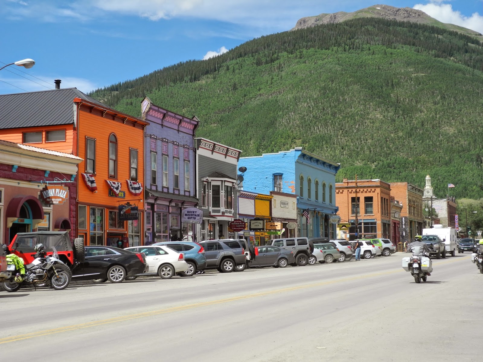
After a quick stop for gas and a snack in Silverton, established in the 1870's during the Colorado mining boom, we started on the 25 mile section of US 550 known as the Million Dollar Highway. Built in the 1880's for supposedly 1 million dollars to connect the two mining towns of Silverton and Ouray, it's a motorcyclist's dream. 


The 12 mile section from Red Mountain through the Uncompahgre Gorge is downright scary - no guardrails, lots of twists and hairpin turns, rocks on one side and a sheer drop-off (remember there are no guardrails) on the other. Mike doesn't get to look around and take in the gorgeous views so I take photos to share with him later.


Once through Ouray - another 1870's mining town - the ride becomes very tame although still beautiful, riding past Ridgway State Park and the park's 5 mile long reservoir as we continued north to Montrose.


We stopped at Backstreet Bagels for lunch on one of the best bagels we've had since we left Vermont 12 years ago, then continued on US 50 west along Colorado's Western Slope through Olathe - famous for fabulous sweet corn.


The temperature was in the mid-90's as we rode along the divided 4-lane highway between the Grand Mesa, West Elk Mountains, and Uncompahgre Plateau. The landscape here is completely different from the jagged mountain peaks in the San Juan mountains.


We were hot and thirsty when we pulled into our hotel on Main Street in downtown Grand Junction, named because it's where the Gunnison and Colorado rivers meet in the Grand Valley. We'll cool off and enjoy the evening before starting Day 2 of trip as we continue north toward Canada.


Tuesday, May 23, 2023

First ride of 2023

 A lot has happened since we last were on a BMW trip: we moved from Arizona to Colorado! We live in the San Juan Mountains in southern Colorado, and are thrilled to watch the deer, elk, chipmunks and birds all around our home.

Today we started a 2-week trip, first heading to Bozeman, Montana to visit our youngest son. We rode 255 miles for the day, first riding west on US 160 out of Pagosa Springs to Durango. 


Pagosa Springs

In Durango we picked up US 550 north, one of our favorite rides through the San Juan and Uncompahgre national forests. I've never ridden south to north, and this is the earliest in the year we've been on this route. There's still a lot of snow after one of the snowiest years on record, and the aspens at the higher elevations haven't yet started to leaf out.


This narrow, 2-lane highway is famous for tight hairpin turns and sheer drop-offs with no guardrails. There wasn't much traffic and we had a lot of fun zooming down the road.

550 goes through Silverton, one of the highest towns in the US at 9,318' and our entrance today to the Million Dollar Highway that runs between Silverton and Ouray. These were originally gold and silver mining towns and today are more famous for the astounding scenery and remote backcountry adventures. 


I had on my raingear from the beginning of the trip to stay warm (temperatures in the 50's and low 60's) but when we spotted rain clouds ahead, we stopped so Mike could put on his rain gear.


I love how small the BMW and Mike look in this photo against the huge mountains!


It was raining as we rode through Ouray, and then the sun came out as the valley opened up. We stopped in Montrose for lunch, and then continued on US 50 west and north toward Grand Junction. It's amazing how quickly the landscape changes in Colorado. We were out of the snow-capped mountains and at lower elevations riding through the Dominguez-Escalante National Conservation Area


We rode through the Uncompahgre Plateau where red-rock canyons and sandstone bluffs dominate the landscape.

As we headed into Grand Junction, Mike had some fun at a stoplight with a guy on a Ninja. They both did wheelies, and Mike accelerated ahead. The power of the BMW!

We're spending the night in Grand Junction on the Western Slope of the Rockies and looking forward to sunny skies and fun riding tomorrow as we continue north toward Montana.


Friday, July 14, 2017

Colorado mountain passes plus rain and hail

Yesterday our ride from home in Arizona to Cortez, Colorado was hot and sunny. Today, on our second day of our Colorado trip, we spent the day dodging rain and hail with temperatures dipping into the low 50's. We were ready for it!


We spent last night at the Retro Inn in Cortez, and said good-bye to the Elvis statue on the front lawn as we headed out of town.

We rode east on 160, passing Mesa Verde National Park, where there are over 600 cliff dwellings that were home to the Ancestral Pueblo people from AD 600-1300. We stayed here several years ago and absolutely loved the ride up to the top of the mesa along the curving road, and the ranger-led tour gave us an in-depth look at the cliff dwellings.


As we rode through the Mancos Valley into the San Juan National Forest, storm clouds starting building in front of us.


160 took us into Durango, where we turned north onto 550 for a motorcyclist's dream ride through the mountains with hairpin turns, curving roads, and stunning views.


The storm clouds kept building as we climbed Coal Bank Pass at 10,640', and then onto Molas Pass at 10,910' where we stopped for a short break.


It started raining soon after we left Molas Pass, and luckily we stopped to put on our raingear before the temperature dropped 15 degrees and it started raining hard. We rode in and out of the rain as we descended into Silverton, an old mining town that is a National Historic Landmark and the southern end of the Million Dollar Highway that winds through the San Juan Mountains from Silverton to Ouray. In the late 1800's this area was prime mining country, and remnants of mining activity are easily visible from the highway.

We've ridden this route before, although never in the rain. The narrow 2-lane highway hugs the mountains on one side and drops off thousands of feet - without guardrails - on the other. I managed to get some video in-between the rain as we headed into Ouray.


Ouray sits at 7,792' nestled in the San Juan Mountains alongside the Uncompahgre River. We stopped for lunch and sat outside on the roof enjoying our sandwiches and watching the traffic on the street below us - until it started to rain again.


550 winds along the Uncompahgre River to Montrose, where we turned east on 50. It was a good thing we kept the raingear on, as we rode through intermittent rain and a couple of spots of hail. It's fun to watch the rain streaming down from the clouds - until we're in the middle of it!


We rode along the Curecanti National Recreation Area, a series of three reservoirs along the Gunnison River. Normally we see numerous boats on the water, but the weather today kept everyone home.


We even managed a photo opportunity during a delay for road construction, and were lucky that the rain held off while we were stopped.


We crested the last pass of the day, Monarch Pass on the Continental Divide at 11, 312' - our highest pass of the day. Storm clouds and rain were all around us as we rode down the Pass into the Arkansas River Valley toward Salida, our stop for the night.


We had been looking forward to this day since we planned our trip since we love this mountain route on the BMW. Tomorrow we have a shorter ride planned to Boulder, where we'll stop for the weekend to visit our kids. Our trip home starts again on Monday - and since we haven't planned our route yet, you'll be surprised right along with us!

Tuesday, June 28, 2016

Twisties and sweepers through the Rocky Mountains

A long day on the BMW is worth it when we get to ride through hairpin turns and long sweeping turns in the Rocky Mountains in Colorado.


We started the second day of our trip in Farmington, NM and quickly crossed into Colorado near Durango. We stayed on US Route 550 heading north, winding and twisting our way on the Million Dollar Highway that runs through Silverton to Ouray.


The 2-lane, narrow road, lack of guardrails, steep drop-offs and jaw-dropping scenery make this one of our favorite rides.


Gold was mined here in the San Juan Mountains with 13 peaks that top 14,000'. This area likes to call itself the "Switzerland of America" because of the steep, forested, and snowy peaks.


Once we passed through Ouray we continued north on Route 550 into Montrose, passing through a wide, green valley along the Uncompahgre River.


In Montrose, we turned east on US Route 50, a ride we've done several times. Route 50 runs along the Gunnison River and the 20-mile long Blue Mesa Reservoir.


We rode through steep, craggy gorges that opened up into wider valleys, and spotted several rafts zooming down the rapidly running river.


We twisted our way up and over Monarch Pass on the Continental Divide in the Sawatch Mountain Range, with panoramic views as we descended down into the valley and along the Arkansas River.


We chose a new route for the final miles north to Denver, starting with 9 North just west of Canon City on the Gold Belt Scenic Byway that runs along the western slope of Pike's Peak where gold was discovered in 1890.

Riding on winding, sweeping, 2-lane paved roads with almost no traffic, we enjoyed views of steep, wooded hills, snowy mountain peaks, and rushing streams.


To get into Denver, we rode the final miles of the day on highways packed with later Friday afternoon traffic. From Denver, you can see the snow-topped Rocky Mountain Peaks that we rode through earlier in the day.

We're spending the weekend in Denver with our kids, and will get back on the BMW on Monday, heading north into Wyoming.


Sunday, July 13, 2014

Discovering Colorado canyons, high mountain passes and mining history on the BMW motorcycle

Rivers, dams, reservoirs, waterfalls, canyons, tunnels, mountain passes, old mining operations, and vibrant mountain towns.

I think we saw just about every type of feature possible in Colorado on our 197 mile motorcycle ride today from Gunnison to Durango. I took more than 150 photos and several videos to try and capture what I saw from my pillion seat on our BMW.

We left Gunnison at 8:30am and headed west on Route 50 into the Curecanti National Recreation Area, a series of three reservoirs along the Gunnison River.


The road sweeps around the reservoirs with views of high mesas and steep, craggy canyons. We turned off onto twisty and winding Colorado 92 at the 390' tall Blue Mesa Dam, the first dam completed on the Gunnison River in 1945. The turbines that provide hydroelectricity are remotely controlled from the Glen Canyon Dam in Page, Arizona.


Route 92 hugs the edges of the canyon to one side and rocky cliffs to the other, occasionally interspersed with meadows, hiking paths, and dirt ATV roads.


Route 92 continues on to the north, out of our way for today's trip. We turned around at an overlook and retraced our route back over the dam, and then continued on Route 50 west to Black Canyon of the Gunnison National Park. As we entered the park I thought that this really wasn't anything special:  green fields with distant views of high mountain peaks. As we drove along the East Portal road, we saw a sign warning about 16% grades and tight turns, and the fun began.


The 2000' tall canyon walls drop at 90 degree angles to the Gunnison River that twists along the bottom of the canyon. We stopped at the lake created by the Crystal Dam and marveled at the Gunnison Tunnel, an 11' by 12' tunnel built between 1905 and 1909 that travels 6 miles from the Gunnison River to provide a reliable source of drinking water to communities in the valley.


We climbed out of the canyon and continued on Route 50 to Montrose, then south on Route 550 to Ouray where we ate lunch on the third floor outside deck of the Ouray Brewery.


 Ouray is located in the San Juan mountains and bills itself as the Switzerland of the US. Originally settled by the Ute Indians, and named for the famous Chief Ouray, miners flocked to the area in the 1870's as part of the gold, silver and zinc mining boom. Unlike mining towns we've visited in Arizona where frequent fires destroyed blocks of buildings year after year, many of the original brick buildings in Ouray still survive.

Ouray is the jumping off point for the thrilling ride up and over the Red Mountain Pass on Route 550, known as the Million Dollar Highway through the Uncompahgre Gorge to the summit. Parts of the road were originally built by Otto Mears in 1883, a remarkable engineering feat in this steep, craggy canyon.


As we twisted and turned around the hairpin curves, we spotted the town of Ouray far below.


Red Mountain is actually a series of three rust-red peaks that get their name from the iron oxide in the rocks.


A few hairpin turns later we came to the viewing area at Bear Creek Falls, where Bear creek drops down to the canyon floor. Look closely and you'll spot hikers sitting next to the cliffs at the bottom of the Falls.


We continued winding our way up the 11,018' pass, passing twisted remains of more than 100 old mining operations along the way. The Idarado Mining Company has been conducting remediation projects in the area since the 1980's to divert water around the toxic tailing piles to keep the streams clear and clean.


It's amazing that this steep, narrow, and twisty pass is kept open all winter. The road reminded us of mountain passes in Europe:  no guardrails, amazingly steep drop-offs from the road to the valley below, and tight hairpin turns.


Once we crested Red Mountain Pass, we had two more passes to cross - Coal Bank and Molas - before we dropped down into Silverton at 9,318' elevation. Silverton plays up its mining history with many original and restored buildings and an old-West ambiance.


We continued on Route 550 into Durango, a busy town on the Animas River where we walked through the historic downtown and watched the narrow gauge train steam in from Silverton. Tomorrow we head south toward home, leaving the green mountains of Colorado behind for the high desert of Arizona.