Showing posts with label navajo nation. Show all posts

Saturday, May 29, 2021

Back on the road in 2021

We started our first long-distance motorcycle trip in almost a year today, and it felt fantastic to pack up the BMW and ride 376 miles from our home in Prescott, Arizona to Farmington, New Mexico. It's the first day of a 2-week trip that will take us to the Denver area to visit our sons, South Dakota, and then - well, we're not exactly sure where we'll head next. 

We headed north from home on AZ 89, picking up I-40E for a few miles to Flagstaff where we once again turned the BMW north on US 89. We were a bit surprised to see snow at the north-facing top of the San Francisco Peaks in Flagstaff. Named for the Franciscan friars who were doing missionary work in this area in the early 1600's, the San Francisco Peaks are a volcanic mountain range with the highest point in Arizona - Mt. Humphrey's at 12,633'.


We rode through the Navajo Nation the majority of the day, turning east on US 160 and stopping at a Subway in Kayenta for lunch. Due to COVID-19 restrictions there is no in-person dining, so we found a spot of shade outside and enjoyed our lunch.


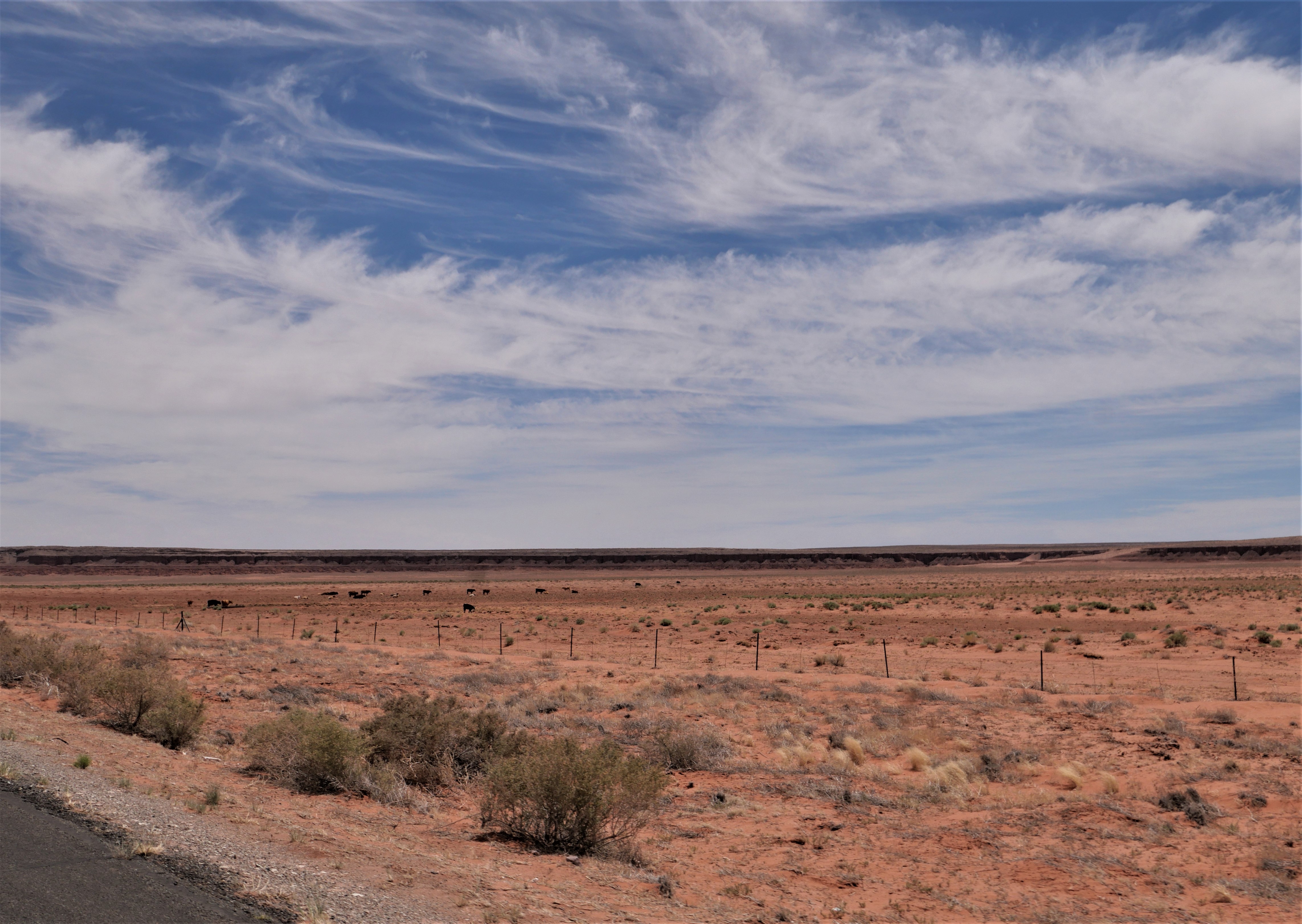
We can't remember the last time we rode on 160E past Kayenta, and enjoyed watching the changing scenery and the far-off distant vistas.


We picked up US 64E and then just a few miles further crossed the state line into New Mexico. We're still in the Navajo Nation, which covers over 27,000 square miles in four states:  Arizona, New Mexico, Colorado and Utah. 


 There was almost no traffic on this stretch of asphalt, and we were excited to see the odometer turn over to 30,000 miles. We've had the BMW for a bit over 3 years and are looking forward to many thousands more miles.


We passed a few herds of cattle and saw a small herd of horses off to the side of the highway taking shelter from the mid-day sun under the rock overhang in a wash. There weren't as many motorcycles as we expected, and much of the time we enjoyed the road to ourselves. Riding through the Southwest is a lesson in vast spaces, long distances between often very tiny towns, and lots of open road. Tomorrow we'll head into Colorado and are looking forward to the Rockies.


Monday, July 27, 2020

On the road again!


Our last long bike trip was 2 years, and we've been looking forward to today for months. We left home this morning on a 3 week trip into Utah, Wyoming and Colorado on a beautiful, sunny July day.

We rode north out of Prescott on I-17 into Flagstaff, then continued north on 89 through the wide open high desert.


Our route led us east on 160, through the Navajo Nation that covers more than 27,000 acres in Utah, Arizona and New Mexico.  This area is part of the Painted Desert where deposits of clay and sandstone were layered by floods, earthquakes, and volcanoes to create stunning, colorful rock formations.


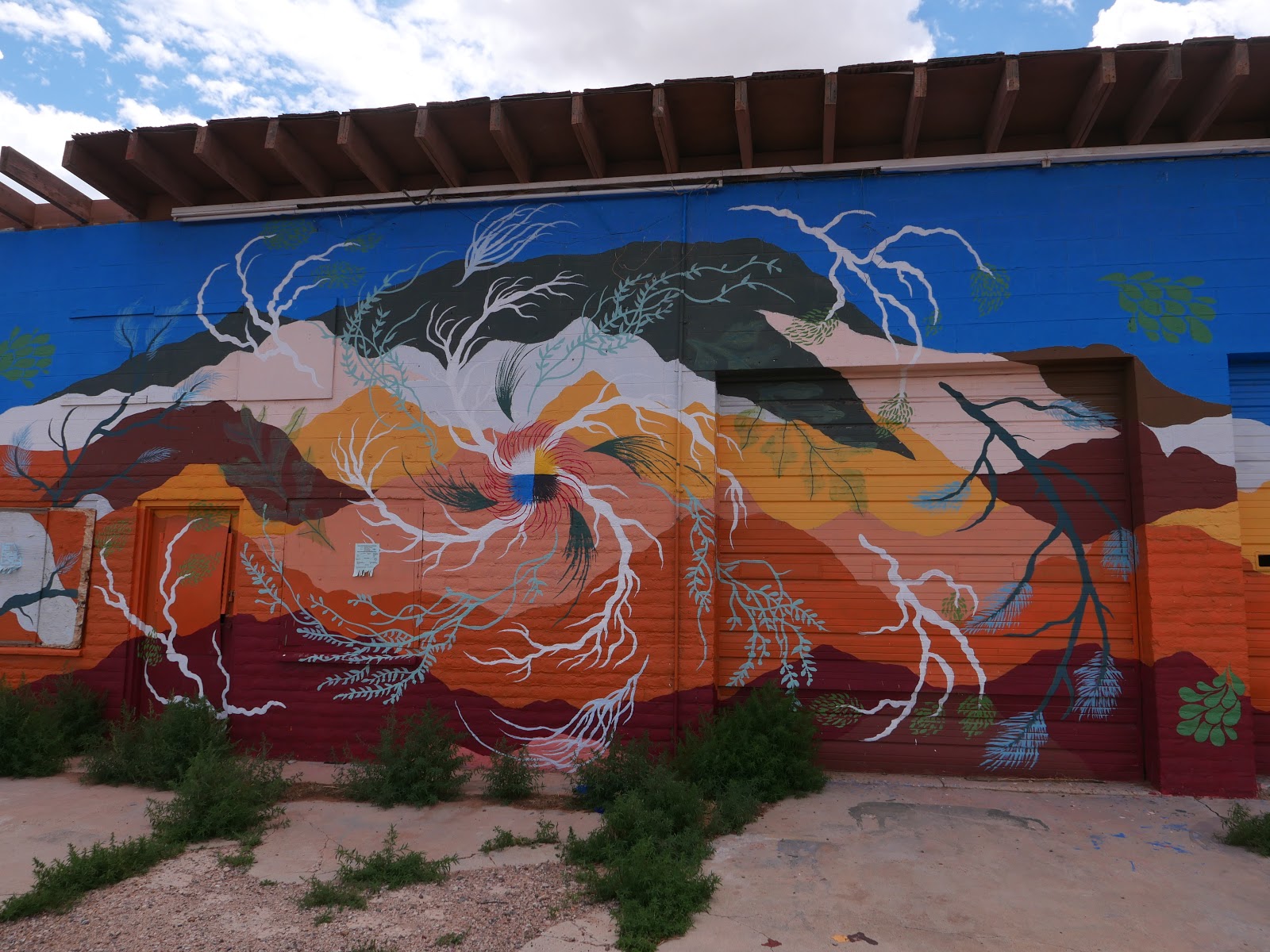
We were also struck by the Native American photos and artwork on abandoned buildings along the highway.


We stopped in Kayenta, a Navajo town on the Colorado Plateau at 5,700' elevation, for a quick lunch at Subway. The Navajo have been hit hard by COVID-19, and require masks and only allow take-out meals. We found a shady spot outside the Subway store and quickly ate lunch while we listened to loud cracks of thunder. Luckily the storm was behind us as we continued north on U.S. 163 into Monument Valley.


Billions of years ago Monument Valley was a lowland basin where sediments that eroded from the nearby mountains built up multicolored layers of rock that eventually were lifted up into a high plateau 1 to 3 miles above sea level. Wind and water erosion wore away the softer rock, leaving the impressive rock formations we rode by today.


At one point Mike saw a horse running along the side of the highway and I was lucky enough to snap a quick picture


We crossed into Utah and a few miles later came into the aptly named town: Mexican Hat.  We circled down the highway that sweeps off the edge of Cedar Mesa, crossing the San Juan River. Mexican Hat is named after a rock formation that looks like a Mexican hat: a large, flat rock that is 60' in diameter perched on top of a much smaller base. The rock formation doesn't look that large from the highway, and you can see it in the middle of the photo below.


The colors of the rocks are amazing, and some of them formed a vvvvv pattern that reminds me of my grandmother's favorite rickrack that she put on most of the clothes she sewed for us.


163 meets up with U.S. 191, and we finished the day's 339 miles riding through Bluff, Utah settled by the San Juan Mission of the Church of Jesus Christ of Latter-day Saints in 1880 when 250 pioneers spent 6 months establishing a wagon road through this inhospitable terrain. We covered more miles in <6 hours than they did in 6 months, which puts travel through the arid, rocky, canyon-filled Southwest into perspective.

We're spending the night in Blanding, Utah, founded in the late 19th century by some of the same hardy pioneers who trekked to Bluff. We dodged the rain and thunderstorms and thoroughly enjoyed the first day of our motorcycle trip.


Tuesday, September 4, 2018

Cross country motorcycle trip coming to an end

It's a bittersweet feeling as we started on our last full day on the BMW today, heading west from Pagosa Springs, Colorado on U.S. 160. Seeing a brightly colored hot air balloon hovering over the town, and then enjoying a bright, sunny day as we rode through the San Juan Mountains past Chimney Rock kept us happy as the BMW hoovered up the miles.


Chimney Rock is a national monument that was home to the Ancestral Puebloans of the Chaco Canyon. We've ridden past Chimney Rock a few times on previous motorcycle trips, and one day we plan to stop and hike in this area.


Continuing west we saw some amazing scenery as we rode through Durango and Mancos.


When we reached Cortez, U.S. 160 turns south through the Ute Mountain Indian Reservation  on the Colorado side of the Four Corners National Monument which is the only point in the United States where four states meet:  Colorado, Utah, New Mexico and Arizona.


The landscape quickly changed from mountains to high desert as we crossed into Arizona in the Navajo Nation.


The ride from Kayenta to Tuba City is absolutely beautiful, with multicolored cliffs on one side, and desert pastures on the other.


Towns are few and far apart on the Navajo Nation, and since we've been through this area numerous times we decided to stop for lunch at the Hogan Family Restaurant in Tuba City. It's a great lunch spot, and one day we plan to make time to walk through the Navajo Code Talkers Museum that is next door to the restaurant.

We started watching the sky, which over the past hour had turned from bright blue to covered with large, angry clouds that looked to be directly in our path as we turned south onto U.S. 89 toward Flagstaff.


We decided to stop and put on our rain gear as the sky turned almost completely black. Once again we were lucky that we missed the worst of the storm as the temperature dropped 30 degrees from 85 to 55 and we rode through scattered rain.


We're celebrating the last night on our cross-country trip in Flagstaff, with a short 2-hour ride home tomorrow morning. We can't believe the trip is almost over!

Here is today's route

Sunday, September 7, 2014

Arizona desert on our BMW motorcycle

There's a huge difference between life on a motorcycle trip and life at home. When we're traveling on the BMW the days fall into a pattern:  up early in the morning to run, breakfast, load up the bike, travel all day with stops for gas and lunch, end up in the late afternoon at our destination, unpack, blog, work and eat dinner.

When we first get home from a trip I'm faced with a pile of laundry, a big stack of mail, hours of work that I've been putting off plus a packed calendar. Did I mention sorting through hundreds of photos and finishing the blog for the trip?

We came back from a 6-day Labor Day weekend trip to Boulder, Colorado on Tuesday and today (Sunday) I'm finally writing up the blog for the last day's ride. The overall theme for this day is emptiness.

New Mexico Route 64 riding west from Farmington

Small towns are often 50 or more miles apart in the Southwest. Many of the towns are home to less than 400 people, and sometimes all we see is a sign at a road crossing, with the promise of a cluster of homes hidden out of sight behind a hill or past the next canyon. We see narrow dirt roads that snake off across the desert with 2 or 3 mailboxes sited at the highway the only sign that people live at the end of these lonely roads.

We started today in Farmington, NM and rode west along Route 64 on the Trails of the Ancients Byway that connects the Four Corners states of New Mexico, Colorado, Utah and Arizona on the Navajo Reservation. People settled here starting in at least 10,000 BC, and I'm guessing that the landscape hasn't changed very much from then until now.


The landscape went back and forth from flat desert with faint shadows of distant mountains on the horizon, to craggy canyons and rolling hills where the highway swept around the larger rock formations, to tall mesas, and sometimes to weirdly shaped rock formations that rose hundreds of feet above the desert.


We were only in New Mexico for a few miles before we crossed into Arizona. At Teec Nos Pos  we continued west onto Arizona Route 160. The Navajo name translates into 'cottonwoods in a circle' but I didn't see any cottonwoods at all as we rode past the tiny town.

We turned south onto Arizona Route 191 with views of the Lukachukai Mountains to the east. We've ridden through those mountains on past trips, but today contented ourselves with straight and flat roads instead of twisty mountain hairpin turns.

horses along the ridge on Arizona 191 near Many Farms

I like reading the names of the towns as we ride along:  Mexican Water, Many Farms, Rock Point. 191 took us to 264, heading west again past Keams Canyon that was the site of a trading post in the late 1800's. The 3 mile long box canyon is known as Pongsikya by the Hopi and Lok'aa'deeshjin by the Navajo and is the only gas station/convenience store for several miles. Too many miles today, because instead of stopping we continued on for another 1 1/2 hours until we stopped for a late lunch in Winslow.

Keams Canyon

We've been through Winslow many times in the past year, but today was the first time we actually rode past the "standing on the corner of Winslow Arizona" statue from the classic Eagle's song.


As we continued on 87 South, we finally rode into the Coconino National Forest where the 2-lane highway wound through stands of tall Ponderosa pine trees along the rugged Mogollon Rim country. It wasn't until we rode down into Camp Verde that the temperature suddenly shot up to 100 degrees. We stopped at a gas station for a cold drink of water and I peeled off layers of clothing to make the last 45 minutes of our ride home bearable.


Some people say there isn't anything to see through this northwestern corner of Arizona, but we enjoy riding through the empty desert. There might not be large towns, traffic, or tourist stops to draw people's interest, but that means we have the opportunity to pay attention to the wisps of clouds that sometimes dot the blue sky, the bright flowering plants that dot the desert during this rainy season, and the way the wind feels as we zoom along the highway with no cars to be seen for miles in front of us.

We've been home for five days and every time I see a motorcycle with side bags and a duffle strapped to the back, I'm envious. 

Thursday, August 28, 2014

A perfect day on the BMW motorcycle in Arizona and Colorado


As we were riding along Arizona 89, heading north from Flagstaff to our destination in Durango, Colorado, we rode through a vast expanse of high desert, where sediments deposited 200 million years ago in the Jurassic period look like sand dunes.

We're on our way to Boulder, Colorado, to visit our kids over the Labor Day weekend. We've been on these roads several times in the past year, yet we continue to enjoy the changing landscape. We started the day riding through tall, dense pine forests that covered the mountains on our way north to Flagstaff, then dropped down into a sandy brown desert that stretched for miles in front of us.

We turned east onto 160 into the Hopi and then the Navajo reservations and the landscape changed again into rocky, different colored buttes and mesas.


It was a perfect day to be on the BMW:  bright sun, blue skies, and temperatures in the 70's. We alternated between stretches of flat, straight road and areas where the pavement swept in wide curves around the canyons and mesas.

When we crossed into Colorado near the Four Corners, where Colorado, Arizona, New Mexico and Utah meet - the only location in the United States where four states meet - the landscape changed once again, this time into irrigated green fields backed by forest-covered mountains.


We rode through the Mancos Valley, past Mesa Verde national park where the Ancient Puebloans settled over 1000 years ago in cliff dwellings carved out of the sandstone. We're staying in busy Durango in the Animas River Valley, surrounded by the San Juan Mountains, where we spent the last night of a trip to Colorado in July. It was hot and sticky here in July, and today we enjoyed the cooler temperatures as the season changes from Summer to Fall.

Tomorrow we continue northeast to Boulder, riding through the Rocky Mountains. We're looking forward to steep climbs and winding descents - and to seeing Duncan and Nate!

Monday, July 14, 2014

Riding out of the mountains and into the high desert on our BMW

We left the green mountains and rivers of Durango and headed south toward New Mexico, winding our way along county roads with hazy views of distant mountains to the west and south. The landscape changed rapidly from steep mountains and twisting roads that snaked through the high passes to straight 2-lane highways that crossed wide valley farmland.

We crossed into New Mexico and the landscape changed even more drastically to what reminded me of a washed-out watercolor painting:  instead of bright green we saw sparse, dusty green shrubs; the bright blue sky was covered with hazy white clouds; even the buildings were a uniform light sand color.


Outside Farmington, NM we entered into the large Navajo Nation and passed by acres of irrigated fields that seem out of place in the high desert.


The land here is so flat that the power lines and water towers dominate the landscape. A few miles later as entered into the Bisti/De-Na-Zin Wilderness, miles of badlands formed by wind and water erosion in the sandstone, shale, mudstone, coal and silt that give various colors to the rock formations.


It seemed we could travel for miles without seeing a house or vehicle on the roads that headed straight for the distant horizon. Periodically I'd spot a couple of horses or a small herd of cows, but the majority of the time we had the road to ourselves.

We stopped for lunch in Gallup, NM which is the center of several Native American tribes including Navajo, Hopi and Zuni. It was a favorite location for Hollywood filmmakers in the 1940's and 1950's and the old Route 66 passed through town. We didn't see any movie stars when we stopped for lunch at Anthony's Taste of the Southwest.

We continued south through the Zuni reservation where the landscape was covered with pine trees. Perhaps the recent rain and warm temperatures made the scent of the pines stronger, but I could almost smell the trees before I could see them. As we passed through the town of Zuni, we saw round beehive-shaped red clay kilns that are used in firing traditional pottery next to many of the homes.


We crossed from New Mexico into Arizona, watching storm clouds gather to the south. The monsoons bring thunder, lightning, and sometimes torrential rain to this area almost every day from July into September. Because of the years-long drought we welcome the rain, yet hope to reach our destination before the worst of the storm hits. We stopped in St. John's to put on rain gear, and minutes later rode into the storm as the temperature dropped 20 degrees and the wind whipped up.

I huddled behind Mike the last 20 miles of today's ride into Show Low. After we unpacked the bikes the full strength of the storm hit, and then passed before we walked next door to dinner.

We experienced thrilling rides the last few days in Colorado, twisting around hairpin curves up and down mountains and riding to over 10,000' elevation with patches of snow remaining on the highest peaks. Today's ride was quiet and serene, with miles of ruler-straight roads and long vistas to the distant mountains broken only periodically by a few canyons or sandstone cliffs. Tomorrow we ride familiar roads home to Prescott, the end of our 8-day journey.

Monday, May 5, 2014

A spontaneous motorcycle trip from New Mexico home

Mike put together a great route for our return trip from Farmington, NM back to Prescott, AZ.

We didn't follow any of it.

I ran the Shiprock Marathon on Saturday, a 26.2 mile point-to-point route that took us right past Shiprock, or Tsé Bitʼaʼí, "rock with wings" or "winged rock" in Navajo. Shiprock is actually a monadnock, or center of an ancient volcano that probably erupted 27 million years ago. Shiprock rises over 1,500' above the plain, with sheets of rock known as dikes radiating away from the central rock formation. Shiprock holds special significance to the Navajo, and is a central feature in their history and religion. We spent the majority of the day riding through the Navajo Nation, an area about the size of West Virginia.

You can see Shiprock from miles away, but I wanted Mike to experience it up close on N13, the 2-lane paved Navajo Nation road, as I did when I ran past it during the marathon.


After the marathon we talked with some local runners who told us N13 continues out into Arizona. We rode by Shiprock and figured we'd use the Garmin to take us back on our planned route. Following N13 into Arizona, we rode into the Red Valley and were amazed by the numerous red rock formations and towering cliffs.


We were thrilled when we saw the sign that N13 is closed in the winter, which told us that we were in for some twisting climbing and descending. Riding through the Buffalo Pass in the snowcapped  Lukachukai Mountains was great fun, with steep ascents until we reached 8,400' and then a wild descent into the valley.


The red cliffs rose steeply from the side of the road, and it seemed like each time we twisted around yet another 10 mph hairpin turn, I caught my breath at the sight of another amazing rock formation. We saw only two other vehicles, and none in front of us so Mike could zip around the curves at his own pace. This road is a motorcycle rider's dream, and to think we found it by chance.


N13 dropped down into a sparsely settled valley with mountain views in the distance, where we passed horses and cattle grazing in the fields along the road. We came to an intersection with N64, and a sign directed us toward Chinle and the Canyon de Chelly. I originally wanted to visit this canyon on our trip home, but thought it was too far out of our way. In a few miles we found ourselves riding along the north rim of the canyon, with teasing views of red rocks and cliffs that dropped far below our sight.

I resigned myself to planning another trip to this area, and then spotted the Canyon de Chelly visitor center. We stopped in and discovered the south rim highway - really another 2-lane paved road - was right around the corner.

Canyon de Chelly is a national monument entirely owned by the Navajo Tribal Trust of the Navajo Nation, and several Navajo families still live in the canyon. The name is a Spanish borrowing of the Navajo word Tséyiʼ, which means "canyon" (literally "inside the rock"). We're learning more about the history of the southwest, and the story of the Navajo Long Walk, where the Navajo who lived in the canyon were forced to leave their homes and walk several hundred miles to Ft. Sumner in New Mexico.


The views from the several look-out points along the south rim highway are breathtaking. We saw people riding horses along the water in the Chinle Wash far below us and decided that we'll come back and spend a few days riding along both rims, hiking, and learning more about the area.


No longer on native highways, but still within the Navajo Nation, we continued south through high desert on 191 until we finally came to the intersection with I-40, a gas station and restaurant. We ate breakfast and left the hotel at 9 am, and were ready for lunch of Navajo hamburgers, basically a hamburger, lettuce and tomato on Navajo fry bread, by the time we stopped at 2 pm. Navajos first made fry bread during the Long Walk when the only staples provided to them by the US government were flour, lard, salt, sugar, and baking powder or yeast. Fry bread is still a staple among several  native tribes, and we saw it on menus everywhere within the Navajo Nation.

At the restaurant we learned we were only 20 miles from the Petrified Forest National Park. We were headed west toward home, the park was on our way, and we decided to stop. Another unplanned adventure! The exit off I-40 leads to a 28 mile park road that started with stunning views of the Painted Desert. The Painted Desert actually covers over 27,000 acres and stretches 160 miles, and we've ridden through sections of it before. The national park goes through some of the most stunning areas where we saw badlands and buttes in numerous shades of lavender, gray,  red, orange, white and pink from the variety of minerals present in the different types of rocks.


It's impossible to understand the size and scale of the cliffs and ridges from these photos. We stood along the rim high above the canyons below us and marveled at the forces of nature that created this landscape. People lived in this area for over 13,000 years, leaving behind hundreds of petroglyphs and early dwellings. We think our cities with skyscrapers and parks are beautiful, but imagine living in this even more stunning countryside, made by nature instead of human hands.

As we continued to drive along the park road, we came into the Petrified Forest where hundreds of logs from ancient trees lie scattered on the high desert grassland.


200 million years ago this area was a huge floodplain filled with tall pine trees. When the trees fell, a mix of silt, mud and volcanic ash buried the logs and cut off oxygen, which slowed their decay. The silica in the groundwater seeped through the logs, petrifying them and turning them into a rainbow of colors.


The 'wood' is actually now stone - really heavy stone that weighs up to 200 pounds per cubic foot. I used to imagine the deserts of Arizona as barren landscapes, and while some of those areas do exist, I'm discovering there is much more to the desert than I realized.

Our several stops today put us behind schedule, and wanting to get home before dark Mike decided to take the dreaded interstate. I hate riding on the interstate, buffeted by wind from the trucks and going too fast to truly enjoy the scenery. 33 miles later Mike exited I-40 for the less windy, more scenic, and a whole lot more fun route 87. It gets really windy in the southwest in the Spring, and the combination of gusting winds and truck traffic made him decide to take the Ponderosa Pine-lined, less traveled route along the Mogollon Rim home.

We pulled into our driveway 11 hours after we started. The BMW's odometer flipped over to 20,000  miles along the way, we rode through two popular national monuments on a day with very few visitors that allowed us to travel at our own speed, twisted over and down a little-known mountain pass, and reminded ourselves that unplanned journeys are our favorite way to get from one destination to the next.