Showing posts with label Arizona. Show all posts

Saturday, September 24, 2022

Ajo to home with some wandering in the middle


After a heavy rain with hail last night, we were thrilled that the roads were dry when we started for home from Ajo, AZ at 7am. The ride north on AZ 85 was uneventful, and as we rode along we decided to not retrace our route from Thursday but instead continue on 85 north until we reached Indian School Road.


The Garmin GPS kept suggesting that we take the I10 to the 303 and finally north on I17 - all interstate highways that we wanted to avoid. We realized too late that AZ 85 did not go as far north as we expected, and spent some time wandering around, looking for a paved road that would get us back to Vulture Mine Road into Wickenburg.


After stopping at yet another intersection with a dirt road and consulting the Butler motorcycle map, we realized that we needed to backtrack, take the I10 for about 9 miles, and then we would be back on little-traveled, 2-lane, paved roads.

The Butler map proved correct, and we were soon back on the winding paved roads that led to Vulture Mine Road.


We crossed the same muddy wash from Thursday, today with more mud but no problem at all for the BMW.

I wanted to be sure to get a photo of Vulture City - settled in 1863 to house miners from the Vulture Mine, Arizona's most successful gold mine, it grew to 5000 people. The mine closed in 1942 since it was considered a non-essential mine, not needed for WWII efforts and the town became was abandoned.


Some of the buildings have been restored and it's now possible to book a tour or hold a special event in the town.

The rest of our ride was uneventful as we wound up 89 from the valley into much cooler temperatures in Yarnell, then continued home on very familiar roads.


When I spotted Thumb Butte, I knew we were very close to home. We really enjoyed Ajo and Organ Pipe Cactus National Monument and being back on the BMW for even a short 3-day trip reminded us how much we enjoy motorcycle travel. We won't wait a year for the next trip!


Friday, September 23, 2022

Ajo, Arizona and Organ Pipe Cactus National Monument


It was a sunny late-September morning for a ride into Organ Pipe Cactus National Monument in the Sonoran Desert in southern Arizona.


 After a quick stop for breakfast at Granny's Kitchen in Why, AZ, we continued south on AZ 80 to Organ Pipe Cactus National Monument. Why supposedly takes its name because it is at a 'Y' intersection of highways 85 and 86. The highway intersection has changed, but the town keeps its name and Granny's Kitchen is a fantastic stop for breakfast or lunch.

Organ Pipe Cactus National Monument was established in 1937 to protect and preserve this scenic area in the Sonoran Desert that borders Mexico. It's the only place in the US where organ pipe cactus grow wild.


The organ pipe cactus is the second largest columnar cactus in the US (saguaros are taller) and grows up to 23' tall. Arizona is the northernmost limit of the organ pipe cactus which are extremely sensitive to frost.

We watched a 15-minute video in the visitor center and Mike talked with the park service staff about riding the BMW on the dirt/gravel/sand roads in the park. They suggested we head out on Puerto Blanco Drive since the Ajo Mountain Drive is closed for construction and turn around where the road becomes one-way because the next section has a number of sandy washes.


Mike stuck to the more hard-packed truck tracks on the loose gravel/dirt road, and we were really happy that the hillier parts over the washes were paved.


We saw only 2 other vehicles over the 10 mile ride, and enjoyed looking at the wide variety of cactus and other desert plants with the mountains in the backdrop.


We then decided to continue south on AZ 85 4 miles until we came close to the border before we turned around and headed back north to Ajo.


By this point it was late morning and the temperature was in the mid-90's so that we felt like we were riding in a convection oven. We decided to park the BMW, get out of our motorcycle gear, and walk the 3 blocks to the town square.


Ajo was the site of the New Cornelia copper mine, and in 1914 John Campbell Greenway came to town and decided to design the town with wide streets and beautiful planned public spaces in the Spanish Colonial Revival style. At the mine's peak 7000 people lived in Ajo. After the mine closed in 1985 many people left and the town declined. Thanks to the International Sonoran Desert Alliance townspeople came together, wrote grants, and were able to bring in millions of dollars to revitalize the town's historic buildings plus bring together people from the Tohono O’odham Nation, Mexico and the United States to preserve and enrich the environment, culture, and economy.


We enjoyed an outdoor lunch from the Ajo Farmer's Market and Cafe, walked around the historic square and looked at the many murals that cover many walls in the downtown area. Tomorrow we ride back north to Prescott, looking forward to cooler temperatures.


Saturday, June 12, 2021

Last day of our 2-week, 2800 mile motorcycle trip through Arizona, New Mexico, Colorado, South Dakota and Wyoming

 The last day of a long motorcycle trip is bittersweet. The days fall into a rhythm: wake up, go for a walk or run, eat breakfast, pack up the bike, ride, unpack, eat, sleep. Repeat. With a small amount of baggage space on the BMW, and needing to carry raingear and cold weather gear, we're limited to just the essentials and basically one or two changes of clothing. Life is simple and we get to either explore new parts of the country or revisit favorite roads. Yet home beckons, even though the first couple of days home are filled with laundry, running errands, and catching up on work.


We started our day in Flagstaff, about 100 miles from our home in Prescott, AZ. We've ridden these roads more times than we remember, yet I'm still taken by the high desert beauty. Flagstaff is at about 7000' elevation with tall, green pine trees and tall mountains. We drop down to about 5500' elevation in Prescott, riding through dry grassland and desert scrub bushes. We watched a couple of trains heading to or from Flagstaff as we rode west along I-40, reminding us of the trains we saw in Wyoming earlier on this trip.

When we turned south on US 89 outside Ash Fork, we knew we were about 1 hour from home.


This is the driest time of year in a part of the country that typically gets only about 16" of rain per year. However, we're in the midst of a deep drought, with only .5 inches of precipitation since October 2020; normal would be 3.6". We left Flagstaff at 8am to beat the heat, and met our goal by arriving home just about 10am to 83 degree temperatures.

Riding 2800 miles over 2 weeks seems like a lot, but break it down into daily rides typically averaging around 5-6 hours and it seems like we could almost continue riding without a break. Home and work calls, but we're already dreaming about our next trip on the BMW.


Friday, June 11, 2021

376 miles on two roads from Colorado to Arizona

 Our route today was simple:  US 160 West from Pagosa Springs, Colorado to US 89 South to Flagstaff, Arizona. We started out at 8am with temperatures in the mid-50's and ended the day pushing 90 degrees. 160 West took us past Chimney Rock National Monument between Pagosa Springs and Durango.


An archaeological site that preserves hundreds of ruins from the Ancestral Puebloans who lived here over 1000 years ago, Chimney Rock is in the San Juan National Forest. Not far down the road we passed Mesa Verde, another site where the Ancestral Puebloans lived for over 700 years, building cliff dwellings that exist today. We celebrated as our odometer rolled over to 32,000 miles. 


In Durango, US 160 becomes the San Juan Skyway, twisting 236 miles through the San Juan Mountains of southwestern Colorado. We were only on this route for a few miles, continuing on 160 West while the scenic skyway turns off onto CO 184.


We rode through Cortez, just outside the Ute Mountain Tribal Park. The park is currently closed due to COVID, but we rode past Sleeping Ute Mountain. According to legend, the mountain is the sleeping Great Warrior God who battled evil, was hurt, and lay down falling into a deep sleep.


Until Cortez the scenery was green - irrigated fields of grass and hay and dark green pine trees on the mountain sides. Continuing west past Cortez brown is the dominant color as the desert takes over.
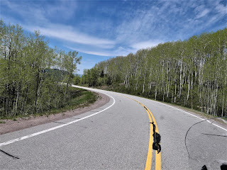

US 160 goes past the Four Corners Monument, the only place where four states meet: Colorado, New Mexico, Arizona and Utah. This is another casualty of COVID, closed by the Navajo Nation to minimize the spread of the disease. We saw several groups of horses today as we rode through the vast  Navajo Nation, and I wondered how they manage to survive on the scarce brown grass. The 2-lane paved highway stretches straight through the desert, only occasionally sweeping in wide turns.


We stopped in Kayenta for lunch at Subway, repeating our lunch stop the first day of our trip almost 2 weeks ago when we rode east on US 160. There aren't many places to stop and eat on the Navajo Nation so we made sure to take advantage of places we know are open. After lunch we continued west on US 160, riding through flat areas that stretched out to hazy cliffs in the far distance that alternated with high rock cliffs and craggy canyons.


We turned south on US 89 with long-distance views of the San Francisco Peaks in Flagstaff, AZ, in front of us.


The temperature climbed and hovered around 90 degrees even as we climbed in elevation to about 7000' in Flagstaff. After 7 hours of travel today, we were ready for an air conditioned hotel room and an early dinner followed by a walk around busy downtown Flagstaff. Tomorrow we head home, finishing our 2-week trip through the Southwest.


Monday, May 31, 2021

Into the mountains

We started off the morning riding east from Farmington, NM on US 64, riding out of the industrial/commercial area into open country, following the 2-lane paved highway as it swept and turned past high rock walls.


64 East took us through the Carson National Forest and then the Jicarilla Apache Nation in this rugged and beautiful part of northern New Mexico. 

We turned north on NM 17, riding through the small town of Chama, home of the historic Cumbres and Toltec Scenic narrow gauge railroad. Only 64 miles of narrow gauge tracks remain, and this year one of the original 1880's steam engines returns to service. 


Route 17 and the narrow gauge railroad snake through the Sangre de Cristo mountains, the southernmost range of the Rocky Mountains. This is gorgeous country, and we were excited to watch the elevation rise to 10,230' at the top of La Manga Pass once we crossed over into Colorado.


We turned around and retraced our route heading south on 17, crossing back into New Mexico and descending through groves of aspens.


We stopped for lunch at Fina's Diner in Chama where we sat outside in the large tent and watched the holiday weekend traffic, including a few motorcycles, zip past us on the highway. We turned north on US 84, crossed back into Colorado, and ended our day in Pagosa Springs.


We love seeing water running in the streams, green grass, and the snowy mountain tops which are so different from our home in Arizona. Pagosa Springs sits at about 7100' elevation on the Western Slope of the Continental Divide in an absolutely stunning part of the country. Our first day of the trip was all about straight roads through the desert, and today we enjoyed sweeping curves through the mountains.


Saturday, May 29, 2021

Back on the road in 2021

We started our first long-distance motorcycle trip in almost a year today, and it felt fantastic to pack up the BMW and ride 376 miles from our home in Prescott, Arizona to Farmington, New Mexico. It's the first day of a 2-week trip that will take us to the Denver area to visit our sons, South Dakota, and then - well, we're not exactly sure where we'll head next. 

We headed north from home on AZ 89, picking up I-40E for a few miles to Flagstaff where we once again turned the BMW north on US 89. We were a bit surprised to see snow at the north-facing top of the San Francisco Peaks in Flagstaff. Named for the Franciscan friars who were doing missionary work in this area in the early 1600's, the San Francisco Peaks are a volcanic mountain range with the highest point in Arizona - Mt. Humphrey's at 12,633'.


We rode through the Navajo Nation the majority of the day, turning east on US 160 and stopping at a Subway in Kayenta for lunch. Due to COVID-19 restrictions there is no in-person dining, so we found a spot of shade outside and enjoyed our lunch.


We can't remember the last time we rode on 160E past Kayenta, and enjoyed watching the changing scenery and the far-off distant vistas.


We picked up US 64E and then just a few miles further crossed the state line into New Mexico. We're still in the Navajo Nation, which covers over 27,000 square miles in four states:  Arizona, New Mexico, Colorado and Utah. 


 There was almost no traffic on this stretch of asphalt, and we were excited to see the odometer turn over to 30,000 miles. We've had the BMW for a bit over 3 years and are looking forward to many thousands more miles.


We passed a few herds of cattle and saw a small herd of horses off to the side of the highway taking shelter from the mid-day sun under the rock overhang in a wash. There weren't as many motorcycles as we expected, and much of the time we enjoyed the road to ourselves. Riding through the Southwest is a lesson in vast spaces, long distances between often very tiny towns, and lots of open road. Tomorrow we'll head into Colorado and are looking forward to the Rockies.


Monday, July 27, 2020

On the road again!


Our last long bike trip was 2 years, and we've been looking forward to today for months. We left home this morning on a 3 week trip into Utah, Wyoming and Colorado on a beautiful, sunny July day.

We rode north out of Prescott on I-17 into Flagstaff, then continued north on 89 through the wide open high desert.


Our route led us east on 160, through the Navajo Nation that covers more than 27,000 acres in Utah, Arizona and New Mexico.  This area is part of the Painted Desert where deposits of clay and sandstone were layered by floods, earthquakes, and volcanoes to create stunning, colorful rock formations.


We were also struck by the Native American photos and artwork on abandoned buildings along the highway.


We stopped in Kayenta, a Navajo town on the Colorado Plateau at 5,700' elevation, for a quick lunch at Subway. The Navajo have been hit hard by COVID-19, and require masks and only allow take-out meals. We found a shady spot outside the Subway store and quickly ate lunch while we listened to loud cracks of thunder. Luckily the storm was behind us as we continued north on U.S. 163 into Monument Valley.


Billions of years ago Monument Valley was a lowland basin where sediments that eroded from the nearby mountains built up multicolored layers of rock that eventually were lifted up into a high plateau 1 to 3 miles above sea level. Wind and water erosion wore away the softer rock, leaving the impressive rock formations we rode by today.


At one point Mike saw a horse running along the side of the highway and I was lucky enough to snap a quick picture


We crossed into Utah and a few miles later came into the aptly named town: Mexican Hat.  We circled down the highway that sweeps off the edge of Cedar Mesa, crossing the San Juan River. Mexican Hat is named after a rock formation that looks like a Mexican hat: a large, flat rock that is 60' in diameter perched on top of a much smaller base. The rock formation doesn't look that large from the highway, and you can see it in the middle of the photo below.


The colors of the rocks are amazing, and some of them formed a vvvvv pattern that reminds me of my grandmother's favorite rickrack that she put on most of the clothes she sewed for us.


163 meets up with U.S. 191, and we finished the day's 339 miles riding through Bluff, Utah settled by the San Juan Mission of the Church of Jesus Christ of Latter-day Saints in 1880 when 250 pioneers spent 6 months establishing a wagon road through this inhospitable terrain. We covered more miles in <6 hours than they did in 6 months, which puts travel through the arid, rocky, canyon-filled Southwest into perspective.

We're spending the night in Blanding, Utah, founded in the late 19th century by some of the same hardy pioneers who trekked to Bluff. We dodged the rain and thunderstorms and thoroughly enjoyed the first day of our motorcycle trip.