Showing posts with label US 160. Show all posts

Friday, June 11, 2021

376 miles on two roads from Colorado to Arizona

 Our route today was simple:  US 160 West from Pagosa Springs, Colorado to US 89 South to Flagstaff, Arizona. We started out at 8am with temperatures in the mid-50's and ended the day pushing 90 degrees. 160 West took us past Chimney Rock National Monument between Pagosa Springs and Durango.


An archaeological site that preserves hundreds of ruins from the Ancestral Puebloans who lived here over 1000 years ago, Chimney Rock is in the San Juan National Forest. Not far down the road we passed Mesa Verde, another site where the Ancestral Puebloans lived for over 700 years, building cliff dwellings that exist today. We celebrated as our odometer rolled over to 32,000 miles. 


In Durango, US 160 becomes the San Juan Skyway, twisting 236 miles through the San Juan Mountains of southwestern Colorado. We were only on this route for a few miles, continuing on 160 West while the scenic skyway turns off onto CO 184.


We rode through Cortez, just outside the Ute Mountain Tribal Park. The park is currently closed due to COVID, but we rode past Sleeping Ute Mountain. According to legend, the mountain is the sleeping Great Warrior God who battled evil, was hurt, and lay down falling into a deep sleep.


Until Cortez the scenery was green - irrigated fields of grass and hay and dark green pine trees on the mountain sides. Continuing west past Cortez brown is the dominant color as the desert takes over.


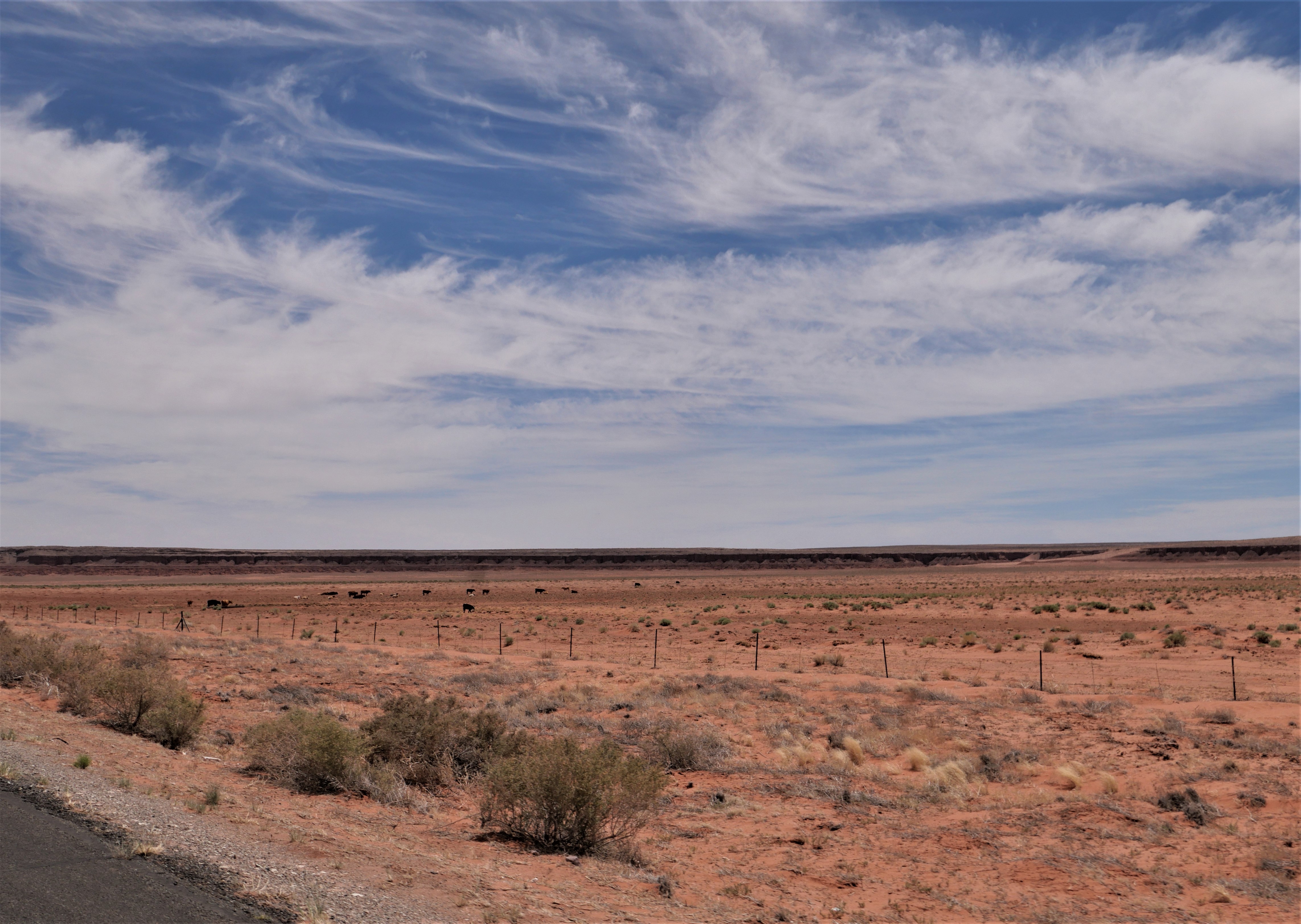
US 160 goes past the Four Corners Monument, the only place where four states meet: Colorado, New Mexico, Arizona and Utah. This is another casualty of COVID, closed by the Navajo Nation to minimize the spread of the disease. We saw several groups of horses today as we rode through the vast  Navajo Nation, and I wondered how they manage to survive on the scarce brown grass. The 2-lane paved highway stretches straight through the desert, only occasionally sweeping in wide turns.


We stopped in Kayenta for lunch at Subway, repeating our lunch stop the first day of our trip almost 2 weeks ago when we rode east on US 160. There aren't many places to stop and eat on the Navajo Nation so we made sure to take advantage of places we know are open. After lunch we continued west on US 160, riding through flat areas that stretched out to hazy cliffs in the far distance that alternated with high rock cliffs and craggy canyons.


We turned south on US 89 with long-distance views of the San Francisco Peaks in Flagstaff, AZ, in front of us.


The temperature climbed and hovered around 90 degrees even as we climbed in elevation to about 7000' in Flagstaff. After 7 hours of travel today, we were ready for an air conditioned hotel room and an early dinner followed by a walk around busy downtown Flagstaff. Tomorrow we head home, finishing our 2-week trip through the Southwest.


Saturday, May 29, 2021

Back on the road in 2021

We started our first long-distance motorcycle trip in almost a year today, and it felt fantastic to pack up the BMW and ride 376 miles from our home in Prescott, Arizona to Farmington, New Mexico. It's the first day of a 2-week trip that will take us to the Denver area to visit our sons, South Dakota, and then - well, we're not exactly sure where we'll head next. 

We headed north from home on AZ 89, picking up I-40E for a few miles to Flagstaff where we once again turned the BMW north on US 89. We were a bit surprised to see snow at the north-facing top of the San Francisco Peaks in Flagstaff. Named for the Franciscan friars who were doing missionary work in this area in the early 1600's, the San Francisco Peaks are a volcanic mountain range with the highest point in Arizona - Mt. Humphrey's at 12,633'.


We rode through the Navajo Nation the majority of the day, turning east on US 160 and stopping at a Subway in Kayenta for lunch. Due to COVID-19 restrictions there is no in-person dining, so we found a spot of shade outside and enjoyed our lunch.


We can't remember the last time we rode on 160E past Kayenta, and enjoyed watching the changing scenery and the far-off distant vistas.


We picked up US 64E and then just a few miles further crossed the state line into New Mexico. We're still in the Navajo Nation, which covers over 27,000 square miles in four states:  Arizona, New Mexico, Colorado and Utah. 


 There was almost no traffic on this stretch of asphalt, and we were excited to see the odometer turn over to 30,000 miles. We've had the BMW for a bit over 3 years and are looking forward to many thousands more miles.


We passed a few herds of cattle and saw a small herd of horses off to the side of the highway taking shelter from the mid-day sun under the rock overhang in a wash. There weren't as many motorcycles as we expected, and much of the time we enjoyed the road to ourselves. Riding through the Southwest is a lesson in vast spaces, long distances between often very tiny towns, and lots of open road. Tomorrow we'll head into Colorado and are looking forward to the Rockies.


Wednesday, July 19, 2017

Scenic byways and lost highways on the BMW motorcycle

What a gorgeous ride we had today! We love riding on roads with little to no traffic and jaw-dropping scenery, and today's ride had it all. We left Grand Junction at 6:30am both to beat the heat and to avoid late-afternoon monsoon weather. Summer is monsoon season in the West, with thunderstorms, hail, and often torrential downpours that cause low-lying areas to flood. Definitely not a good time to be on a motorcycle!

We started our day riding south on CO 141, the Unaweep Tabeguache Scenic Byway. We were on this road a couple of years ago heading into Grand Junction, and we weren't disappointed with the trip in the opposite direction.


People lived in these canyons and river valleys on the Colorado Plateau at least 10,000 years before the arrival of the first Europeans - the Spanish. Miners came here in the late 1800's looking for gold, copper and other minerals, and today there are a few, isolated ranches scattered across the valleys.


I spotted a ruined sandstone building to the side of the highway, and later discovered that it's the Driggs Mansion, a one-story sandstone house built around 1918 by Italian stonemasons, using local stone from nearby canyons. Today it's on the Colorado State Register of Historic Properties.


Soon after we passed the Driggs Mansion, our odometer turned over to 49,000 miles. We reached 48,000 miles on the first day of this trip, and have a few hundred more miles to go before we reach home. 


The Dolores River runs through the canyon, with rock cliffs that tower over 1000' above us on both sides of the 2-lane road.


We stopped to learn more about the Hanging Flume, a 10-mile long engineering feat built in the late 1800's to funnel water from the Delores River to provide enough pressure for hydraulic gold mining for the Lone Tree Mining Company. The wooden trestles cling to the rock canyon walls hundreds of feet above the river below, and originally supported wooden boxes to channel the water. 

Look closely at the right side of the canyon wall, and you'll see what's left of the original Hanging Flume. Here's a close-up:


We continued curving and twisting our way south on CO 141 through more canyons until we reached Naturita, a small town of around 650 people where CO 141 turned into a wide, open valley, leaving the canyons behind.


This section of CO 141 is marked by Butler Motorcycle Maps as a 'Lost Highway', meaning it's remote, often without cell service or stops for food or gas, and very lightly traveled. We loved it! At one point I saw a sign stating "Disappointment Valley" and I could easily understand how someone might be highly disappointed moving here.

CO 141 ends at US 491, on the northern edge of Canyon of the Ancients National Memorial. We headed northwest, quickly crossing into Utah and stopped in Monticello for lunch. Much of this part of the West was settled by Mormon pioneers in the late 1880's, and from 1948-1960 it was the site of several uranium mines. Today there are 27 windmills outside town.


We turned south onto US 191, riding through small towns on the dry Colorado Plateau, and encountering a mama cow and her calf running alongside the highway on the Ute reservation. Most of the day we rode through open range land, with the possibility of cattle or horses near or on the highway - and the cattle have the right-of-way!


Our last turn of the day was onto US 160, riding past Carson Mesa and Comb Ridge toward Kayenta in the Navajo Nation. 


We rode 288 miles in about 8 hours, taking our time to enjoy the changing scenery, bright blue skies, and the highway mostly to ourselves. Tomorrow we'll end our week-long journey, and hopefully miss the monsoons!