Showing posts with label San Luis Valley. Show all posts

Tuesday, July 25, 2023

Riding home: familiar and new Colorado roads

 We started off the third and last day of our motorcycle trip Monday morning in Leadville, looking forward to more high mountain passes and a road we haven't yet ridden. We started off riding south on US 24, looking out over the snowy Rockies.


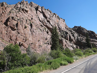
Soon the highway started curving and winding along rocky cliffs cut by the Arkansas River that starts near Leadville and ends 1469 miles later at the Mississippi in Arkansas.


We saw a few fly fishermen but no rafts on the river. Soon after we started riding along the Collegiate Peaks, a 57 mile stretch of the largest concentration of mountains over 14,000' in the United States.


We've ridden this way many times, but I'm always awed by the sight of these towering mountains, and even more impressed with hikers who climb them.

South of Buena Vista US 24 meets up with US 285, continuing south past more of the Collegiate Peaks.


In Poncha Springs we turned west onto US 50 and started winding our way up Monarch Pass our highest point for today at 11,312'. There's a ski area just east of the summit, and the gondola is open in the summer to take visitors for a sky-high view of the area.


After riding out into a broad valley, we turned south onto CO 114 - a road we had never been on. To our delight, the first 23 miles were freshly paved, and with no other traffic in sight we zoomed along the road.


We knew more fun was in store when we started seeing road signs warning about twisting curves.


The ride through Cochetopa Canyon is beautiful, with sharp turns through the rocky canyon.


We started seeing signs warning about road construction, and soon came upon the end of the newly paved section of highway. We crossed another pass - this time North Pass at 10,010' that travels along the Continental Divide. This was one of the original routes through the Continental Divide as it's a relatively gentle climb and descent - for a motorcycle, but not for someone with a horse and wagon!


CO 114 ends at Saguache where we turned once again onto US 285 south. We rode this route through the San Luis Valley in reverse on the first day of this trip, and started thinking about where we might stop for lunch as we passed bright green irrigated fields bordered by dusty brown desert.


We stopped in Del Norte on US 160W for lunch. It's often challenging to find a restaurant open on a Monday, and we were lucky to find the Three Barrel Brewing Company open 7 days per week. Leaving Del Norte we had about 90 miles left on our trip, riding over Wolf Creek Pass at 10,856'. This is a busy highway with trucks and RVs, and because the road has several tight turns and steep elevation changes, there are runaway truck ramps - just in case.


Riding down the Pass into Pagosa Springs we were just a few miles from home. We rode through incredibly beautiful areas over these past three days, yet the final stretch toward home is one of the most gorgeous areas in the entire state.


Sunday, June 4, 2023

Last day of our 2-week Colorado, Utah, Wyoming, Idaho, Montana trip

 We enjoyed sunny skies our two days in Lakewood, CO visiting our son and his girlfriend, and today the rainy weather finally caught up with us. It poured all night and continued raining hard as we loaded up the BMW (thank goodness our son has a garage). We worked our way through busy Denver traffic and headed south on US 287. Due to the heavy rain and temperatures in the low 40's, I wasn't able to take any pictures until we crossed Kenosha Pass at 10,000' and dropped down into South Park, the third and final high altitude valley - over 9,000' - in Colorado that we've ridden through on this trip.


We crossed Trout Creek Pass that marks the southern end of South Park, and once again it started raining. As we wound down toward Buena Vista, the rain stopped and we were able to enjoy views of the Collegiate Peaks, the highest concentration of mountain peaks >14,000' in the country.


The rain picked up again but we had a rain-free window when we stopped for a delicious lunch at the FlaminGo food truck. They're open until 1pm - don't miss it!


More rain, then another dry spell as we rode through the San Luis Valley, a major agricultural center. 


As we started up Wolf Creek Pass, 10,857' on the Continental Divide in the San Juan Mountains, we knew we were close to home. 


Pagosa Springs is on the western side of Wolf Creek Pass and even better the sun was shining!


We rode 303 miles today for a total of 2090 miles on this two-week trip, visiting our two sons, riding through two national parks, and seeing more of the West. Now that we live in Colorado, we plan to explore more of the area this summer - and hopefully not when it's raining!


Monday, May 31, 2021

A rainy ride through the Rockies

 The weather forecast wasn't great, with rain and intermittent thunderstorms forecast for the entire day. We opted to leave Pagosa Springs before 8am and wore all our warm clothes, liners, and rain gear as we rode east on US 160 through the Rio Grande National Forest.


We wanted to get over Wolf Creek Pass, at 10,857' at the top of the Continental Divide, before bad weather hit. Originally a 12' wide dirt road constructed in 1916, it's now a multi-lane paved highway with maximum 6.8% grade. 


Although the ski area on the east side of the summit is closed for the year, there's still a significant quantity of snow. We missed the rain, but the temperature dipped to 42 degrees as we zoomed down the mountain into the San Luis Valley, a 122 mile long, 74 mile wide high mountain valley home to small towns and agriculture. 


We turned northeast on Colorado 112 for a short stretch before heading north on US 285 through the valley with the northern part of the Sangre de Cristo mountain range to our right. The clouds dropped down below the tops of the mountains and we rode in and out of rain the rest of the trip.


We ended the day in Buena Vista, a beautiful mountain town at about 8,000' with normally gorgeous views of the Presidential Peaks. The weather should clear up tomorrow and we'll be able to see the mountains as we continue our ride north.

Monday, September 3, 2018

Riding through the Rockies

We're back on the BMW after spending two days in Boulder, Colorado with our son. Hiking, going to the movies (Operation Finale and Black Kkklansman), and enjoying busy Pearl Street was a lot of fun and a good break from the trip.


We've ridden the BMW in Colorado many times over the past 5 years and have learned to be prepared for abrupt weather changes as the elevation climbs to over 10,000' in the Rockies. The beginning of the trip we headed along the edge of the Front Range, passing by the area where we hiked the day before.


We weren't very far into the day when we reached 8000 miles for our trip. We left home 37 days ago anticipating that we would cover approximately 9000 miles on our cross-country adventure, and we should be close to that by the time we get home to Arizona. Mike says the BMW is made for this type of long-distance riding, hovering up the miles on a comfortable ride.

Boulder sits at 5200' elevation, and after leaving the Front Range we started to climb into the heart of the Rockies over the Kenosha Pass at 10,000'. I always hope to see mountain goats or bighorn sheep, but the only animal we saw today was an antelope.


Even with the heavy Labor Day traffic, we made great time through the mountains. Dropping down from the Kenosha Pass we entered South Park, a vast, high, flat mountain valley at about 9000'.


We could see 14,000' mountain peaks all around us until the clouds descended and it started to rain lightly. Time to put on the rain gear!


As we crossed Poncha Pass with high sheer cliffs that bordered both sides of the 2-lane highway into the San Luis Valley the rain stopped, the sun came out, and we enjoyed a beautiful summer day.


We stopped for lunch in Del Norte, once a bustling city of 10,000 people during the mining boom years, and now a small, quiet ranching town of about 1700.

We only had about 60 miles left on today's trip after lunch, and since the sun was shining in Del Norte I took off my rain jacket. We forgot we had one last mountain pass to cross today:  the Wolf Creek Pass over the Continental Divide, and at 10,387' our highest elevation of the day. We saw the rain clouds in the distance and once again stopped to put on raingear. The temperature dropped 20 degrees to 46 degrees at the top of the pass, and we shivered our way through the hairpin turns over the top of the pass until we dropped down to Pagosa Springs.


We're spending the night in Pagosa Springs, enjoying the views of the San Juan Mountains and walking through the town for dinner. The San Juan River runs right by our motel, and we ate dinner at the Riff Raff Brewing Company which is completely heated by geothermal heat from the world's deepest hot spring that gives the town it's name. Tomorrow we continue west through Colorado until we turn south toward Arizona, giving us one more day to enjoy Rocky Mountain motorcycling.

Here is today's route

Friday, September 6, 2013

Colorado mountains

I always imagine Colorado as brown and rocky, but today's ride through several national forests and across pine-covered mountains was lush and green, especially compared to yesterday's ride through the dry desert-like high mesas.


on US 550 North toward Durango
 
We started off in Farmington, New Mexico and quickly crossed into Colorado, riding through the southern part of the San Juan National Forest, 1.8 million acres in southwestern Colorado. Pagosa Springs, elevation 7,000' and home to several hot mineral springs, is on the western side of the Continental Divide.
 

 riding east from Pagosa Springs
 
 
We crossed the Continental Divide on 10, 857' Wolf Creek Pass. We're riding through the Rocky Mountains that range from Canada to Mexico. Technically, Wolf Creek Pass is in the San Juan Mountain range with six peaks higher than 14,000'.
 

Wolf Creek Pass
 
The 1.8 million acre Rio Grande National Forest is on the eastern side of Wolf Creek Pass and the Continental Divide. We rode through the Forest on US 160, and stopped for lunch in Del Norte, originally a stage coach stop and a supply town for local mining operations.


I enjoy eating lunch in small, local restaurants to get a feel for the area. We were the only motorcycle riders among two men wearing cowboy hats, an elderly couple, and men dressed in casual business clothes. Del Norte is on the western edge of the San Luis Valley, a high altitude, desert-like basin that is heavily irrigated from underground aquifiers to support local farming. It's surprising to see dry, arid landscapes right next to bright green fields.


We rode on US 285 N through the San Luis Valley and then headed east on US 50  at Pancha Springs (elevation 7,465') and on through Salida (elevation 7,083').  The temperature today hovered near 90 degrees, even though we're at a high elevation. We stopped for a drink of water and talked with three guys heading out to ride motorcycles on the dirt forest roads that criss-cross the mountains.
 
 
We're staying in Colorado Springs (elevation 6,035') for three nights to watch our youngest son, Nate, compete in the Pike's Peak Downhill longboarding race. The lower elevation and miles of asphalt in Colorado Springs raised the temperature into the high 90's. The combination of heat and stop-and-go traffic made us glad to get off the bike and into an airconditioned hotel room.
 
We've covered almost 800 miles the past two days across three states, and we're looking forward to riding up the Pike's Peak highway tomorrow and looking down into the valley.