Showing posts with label Rockies. Show all posts

Wednesday, August 5, 2020

Exploring Colorado's mountain passes on the BMW

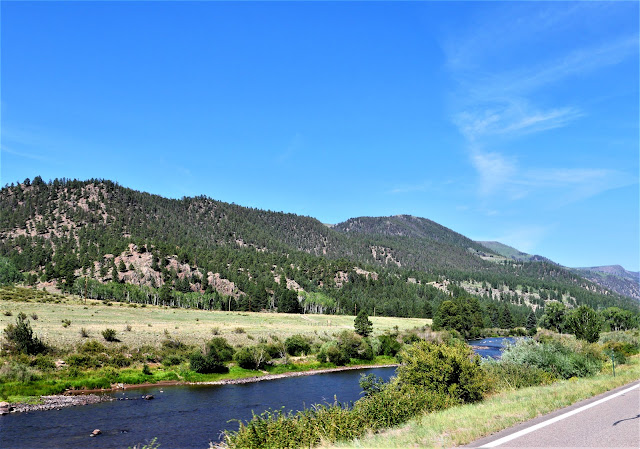
We've been riding around Colorado for the past few days, discovering new roads that we haven't been on before and riding favorite roads for a second time. We started off heading east from Pagosa Springs on US 160 East, riding past green fields and ranches bordered by the mountains.


Soon we started climbing up in the San Juan mountains, heading up Wolf Creek Pass


The steep road winds and twists up to the top of the Pass at 10,857' where we crossed the Continental Divide for the first time today before we descended down the eastern slope past the Wolf Creek ski area.


In South Fork we turned north onto Colorado 149, the first time we've been on this road and what a find! 149 is the Silver Thread scenic byway that traverses remote parts of the state that were once important in silver mining, and today is an outdoor lover's paradise. The Rio Grande River flows along the highway, which twists and turns to match the river's path.


We followed the Rio Grande through the mountains to the small town of Creede, which in the late 1800's was home to over 10,000 people due to the booming silver mining in the area.


As we continued north past Creede, we stopped at a scenic overlook and discovered we were looking at the headwaters of the Rio Grande where it starts at an elevation of over 13,000' in the San Juan mountains before it travels 1,885 miles to the Gulf of Mexico.


A couple also stopped at the overlook told us about a waterfall just a couple of miles further north, so we turned off the highway to see North Clear Creek Falls, a 100+ foot waterfall formed by volcanic activity 27 million years ago.


Back on the highway, we continued north, climbing up Spring Creek Pass and crossing the Continental Divide for the second time today at 10,889' before we descended down toward Lake City.


The mountains weren't done with us yet as we quickly ascended up the even higher Slumgullion Pass at 11,530'. 


The descent down the north side of Slumgullion Pass at times is a 9% grade, and the sweeping turns made this section a fantastic motorcycle ride. We descended down into Lake City at 8,661'. Much of the town is part of a historic district with many of the original homes from mining days restored to promote tourism. We stopped for lunch at the Lake City Cafe and enjoyed one of the best meals of our trip.

149 continues north along the Lake Fork of the Gunnison River and through Independence Gulch.


149 ends at US 50, just past the Blue Mesa Reservoir.


We turned east onto US 50, our final leg for the day. We rode through Gunnison, then retraced our route from 3 days ago up and over Monarch Pass - at 11,312' our last crossing of the Continental Divide for the day.


We're spending the night in Salida and planning an earlier start tomorrow with a goal of riding to the top of Pike's Peak - 14,115'.

Monday, September 3, 2018

Riding through the Rockies

We're back on the BMW after spending two days in Boulder, Colorado with our son. Hiking, going to the movies (Operation Finale and Black Kkklansman), and enjoying busy Pearl Street was a lot of fun and a good break from the trip.


We've ridden the BMW in Colorado many times over the past 5 years and have learned to be prepared for abrupt weather changes as the elevation climbs to over 10,000' in the Rockies. The beginning of the trip we headed along the edge of the Front Range, passing by the area where we hiked the day before.


We weren't very far into the day when we reached 8000 miles for our trip. We left home 37 days ago anticipating that we would cover approximately 9000 miles on our cross-country adventure, and we should be close to that by the time we get home to Arizona. Mike says the BMW is made for this type of long-distance riding, hovering up the miles on a comfortable ride.

Boulder sits at 5200' elevation, and after leaving the Front Range we started to climb into the heart of the Rockies over the Kenosha Pass at 10,000'. I always hope to see mountain goats or bighorn sheep, but the only animal we saw today was an antelope.


Even with the heavy Labor Day traffic, we made great time through the mountains. Dropping down from the Kenosha Pass we entered South Park, a vast, high, flat mountain valley at about 9000'.


We could see 14,000' mountain peaks all around us until the clouds descended and it started to rain lightly. Time to put on the rain gear!


As we crossed Poncha Pass with high sheer cliffs that bordered both sides of the 2-lane highway into the San Luis Valley the rain stopped, the sun came out, and we enjoyed a beautiful summer day.


We stopped for lunch in Del Norte, once a bustling city of 10,000 people during the mining boom years, and now a small, quiet ranching town of about 1700.

We only had about 60 miles left on today's trip after lunch, and since the sun was shining in Del Norte I took off my rain jacket. We forgot we had one last mountain pass to cross today:  the Wolf Creek Pass over the Continental Divide, and at 10,387' our highest elevation of the day. We saw the rain clouds in the distance and once again stopped to put on raingear. The temperature dropped 20 degrees to 46 degrees at the top of the pass, and we shivered our way through the hairpin turns over the top of the pass until we dropped down to Pagosa Springs.


We're spending the night in Pagosa Springs, enjoying the views of the San Juan Mountains and walking through the town for dinner. The San Juan River runs right by our motel, and we ate dinner at the Riff Raff Brewing Company which is completely heated by geothermal heat from the world's deepest hot spring that gives the town it's name. Tomorrow we continue west through Colorado until we turn south toward Arizona, giving us one more day to enjoy Rocky Mountain motorcycling.

Here is today's route