Sunday, March 17, 2019
13,000 miles in 1 year!
Today was a banner day for several reasons:
- It's our first ride together in 2019, with the weather finally cooperating. We've had a rainy, snowy (28" in one memorable storm a couple of weeks ago), and cold winter for Arizona which has meant no motorcycle riding and more shoveling than we anticipated.
- The mountains south of our home in Prescott are still topped with snow. The temperature at home was 65 degrees and it feels slightly out of kilter to see snow on the mountains.
- The bike will be 1 year old on March 23rd, and today the odometer rolled over to 13,000 miles as we pulled into our driveway.
We rode one of our favorite twisty loops through the mountains into the valley, starting south on White Spar/89 through Wilhoit to Kirkland, then north back to Prescott on Iron Springs/Yavapai County 10 through Skull Valley.
A sunny day, twisty 2-lane roads with very little traffic, and long views over the high desert mountains turned a familiar ride into something special.
Over the past year we've ridden the BMW 130,000 miles on small day trips as well as a 5 1/2 week trip around the United States. Where will the next year take us?
Here is today's route
Monday, November 5, 2018
Sand, hawks, and starry skies in Joshua Tree California
Friday was a gorgeous day in Arizona, with bright blue skies that I call "Arizona blue" and temperatures in the mid 60's as we headed south and then west toward Joshua Tree, California. Fall is a wonderful time of the year for motorcycle riding in the Southwest as the daytime temperatures range from the 50's to mid 80's and there's rarely any threat of rain.
We started our trip down familiar roads through the Weaver Mountains in Yarnell where we enjoyed the winding, twisting curves that are one of our favorite motorcycle rides.
We rode out of the mountains and into the Mojave Desert that covers over 25,000 square miles in Arizona, Utah, Nevada and California. U.S 60 took us through tiny, isolated, dusty, sandy former mining communities like Aguila and Salome that oddly enough and due to irrigation are also centers of agriculture. It was a bit of a shock to see the blue Colorado River running through the desert in Parker, AZ and then we were back into the sandy desert.
We have been this way before and knew that it was 109 miles from Parker to the next town, Twentynine Palms so we stopped for gas before heading west on CA Route 62.
Everything looks dusty and grey, and for good reason because the annual rainfall is about 5". There aren't any trees in the Mojave Desert, but there are a wide variety of small, spindly bushes that dot the sandy landscape to the mountains that rim the desert.
Mike had to be extra cautious along the 2-lane paved road because much of the way there is no paved shoulder, and the 'shoulder' is typically deep sand.
A railroad runs along the north side of the road for a few miles, and the sandy bank along the sides of the railway are lined with rock and railroad tie graffiti, such as a heart outlined with white rocks surrounding initials and names spelled out in black rocks or old railroad ties.
I can't imagine the amount of time someone put into painting rocks bright blue, deep red and white and then hauling them out here to make this statement.
We stayed at the High Desert Motel in the town of Joshua Tree, on the edge of the Joshua Tree National Park and where the famous Joshua trees are just about everywhere.
Saturday morning started off just as the sun was rising as we rode 10 minutes down the road to meet with Lorrie Agnew, Master falconer of JT Falconry Adventures to learn about his birds which include three Harris's hawks, two peregrine falcons, and a kestrel, the smallest of the falcons. Lorrie explained falconry and about the birds and we even were able to pet the Harris's hawks soft feathers. It's amazing that these fierce birds of prey with long sharp talons and even sharper beaks sat quietly on Lorrie's gloved arm as we stroked their backs. Lorrie then took us into the desert with the Harris's hawks to watch them hunt.
It was fascinating to learn about the birds and how much time, effort and love for birds falconers put into their hobby. Here is a short clip of Skippy, Lorrie, and Mike.
We traveled 640 miles during our 3-day quick weekend trip into California on little-traveled roads that allowed us to zoom along the mostly straight roads with the sunshine on our backs. We're still smiling.
https://goo.gl/maps/ r85v3CApDEK2 for a map of our route
We started our trip down familiar roads through the Weaver Mountains in Yarnell where we enjoyed the winding, twisting curves that are one of our favorite motorcycle rides.
We rode out of the mountains and into the Mojave Desert that covers over 25,000 square miles in Arizona, Utah, Nevada and California. U.S 60 took us through tiny, isolated, dusty, sandy former mining communities like Aguila and Salome that oddly enough and due to irrigation are also centers of agriculture. It was a bit of a shock to see the blue Colorado River running through the desert in Parker, AZ and then we were back into the sandy desert.
We have been this way before and knew that it was 109 miles from Parker to the next town, Twentynine Palms so we stopped for gas before heading west on CA Route 62.
Everything looks dusty and grey, and for good reason because the annual rainfall is about 5". There aren't any trees in the Mojave Desert, but there are a wide variety of small, spindly bushes that dot the sandy landscape to the mountains that rim the desert.
Mike had to be extra cautious along the 2-lane paved road because much of the way there is no paved shoulder, and the 'shoulder' is typically deep sand.
A railroad runs along the north side of the road for a few miles, and the sandy bank along the sides of the railway are lined with rock and railroad tie graffiti, such as a heart outlined with white rocks surrounding initials and names spelled out in black rocks or old railroad ties.
I can't imagine the amount of time someone put into painting rocks bright blue, deep red and white and then hauling them out here to make this statement.
We stayed at the High Desert Motel in the town of Joshua Tree, on the edge of the Joshua Tree National Park and where the famous Joshua trees are just about everywhere.
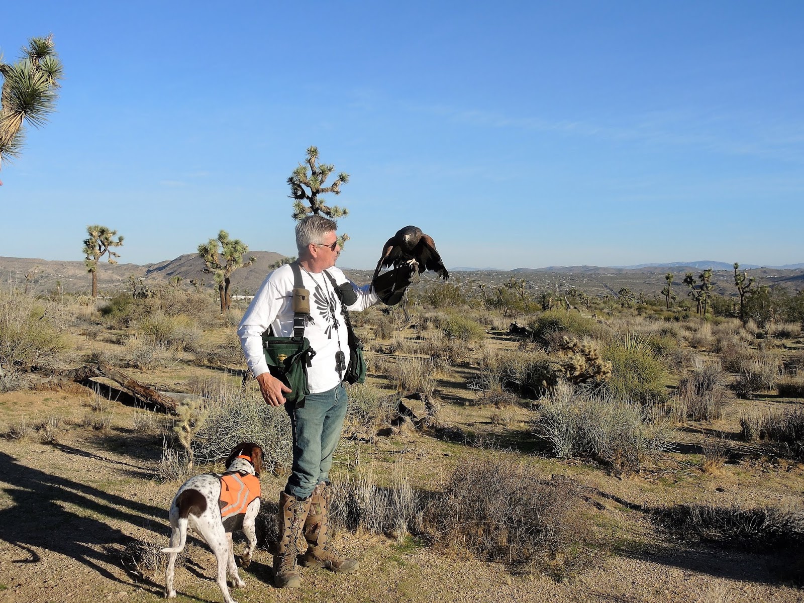
Saturday morning started off just as the sun was rising as we rode 10 minutes down the road to meet with Lorrie Agnew, Master falconer of JT Falconry Adventures to learn about his birds which include three Harris's hawks, two peregrine falcons, and a kestrel, the smallest of the falcons. Lorrie explained falconry and about the birds and we even were able to pet the Harris's hawks soft feathers. It's amazing that these fierce birds of prey with long sharp talons and even sharper beaks sat quietly on Lorrie's gloved arm as we stroked their backs. Lorrie then took us into the desert with the Harris's hawks to watch them hunt.
Lorrie Agnew, hunting dog Sara, and Skippy the Harris's hawk
It was fascinating to learn about the birds and how much time, effort and love for birds falconers put into their hobby. Here is a short clip of Skippy, Lorrie, and Mike.
We ate a late breakfast at Larry's and Milt Western Cafe in Yucca Valley, saw the new Bohemian Rhapsody movie, and then I ran the Joshua Tree half-marathon that started at sunset. I was the only one of about 3000 runners who arrived on the back of a motorcycle! We started the day at 6 am and ended back at the motel about 10:30 pm and packed a lot into that time.
Sunday morning we retraced our route back home to Prescott, where the BMW's odometer rolled over to 12,000 miles while we were riding through the sandy Mojave Desert.
https://goo.gl/maps/
Sunday, September 23, 2018
A BMW ride in search of aspens
It's the end of September and we thought we might see the changing leaf colors of the aspen trees in Flagstaff. No Fall colors yet, but we had a beautiful ride through the ponderosa pine forests along the Mogollon Rim.
One of our favorite rides is on Lake Mary Road into Flagstaff, and today didn't disappoint. A dam on Walnut Creek forms Lake Mary, named after Mary Riordan, a daughter of wealthy lumber barons who built the lake in 1905 as a water supply for Flagstaff. There wasn't much water today in the reservoir, and no water at all in Mormon Lake. Unfortunately, Mormon Lake is the largest natural lake in Arizona, and the fact that it has no water today, at the end of the rainy monsoon season, says a lot about the drought in the Southwest.
As we rode closer to Flagstaff the San Francisco Peaks, the highest mountains in Arizona, started to come into view.
Our goal today in search of changing aspen leaf colors was the Flagstaff ski area, the Snowbowl. Skiing started here in 1938 at 9,200' elevation at the base lodge with chair lifts taking skiers to 11,500'.
We saw plenty of aspen trees on the climbing, twisting 7 mile road to the base lodge.
Today was the first time I wore the new Viking Cycle Ironborn women's textile motorcycle jacket on a ride, and overall I liked the comfortable fit and all the pockets. On the trip home from Flagstaff the temperatures rose to 98 degrees and even with the jacket vents open I was hot and sweating. However, in those temperatures I most likely would have been just as hot wearing my old Olympia jacket with mesh panels for ventilation. Thanks to Viking Cycle for sending me the jacket to review!
We spent 5 hours on the road and covered 267 miles in a large circle in north-central Arizona. Check out our route here. Even in this relatively small area we experienced a wide range of terrain as we traveled from the high desert in Prescott, through ponderosa pine forests, climbed to the higher elevation in Flagstaff, wound our way up to the Snowbowl in the San Francisco Peaks, then descended 6,000' into the green Verde River valley until we finally climbed back to Prescott. What a fun way to spend a Sunday!
One of our favorite rides is on Lake Mary Road into Flagstaff, and today didn't disappoint. A dam on Walnut Creek forms Lake Mary, named after Mary Riordan, a daughter of wealthy lumber barons who built the lake in 1905 as a water supply for Flagstaff. There wasn't much water today in the reservoir, and no water at all in Mormon Lake. Unfortunately, Mormon Lake is the largest natural lake in Arizona, and the fact that it has no water today, at the end of the rainy monsoon season, says a lot about the drought in the Southwest.
As we rode closer to Flagstaff the San Francisco Peaks, the highest mountains in Arizona, started to come into view.
Our goal today in search of changing aspen leaf colors was the Flagstaff ski area, the Snowbowl. Skiing started here in 1938 at 9,200' elevation at the base lodge with chair lifts taking skiers to 11,500'.
We saw plenty of aspen trees on the climbing, twisting 7 mile road to the base lodge.
The view from the highest point of the road to the ski area is incredible, and a perfect spot for a photo of the BMW.
Today was the first time I wore the new Viking Cycle Ironborn women's textile motorcycle jacket on a ride, and overall I liked the comfortable fit and all the pockets. On the trip home from Flagstaff the temperatures rose to 98 degrees and even with the jacket vents open I was hot and sweating. However, in those temperatures I most likely would have been just as hot wearing my old Olympia jacket with mesh panels for ventilation. Thanks to Viking Cycle for sending me the jacket to review!
We spent 5 hours on the road and covered 267 miles in a large circle in north-central Arizona. Check out our route here. Even in this relatively small area we experienced a wide range of terrain as we traveled from the high desert in Prescott, through ponderosa pine forests, climbed to the higher elevation in Flagstaff, wound our way up to the Snowbowl in the San Francisco Peaks, then descended 6,000' into the green Verde River valley until we finally climbed back to Prescott. What a fun way to spend a Sunday!
Thursday, September 20, 2018
Viking women's Ironborn textile jacket
The great folks at Viking Cycle sent me a women's pink Iron Born textile motorcycle jacket to review. Mike caught the "Ironborn" Game of Thrones reference right away!
I've worn a high-visibility yellow Olympia motorcycle jacket for years, and while I like wearing something that can be easily seen while we're on the road the Viking jacket looks much more stylish and has several fantastic features.
First, the Viking jacket has six different spots where I can adjust the fit to snug up the jacket closer to my body or to tighten up the wrists and at the elbows. I usually feel like a marshmallow wearing motorcycle gear, and this jacket actually looks great!
I also love all the pockets. There are pockets on the outside of the jacket on the front, a nifty pocket on the left sleeve by my wrist plus inner pockets. One of the inside pockets is designed specifically for a phone complete with a very clever system to wind headphone cables from the inside pocket to the top of the collar without the cables getting tangled.
The jacket comes with a warm quilted liner that easily zips into the outer shell. There are 2 buttons at the cuff of each sleeve to hold the liner but I found these are difficult to use, and the liner stays in place just as well without using the buttons.
I'll be interested to see how the Viking jacket ventilation system works when I test it out on a bike ride in the next few days. There are vents on the back as well as the front of the jacket that are designed for better airflow and to pull out hot air which is crucial riding in the hot and sunny Southwest. The jacket is also water resistant, and while we have rain gear that we put on when it's raining hard, I appreciate a water resistant jacket for light rain.
Another important feature for me is the removable armor so that I'm confident I'll be protected in case we ever go down on the bike. There is armor for the elbows, spine and shoulders.
The jacket feels comfortable and not at all heavy, and I like that it's lower in the back so that when I sit on the motorcycle it covers me all the way to the motorcycle seat.
Mike took a video of me demonstrating the jacket features:
Look for the next blog post when I wear the Viking jacket on a ride.
I've worn a high-visibility yellow Olympia motorcycle jacket for years, and while I like wearing something that can be easily seen while we're on the road the Viking jacket looks much more stylish and has several fantastic features.
I also love all the pockets. There are pockets on the outside of the jacket on the front, a nifty pocket on the left sleeve by my wrist plus inner pockets. One of the inside pockets is designed specifically for a phone complete with a very clever system to wind headphone cables from the inside pocket to the top of the collar without the cables getting tangled.
The jacket comes with a warm quilted liner that easily zips into the outer shell. There are 2 buttons at the cuff of each sleeve to hold the liner but I found these are difficult to use, and the liner stays in place just as well without using the buttons.
I'll be interested to see how the Viking jacket ventilation system works when I test it out on a bike ride in the next few days. There are vents on the back as well as the front of the jacket that are designed for better airflow and to pull out hot air which is crucial riding in the hot and sunny Southwest. The jacket is also water resistant, and while we have rain gear that we put on when it's raining hard, I appreciate a water resistant jacket for light rain.
Another important feature for me is the removable armor so that I'm confident I'll be protected in case we ever go down on the bike. There is armor for the elbows, spine and shoulders.
The jacket feels comfortable and not at all heavy, and I like that it's lower in the back so that when I sit on the motorcycle it covers me all the way to the motorcycle seat.
Mike took a video of me demonstrating the jacket features:
Look for the next blog post when I wear the Viking jacket on a ride.
Monday, September 17, 2018
3 hours sitting on a dirt road in Paulden, AZ
We thought it would be fun to take a 1-2 hour ride to explore Perkinsville Road from Chino Valley just north of our home in Prescott, AZ. It was our first ride after our 39-day cross-country motorcycle trip, a beautiful sunny Sunday morning, and we wanted to be home in time to watch the Patriots/Jacksonville NFL game.
We enjoyed smooth riding on 2-lane paved roads into Chino Valley and then turned east onto Perkinsville Road. The road is named for A.M. Perkins who established a ranch in this area in 1900. In 1912 a railroad spur was constructed to connect the copper mine in nearby Jerome with a smelter, and a train depot was located on the Perkins' ranch. In the early 1900's 10-12 families lived here and Perkinsville boasted a school, general store and post office. By the 1950's the only people left were the ranchers.
Perkinsville Road in Chino Valley soon turns to dirt, but there are several businesses right outside town: The Chino Valley Shooting Facility, Perkinsville Meat Processors, and Perkinsville Livestock Auction.
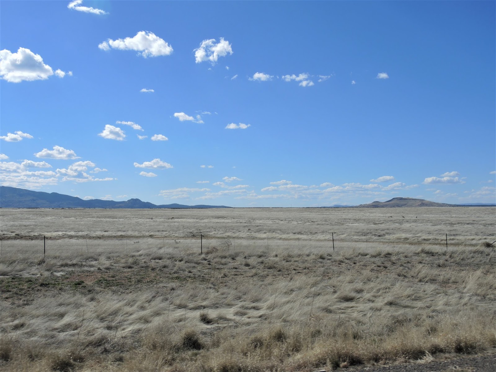
The well-maintained dirt road becomes a primitive road with prominent signs that state: "Primitive road, caution, use at your own risk. This surface is not regularly maintained." Much of this land is designated wilderness where ranchers have grazing rights. At first the land was fenced in and then later we rode through open range country. Notice the fence poles are made from tree limbs, not metal poles, and imagine how many hours of work it took to build these fences.
About 9 miles east of Chino Valley we passed the Garchen Buddist Institute, a Tibetan Buddhist retreat and teaching center. We had heard about the center and honestly, we're somewhat surprised that many people manage the trip on the dirt road.
As we continued north, we crested a hill and saw amazing views of the red rock landscape around Sedona.
We love riding on roads with little traffic which gives us the opportunity to take our time and enjoy the high desert landscape. Today we could ride for 20 minutes or more before seeing a vehicle, but we were within 20-30 miles of a small town or highway the entire day.
About 25 miles out of Chino Valley we finally came to the old Perkins ranch with a cedar corral next to the road, and in the distance saw some of the Perkinsville buildings. A one-lane bridge crosses the Verde River, one of only two wild and scenic Arizona rivers. The Verde River is a free-flowing river that has water in it year-round, unlike most of the rivers in the state that are typically a dry, dusty riverbed with water only during the monsoon rains.
We continued following Perkinsville Road until we came to an intersection with Yavapai County Road 73, a paved road that leads to Williams, AZ. We have been on this road before and had a decision to make: should we take the paved road north to Williams, adding another hour plus to our trip? Or should we continue about 10 miles on the dirt road to AZ 89 north of Paulden and a much shorter trip home? The football game was calling us so we decided on the shorter route.
About 5 miles down the road after crossing a dry wash lined with sharp rocks the tire pressure warning light on the dashboard started flashing red.
A flat rear tire is normally no problem because Mike carries a tire repair kit and a compressor. However, a rock cut a 3/4" wide gash in the tire which is far too large to plug.
We're on a lightly traveled dirt road with no signs of people in sight, and it's noon in Arizona on a sunny September day with the temperature hovering around 90.
Big sighs from both of us as Mike attempted to contact BMW Motorcycle Owners of America roadside assistance. Of course there was no cell phone coverage. Because it was supposed to be a short trip, we didn't bring water with us, and suddenly we were in a difficult situation.
Within a few minutes a man driving a pick-up truck saw us on the side of the road and stopped to help. He had cell phone coverage and generously allowed Mike to use his phone to get through to MOA roadside assistance. Explaining our location to the lady at roadside assistance wasn't easy, but finally she seemed to understand where we were and located a tow truck company in Chino Valley. She told us to expect a 90 minute wait, so the helpful gentleman in the pick-up gave us a bottle of water and continued on his way home.
Every 20-30 minutes a car, pick-up truck pulling a camper, or an ATV slowed down as they drove by and asked if we needed help. One group gave us 3 bottles of cold water so we wouldn't get dehydrated, and we wore our motorcycle jackets to protect us from the sun. Mike sunburns really easily so he also wore his motorcycle helmet while we waited, but it was too hot for me so I put a washcloth that Mike keeps on the BMW over my head.
90 minutes later with no tow truck in sight, we flagged down the next vehicle to come by, a camper driven by a couple from Yuma who thankfully had cellphone service. We stood in the shade of their camper while they waited almost an hour with us, sharing conversation and more cold water.
After a few back-and-forth calls with the tow truck company who originally had the wrong location for us, Johnny from Tri-City Towing came to our rescue.
We spent approximately 3 hours on the side of the dirt forest road from the time of the flat until Johnny arrived. Our short motorcycle ride turned into a much longer adventure than we anticipated, and thanks to the friendly people who stopped to help us we survived a potentially hazardous situation with yet another exciting motorcycle story to share.
Follow our route here
We enjoyed smooth riding on 2-lane paved roads into Chino Valley and then turned east onto Perkinsville Road. The road is named for A.M. Perkins who established a ranch in this area in 1900. In 1912 a railroad spur was constructed to connect the copper mine in nearby Jerome with a smelter, and a train depot was located on the Perkins' ranch. In the early 1900's 10-12 families lived here and Perkinsville boasted a school, general store and post office. By the 1950's the only people left were the ranchers.
Perkinsville Road in Chino Valley soon turns to dirt, but there are several businesses right outside town: The Chino Valley Shooting Facility, Perkinsville Meat Processors, and Perkinsville Livestock Auction.
The well-maintained dirt road becomes a primitive road with prominent signs that state: "Primitive road, caution, use at your own risk. This surface is not regularly maintained." Much of this land is designated wilderness where ranchers have grazing rights. At first the land was fenced in and then later we rode through open range country. Notice the fence poles are made from tree limbs, not metal poles, and imagine how many hours of work it took to build these fences.
About 9 miles east of Chino Valley we passed the Garchen Buddist Institute, a Tibetan Buddhist retreat and teaching center. We had heard about the center and honestly, we're somewhat surprised that many people manage the trip on the dirt road.
As we continued north, we crested a hill and saw amazing views of the red rock landscape around Sedona.
We love riding on roads with little traffic which gives us the opportunity to take our time and enjoy the high desert landscape. Today we could ride for 20 minutes or more before seeing a vehicle, but we were within 20-30 miles of a small town or highway the entire day.
About 25 miles out of Chino Valley we finally came to the old Perkins ranch with a cedar corral next to the road, and in the distance saw some of the Perkinsville buildings. A one-lane bridge crosses the Verde River, one of only two wild and scenic Arizona rivers. The Verde River is a free-flowing river that has water in it year-round, unlike most of the rivers in the state that are typically a dry, dusty riverbed with water only during the monsoon rains.
We continued following Perkinsville Road until we came to an intersection with Yavapai County Road 73, a paved road that leads to Williams, AZ. We have been on this road before and had a decision to make: should we take the paved road north to Williams, adding another hour plus to our trip? Or should we continue about 10 miles on the dirt road to AZ 89 north of Paulden and a much shorter trip home? The football game was calling us so we decided on the shorter route.
About 5 miles down the road after crossing a dry wash lined with sharp rocks the tire pressure warning light on the dashboard started flashing red.
A flat rear tire is normally no problem because Mike carries a tire repair kit and a compressor. However, a rock cut a 3/4" wide gash in the tire which is far too large to plug.
We're on a lightly traveled dirt road with no signs of people in sight, and it's noon in Arizona on a sunny September day with the temperature hovering around 90.
Big sighs from both of us as Mike attempted to contact BMW Motorcycle Owners of America roadside assistance. Of course there was no cell phone coverage. Because it was supposed to be a short trip, we didn't bring water with us, and suddenly we were in a difficult situation.
Within a few minutes a man driving a pick-up truck saw us on the side of the road and stopped to help. He had cell phone coverage and generously allowed Mike to use his phone to get through to MOA roadside assistance. Explaining our location to the lady at roadside assistance wasn't easy, but finally she seemed to understand where we were and located a tow truck company in Chino Valley. She told us to expect a 90 minute wait, so the helpful gentleman in the pick-up gave us a bottle of water and continued on his way home.
Every 20-30 minutes a car, pick-up truck pulling a camper, or an ATV slowed down as they drove by and asked if we needed help. One group gave us 3 bottles of cold water so we wouldn't get dehydrated, and we wore our motorcycle jackets to protect us from the sun. Mike sunburns really easily so he also wore his motorcycle helmet while we waited, but it was too hot for me so I put a washcloth that Mike keeps on the BMW over my head.
90 minutes later with no tow truck in sight, we flagged down the next vehicle to come by, a camper driven by a couple from Yuma who thankfully had cellphone service. We stood in the shade of their camper while they waited almost an hour with us, sharing conversation and more cold water.
After a few back-and-forth calls with the tow truck company who originally had the wrong location for us, Johnny from Tri-City Towing came to our rescue.
We spent approximately 3 hours on the side of the dirt forest road from the time of the flat until Johnny arrived. Our short motorcycle ride turned into a much longer adventure than we anticipated, and thanks to the friendly people who stopped to help us we survived a potentially hazardous situation with yet another exciting motorcycle story to share.
Follow our route here
Subscribe to:
Posts (Atom)