Showing posts with label BMW motorcycle travel. Show all posts

Tuesday, August 11, 2020

Riding the BMW from Colorado into Arizona

 Today's ride took us from the lush green mountains around Pagosa Springs, Colorado into the wide-open desert in northern Arizona over 370 gorgeous miles.

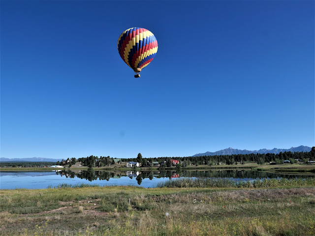
It was fun to see a hot air balloon as we started our ride today heading west on US 160. We rode past Chimney Rock National Monument at the southern edge of the San Juan Mountains, where over 200 homes and ceremonial buildings of the Ancestral Puebloans are preserved.

160 West took us through Durango and Cortez through the Southern Ute Reservation and the Ute Mountain Reservation, reminders that people made this area their home for thousands of years before Europeans arrived. We reached 3,000 miles for our trip - so far - in Cortez.

After riding through the San Juan mountains outside Durango, we rode past Mesa Verde National Park, established in 1906 to preserve more sites of the Ancestral Puebloans, including 600 cliff dwellings. The park towers at 6,000'-8,500' above the surrounding valley.

Whenever we head home from a motorcycle trip north of us, we have to ride through the Navajo Reservation which covers 27,000 acres in Arizona, Utah and New Mexico. That's slightly larger than the entire state of Tennessee! Small towns are few and far between in the Navajo Nation, and with COVID restrictions there are many closures. We make sure to fill up the BMW with fuel before we get onto the Nation and not stop at all, if possible. Today we stopped in Cortez which sits at 6,200' elevation in the Montezuma Valley in southwestern Colorado. As we headed south on US 160, we left the green mountains behind us as we entered the desert. For the next part of our trip, the only green we would see are areas that are irrigated.

Unlike riding the twisting, curving roads through the Rocky Mountains the past few days, today's ride was on straight roads which allowed us to zoom along the highway at faster speeds. We crossed the San Juan River which marks the boundary between the Ute Mountain Reservation and the Navajo Reservation and then past Four Corners where the states of Utah, Arizona, Colorado and New Mexico meet.

The landscape changed again as we rode into Kayenta, a town of about 5,000 people in the Navajo Reservation. The red rock cliffs and buttes seem to change color and even shape with the changing light from sun to cloudy skies, making this a mesmerizing ride. 


US Route 160 ends at US 89, where we turned south toward Flagstaff, Arizona, our stop for the night. The temperature rose to 99.5 degrees and thankfully a partly cloudy sky kept it a bit cooler as we rode toward the San Francisco Peaks.

Flagstaff sits at about 7,000' elevation so the temperature dropped into the low 80's. Tomorrow is a short 2 hour ride home, and the end of our 17 day motorcycle trip.

Thursday, August 6, 2020

Winding roads in Colorado on the 11th day of our Summer 2020 trip on the BMW

It was another bright, sunny morning when we left Salida, Colorado and rode east on US 50. This is one of Mike's favorite roads:  steep rocky walls alternating with more gentle, rounded hills through a canyon with the Arkansas River running alongside the road. 

Train tracks run along one side of the Arkansas River, and we were surprised to see a line of empty railroad cars that stretched about 2 miles sitting on the track with no engine in sight.

We turned north onto Colorado 9 and after a few short miles continued north on County Route 11, part of the Gold Belt Tour, a scenic byway that travels through many of the towns that were an important part of the gold mining boom in the early 1890's. There was hardly any traffic and we enjoyed long views of the mountains, wide open valleys, and sweeping, twisting roads.

Our route took us through Cripple Creek, originally the site of ranches in its 9,000' elevation valley until one of the largest gold strikes was discovered in 1890. In three years the town's population went from 500 to 10,000. Today the population is around 1,200, and while gold continues to be mined here, Cripple Creek is now more of a tourist destination. Much of the town has been restored and is part of the historic district, and in 1991 gambling became legal. We rode through about 10am on a Thursday and the town appeared almost completely empty.


We continued north on Colorado 67 when we started to see far-off views of snowy Pike's Peak.

Pike's Peak is a 14,115' tall mountain in the Front Range of the Rocky Mountains, just 12 miles west of Colorado Springs. Our goal was to ride to the top of the mountain via the 19-mile Pike's Peak Highway. However, when we got to the entrance we discovered that due to construction at the summit, we could only ride up 13 miles and then would need to take a shuttle the rest of the way. We're not interested in riding in a bus filled with people, so we turned around and rode into Manitou Springs for lunch and to consult the map.

With the skies threatening rain we decided to ride a short route continuing north on Colorado 67 past Woodland Park which bills itself as the 'city above the clouds' at 8,465'.
Route 67 twists and turns through the Rocky Mountains, and when we turned west onto County Route 126 the road followed the South Platte River.

We rode through sections of the forest burned in the 2002 Hayman Fire, a haunting reminder of the damage fire causes in this dry part of the country.

The skies got darker and when we saw a flash of lightning we decided to turn around and retrace our route back to Colorado Springs where we're spending the night. While we weren't able to ride up Pike's Peak as planned, we had a beautiful day in the Rockies.

Sunday, September 23, 2018

A BMW ride in search of aspens

It's the end of September and we thought we might see the changing leaf colors of the aspen trees in Flagstaff. No Fall colors yet, but we had a beautiful ride through the ponderosa pine forests along the Mogollon Rim.


One of our favorite rides is on Lake Mary Road into Flagstaff, and today didn't disappoint. A dam on Walnut Creek forms Lake Mary, named after Mary Riordan, a daughter of wealthy lumber barons who built the lake in 1905 as a water supply for Flagstaff. There wasn't much water today in the reservoir, and no water at all in Mormon Lake. Unfortunately, Mormon Lake is the largest natural lake in Arizona, and the fact that it has no water today, at the end of the rainy monsoon season, says a lot about the drought in the Southwest.


As we rode closer to Flagstaff the San Francisco Peaks, the highest mountains in Arizona, started to come into view.


Our goal today in search of changing aspen leaf colors was the Flagstaff ski area, the Snowbowl. Skiing started here in 1938 at 9,200' elevation at the base lodge with chair lifts taking skiers to 11,500'.


We saw plenty of aspen trees on the climbing, twisting 7 mile road to the base lodge.


The view from the highest point of the road to the ski area is incredible, and a perfect spot for a photo of the BMW.


Today was the first time I wore the new Viking Cycle Ironborn women's textile motorcycle jacket on a ride, and overall I liked the comfortable fit and all the pockets. On the trip home from Flagstaff the temperatures rose to 98 degrees and even with the jacket vents open I was hot and sweating. However, in those temperatures I most likely would have been just as hot wearing my old Olympia jacket with mesh panels for ventilation. Thanks to Viking Cycle for sending me the jacket to review!


We spent 5 hours on the road and covered 267 miles in a large circle in north-central Arizona. Check out our route here. Even in this relatively small area we experienced a wide range of terrain as we traveled from the high desert in Prescott, through ponderosa pine forests, climbed to the higher elevation in Flagstaff, wound our way up to the Snowbowl in the San Francisco Peaks, then descended 6,000' into the green Verde River valley until we finally climbed back to Prescott. What a fun way to spend a Sunday!


Saturday, August 11, 2018

An out-of-the-ordinary day on the BMW

Usually we plan our route for the day's ride to stay off the Interstate highways, much preferring the slower pace of local roads that also give us more of a feel for the communities. We also book our hotel room so we know where we're headed, and plug the hotel's address into our Garmin GPS system so that no matter how many scenic 'wrong' turns we take, we always end up where we plan to spend the night.

Today we threw caution to the wind. The weather forecast was for intermittent rain and thunder storms, and while we planned to spend the night somewhere in Pennsylvania, we also needed to ride into Delaware to check off our 13th new state. We decided to start the day's trip with about 100 miles on I-81 heading north from Harrisonburg, VA to Chambersburg, PA to cover the miles quickly and hopefully beat the storms.


We started at 6:30 am before the sun came up, and watched the light gradually highlight the Blue Ridge and Allegheny mountains in the distance. I-81 travels through the Shenandoah Valley and crosses the Shenandoah River.


We crossed in and out of Maryland and Pennsylvania a few times today so that we could dip into the northwestern corner of Delaware. We rode through Gettysburg, PA, site of the bloodiest battle of the Civil War, the inspiration for President Lincoln's famous Gettysburg address, and the turning point in the war that ended General Robert E. Lee's second invasion into the North.


This was the most traffic we've experienced yet in our 14 days on the road from home in Arizona, and it was jarring and frustrating to be in stop-and-go traffic through the numerous towns and small cities. We decided to let the Garmin GPS take over, and were relieved to be routed away from the centers of most of the towns and instead enjoyed the quieter side roads through the rolling hills of this part of the country.


We finally stopped for a late lunch in the beautifully named town of Honey Brook. We saw a billboard advertising a local diner, and Wimpy & Dee's didn't disappoint. Our waitress was friendly and helpful, the chocolate milkshake perfect with our sandwiches, and we enjoyed the 1950's memorabilia.


While we were eating lunch cellphones all around us started buzzing with a thunderstorm and possible flooding weather alert. We decided to find a hotel within an hour's ride to hopefully beat the approaching storm, and settled on Limerick, PA. This part of Pennsylvania is home to many Amish, and our route took us past several Amish farms, a couple of Amish driving a horse-pulled cart, and children working in the fields or riding push-scooters.


Everything out-of-the-ordinary worked out today:  we just missed several storms, riding on wet roads where steam was rising off the pavement covered with puddles; we rode into Delaware; the Interstate helped us get around congested areas and ride faster; and taking our chances using the Garmin instead of pre-planning our route took us on curving roads through the beautiful green countryside.

We rode 360 miles today and 4167 total miles so far on our trip. Each day brings new challenges and something unexpected as we continue to make our way northeast.  Here is today's route

Friday, August 10, 2018

A twisty 13th day on our cross-country BMW trip

Part of the fun of traveling across the country is to eat meals in local restaurants in the small towns we pass through. We've noticed that whole grain bread, fruit and vegetables are much more difficult to find in the South, and today was the first time I've ever seen bologna on the menu. Bologna was one of the meat options at breakfast (sausage, bacon, or bologna) in Sparta, NC and a fried bologna sandwich with American cheese was on the lunch menu in Franklin, WV.  We passed on both.

After breakfast without bologna, we started our ride heading northeast through the Appalachian Mountains, quickly crossing from North Carolina into Virginia, and then crossing back and forth across the West Virginia/Virginia border.

Once again we rode through misty fog created by low-hanging clouds that remind me of the cotton spiderwebs used to decorate for Halloween.


The sun quickly burned off the mist, and we enjoyed sunny skies for most of the day.


Our ride took us through green farmland with fat and happy cows grazing on the steep hillsides, to technical twisties up, down, and around the mountains. The tight corners, 9% grades down the mountains, rivers and streams running along the road, and the green fields and forests made this an absolutely awesome day.


Mid-morning we were startled when a bear shambled across the road in front of us, and an hour or so later a young fawn scurried across the road.


Our route took us through several national forests:  Jefferson, Washington, and Monongahela and we even went past the Green Bank Observatory in West Virginia, home to the most accurate large dish radio telescope in the world. Soon after we passed the observatory and were winding our way up and down the mountains on WV 28, the BMW's odometer rolled over to 6000 miles. We did a little happy dance and continued zooming on our way.

We ended the day in Harrisonburg, Virginia, in the Shenandoah Valley  Tomorrow we'll continue northeast, dipping into Delaware to cross it off our list of new states.  Here is today's route


Thursday, August 9, 2018

Blue Ridge Parkway fun on the BMW

There are so many fantastic motorcycle roads in North Carolina, we could stay here for weeks and not run out of roads to enjoy. Today we decided to ride on the Blue Ridge Parkway that winds 469 miles through the Blue Ridge Mountains in North Carolina and Virginia. We had time today for 100 miles, starting just outside Waynesville, NC and exiting at Linville, NC.


The sun was just rising when we left our hotel in Waynesville on twisting, curving 2 lane roads that led to the Parkway.


The Blue Ridge Parkway began when President Franklin Roosevelt visited the Skyline Drive in Virginia in 1933, and together with legislators and the Department of the Interior developed plans for a park-to-park public works project to connect with the Great Smoky Mountains Park. Even though millions of people drive portions of the Parkway each year, today we saw very little traffic and enjoyed curving along the sweeping 2-lane road.


Yesterday's ride on the Cherohala Skyway and the Moonshiner 28 featured twisty, technical curves through densely wooded mountain forests, and today's ride offered more sweeping curves up and down the mountains with periodic wide-open vistas over the valleys below.


The Blue Ridge Mountains get their name from the blue cloudy haze that hovers above and below some of the tallest peaks.


At one point, the clouds and fog dipped down to completely cover the road in front of us, then the sun came out and started to burn off the fog.


There are 25 tunnels in the North Carolina portion of the Blue Ridge Parkway, and we rode through several of them today.


After about 3 hours enjoying the scenery along the quiet, sweeping Parkway we completed our day's ride heading north on U.S. 21 toward Sparta North Carolina, our stopping point for today. The local communities along U.S. 21 in North Carolina and Virginia have a tourist campaign called "Take a Break from the Interstate", referring to I-77 that took much of the traffic away from U.S. 21 that used to be the main north/south route from the Great Lakes to Florida. We heartily agree with enjoying the more scenic, slower paced 2-lane highways and avoiding the Interstates whenever possible.


Our host at the Alleghany Inn recomended Becca's Backwood Bean Coffee Shop that serves artisan-style pizza on Thursday nights. The coffee shop was crowded when we arrived, and luckily there were 2 open seats at the bar where we enjoyed delicious ham and pineapple pizza with fresh salads. We walked down the street to the recently opened Laconia Ale Works second location. Friendly people, good products, and we wish them all the best.

We've traveled roughly 3400 miles over the past 12 days, and tomorrow we continue our trip north through West Virginia and into Virginia. We're looking forward to continuing our ride in the Appalachian Mountains.  Here is today's route