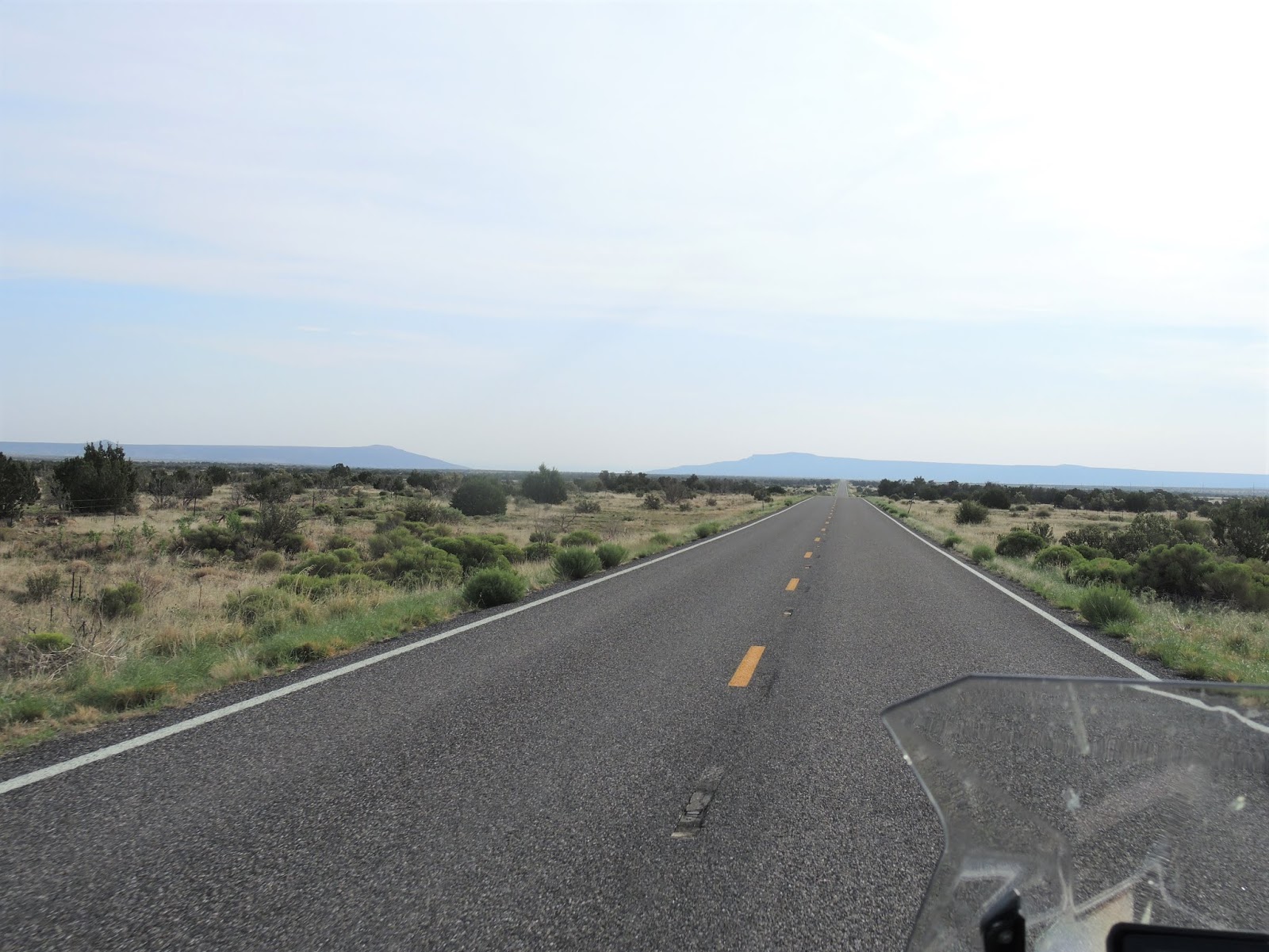
Day 2 of our cross-country motorcycle trip started in Farmington, NM. We left at 6:45am to beat the heat and the potential rain/hail - and neither one happened. We stopped to put on the warmer jacket liners as the temperature dropped down from 68 to 65 degrees, and then it kept on dropping to a low of 51 at one point.
We rode east from Farmington on U.S. 64 east, climbing a high plateau. There was very little traffic, but we saw plenty of cattle - some right next to or even in the middle of the highway - and deer.
When we started in the morning Mike reminded me that U.S. 64 twists and turns quite a bit, and it would be easy to miss a turn. In Chama, we missed our turn and instead of continuing east on U.S. 64 we headed northeast on what turned out to be Colorado 17. It was an absolutely beautiful ride, climbing through two passes in the San Juan Mountains that topped out at over 10,000': Cumbres Pass and La Manga Pass.
When we saw the sign that we were entering Colorado, we knew we had missed a turn. The scenery was so gorgeous and the twisties and hairpin turns so much fun that we kept heading east until we reached the intersection of U.S. 285 South where we stopped to double check the map and a photo opp with the engine of the Cumbres & Toltec Scenic Railroad, a narrow gauge RR line constructed in 1881 to support mining.
After a quick ride on U.S. 285 South we turned east again on U.S. 64 toward Taos, riding through wide-open valleys with distant views of the mountains.
U.S. 64 winds directly through Taos, colonized in 1615 by the Spanish and today a quirky tourist town in the Sangre de Cristo Mountains.
We continued east on U.S. 64, part of the Enchanted Circle Scenic Byway roads that are made for a BMW motorcycle.
We saw numerous signs for the Philmont Scout Ranch, 214 square miles of high adventure training for Boy Scouts that started operating in 1938. Unfortunately, the Morris Creek Fire started in this area the end of June, destroying over 1600 acres and leaving the danger of flooding and mudslides in its path.
We also rode by signs for the EX UU Ranch, established in 1848 and today the largest private ranch in the country with over 180,000 acres.
The scope and expanse of the wild countryside in this part of northern New Mexico is hard to wrap my mind around. We rode for miles without seeing any signs of humans except for the paved road we followed, reveling in the quiet landscape.
We turned onto NM 21 in Cimarron, then east onto U.S. 56 in Springer, riding the final 85 miles through wide open prairies.
We're spending the night in Clayton, NM, a town of about 3000 people established as a water stop for the railroad in the 1880's and today the county seat. President Teddy Roosevelt passed through Clayton in 1905, thanking the local men who volunteered in his regiment. The Hotel Eklund was built in 1898, and our third story was added in 1905.
We ended our day with a walk for Mike and run for me through the town followed by dinner in the historic saloon of the Hotel Eklund, where we saw the bullet holes in the ceiling above the bar that were fired by an enthusiastic customer when the telegraph operator brought news that Warren Harding was elected president.
We rode 397 miles today, and the odometer on the BMW that we purchased the end of March rolled over to 3000 miles. Stay tuned for where we'll be when the odometer rolls over to 4000 miles! Tomorrow we continue east, riding through 3 new states: Kansas, Oklahoma and Texas. Here is the route we have taken so far
Monday, July 30, 2018
Sunday, July 29, 2018
Cross country BMW motorcycle trip begins!
Mike and I have been planning a cross-country trip on our BMW motorcycle for months. The goal is to ride the BMW in every one of the lower 48 states. Because we lived in Vermont before we moved to Arizona 5 years ago and we love traveling on our BMW, we only have 19 states left. However, these states are spread throughout the country. We're starting our trip on the southern route: heading east from Arizona through the southern states all the way to Florida. Then we turn north through the east coast states and stopping in Vermont for almost a week to visit family and friends before we head west to eventually ride through the northern states. After South Dakota, we plan to ride through Colorado to visit our oldest son and then finally back home to Arizona.
We'll be gone 5-6 weeks depending on weather and whim. It's the first time we haven't had a set return date on a trip, and we're loving the freedom of taking the trip one day at a time.
Today was our first day of the trip, riding on familiar roads from Arizona to Farmington, NM.
The landscape changes from forest to high desert on AZ 87 north to Winslow, with long-distance views to the shadowy mountains to the north and west. Winslow is famous for being part of the Eagle's song "Take it Easy" where there is a statue 'standing on the corner in Winslow Arizona' and it's on the old Route 66 that crossed the U.S. from Chicago to Los Angeles.
From Winslow, we continued north on AZ 87 through the Navajo and Hopi reservations where we saw more horses and sheep than cars.
At Second Mesa on the Hopi Reservation we turned east on AZ 264, and then north on AZ 191 where we stopped for lunch in Chinle. The Navajo Nation covers 27,000 square miles, and the smaller 2,500 square mile Hopi Reservation is surrounded completely by the Navajo Nation. Riding through both of these reservations the miles slide by quickly because of the lack of traffic and people, plus we make great time on the lightly traveled roads.
4 years ago we discovered Indian Route 13 that winds through the Chuska Mountains between Lukachukai in Arizona and the Red Valley in New Mexico. It's one of our favorite motorcycle roads because of the steep, twisting, winding road that runs over the Buffalo Pass - our first mountain pass of our trip.
After crossing in New Mexico we rode past Shiprock, the remainder of a volcanic eruption 30 million years ago. The prominent rock formation that rises 1500' above the desert is sacred to the Navajo.
From Shiprock we left the peaceful 2-lane highways and headed north on the busier 4-lane divided highway US 491 to the town of Shiprock, then east on US 64 along the San Juan River into Farmington, our stop for the night.
Starting our cross-country trip on familiar roads gave us the opportunity to ease into the routine of motorcycle travel. Tomorrow we continue east riding through the mountains of northern New Mexico. More steep and twisty roads are in store - our favorite!
Sunday, July 1, 2018
BMW ride on a hot day for pie
We decided the hot weather - temperatures in the high 90's today in Prescott - wasn't going to stop us from riding the BMW. The question was: where to go? Flagstaff, at 7000' feet elevation is cooler, but we didn't have enough time today. Going south to lower elevations where the temperatures would be well over 100 degrees simply wasn't option. We decided to ride on familiar roads to a new destination: pie in Wikieup.
Bright, Arizona blue skies and twisty 2-lane paved roads with almost no traffic made this a zen-like ride. Usually we see several groups of motorcycles on this route, but today we saw only one other bike, a Harley, which we quickly passed.
We headed west on Iron Springs road out of Prescott, riding through the Prescott National Forest. We're currently in Stage II fire restrictions which basically mean we can't do anything that might cause a spark: campfires, charcoal fires, outdoor smoking, operating equipment like chainsaws, and even our town's 4th of July fireworks have been cancelled. All the vegetation is various shades of brown, with a few green bushes scattered around as a reminder that once the monsoon rains start, the desert will come to life again.
Iron Springs road becomes Yavapai County Road 10, and we periodically ride across cattle guards. Instead of miles of fences to keep cattle off the road, cattle guards are basically a series of metal pipes laid across the road over a ditch. When cattle (or people with smaller feet, like me) try to cross, their legs fall into the openings between the pipes and they are stuck. Cattle learn not to cross cattle guards, and I've learned to walk around them.
In Kirkland we turn right onto AZ 96 west, with the highway snaking through the mountains. It seems like we would be climbing higher in elevation, but actually Prescott is at 5500' and we descended through Skull Valley at 4260', Kirkland at 3900' and Hillside at 3850'. A few miles past Hillside we turned onto AZ-97 south for about 14 miles. This is one of our favorite motorcycle roads, reminding us of a roller coaster as we zoom down hills through areas marked 'do not enter when flooded', then zip back up the next hill. There are no straight stretches of road here, and we see only one car over the 14 miles of up and down, twisty fun.
AZ-97 takes us to US-93, a 4-lane divided highway which is the main road between Las Vegas and Phoenix. Luckily we only have about 30 miles to ride through the Big Sandy Valley in the Mohave Desert to Wikieup, a town of less than 200 residents. Wikieup is a Mohave word for 'shelter' or 'home'. In the winter, hundreds of RVs make their home here, but today it was 102 degrees and there were no RVs in sight.
We stopped at the Cool Water Cafe, part of the Hidden Oasis RV Park for lunch, sort of on purpose. I had heard that there was a great restaurant in Wikieup with amazing pie, and when Mike googled restaurants in Wikieup he found the Cool Water Cafe advertising pie and thought this was it. After all, how many restaurants can there be in the tiny town of Wikieup? (apparently there are 5). I saw a sign for Luchia's 4 miles down the road and realized THIS was the restaurant I'd heard of. It was hot, we were hungry, and the Cool Water Cafe had pie. We made a quick decision to stop and enjoyed our lunch of a sub for Mike and panini for me, with homemade blackberry pie for dessert. We were the only people in the Cafe and chatted with the owner about the numerous solar-powered bobble heads on the window sill next to our table as she made our lunch.
After cooling off with ice cold water and lemonade in the air-conditioned cafe, we retraced our route, climbing from 2000' elevation in Wikieup back to the cooler 5500' elevation in Prescott.
At one point today Mike said it felt like he was riding through hot air powered by a hair dryer, and I said it felt more like a convection oven. We're not about to let the heat stop us from enjoying the BMW and the Arizona countryside. Especially when there is pie involved.
Bright, Arizona blue skies and twisty 2-lane paved roads with almost no traffic made this a zen-like ride. Usually we see several groups of motorcycles on this route, but today we saw only one other bike, a Harley, which we quickly passed.
We headed west on Iron Springs road out of Prescott, riding through the Prescott National Forest. We're currently in Stage II fire restrictions which basically mean we can't do anything that might cause a spark: campfires, charcoal fires, outdoor smoking, operating equipment like chainsaws, and even our town's 4th of July fireworks have been cancelled. All the vegetation is various shades of brown, with a few green bushes scattered around as a reminder that once the monsoon rains start, the desert will come to life again.
Iron Springs road becomes Yavapai County Road 10, and we periodically ride across cattle guards. Instead of miles of fences to keep cattle off the road, cattle guards are basically a series of metal pipes laid across the road over a ditch. When cattle (or people with smaller feet, like me) try to cross, their legs fall into the openings between the pipes and they are stuck. Cattle learn not to cross cattle guards, and I've learned to walk around them.
In Kirkland we turn right onto AZ 96 west, with the highway snaking through the mountains. It seems like we would be climbing higher in elevation, but actually Prescott is at 5500' and we descended through Skull Valley at 4260', Kirkland at 3900' and Hillside at 3850'. A few miles past Hillside we turned onto AZ-97 south for about 14 miles. This is one of our favorite motorcycle roads, reminding us of a roller coaster as we zoom down hills through areas marked 'do not enter when flooded', then zip back up the next hill. There are no straight stretches of road here, and we see only one car over the 14 miles of up and down, twisty fun.
AZ-97 takes us to US-93, a 4-lane divided highway which is the main road between Las Vegas and Phoenix. Luckily we only have about 30 miles to ride through the Big Sandy Valley in the Mohave Desert to Wikieup, a town of less than 200 residents. Wikieup is a Mohave word for 'shelter' or 'home'. In the winter, hundreds of RVs make their home here, but today it was 102 degrees and there were no RVs in sight.
We stopped at the Cool Water Cafe, part of the Hidden Oasis RV Park for lunch, sort of on purpose. I had heard that there was a great restaurant in Wikieup with amazing pie, and when Mike googled restaurants in Wikieup he found the Cool Water Cafe advertising pie and thought this was it. After all, how many restaurants can there be in the tiny town of Wikieup? (apparently there are 5). I saw a sign for Luchia's 4 miles down the road and realized THIS was the restaurant I'd heard of. It was hot, we were hungry, and the Cool Water Cafe had pie. We made a quick decision to stop and enjoyed our lunch of a sub for Mike and panini for me, with homemade blackberry pie for dessert. We were the only people in the Cafe and chatted with the owner about the numerous solar-powered bobble heads on the window sill next to our table as she made our lunch.
After cooling off with ice cold water and lemonade in the air-conditioned cafe, we retraced our route, climbing from 2000' elevation in Wikieup back to the cooler 5500' elevation in Prescott.
At one point today Mike said it felt like he was riding through hot air powered by a hair dryer, and I said it felt more like a convection oven. We're not about to let the heat stop us from enjoying the BMW and the Arizona countryside. Especially when there is pie involved.
Sunday, June 10, 2018
Overnight BMW motorcycle ride to Cottonwood
We're planning a cross-country motorcycle trip later this summer, and decided to try out the new Mosko Moto soft-sided bags on an overnight trip.

We often ride to Cottonwood, about 40 miles away, for a quick day trip and lunch at Bocce where we can sit outside and enjoy one of their fantastic thin crust pizzas and interesting salads. Cottonwood has developed into one of the premier wine-tasting areas in Arizona, featuring Arizona-grown grapes and local wines. Since we don't drink alcohol when riding the BMW, we decided to spend the night and take advantage of walking around Old Town Cottonwood, sampling wine, listening to music, and trying out some of the other restaurants.
We left home about 2pm with the temperature hovering around 90℉, knowing it would be warmer in Cottonwood at a lower elevation than our home in Prescott. Luckily, the trip east takes us over Mingus Mountain and through the old copper mining town of Jerome where we enjoyed the cooler breezes as we zoomed up the twisties on 89A.
As we got closer to Jerome, the views opened up to the tall cliffs of the Mogollon Rim in the distant north.
Mike guessed the temperature would be 102℉ in Cottonwood, and he was off by only .5℉; it was 101.5℉.
We stayed at the Iron Horse Inn on Main Street in Old Town Cottonwood. It was originally built in the 1930's as a motor court, and retains the same basic outside look.

After checking in, we walked through wrought iron gates into the shady courtyard, and found our room up a steep flight of cement steps.
Cottonwood was founded in 1874 when soldiers from nearby Camp Verde were stationed here. It took its name from a stand of 16 large cottonwood trees that grew near the Verde River. Historically it was a farming area for the nearby mountain towns, and today it's often used as a stopping off point for people visiting Jerome or Sedona.
Old Town Cottonwood boasts an eclectic mix of boutiques, restaurants, bars, wine-tasting venues and stores selling everything from countertops to locally produced art. We walked down the shady side of Main Street and stopped at The Tavern Grill where we sat outside and enjoyed an appetizer. Then we headed back up the other side of Main Street to the Merkin Vineyards tasting room where we sampled a few of their wines made from grapes grown in the Wilcox area of southern Arizona.
Our next stop was The State Bar, with its all-Arizona beer and wine selection. The Friends of the Verde River were hosting a music fest and fundraiser, and we sat on comfy chairs outside listening to different local bands and DJs. When it came time for a late dinner, we walked 3 blocks to the 3 Kings Kasbar for tapas and dessert.
This morning we ate a delicious breakfast of huevos rancheros for Mike and a breakfast sandwich for me with fresh squeezed orange juice for both of us at the Red Rooster Cafe. We listened to a talented musician who played a variety of different instruments, including bongos, drums, flutes and all kinds of bells and gourds while we enjoyed our breakfast.
We retraced our route from yesterday through Jerome and back home, and since it was fairly early on a Sunday morning, there was almost no traffic to slow us down as Mike swooped through the hairpin turns up and down the mountain.
We rode past one of the closed copper mines that brought thousands of people to this area in the 1920's. Today around 500 people live in Jerome, and hundreds more come here to see the quirky town and shops.
We're lucky to live in this beautiful area of Arizona where people from all over the world come to ride their motorcycles through the Southwest high desert.

We often ride to Cottonwood, about 40 miles away, for a quick day trip and lunch at Bocce where we can sit outside and enjoy one of their fantastic thin crust pizzas and interesting salads. Cottonwood has developed into one of the premier wine-tasting areas in Arizona, featuring Arizona-grown grapes and local wines. Since we don't drink alcohol when riding the BMW, we decided to spend the night and take advantage of walking around Old Town Cottonwood, sampling wine, listening to music, and trying out some of the other restaurants.
We left home about 2pm with the temperature hovering around 90℉, knowing it would be warmer in Cottonwood at a lower elevation than our home in Prescott. Luckily, the trip east takes us over Mingus Mountain and through the old copper mining town of Jerome where we enjoyed the cooler breezes as we zoomed up the twisties on 89A.
As we got closer to Jerome, the views opened up to the tall cliffs of the Mogollon Rim in the distant north.
Mike guessed the temperature would be 102℉ in Cottonwood, and he was off by only .5℉; it was 101.5℉.
We stayed at the Iron Horse Inn on Main Street in Old Town Cottonwood. It was originally built in the 1930's as a motor court, and retains the same basic outside look.
After checking in, we walked through wrought iron gates into the shady courtyard, and found our room up a steep flight of cement steps.
Cottonwood was founded in 1874 when soldiers from nearby Camp Verde were stationed here. It took its name from a stand of 16 large cottonwood trees that grew near the Verde River. Historically it was a farming area for the nearby mountain towns, and today it's often used as a stopping off point for people visiting Jerome or Sedona.
Old Town Cottonwood boasts an eclectic mix of boutiques, restaurants, bars, wine-tasting venues and stores selling everything from countertops to locally produced art. We walked down the shady side of Main Street and stopped at The Tavern Grill where we sat outside and enjoyed an appetizer. Then we headed back up the other side of Main Street to the Merkin Vineyards tasting room where we sampled a few of their wines made from grapes grown in the Wilcox area of southern Arizona.
Our next stop was The State Bar, with its all-Arizona beer and wine selection. The Friends of the Verde River were hosting a music fest and fundraiser, and we sat on comfy chairs outside listening to different local bands and DJs. When it came time for a late dinner, we walked 3 blocks to the 3 Kings Kasbar for tapas and dessert.
This morning we ate a delicious breakfast of huevos rancheros for Mike and a breakfast sandwich for me with fresh squeezed orange juice for both of us at the Red Rooster Cafe. We listened to a talented musician who played a variety of different instruments, including bongos, drums, flutes and all kinds of bells and gourds while we enjoyed our breakfast.
We retraced our route from yesterday through Jerome and back home, and since it was fairly early on a Sunday morning, there was almost no traffic to slow us down as Mike swooped through the hairpin turns up and down the mountain.
We rode past one of the closed copper mines that brought thousands of people to this area in the 1920's. Today around 500 people live in Jerome, and hundreds more come here to see the quirky town and shops.
We're lucky to live in this beautiful area of Arizona where people from all over the world come to ride their motorcycles through the Southwest high desert.
Sunday, May 27, 2018
It was a sunny Saturday with Arizona-blue skies so we decided to go on a 4-hour round-trip ride through the cooler pine forests to Payson and back. Even though this is the start of the Memorial Day holiday weekend, we only encountered traffic in two places: on the 7-mile stretch of I-17 and riding through the small town of Strawberry, where both sides of the 2-lane highway were crowded with parked cars and people walking through the local arts and crafts fair.
This is a familiar ride for us, since whenever our long trips head north or east we typically ride part of this route: I-17 north to the General Crook exit onto AZ-260. George Crook was a career US Army officer, promoted to Major General during the Civil War. He was sent to the West during the Indian Wars, and fought against the Apache in Arizona. Geronimo surrendered to General Crook in 1886, marking the end of the Indian Wars in the Southwest. After leaving the Army, Crook worked for the US government promoting better treatment of the Native Americans.
Heading north on I-17 we see the Mogollon Rim, an escarpment that rises to 7,000' elevation and in many places is 2000' above the valley below. The Rim forms the southern end of the Colorado Plateau that slices 200 miles across northern Arizona. Our trip today takes us through "Rim Country", the area in Arizona right along the Rim in the densely forested White Mountains.
Because of the higher elevation, it's 15-20 degrees cooler on the Rim than in Prescott, which is one reason why this is such a popular area in the summer. Due to the extremely high risk of fire this month, the Forest Service closed most of the Coconino National Forest to all types of public access, and we saw bright yellow and red warning signs across all of the forest roads along our trip.
We turned south on AZ-87, riding through the small towns of Strawberry and Pine until we reached Payson. After a quick stop for ice cream and a bottle of water, we retraced our route back home to Prescott.
I zipped up my motorcycle jacket all the way to the chin as we rode along the windy Mogollon Rim, and then unzipped it as we dropped down off the Rim into Camp Verde, where at 3,100' elevation the temperature soars into the high 80's and the landscape changes from pine forests to scruffy high desert vegetation.
We saw several groups of motorcycles along our trip today, but the majority of the time we had the 2-lane AZ-260 and AZ-87 to ourselves - just the way we like it.
This is a familiar ride for us, since whenever our long trips head north or east we typically ride part of this route: I-17 north to the General Crook exit onto AZ-260. George Crook was a career US Army officer, promoted to Major General during the Civil War. He was sent to the West during the Indian Wars, and fought against the Apache in Arizona. Geronimo surrendered to General Crook in 1886, marking the end of the Indian Wars in the Southwest. After leaving the Army, Crook worked for the US government promoting better treatment of the Native Americans.
Heading north on I-17 we see the Mogollon Rim, an escarpment that rises to 7,000' elevation and in many places is 2000' above the valley below. The Rim forms the southern end of the Colorado Plateau that slices 200 miles across northern Arizona. Our trip today takes us through "Rim Country", the area in Arizona right along the Rim in the densely forested White Mountains.
Because of the higher elevation, it's 15-20 degrees cooler on the Rim than in Prescott, which is one reason why this is such a popular area in the summer. Due to the extremely high risk of fire this month, the Forest Service closed most of the Coconino National Forest to all types of public access, and we saw bright yellow and red warning signs across all of the forest roads along our trip.
We turned south on AZ-87, riding through the small towns of Strawberry and Pine until we reached Payson. After a quick stop for ice cream and a bottle of water, we retraced our route back home to Prescott.
I zipped up my motorcycle jacket all the way to the chin as we rode along the windy Mogollon Rim, and then unzipped it as we dropped down off the Rim into Camp Verde, where at 3,100' elevation the temperature soars into the high 80's and the landscape changes from pine forests to scruffy high desert vegetation.
We saw several groups of motorcycles along our trip today, but the majority of the time we had the 2-lane AZ-260 and AZ-87 to ourselves - just the way we like it.
Subscribe to:
Posts (Atom)