Showing posts with label Cumbres Pass. Show all posts

Sunday, October 22, 2023

Colorado/New Mexico Loop on a late Fall day

 It was a beautiful late October day yesterday, so we decided to ride 194 miles looping south into New Mexico. Thanks to Butler motorcycle maps we chose a road marked in red, meaning lots of elevation changes and twisties.

To get to the twisty road, we first headed south on US 64/84 through the Chama River Valley. This was our first time riding the BMW on this route that is bordered by ranch land.


We headed east when US 64 split off from US 84 an started to climb up Brazos Summit, the second highest paved road in New Mexico.


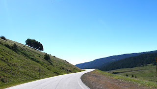
What a fun road on a motorcycle - 77 miles with lots of curves and twisty turns, stunning long views with Fall foliage colors, and almost no other vehicles on the road.


The highway tops off at 10,528' and then winds down to about 8,000' in Tres Piedras at the junction of US 64 and US 285 where we turned north on US 285.

What a change in landscape as we rode on a straight road through a high altitude valley with wide open plains and far-off views of the Rockies.


We rode past the Rio del Norte National Monument, an important wildlife corridor and home to people for thousands of years. 

We crossed back into Colorado and turned west in Antonito on CO 17, one of our favorite drives as it twists and turns through the San Juan Mountains over the Cumbres Pass at 10,022'.


We had a beautiful afternoon with perfect Fall weather, gorgeous scenery, and fun motorcycle roads straddling Colorado and New Mexico.


Sunday, July 16, 2023

Sunday morning ride

 We decided to ride in a big circle today, heading south from Chromo, Colorado to Chama, NM and then turning east on CO 17. This is a twisty 2-lane paved road that winds through the Sangre de Cristo mountains that are the southernmost part of the Rockies straddling the Colorado and New Mexico border.


We rode over Cumbres Pass at 10,0220' and as we descended toward the east we left behind green meadows and started seeing towering rocky cliffs as we headed into the San Luis Valley


At over 7,600' elevation, this 122 mile long, 74 mile wide high desert valley is home to agriculture and ranching. This area was originally home of the Utes, later explored by the Spanish and part of Mexico, and ceded to the United States in 1848 after the Mexican-American war.


CO 17 meets up with CO 285 in Antonito, and we then headed west on US 160 in Monte Vista. 


Up until this point we saw very little traffic, enjoying the road to ourselves. US 160 is a much more heavily traveled road and Mike zoomed past slower moving RVs and trucks at every opportunity.


We left home about 8:30am and by the time we reached South Fork we were hungry - and stumbled upon a superb food truck/bar/outdoor spot:  Rachel's


They had a small yet unique and delicious menu - we shared KoKo's Huevos and a Banana Split parfait while sitting at a picnic table in a shaded area. We were too early for the band that starts at noon on Sundays and are already planning another trip here.


We continued on US 160W over Wolf Creek Pass in the San Juan Mountains, crossing the Continental Divide at 10,857' before we descended down into Pagosa Springs.


We live about 25 miles south of Pagosa Springs, so we stopped at the Farmer's Market for fresh Palisade peaches, cherries and sweet corn before turning south on US 84 and home.

We rode 220 miles in about 4 hours (including the two stops) on a beautiful July summer morning. Fabulous motorcycle riding is one of the big reasons we live here, and today is a fantastic example of a perfect motorcycle day.


Monday, July 30, 2018

Twisties and an unexpected trip through Colorado

Day 2 of our cross-country motorcycle trip started in Farmington, NM. We left at 6:45am to beat the heat and the potential rain/hail - and neither one happened. We stopped to put on the warmer jacket liners as the temperature dropped down from 68 to 65 degrees, and then it kept on dropping to a low of 51 at one point.


We rode east from Farmington on U.S. 64 east, climbing a high plateau. There was very little traffic, but we saw plenty of cattle - some right next to or even in the middle of the highway - and deer.


When we started in the morning Mike reminded me that U.S. 64 twists and turns quite a bit, and it would be easy to miss a turn. In Chama, we missed our turn and instead of continuing east on U.S. 64 we headed northeast on what turned out to be Colorado 17. It was an absolutely beautiful ride, climbing through two passes in the San Juan Mountains that topped out at over 10,000':  Cumbres Pass and La Manga Pass.


When we saw the sign that we were entering Colorado, we knew we had missed a turn. The scenery was so gorgeous and the twisties and hairpin turns so much fun that we kept heading east until we reached the intersection of U.S. 285 South where we stopped to double check the map and a photo opp with the engine of the Cumbres & Toltec Scenic Railroad, a narrow gauge RR line constructed in 1881 to support mining.


After a quick ride on U.S. 285 South we turned east again on U.S. 64 toward Taos, riding through wide-open valleys with distant views of the mountains.


U.S. 64 winds directly through Taos, colonized in 1615 by the Spanish and today a quirky tourist town in the Sangre de Cristo Mountains.


We continued east on U.S. 64, part of the Enchanted Circle Scenic Byway roads that are made for a BMW motorcycle.


We saw numerous signs for the Philmont Scout Ranch, 214 square miles of high adventure training for Boy Scouts that started operating in 1938. Unfortunately, the Morris Creek Fire started in this area the end of June, destroying over 1600 acres and leaving the danger of flooding and mudslides in its path.

We also rode by signs for the EX UU Ranch, established in 1848 and today the largest private ranch in the country with over 180,000 acres.

The scope and expanse of the wild countryside in this part of northern New Mexico is hard to wrap my mind around. We rode for miles without seeing any signs of humans except for the paved road we followed, reveling in the quiet landscape.

We turned onto NM 21 in Cimarron, then east onto U.S. 56 in Springer, riding the final 85 miles through wide open prairies.


We're spending the night in Clayton, NM, a town of about 3000 people established as a water stop for the railroad in the 1880's and today the county seat. President Teddy Roosevelt passed through Clayton in 1905, thanking the local men who volunteered in his regiment. The Hotel Eklund was built in 1898, and our third story was added in 1905.


We ended our day with a walk for Mike and run for me through the town followed by dinner in the historic saloon of the Hotel Eklund, where we saw the bullet holes in the ceiling above the bar that were fired by an enthusiastic customer when the telegraph operator brought news that Warren Harding was elected president.

We rode 397 miles today, and the odometer on the BMW that we purchased the end of March rolled over to 3000 miles. Stay tuned for where we'll be when the odometer rolls over to 4000 miles! Tomorrow we continue east, riding through 3 new states:  Kansas, Oklahoma and Texas.  Here is the route we have taken so far