Friday, July 11, 2014

Mountains, marmots and creeks in Aspen

After three days on the motorcycle, we spent today off the bike in Aspen. Aspen, originally called Ute City after the Ute Indians who lived in the area, was founded during the silver mining boom in the 1880's. The ski area was developed in the 1940's, John Denver and Hunter Thompson lived here in the 1970's, and today Aspen is home to some of the most expensive real estate in the United States.

After a morning run along the Rio Grande River path, Mike and I took the RFTA bus to Maroon Bells, two fourteeners (mountains higher than 14,000' elevation) in the Elk Mountains near Aspen.


The bus driver told explained how glaciers formed the U-shaped valley, told us about the wildlife in the area, gave tips on the best hikes in the area, and made us laugh with stories about the area. We hiked around Maroon Lake,


and headed down the Maroon Creek trail over rocks and scree where we saw three marmots, past wildflowers, through stands of pines and aspens and along narrow trails lined with wet, green grass and bushes.


The bus driver warned everyone to stay a safe distance away from the several moose who live in the area. We didn't expect to see the moose, but as we walked down the access road, we stopped and watched a moose standing in the creek.


After a bus ride back into busy Aspen, we rode the gondola to the top of the mountain. The town of Aspen is located at just under 8000', and after a 15 minute ride the gondola took us to the Sun Deck at 11,212'. We looked out over the snowy mountains in the White River National Forest and waited out a rain/thunder/lightning storm before riding the gondola back into town.


Tomorrow we're back on the motorcycles, headed south through the Rockies to Gunnison. We're ready for high mountain passes and more amazing mountain views.

Thursday, July 10, 2014

Sunny ride into Aspen

Bright blue skies and a hot sun greeted us this morning in Grand Junction, Colorado.  At around 60,000 people, it's the largest city on the Western Slope, which is all of Colorado west of the Continental Divide. Its name comes from the junction of the Colorado and Gunnison rivers, which to our amazement are both fairly large moving bodies of water. We're used to 'rivers' in Arizona, which typically are dry and sometimes have a trickle of water. No wonder there is so much green here, even in a high desert climate.

Tom and Christine's friends Bill and Cynthia joined us for today's ride to Aspen and led us on a route that started off heading east on Interstate 70 through the Grand Valley that is bordered by the Grand Mesa, the world's largest flat-topped mountain, on one side; and the red rock cliffs of the Colorado National Monument on the other. We rode past vineyards and fruit orchards in the green valley along the Colorado River, an area originally the home of the Ute people with white settlers arriving in the 1880's. 


Usually I dislike riding on busy Interstates, but the scenery trumped the semi-trucks on the 20 miles we were on I-70. We left the interstate at exit 49 onto Colorado 65, the Grand Mesa Byway, that twisted and turned through the dry landscape.


We turned off on 45 1/2 road to enjoy more sweepers before rejoining I-70 and continuing east.


We stopped in Rifle for lunch at the Shooter's Grille where many of the waitresses wore a holstered pistol on their belt. I'm always curious about the history of names of towns, and legend has it that Rifle got its name from an old cowboy surveyor who left his rifle leaning against a tree and after that referred to the area as 'Rifle'.

We finished the day riding on I-70 to Glenwood Springs, then on busy 4-lane Colorado route 82 into Aspen. The road bisects mountains covered with pine trees, with intermittent vistas of snow-capped peaks in the distance. Our odometer turned over  to 24,000 miles just outside Aspen, and we slapped a high-five and did a little dance on the bike celebrating the mileage.

This was the first day of the trip we didn't need our raingear, surprising since July and August are known for rain and thunderstorms. Tomorrow we spend a full day in Aspen, and we're looking forward to exploring the town and mountains.

Wednesday, July 9, 2014

Riding into Colorado mountains, snowy passes, and high desert

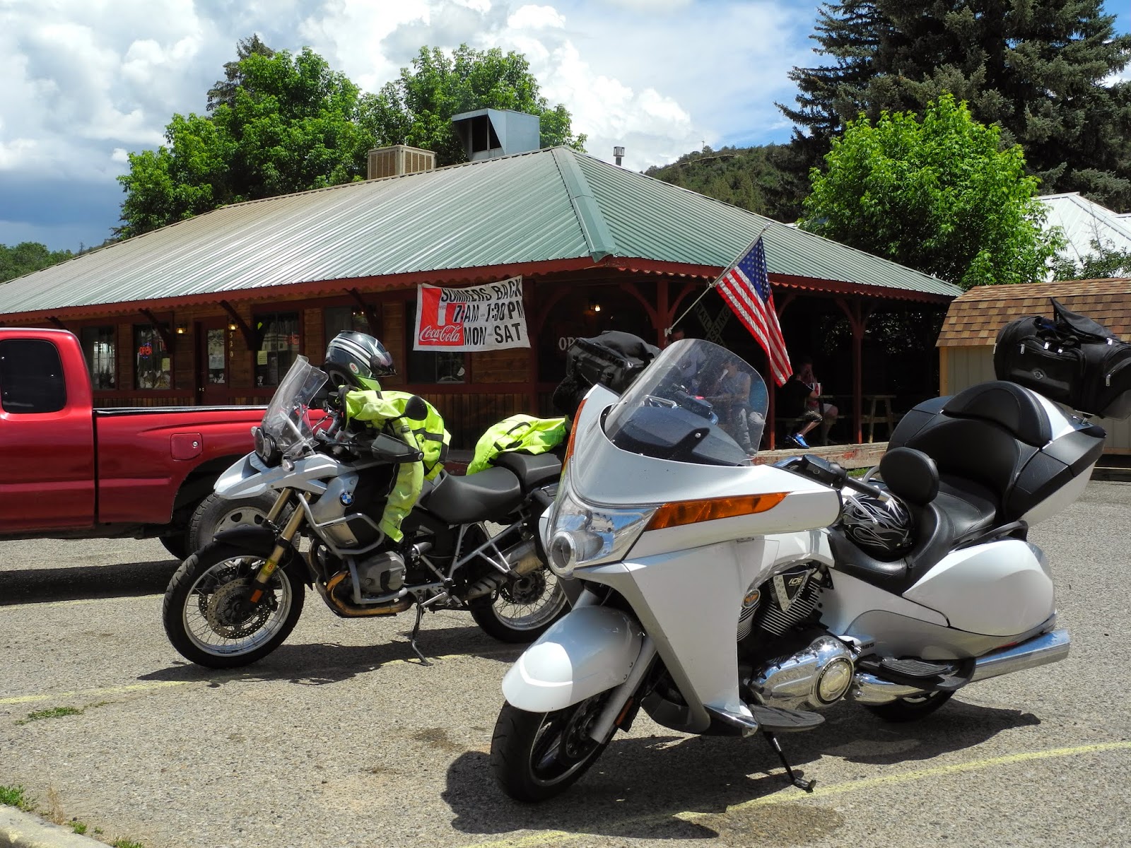
Our motto on motorcycle trips is to be flexible and enjoy the journey. We needed that motto this morning when Tom, riding with us on his Victory Vision Tour, discovered his rear tire was flat. We thought of all the potentially disastrous scenarios if he'd had a flat yesterday while riding in mid-90 degree temperatures through remote areas of the Hopi or Navajo reservation; or twisting up and down the hairpin turns on Buffalo Pass.

Not only was he lucky the tire went flat overnight, but his luck held when the Farmington, NM Four Corners Harley-Davidson  dealer had a tire that fit Tom's bike and was willing to change the tire right away. Tom raved about the service and the friendly folks who took care of his bike. Holding true to our motto, Mike, Christine and I went for a walk while Tom was getting the tire repaired and discovered the gorgeous trail system along the Animas River behind our hotel.

We started our trip northwest to Grand Junction, Colorado 4 hours later than planned, but that gave us the opportunity to ride into Grand Junction just before dusk with views of the almost-full moon over the high mesa and a cooler ride for the end of the day.

We started the ride in hot and dry New Mexico, riding along route 170 through irrigated farmland.


About 30 miles later we crossed into Colorado, and the scenery immediately changed to lush pine forests and rolling hills covered with green grass.


We saw a herd of elk and not far down the road a herd of buffalo. I've been looking for buffalo since we moved to Arizona last year, and these are the first I've seen. As we rode through Mancos, CO we caught our first sight of the Rockies towering in the distance.

We stopped for lunch in Dolores, CO, a small western town on the banks of the Dolores River that flows out of the San Juan Mountains.


The Depot Restaurant advertised the best burgers in Colorado, and also offered elk and buffalo burgers - perhaps from the same herds I saw earlier? I opted for the regular cheeseburger.

Mike talked with a motorcycle rider who was heading out of the mountains. He told us that the black clouds we'd been watching all morning were in fact a rainstorm coupled with cold temperatures, so we put on extra layers of clothing and rain gear before we started north on Colorado 145.

Since the raincover on the waterproof bag the Bennies borrowed from us flew off in the wind yesterday, they jerry-rigged a black plastic garbage bag cover that stayed put for the rest of the windy, cold and rainy ride.


Less than 10 miles later the temperature dropped - and kept dropping into the high 40's as we climbed toward Telluride on the San Juan Skyway through the heart of the San Juan Mountains. The road twisted and swooped around the corners with foggy views of the snowy (snow in July???) peaks all around us.


We rode into the Telluride ski resort for a very welcome cup of hot chocolate and a rest out of the cold rain.


We parked the bikes at 9300', our highest elevation for today. I added another clothing layer before we got back on the bikes and headed down toward the intersection of Colorado 145 and 141 where the rain finally ended and we were surprised by the amazing Unaweep Canyon.

Until this point my camera was safely tucked under my jacket liner, motorcycle jacket, and outer raingear. Even with a few scattered drops of rain I couldn't resist pulling out the camera to take pictures and video of the towering redstone cliffs that rose vertically on both sides of the road.


We've ridden through the red rock canyons in Sedona, AZ but this canyon kept going for almost 100 miles of jaw-dropping scenery. The canyon cuts across the Uncompahgre Plateau, often with a small stream keeping us company along the side of the road. We saw fewer than 5 vehicles through the entire canyon, which meant we could zoom on the sweepers or slow down to look around to all sides to take in the views.


We finally dropped out onto Route 50, and spent the last half-hour of our trip riding into Grand Junction and watching the sun start to set.

The day started off on a potentially negative note with a flat tire on Tom's bike, and ended with a ride through an unbelievable canyon. What will tomorrow bring?

Tuesday, July 8, 2014

Prescott AZ to Farmington NM via the scenic route

We never take the Interstate or the direct route unless it absolutely can't be avoided. Today we rode 4 miles of a total 413 miles on Interstate 40. The rest of the time we wound our way along the Mogollon Rim that forms the high edge of the Colorado Plateau, through the tiny yet famous town of Winslow, Arizona; along miles and miles of straight road through the little traveled Hopi and Navajo Nations, next to the breathtaking Canyon de Chelly, over the remote Buffalo Pass through the Lukachukai Mountains, and finally next to the massive Shiprock in New Mexico.

413 miles, 10 hours, two motorcycles. It's a fantastic start to a week-long trip into Colorado.

The beginning of July is the start of monsoon season in the Southwest when we get the bulk of the rain for the entire year. Overcast and cloudy skies kept the temperature reasonable, with highs in the mid-90's. We came prepared with rain gear, and needed it for only a short time as we headed north toward Canyon de Chelly. The winds picked up, the temperature dropped 30 degrees to 65, and we were pelted with big, fat raindrops for a few miles. The only downside to the rain and wind was that the waterproof cover for the Viking Cruise Roll Bag given to us by Motorcycle House a couple of months ago flew off the bike despite using the bungee cord to tie it down as securely as possible.


The rain stopped just as we turned off Route 12 onto the twisty paved road that leads to the Antelope House overlook which gave us the opportunity to climb over the wave-patterned rocks and peer cautiously over the steep cliffs down into the canyon.


Ancient Puebloans built stone houses and farmed in the canyon until the mid-1300's. They were followed by the Hopi and then the Navajo, who continue to live here today.


We wanted to show Tom and Christine the Lukachukai Mountains on Navajo Route 13 that follows Buffalo Pass. We discovered this 2-lane paved road filled with hairpin turns and climbing to over 8000' elevation in May, and looked forward to riding it again. The towering red rocks, sculpted into formations ranging from smooth, horizontal waves to rough towers that resemble sandcastles, rise over the tall pine trees.


These videos give you my pillion-seat perspective of the twisting hairpin curves and scenery as we descended down Buffalo Pass:


We ended the day riding past Shiprock, the remaining center core of an extinct volcano that rises 1500' above the surrounding landscape. It's a focal point for the Navajo and can be seen for miles. You see it rising up through the clouds as we descend Buffalo Pass in the above video.

Tomorrow we head north into Colorado, looking forward to more mountain passes.


Monday, June 9, 2014

A BMW motorcycle is the best way to experience the mountain twisties on the way to Jerome


There are many old mining towns tucked into the mountains throughout Arizona. Once a town of 15,000 people who worked in the largest copper mine in Arizona, Jerome dwindled to less than 100 people in the 1960's, declared itself a ghost town, and eventually reinvented itself into a quirky artist's community that caters to hundreds of tourists who wander up and down the narrow, steep streets.

We've ridden the 35 miles from Prescott to Jerome via Arizona 89A several times in the past 10 months that we've lived in Arizona, and never tire of zooming up and down the twisting, curving road over tall pine covered Mingus Mountain.

Today I decided to take video of the trip to give you the opportunity to experience the hairpin turns and long vistas north to the Mogollon Rim from the back of the BMW.

Enjoy!

curving roads and long views

entering Jerome


leaving Jerome toward Cottonwood