Friday, July 14, 2017

Colorado mountain passes plus rain and hail

Yesterday our ride from home in Arizona to Cortez, Colorado was hot and sunny. Today, on our second day of our Colorado trip, we spent the day dodging rain and hail with temperatures dipping into the low 50's. We were ready for it!


We spent last night at the Retro Inn in Cortez, and said good-bye to the Elvis statue on the front lawn as we headed out of town.

We rode east on 160, passing Mesa Verde National Park, where there are over 600 cliff dwellings that were home to the Ancestral Pueblo people from AD 600-1300. We stayed here several years ago and absolutely loved the ride up to the top of the mesa along the curving road, and the ranger-led tour gave us an in-depth look at the cliff dwellings.


As we rode through the Mancos Valley into the San Juan National Forest, storm clouds starting building in front of us.


160 took us into Durango, where we turned north onto 550 for a motorcyclist's dream ride through the mountains with hairpin turns, curving roads, and stunning views.


The storm clouds kept building as we climbed Coal Bank Pass at 10,640', and then onto Molas Pass at 10,910' where we stopped for a short break.


It started raining soon after we left Molas Pass, and luckily we stopped to put on our raingear before the temperature dropped 15 degrees and it started raining hard. We rode in and out of the rain as we descended into Silverton, an old mining town that is a National Historic Landmark and the southern end of the Million Dollar Highway that winds through the San Juan Mountains from Silverton to Ouray. In the late 1800's this area was prime mining country, and remnants of mining activity are easily visible from the highway.

We've ridden this route before, although never in the rain. The narrow 2-lane highway hugs the mountains on one side and drops off thousands of feet - without guardrails - on the other. I managed to get some video in-between the rain as we headed into Ouray.


Ouray sits at 7,792' nestled in the San Juan Mountains alongside the Uncompahgre River. We stopped for lunch and sat outside on the roof enjoying our sandwiches and watching the traffic on the street below us - until it started to rain again.


550 winds along the Uncompahgre River to Montrose, where we turned east on 50. It was a good thing we kept the raingear on, as we rode through intermittent rain and a couple of spots of hail. It's fun to watch the rain streaming down from the clouds - until we're in the middle of it!


We rode along the Curecanti National Recreation Area, a series of three reservoirs along the Gunnison River. Normally we see numerous boats on the water, but the weather today kept everyone home.


We even managed a photo opportunity during a delay for road construction, and were lucky that the rain held off while we were stopped.


We crested the last pass of the day, Monarch Pass on the Continental Divide at 11, 312' - our highest pass of the day. Storm clouds and rain were all around us as we rode down the Pass into the Arkansas River Valley toward Salida, our stop for the night.


We had been looking forward to this day since we planned our trip since we love this mountain route on the BMW. Tomorrow we have a shorter ride planned to Boulder, where we'll stop for the weekend to visit our kids. Our trip home starts again on Monday - and since we haven't planned our route yet, you'll be surprised right along with us!

Wednesday, July 12, 2017

Colorado bound on the BMW

We started a week-long trip to Colorado to visit our kids today, riding from our home in Prescott, Arizona to Cortez, Colorado. It's our first time wearing our new helmets; a high-vis yellow Bell helmet for me, and a Scorpion helmet with high-vis yellow stripes for Mike. No one is going to be able to say they didn't see us!


We started at 6:30am to beat the heat, heading north and east. After a few short, quick miles on I-17 we turned east on 260 at Camp Verde, riding through the pines in the Coconino National Forest as we climbed up the Mogollon Rim.


There was almost no traffic on this Wednesday morning, which made for fun, fast riding - until we were stopped for road construction on 87N.


Mike had to ride slower than usual due to loose gravel on the road for several miles, before the construction ended and we rode into Winslow. A couple of short miles on I-40 and we turned north again on 87, riding through the Navajo Nation and then into the Hopi Nation.


This is very sparsely settled land with nothing in view for miles and miles. The Hopi Nation covers 1.5 million acres, and there are only 12 villages within the entire Nation. The Navajo Nation is much larger and is located in Arizona, Utah and New Mexico.

Our route took us from 87N to 264E, when we did a happy dance as the odometer rolled over to 48,000 miles. We purchased the BMW 5 years ago, but only rode 6000 miles the first year. The last 4 years we've averaged 10,500 miles per year - and we're ready to do more!


It's monsoon season in Arizona, which means our normally bright-blue, cloudless skies are covered in large, puffy white clouds that can quickly turn into thunderstorms and downpours of 2-4" of rain per hour. We were lucky today and enjoyed only the puffy white clouds.


We rode for 6 hours before stopping for lunch in Chinle on 191N because there simply aren't many places to eat when you're riding through northeastern Arizona. The stunning landscape makes up for the lack of towns, with mesas, rock formations,and even a horse grazing by the side of the highway to keep us interested.


We rode past the Four Corners Monument, the only place in the United States where 4 states come together in one point:  Arizona, Colorado, New Mexico and Utah. Just a few short miles later we crossed the San Juan River, turned east on 160, and rode into Cortez, CO, our stop for the night.

We're staying at the Retro Inn, a fun local motel with a statue of Elvis sitting on a bench out front. Tomorrow we continue riding northeast, heading toward Salida, CO. Keep your fingers crossed we don't encounter thunderstorms!

Friday, November 25, 2016

Instead of Black Friday shopping, we're on a motorcycle ride!

We ended our 3-day trip to Bisbee, AZ by riding 7 hours home to Prescott. No Black Friday shopping for us! We ate breakfast at the Bisbee Coffee Company just across from the Copper Queen Hotel so we could get a fairly early start. Everyone in Bisbee must have been out of town, because the streets were almost completely empty at 8am.


There aren't many paved roads in Arizona, and since we prefer to stay off the interstate highways as much as possible, our only option was to retrace our route from Wednesday. We rode east out of Bisbee on AZ 80, then headed north on AZ 191. It's fun to watch the names of the tiny towns: Sunizona (population around 300), Sunsites (best known because it's next to Pearce, a mining ghost town), and Cochise. Bisbee and the surrounding area are in Cochise County, named after the famous Apache chief. The ghost town of Cochise was founded in the 1880's as a railroad stop, but today has about 50 residents. Big Nose Kate, Doc Holliday's girlfriend, lived in Cochise after he died. They were part of the famous Shootout at the OK Corral in Tombstone, and Kate lived in Prescott. The distances in the Southwest are vast, but the people who settled here seemed to travel all over the state.

We rode 20 very windy miles east on I-10, then headed north again on AZ 191 until it intersected with AZ 70 in the Gila River Basin. The 649 mile long Gila River starts in New Mexico and runs west across southern Arizona to the Colorado River in Yuma.


We rode past green irrigated fields and many cotton fields, always surrounded by mountains to the north, east and west.

We picked up AZ 188, which wound through the Superstition Mountains and past 18-mile long Roosevelt Lake, created by the Roosevelt Dam on the Salt River in 1911.


We turned north onto AZ 87, heading toward Payson in the heart of the Mogollon Rim which is the southern boundary of the Colorado Plateau. There is no flat land around Payson, and the highway twists and winds through the tall pine trees in the Tonto National Forest.


In Payson we turned onto AZ 260, continuing to wind through the mountains and forests, finally turning west toward Camp Verde. Somehow the trip home always seems to take longer the closer we get to home, and Camp Verde is only 50 miles from Prescott. These are familiar roads that we travel often, no longer needing the GPS or my written directions.


We didn't see any antelope today as we rode through the Prescott Valley grassland, so the cows will have to serve as our welcoming party.

We traveled 956 miles over the past three days, with the BMW's odometer turning over to 45,000 miles on the first day of our trip. I wonder where we'll be when we reach 50,000 miles?

Thursday, November 24, 2016

Riding into the Chiricahua National Monument

We spent last night at the Copper Queen Hotel in Bisbee, AZ, an old copper mining town and now home to artists, restaurants, and quirky little shops. The Copper Queen is supposed to be haunted, but we didn't hear - or see - any ghosts.


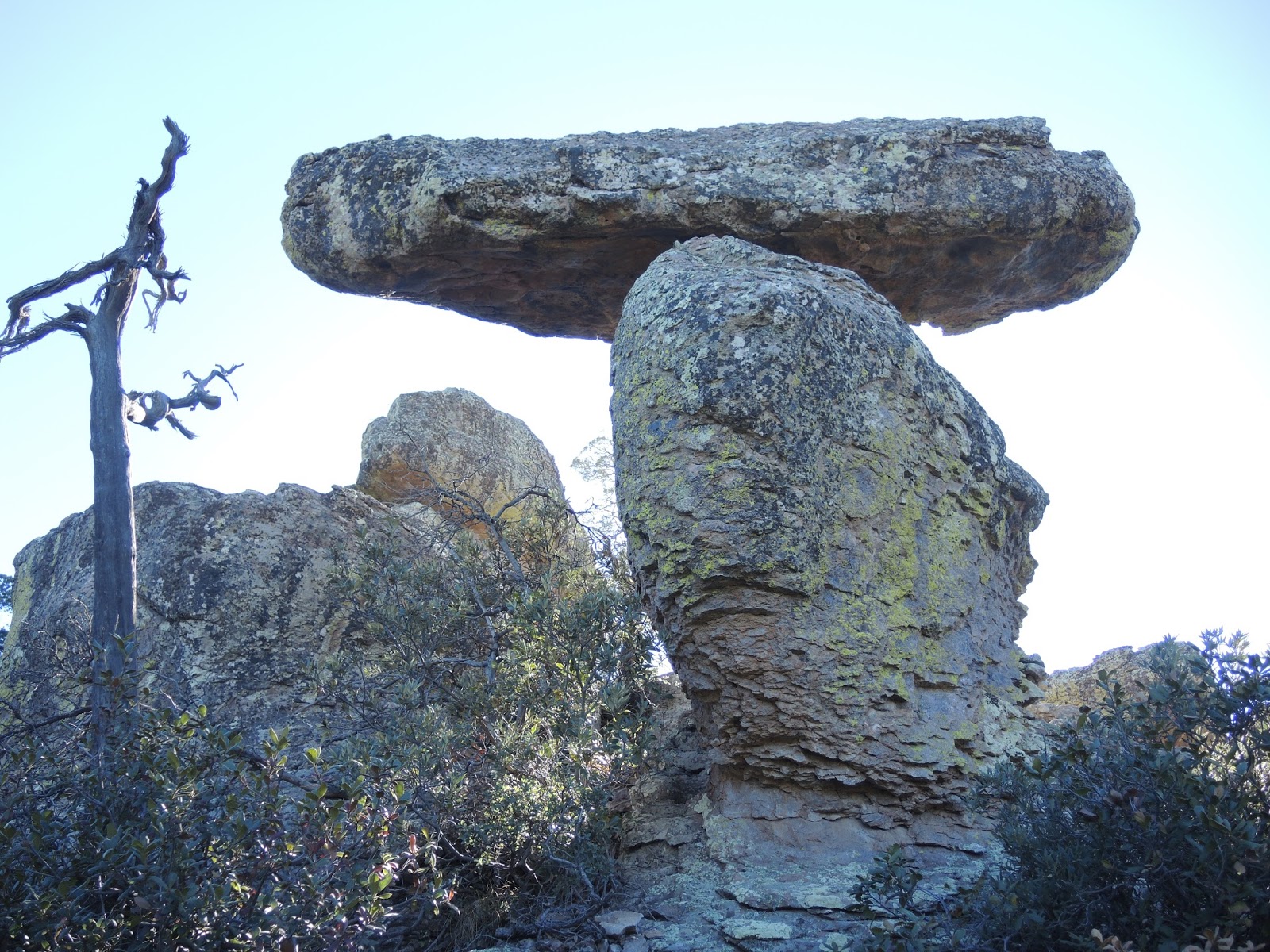
We're celebrating Thanksgiving by riding to the Chiricahua National Monument about 75 miles northeast of Bisbee. It was established in 1924 to protect the balancing rocks and hoodoos that were formed by volcanic activity 27 million years ago that eventually eroded into the fabulous rock formations we see today.


To get to the Chiricahua National Monument we headed west on AZ 80 and then rode on local 2-lane paved roads through the grasslands with distant views of mountains that cover this part of southeastern Arizona.


The Chiricahua Mountains are known as 'sky islands' because they're surrounded by vast acres of grasslands, similar to an island surrounded by the ocean.

The Chiricahua Apache called this area the "Land of Standing Up Rocks". The Sonoran and Chihuahuan deserts meet here, along with the Rocky Mountains and the Sierra Madre ranges making this a unique geographical area.


We rode on the 7-mile long paved road that winds through Bonita Canyon. The temperature dropped 12 degrees as we descended into the canyon, which is shaded by tall oak and cypress trees along the creek. The road climbs out of Bonita Canyon and winds around the mountain with distant views of the high mountain peaks. The park road ends at Massai Point at 6870'.

We stopped for two short hikes so we could see the rock formations up close at Massai Point and Echo Canyon.


We retraced our route back to Bisbee, continuing our non-traditional Thanksgiving by enjoying dinner in the Copper Queen Hotel's Saloon with a 100+ year old lifesize portrait of the British actress Lily Langtry that covered one entire wall.

Tomorrow we ride back home to Bisbee, swapping Black Friday shopping with something much more fun - riding the BMW motorcycle.

Our Thanksgiving BMW Motorcycle Ride in Southeastern Arizona

Wednesday morning the temperature was 45 degrees in Prescott. I put on warm tights, a fleece turtleneck, warm sweater, two warm upper body motorcycle jacket liners, motorcycle jacket, rain jacket, motorcycle liners for the motorcycle pants, socks, boots, neck warmer, helmet, and my super-heavy-duty mittens. I was (finally) ready for our trip to Bisbee in southeastern Arizona. The last time we went on a motorcycle trip in June and July, the temperatures were well above 100 degrees and I wore shorts and a sleeveless shirt under our lightweight motorcycle gear.

With no one coming to visit us for Thanksgiving, we decided to ride south for warmer temperatures. We started off Wednesday morning riding north on I-17 to reach AZ 260 heading east toward Payson, riding along the Mogollon Rim through the pine forests before we started descending into warmer temperatures and the Tonto Basin in the Sonoran Desert.


We stopped for lunch in Punkin Center, a tiny unincorporated town on AZ 188, because it was the first restaurant we saw since we rode through Payson over an hour earlier. After lunch, we continued south on AZ 188 along Theodore Roosevelt Lake in the Tonto National Forest.


Lake Roosevelt is the largest reservoir completely within Arizona, and was formed by a dam on the Salt River, dedicated by President Theodore Roosevelt himself in 1911,one year before Arizona became a state. It's always a bit strange to see lakes in Arizona since it's such a dry area of the country, and this one is big enough to boast a marina and several boat ramps and campgrounds.

AZ 188 ends at AZ 60 near Globe, and as we continued south we rode through the 1.86 million acre San Carlos Apache reservation. Established in 1872, it's home to 15,000 people.


We rode past miles of fields of cotton and much of the time the sides of the highway were lined with scattered white tufts of cotton. In the 1980's Arizona grew 66% of the Pima cotton produced in the United States, but today produces only 2% of the total U.S. cotton crop due to changing climate conditions and the growth of cities that have overtaken agricultural land.

We continued south on AZ 191 and turned west onto I-10 for a short 6 miles before we turned south on local, 2-lane paved roads with almost no traffic. Usually traffic the day before Thanksgiving is a nightmare, but staying off the major roads and heading into a lightly settled area of Arizona meant we had long stretches of straight pavement all to ourselves.


We rode into Bisbee just before 5pm, ready to walk around this once booming copper mining town built into the side of the Mule Mountains.


Our home for the next 2 days is the Copper Queen Hotel which opened in 1902 as the grandest hotel in the largest city between St. Louis and San Francisco. Supposedly it's haunted by three ghosts - we'll find out!