Showing posts with label Vermillion Cliffs. Show all posts

Tuesday, September 29, 2020

Riding home from Zion

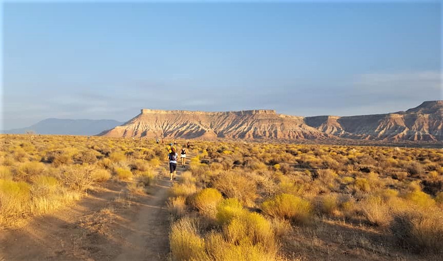
We left La Verkin, Utah about 8:30am local time, heading home after a weekend that included a ride through Zion National Park and a 13.5 mile trail race yesterday.


Riding through the vast southwestern part of the country, where the road stretches before us to the horizon and we can look out over a valley to the mountain ranges 100 miles distant, makes us appreciate the small details. A few cattle grazing in the dry scrub brush, birds lazily swooping on the updrafts, a couple of trees next to an abandoned homestead, the feel of the wind  as we zoom down the almost empty 2-lane paved road.


We rode east on Utah 59, which becomes Arizona 389 and entered the Arizona Strip, the remote, arid, northernmost part of Arizona that lies north of the Grand Canyon. Indigenous people lived in this area for at least 8,000 years and Spanish explorers first saw the South Rim of the Grand Canyon in the 1500's. The first Europeans didn't arrive to this more remote section of present-day Arizona until the late 1700's.

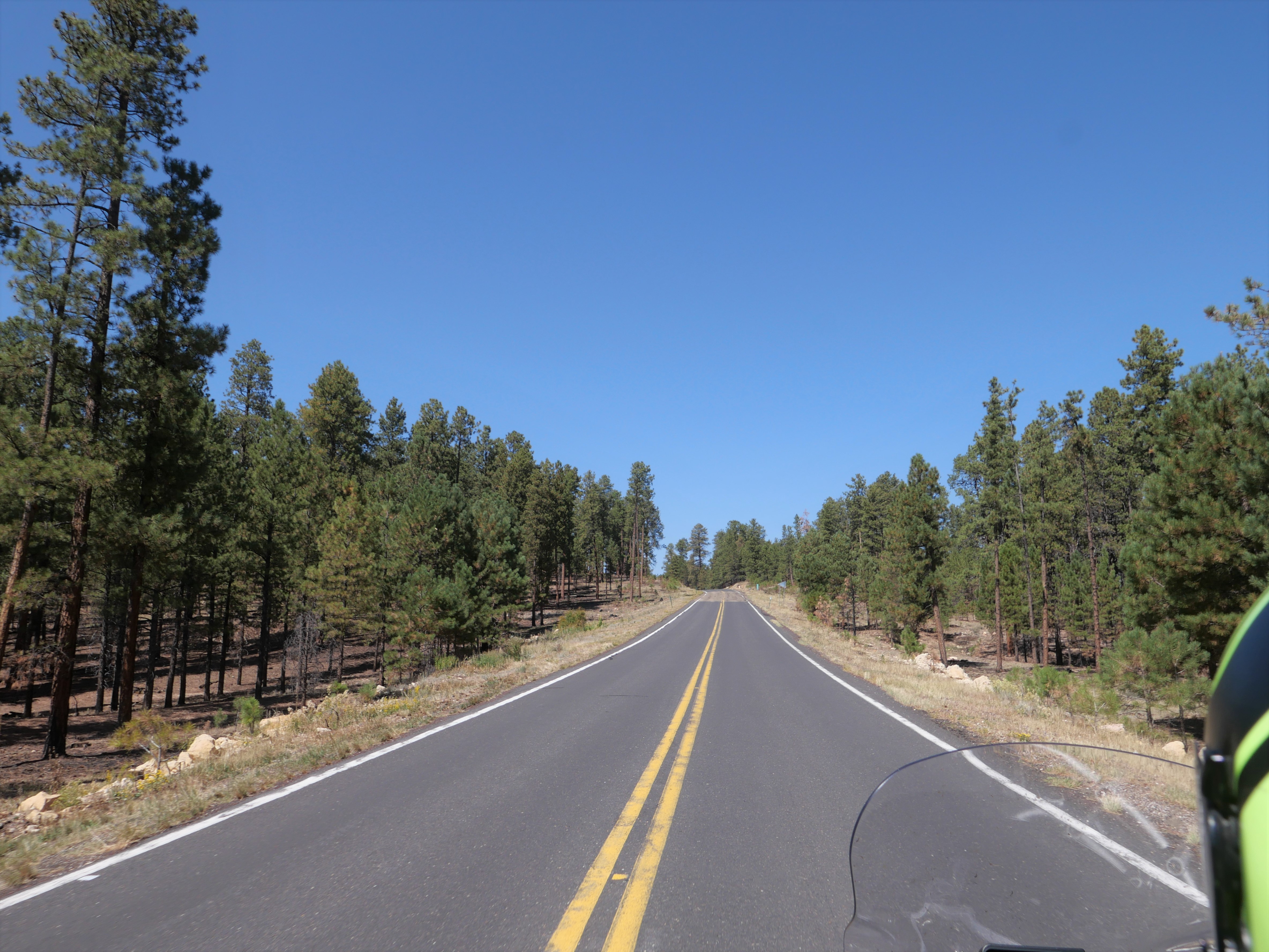
We picked up US 89A in Fredonia and gradually started to climb into the pine forests of the Kaibab Plateau.


We enjoyed the cooler temperatures at this higher elevation as the road curved and climbed to almost 8,000' elevation before we started to wind down into the valley along the Vermillion Cliffs National Monument, known for sherbet-colored swirls of slickrock and towering cliffs.


We crossed over the Colorado River and continued south on US 89 through the Navajo Reservation until we started to see the San Francisco Peaks, a mountain range just outside Flagstaff that contains Humphrey's Peak, the highest mountain in Arizona at 12,633'. After a quick stop in Flagstaff for lunch, we continued toward home riding on I-40 west until we turned off on the much less traveled AZ 89.

We love long motorcycle trips where we spend a few weeks on the road exploring new areas, and also relish a weekend trip and the opportunity to revisit familiar roads. With cooler weather coming, we'll change up our travels and head south instead of north, hopefully within the next couple of months.


Thursday, September 24, 2020

345 miles today from home in Arizona to La Verkin, Utah

 We started a 4-day trip this morning, leaving our home in Prescott, Arizona and heading north first to Flagstaff, and then continuing north on US 89 through the high desert of the Navajo Reservation.


This landscape looks almost other-worldly, and even though we've ridden this way several times, we never get tired of looking out over the sand and rocks.

We've been looking for a shiny tanker truck so we could take a photo of us on the BMW as we ride by, and today we finally find one:


Soon after this photo, the BMW's odometer turned over to 26,000 miles and we did a little happy dance on the bike for all the fun we've had over the past 2.5 years.

We turned left onto US 89A, and stopped at Marble Canyon to walk across the Navajo Bridge over the Colorado River. This is considered the beginning of the Grand Canyon, and is where the historic Lee's Ferry was located. For about 55 years the ferry was the only way to cross the Colorado River, until the first bridge was built in 1929. A new bridge designed for larger trucks was completed in 1995, and the old bridge is now reserved for pedestrians.


We continued west on US 89A past the Vermillion Cliffs National Monument near the Arizona/Utah border where the Paria Plateau drops 3,000' to the valley floor.


After passing by Vermillion Cliffs, the highway winds and climbs up the Kaibab Plateau and the landscape changes once again, this time to dense forests of tall pines. We stopped for lunch in Jacob Lake where we couldn't pass by the large, delicious homemade cookies. 89A continues west at this point, winding through the pine forests that unfortunately were decimated by the Magnum Fire in June of this year.


We wound our way down an average 6% grade off the top of the Kaibab Plateau to the high desert floor below us, and when we reached Fredonia we turned west on State 389, riding through part of the Kaibab Paiute Reservation only 50 miles north of the Grand Canyon.


The temperature rose into the mid 90's and we were glad we only had a few miles left until we reached La Verkin, Utah where we're staying for 3 nights. We're looking forward to some gorgeous motorcycle riding!


Sunday, May 31, 2020

Motorcycling around Utah

Saturday I ran a 60k trail race near Bryce Canyon National Park just outside Hatch, UT and Mike rode the BMW on a scenic tour west of Hatch.

The trail race climbed over 1,000' onto the Paunsaugunt Plateau in the first 3 miles, wound around the wide, green alpine meadow, climbed and twisted on Thunder Mountain Trail, and finished with more steep climbs and even steeper descents through the Dixie National Forest.


This was truly an epic trail race with 4,000' of climbing, another 4,000' descending, forests, rocks, hoodoos, and even a few raindrops to cool us off.

While I was running, Mike rode the BMW north on Route 89 to Panguitch and then headed west on Utah Route 143 which according to Butler Motorcycle Maps is a fantastic motorcycle rode - and Mike was stoked. He rode up to almost 11,000' with snow still lingering in spots on the mountains, craggy peaks, and gorgeous overlooks.


Today (Sunday, May 31st) we rode back home from Hatch on Route 89. Our route took us through the green mountain valley of the Sevier River that twists and turns so much it looks like a long chain of the letter 'S' hooked together for miles.


We stopped in Kanab, founded by Latter Day Saint families like so many of the towns in Utah, and named for a Paiute word meaning 'place of the willows'.


Kanab sits at the base of the Vermillion Cliffs, and while it's a favorite tourist spot today the town was quiet. We ate breakfast at Jakey-Leigh's coffee shop and bakery before we continued south. Just south of Kanab Mike started to pass a white pick-up truck and got almost next to it before he saw the Sheriff sign on the door and quickly slowed down. The Sheriff kept driving the speed limit, and we were content to follow him for a few miles before he turned off.

Kanab is only about 70 miles north of Page, AZ and as we dropped down from around 6,000' to 4,000' in Page, the temperature climbed into the 90's. Route 89 enjoys views of the Grand Staircase Escalante national park the Vermillion Cliffs, and the changing colors and formations of the weathered rocks and high cliffs makes the drive outstanding.


We crossed into Arizona and caught glimpses of bright-blue Lake Powell to the east.


Lake Powell was created in 1963 when the 710' Glen Canyon Dam on the Colorado River was built to the dismay of many environmentalists. When it's full (which hasn't been since 1999 due to several years of drought), Lake Powell is 186 miles long with over 90 side canyons. It's the second-largest man-made reservoir in the United States - just behind Lake Mead, nearly 300 miles of Colorado River to the west.

We rode another 130 miles south on Route 89 from Page to Flagstaff, and along the way the odometer rolled over to 19,000 miles so we did a little happy dance on the bike.


It was a hot and windy ride and we were glad to see the snowy San Francisco peaks in Flagstaff where we enjoyed a few miles of cooler temperatures. Like so many places in the Southwest, the San Francisco peaks were named by Franciscan friars doing missionary work in the area in 1629.

We turned off Route 89 in Flagstaff and headed south on I-17. As the elevation dropped from 7,000' in Flagstaff to 3,000' in Camp Verde the temperature rose again. Unfortunately,  a combination of an accident on Route 169 and a brush fire further south on I-17 made us take a detour that added about 45 minutes to our trip.

It's been a fantastic 4 days of motorcycle riding, and all within about 8 hours of home. We're looking to miles more of exploring on the BMW.


Wednesday, May 14, 2014

BMW trip to Idaho: jaw-dropping, unexpected scenery


We've lived in Arizona for 9 months and today was the first time we've seen the Grand Canyon, even though it's only a 2 hour ride away. "Grand" doesn't do it justice:  the depth, length, width and sheer volume of sensory information that hit us when we stepped to the edge and looked out took our breath away.


We've been planning a trip to Boise, ID for the past 2 months, but until breakfast this morning we didn't plan on stopping at the Grand Canyon. Mike looked at the map and decided to change our plans for our initial route, which led us straight to the Grand Canyon.

This was our first trip with the Viking Cruise Roll Bag sent to us for testing and review by Motorcycle House. It fit snugly on top of our tail bag, held in place by the 4 bungee tie downs. I liked having outside zippered pockets for our maps and a bottle of water, and getting in and out of the large top opening was a breeze.


On the trip north to the Grand Canyon we rode in and out of the Kaibab National Forest, a 1.6 million acre forest that borders both the North and South rims of the Grand Canyon. We spotted 3 elk in the trees off to the side of the road and saw several large raptor nests at the very top of pine trees.

Because the Grand Canyon stretches almost 300 miles across Arizona, we followed Route 64 east even though our eventual destination lies west. We rode through the Painted Desert in the Navajo Nation, past mounds of stone that look like sand dunes, rock formations with striped colors, pink rocks with wavy patterns, and craggy cliffs with stripes of white, pink and brown.


My stomach growled for over an hour until we came to the Cameron Trading Post where we talked with a German leading a motorcycle tour group through the Southwest. We saw several groups of 10-15 motorcycles today, and discovered that many are Europeans traveling through the US.

I tried Navajo beef stew and fry bread the size of a dinner plate, and Mike ordered the prickly pear milkshake to go with a cheeseburger. Fry bread originated out of necessity when the US government forced the Navajo to leave their homeland in Arizona and resettle to New Mexico, a walk of several hundred miles known as the Long Walk. To prevent starvation, the government provided flour, lard and sugar and fry bread was born. I pulled off three small pieces to eat with the stew, then discovered the pool of oil on the plate and decided to skip the rest of the bread in favor of trying Mike's shake.

After lunch we continued north on 89 into Page, Arizona and caught glimpses of Lake Powell, created in 1963 when the Glen Canyon Dam was built across the Colorado River.


We crossed into Utah and rode along the Vermillion Cliffs National Monument, another amazing area filled with sand dunes and rock cliffs in a variety of colors due to different minerals.


As we turned west onto Utah Route 14, we had no idea that we would climb to over 9,000' and the temperature would drop below 50 degrees. The road twisted and turned as it climbed out of the desert into the Dixie National Forest. We rode past steep green meadows dotted with Swiss-style chalets and rushing creeks filled with melting snow - although there is still snow blanketing the higher elevations.


We stopped at Navajo Lake, formed by lava flow millions of years ago. It's only 25' deep, and surrounded by fields of black basalt rocks.


We ended our 429 mile trip zooming down route 14 into Cedar City, UT, our stop for the night. At some points the sheer rock walls towered above us blocking out the late afternoon sun.


 The day was filled with unexpected scenery, unplanned stops for photos and lunch, and chance conversations with motorcycle riders looking for adventure. Tomorrow we cross into Nevada, continuing our trip north.