Showing posts with label Lake City. Show all posts

Monday, August 5, 2024

Zoom Zoom!!

 The last day of a long motorcycle trip (we've been on the road for 18 days) is always bittersweet. We've been having so much fun on the BMW that over breakfast today I could keep going for another 2 or 3 weeks. Yet we're also looking forward to being back home.

Today we rode familiar roads - so familiar that we didn't need to consult a map. We rode west on US 50 out of Gunnison, Colorado for a few miles, enjoying the early morning cooler weather (temperature 52 degrees).


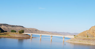
Just as we entered the Curecanti National Recreation Area, a series of three gorgeous reservoirs in the Upper Gunnison River Basin, we turned south on CO 149. 


This is one of our favorite highways to ride because it's a smooth, winding, curving, always fun road plus in a gorgeous part of Colorado.


We rode through Lake City, today a favorite of tourists and folks riding off-road vehicles in the surrounding San Juan mountains with a history as a supply center for regional mining operations in the late 1800's to early 1900's.

Once south of Lake City, we crossed the Slumgullion Earthflow on our way up the twisting hairpin turns to Slumgullion Pass at 11,361'.


There are two major earthflows here - the first occurred 700 years ago when a mass of volcanic rock 4 miles 4 miles long and 2000' wide flowed into the valley.  The second earthflow started 300 years ago and is still moving about 23' per year.

After cresting Slumgullion Pass - with 9% grades this is the steepest maintained road in Colorado - we descended a bit to the Spring Creek Pass at 10,898' and crossed the Continental Divide.


This section of Colorado 149 is the Silver Thread Scenic Byway named for the silver mining in this area. It's amazing to think about how these 2-lane paved highways came to be: starting with Ute Indian hunters who followed game trails, then European explorers on horseback widened the trails, and enterprising people built toll roads - first charging 25 cents for a horse and rider or $1 for a wagon and team of horses. Railroad tracks were laid in the early 1900's and the dirt roads were paved for car traffic. The section between Lake City and Creede wasn't paved until 1968!


The road between Lake City and Creede, once a booming mining town and now another tourist favorite, runs along the Rio Grande through fields and canyons with the ever-present San Juan mountains as a backdrop.


A few miles later we turned west onto US 160 in South Fork, riding over Wolf Creek Pass at 10,856' and once again crossed the Continental Divide. Click here for a map of the Continental Divide in Colorado.


We wound our way down toward Pagosa Springs, enjoying the curving, twisting descent.


One more highway today - US 84 south from Pagosa Springs to our home in Chromo, CO. We rode 4200 miles through five states (Colorado, Wyoming, Montana, Idaho and Utah) and three Canadian provinces (British Columbia, Alberta and Saskatchewan). 

Although we weren't able to visit Jasper, Banff, and the Icefield Parkway in Canada due to devastating wildfires in the area, we were able to stop in Waterton Lakes and saw glaciers from a distance there and in Glacier National Park

Thanks to Butler Motorcycle Maps we were able to plot our route through stunning areas, choosing as often as possible roads made for motorcycles with sweeping curves and twisting hairpin turns. The only time we had to regroup and plan a different route was in Canada because Butler doesn't make Canadian maps. 

Less than 60 miles total were spent on Interstate highways, and most of the time we rode 2-lane roads that had very little traffic. Some days we saw more eagles and osprey on telephone poles along the road or soaring through the sky above us than people! Along the way we spent two days with our son in Bozeman, Montana and met friendly people every place we stopped, often talking with other motorcycle riders.

We'll plan another long motorcycle trip in 2025 - if you see us on the road, wave and smile!


Monday, September 4, 2023

Tour of the San Juans Day One

It's Labor Day weekend so we decided to hop on the BMW and do a circular loop of the San Juan Mountains, part of the Rockies located in SW Colorado and NW New Mexico. There are over 28 peaks in this mountain range, and 6 of them are over 14,000' high. The San Juans are the largest mountain range by area in Colorado, covering 13 different counties - including our own Archuleta County. 

These mountains were created as the continental plates slammed into each other, and then volcanic activity and glaciers carved the steep mountains and U-shaped canyons. The Ute people lived here for hundreds of years, and the Spanish were the first Europeans to explore this area, naming many of the mountains and rivers.

It's an absolutely gorgeous spot for motorcycle riders and we took full advantage of the opportunities literally in our back yard.

We started our trip heading northeast on US 160 from Pagosa Springs, riding once again over Wolf Creek Pass on the Continental Divide at 10,857'. On the eastern side of the pass we turned north onto CO 149 at South Fork, at the confluence of the South Fork and Rio Grande rivers.


South Fork is start of the 117 mile Silver Thread Scenic Byway and we thoroughly enjoyed winding our way along the Rio Grande river. We passed through Creede, which bears the distinction of being the town with the most people (257 in the 2020 Census) AND the county seat of Mineral County. It's hard to believe that in 1891 more than 10,000 people lived in Creede due to the silver mining boom.

Our first stop of the day was at Clear Creek Falls, where the water shoots over the plateau down the rocks of the 100' canyon. From the highway you have no idea that the canyon or the waterfall is just a few hundred feet away - so be sure to stop.


 Not long after riding past the waterfall we started climbing up the first of two passes:  Spring Creek Pass at 10,898' along the Continental Divide.


The 2-lane paved road winds and twists, complete with some U-shaped hairpin turns up Slumgullion Pass at 11,530'. Some of the climbs are 9% grade, and we had a lot of fun zooming along, looking at the mountain peaks in the distance.

Our second stop of the day was at Windy Point overlook where we could clearly see several high peaks of the Umcompahgre Wilderness only 15 miles away.


The highest peak (the pointy one that leans to the right) is Uncompahgre Peak, at 14,321'.

We could also see the Slumgullion Earthflow Natural Landmark that started 850 years ago when a huge chunk of rock, dirt and forest broke off and slid 4 miles down the side of the mountain.


The earth continues to move about 20' each year, and as we rode past the 'toe' of the earthflow, I wondered when it will slide over the highway.

 
CO 149 took us into Lake City, another town that grew during the mining years to 5000 people, and today is home to about 430. In 1978 the Lake City Historic District was listed in the National Register of Historic Places, and the town is gorgeous. We stopped for lunch and then rode through the original downtown area, now home to galleries and shops.

We continued north on CO 149, riding through a gorge formed by the Lake Fork of the Gunnison River.


The landscape opened up as we rode through grasslands with far off views of more of the San Juan Mountains.


The Silver Thread Scenic Byway ends at Blue Mesa Reservoir, where CO 149 meets US 50.


The Blue Mesa Reservoir is the largest body of water in Colorado, 20 miles in length with over 96 miles of shoreline. It's impressive to ride for miles along the lake, and we were surprised that there weren't more boats on the water on a beautiful Labor Day weekend. 

We've ridden on US 50 several times over the last 10 years, and there is always construction. This year was one of the only times we didn't have to stop and wait for several minutes as the traffic was reduced to one-way only for a few miles - but there was a section that was loose gravel, always challenging on a motorcycle.


We finished the day in Montrose after riding 241 miles through the stunning San Juan Mountains, looking forward to another day as we continue our 2-day ride.


Wednesday, June 9, 2021

Twisting, sweeping turns through the Rocky Mountains

 We started this morning wandering around Glenwood Springs, Colorado, trying to find CO 82 East. We'd see a sign, get turned around, take a wrong turn on the extremely confusing roundabout, and finally stopped and asked directions. It was worth it, because CO 82 East heads directly toward 12,965' Mt. Sopris in the Elk Mountain Range of the Rockies just outside Glenwood Springs. 


The day just kept getting better as we turned south on CO 133, riding along the fast-moving White River on the West Elk Scenic Byway


The road climbs up 8% grades to McClure Pass, winding to the 8755' summit then twisting down the other side.


Like many of the mountain passes in Colorado, the Ute Native Americans were the first to traverse this area, followed by the Spanish in the late 1700's. It's difficult to comprehend how miners and ranchers drove their wagons up the steep grades when this was a rutted dirt road. 


CO 133 winds through Paonia, named for numerous peonies in the area (evidently the early settlers didn't know how to spell), and now home to farms, orchards, and wineries.


Staying on the Elk Loop Scenic Byway, we picked up CO 92 East, continuing through green ranches until the road started climbing, twisting, and turning in the Curecanti National Recreation Area


Steep cliffs drop down to the Gunnison River and reservoirs formed by three different dams and hairpin turns lined with wildflowers and aspens snake through the mountains.


We turned east on US 50, passing by the Blue Mesa Reservoir, then turned south on Colorado 149.


CO 149 from Blue Mesa Reservoir to South Fork through the San Juan Mountains was named the Silver Thread Scenic Byway in 1990.


We stopped in Lake City, incorporated as a silver mining town in 1875, for lunch at the Lake City Cafe, a superb restaurant in a gorgeous setting. Although home to only about 450 residents, it's a busy tourist center with over 400 buildings listed on the National Register of Historic Places.


After lunch we continued south on CO 149, twisting our way up to Slumgullion Pass at 11,530'.


With grades up to 9%, this is one of the steepest paved maintained roads in Colorado. This area is part of the Slumgullion Earthflow National Natural Landmark where about 700 years ago a large chunk of decomposing volcanic rock slid down the mountain to form a natural earth dam that blocked the Lake Fork of the Gunnison River and formed Lake San Cristobal (the lake that gives Lake City its name). 


CO 149 took us through Creede where two major rivers start:  the San Juan and the Rio Grande.


CO 149 ends at US 160, and is also the end of the Silver Thread Scenic Byway. We headed west on US 160 to Wolf Creek Pass and the Continental Divide. Traffic came to a halt right at the top of the Pass due to a truck pulling a camper that caught fire. We got off the motorcycle, walked around, and read the signs about the Pass at 10,857' for about 25 minutes before we were able to continue down the mountain.


We rode 307 miles today, almost exclusively on scenic byways through some of the most beautiful areas of Colorado. We're stopping for the night in Pagosa Springs at 7,126' above sea level in the San Juan Basin. 


At Hermit's Rest in the Curecanti National Recreation Area