Showing posts with label windmills. Show all posts

Wednesday, July 31, 2024

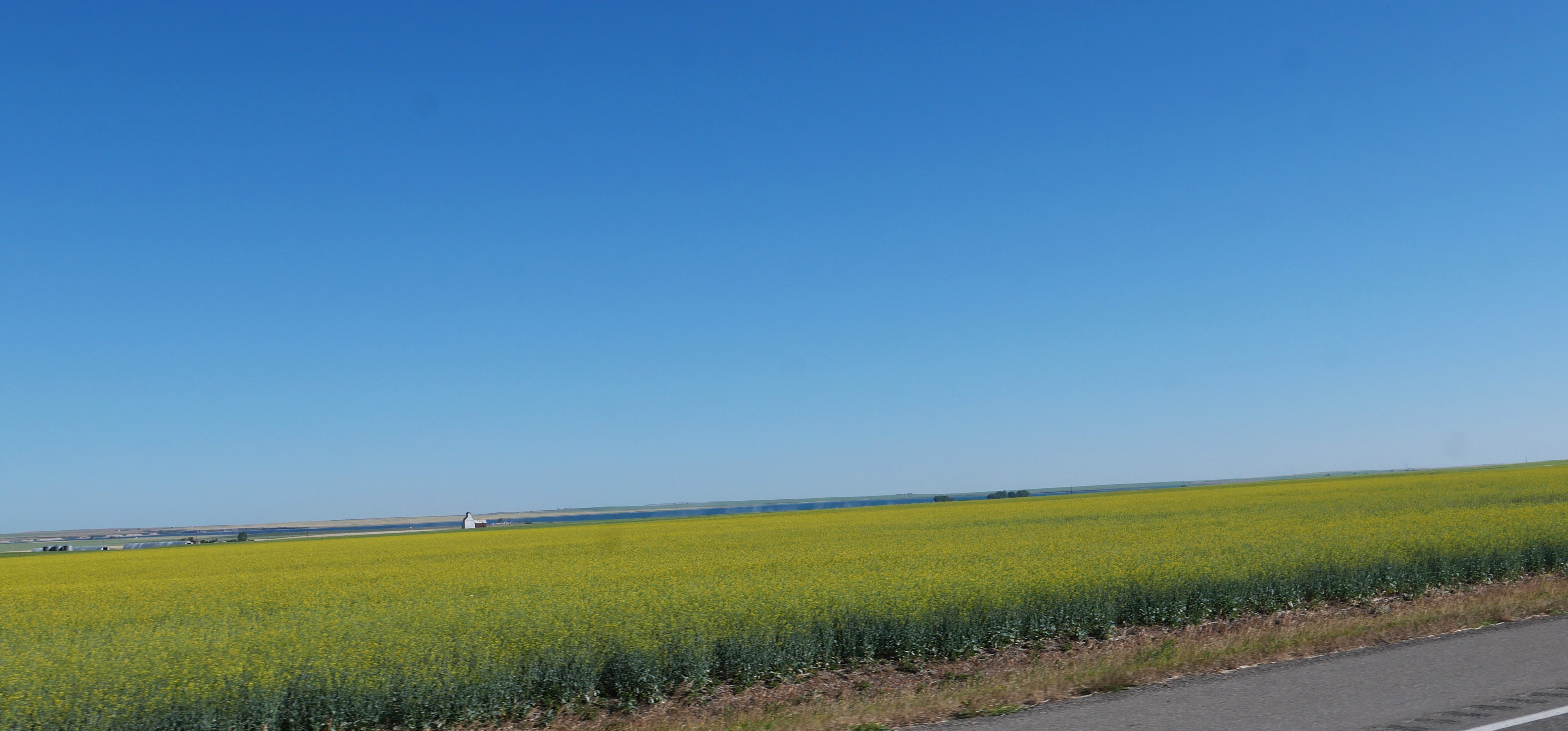
Straight roads through the prairie

 We started today in Cardston, Alberta and thought we had a plan to get to the Wild Horse border crossing to get back into the United States. Like other aspects of this trip, we had to regroup and be flexible mid-way through today's ride.

Today was all about riding through wide open land planted with wheat, hay and other crops.


Unlike riding through the mountains, today the roads were straight and the views endless, broken every now and then by very distant, shadowy mountain ranges and windmill farms.


The day started as planned, riding on Alberta highway 5 east, to 52 east, and then onto the 4-line divided highway 4 for a short period of time.

We then turned onto Alberta highway 501 east and for the first few miles everything went to plan.


Then all of a sudden the road went from paved asphalt to gravel/dirt - not a lot of fun when riding 65 mph. It was a short stretch of gravel and as we hit the next section of pavement we thought everything was OK - until we reached another gravel/dirt section.


We had no idea how long the gravel section would last so stopped, looked at our older Canadian map, and decided to use the Garmin GPS to guide us to our hotel in Havre, MT. That meant about 80 additional miles riding, and since any mile on the BMW is a great mile, we enjoyed the rest of the trip.

The Garmin took us on Alberta 879 north, then 61 east, part of the Red Coat Trail, an 800 mile route that approximates the path taken in 1874 by the North-West Mounted Police as they marched west to bring law and order to the Canadian West. We rode past several large windmill farms today, and in this wide-open country they look even more imposing.


We then turned onto Alberta highway 3 east, following a very slow moving truck loaded with hay bales for part of the way.


We stopped in Medicine Hat, named for the eagle tail feather headdress worn by Blackfoot medicine men. We had been on the BMW for almost 4 hours and needed both a gas station and lunch - and were thrilled to find the Rosewood Bistro and their menu using locally sourced food. The friendly waitress pointed out a gas station just around the corner, and we got back on the road ready for the next part of the day.

We rode on Trans Canada Highway 1  for a short period of time, long enough to see a very long train waiting at a grain elevator.


We then turned onto Alberta 41 heading south toward the Wild Horse border crossing. The next 68 miles to the border we saw only 2 other vehicles which surprised us since we expected more traffic crossing the border.


The prairie was broken up by rolling hills and stands of pine trees in the Cypress Hills Interprovincial Park


Once we passed through the park, it seemed like the straight road in front of us went on as far as we could see to the horizon.


It was windy all day, but now the wind got even stronger and at times we were buffeted by an especially strong gust. 

We crossed into the United States with just one car in front of us, and for the next 44 miles rode on Montana highway 232 into Havre - again seeing only 2 other vehicles.


The temperature rose into the high 80's, and between the wind and the heat we were ready for an air conditioned hotel room in Havre. Based on a suggestion from the hotel staff we ate dinner at the absolutely fantastic Bow and Marrow Steakhouse - by far the best meal we've had not only on this trip, but since we moved to Colorado 18 months ago. Meals on motorcycle trips are hit or miss, and we'll remember this meal for months. It's worth a stop in Havre just to eat here!


Wednesday, August 22, 2018

Back on the road again


We're back on the road after a week in Vermont visiting friends and family, attending a wedding celebration where the bride and groom were dressed as Sharon and Ozzy Osbourne and the guests in 1980's era clothing, hiking up Bromley Mountain, running the Bennington Battle Day 5k, and spending time with Mike's parents and our son Nate.


The weather forecast came true today:  rain, clouds, light rain, heavy rain, and intermittent fleeting moments of filtered sunlight.


The good news is that our new raingear worked great! Mike thoughtfully purchased rubber gloves for me to wear since my motorcycle gloves are quickly soaked through and make my hands cold when we have to ride in the rain. Today my hands were dry and happy wearing bright lime-green gloves that although are designed for washing dishes and other household chores, make fantastic waterproof gloves during rainy motorcycle rides.

Our route took us west through Arlington Vermont and into New York state, riding through Saratoga Springs and then winding our way on narrow county roads until we turned onto U.S. 20 west for much of the day.


This part of New York state is filled with rolling hills either covered with trees or dotted with farmland, rivers, streams, and small towns at the bottom of valleys. It was like riding a roller coaster:  we curved our way up the hills, then wound down 9-10% grades into the valley, rode a few flattish blocks through a small town, then started back up a steep hill.


The wind buffeted us when we were at the tops of the hills or riding along the ridge lines so we weren't surprised to see large windmills taking advantage of the blustery conditions.


Our route took us through the Finger Lakes region, a group of 11 long, narrow lakes formed by glaciers 2 million years ago before we turned southwest and stopped for the night in Springville, NY  in western New York. We rode just over 300 miles in about 9 hours today, rolling up over 5000 total miles on our cross-country trip. Tomorrow the weather promises to be cool and sunny, perfect conditions to continue west into Ohio.  Here is today's route


Saturday, July 2, 2016

Riding west along the Columbia River

We started today in Walla Walla, Washington, riding west on Route 12 through farmland and low, rolling hills. After 35 miles we turned onto Route 730, and the rest of the day followed the Columbia River to Portland, Oregon.


The Columbia River at this point is also called Lake Wallula due to the dams on the Columbia and Snake Rivers that create the 26,000 acre lake. I was expecting to see a river, not a wide lake that stretched as far as we could see.


We crossed the Columbia on Route 82, and then quickly turned onto Oregon Route 14, a 2-lane paved road that closely follows the river shoreline and is part of the Lewis and Clark scenic byway system we've been following since we left Bozeman, Montana earlier in the week.


The landscape surrounding the Columbia gradually changed from dry, rounded hills without trees to steep rocky cliffs, and finally to heavily forested cliffs as we continued to head west.


Along the way we almost constantly saw hundreds of windmills in Oregon and Washington, sometimes far away and a couple of times close enough that we could watch the three large arms turning slowly.


The mile-wide Columbia gorge at almost sea level creates strong thermal winds that power the windmills. We felt the headwind on the BMW, and watched people enjoy riding the winds using brightly-colored parasails and windsurfers.

Train tracks also closely follow both sides of the Columbia, sometimes right next to the road. At one point Mike counted 115 train cars plus 3 engines as we caught up to - and then passed - the train heading west.


We saw 4 dams on the Columbia that create wider 'lakes'. The dams on the Columbia and other rivers in the Northwest provide 40% of the total hydropower in the US. We stopped to look out over the river at the McNary Lock and Dam, opened in 1954.


There is very little car traffic, and almost no truck traffic on Washington Route 14 because of the 7 tunnels along the way built in 1933-1937.


The power of the wind, enormity of the Columbia River, huge scale of the windmills, and the twisting, winding highway that follows the river were awesome. The most majestic views today, however, were of Mt. Jefferson, at 10,495' the  second highest point in Oregon in the Cascade Mountain Range. It was named in 1806 by Lewis and Clark for President Jefferson.


We crossed over the Columbia for the final time on the Bridge of Gods, a 1,131' long toll bridge built in 1926. The bridge has steel decking that makes Mike ride extremely cautiously because of the potential for the steel to be slippery. Lewis and Clark had to portage around this area because of the Cascade Rapids.

Oregon Scenic Route 30, an old, narrow 2-lane paved highway winds through the dense forests on the south side of the Columbia. It's a gorgeous drive with several waterfalls visible from the road. Unfortunately, on a Saturday afternoon during the 4th of July holiday weekend, we were stuck in miles-long traffic jams as people jockeyed for limited parking spaces.


We ended the day in riding through busy Portland city traffic, reminding us why we much prefer little-traveled, 2-lane roads on the motorcycle. We'll stay in Portland through the weekend, then start our trip back home to Arizona.