

Even with tights, motorcycle pants, 3 layers of shirts (including one long-sleeved wool shirt), 2 layers of liners inside my motorcycle jacket, and full raingear - I was shivering and cold as we rode south through the Rocky Mountains.


We crested the highest point on I-70 at 11,155' as we rode 1.6 miles through the Eisenhower Tunnel, the highest vehicle tunnel in the world.


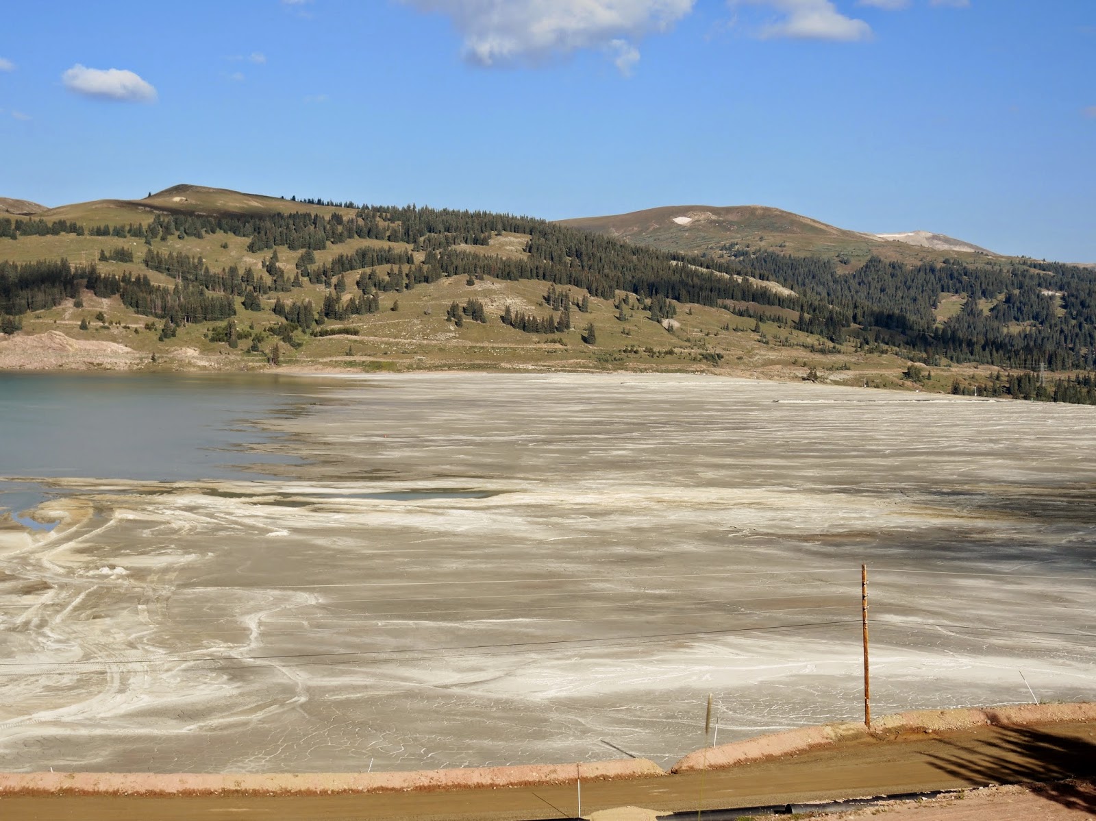
When we turned off I-70 we stopped for gas and to warm up before continuing south on Colorado 91 toward Leadville. This was a new route for us, and after we crested Fremont Pass on the Continental Divide at 11,318' we rode past several shallow ponds. Curious, we stopped at a pullout to discover the Climax Molybdenum open-pit mine and several tailing ponds that cover the valley that once was home to three mining towns: Kokomo, Robinson, and Recen. Mining shaped so much of the early history of the West, and it continues to have a major impact today.
A bit further south Colorado 91 joined route 24, taking us into Leadville, at 10,430' the highest incorporated city in the United States. We've always heard that Leadville is a beautiful town, but we were disappointed at the run-down houses, empty buildings, and general air of depression.

Route 24 is part of the Top of the Rockies scenic byway system, and it lived up to its name as we rode past high, peaked mountains that rose above the treeline, and sometimes above the clouds.

Continuing south, we rode past the Collegiate Peaks in the Sawatch Range of the Rockies. Ranging from 13,132' to 14,421', several of the mountains are named after famous universities, including Princeton, Harvard and Yale. By this time the temperature had warmed up into the 70's, and as we rode through green fields in the valley with the mountains off to the west I can understand why people want to live and vacation here.
We turned onto Colorado route 285, continuing south through the San Luis Valley where we rode past irrigated green fields surrounded by mountains.

When we traveled to Boulder 5 days ago, we rode these same roads, but in the opposite direction. That gave us the opportunity to view the scenery in a slightly different way as we turned onto Colorado Route 112 where we stopped to admire a buffalo herd just outside Del Norte.

I imagined herds of buffalo (actually, the correct name is bison) covering the plains when settlers first ventured into this area. I wonder what they would think of our motorcycle?
After lunch in Del Norte we turned west onto Route 160, crossing the Continental Divide yet again at Wolf Creek Pass.

We stopped on the western side of the Pass, looking out toward Pagosa Springs in the valley far below.


We stayed on 160 until just outside Durango, where we turned south onto 550 for the final miles into Farmington, NM at the junctions of the San Juan, Animas and La Plata rivers. We had gotten used to the green scenery in Colorado, and were surprised at how quickly the green forests gave way to the arid brown of the desert around Farmington.
By the time we pulled into Farmington the temperature was 92 degrees and I'd shed all of my warm clothing that I layered on earlier in the morning. A walk along the Animas River just behind our hotel was the perfect way to end the day.
No comments:
Post a Comment