

We took a delightfully twisty route from Donegal toward Sligo, a short distance as the crow flies but we spent almost two hours riding on curving, narrow, hedge-lined roads.

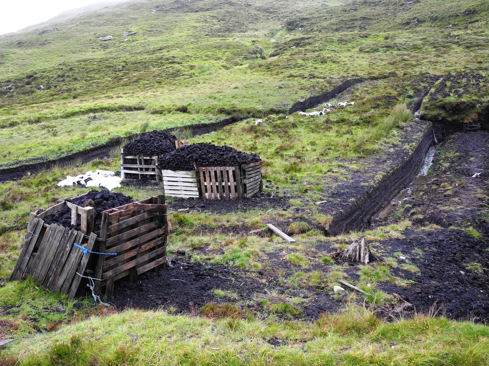
As we turned west, the landscape changed to vast meadows, few trees, and sheep everywhere we turned. Because of the lack of trees for firewood, the people living here learned to use turf, cut from the bogs that cover the landscape, for fuel. Turf cutting still goes on today, as we saw almost everywhere we traveled yesterday and today.
We stopped at Ceide Fields, the site of Stone Age foundations, walls, and tombs built of stone and dating from over 5000 years ago. Oddly enough, this site was discovered in the 1930's by a man cutting turf in his fields. Ceide Fields is located directly next to cliffs soaring 1214 feet over the Atlantic.

The wind was so strong today that gusts periodically pushed me backwards as walked along the cliffs. Mike had to lean the bike into the wind to keep us upright as we drove along the coast.

windblown along the Atlantic
We continued riding west along the coast, heading toward the tip of the Mullet Peninsula that juts out into the Atlantic on a narrow spit of land with a lighthouse at the end. On our way, we got turned around and as we stopped to look at our map, a man came out of his house and offered his help. He not only gave us directions, he also gave us a tourist map much more detailed than ours. In much of Ireland the road signs are in both English and Irish. On the Mullet Peninsula everything is in Irish only, making it more difficult for us to navigate the roads, but adding to the adventure. Belmullet becomes "Béal an Mhuirthead", Ballycastle "Baile an Chaistil", and Blacksod, the town at the very tip of the peninsula, is "Cuan an Fhóid Duibh". Don't ask me about the pronunciation!
the Gulf Stream makes the climate here warm enough for palm trees

We rode back through the peninsula and then turned southeast toward Westport and our B & B for the next two nights. We stopped for gas in nearby Newport, a gorgeous town with breathtaking views of the 365 islands that are scattered throughout Clew Bay. The man who came out to help us asked, as usual, where we are from. When Mike told him the Northeast, he asked for more specifics, and it turns out he's skied in Killington and Sugarbush in Vermont, plus driven throughout New Hampshire and Maine. Vermont, he assured us, is his favorite place in the States.
Each evening over dinner we talk about the day's trip, the friendly and helpful people we've met, the beautiful and often unplanned places we've visited, and how the next day simply won't be as wonderful. We're always proved wrong, because the next day always manages to surprise us in unexpected ways. Our travels on the motorcycle are more about the journey than the destination, and this trip is no exception.
No comments:
Post a Comment