The last day of a long motorcycle trip (we've been on the road for 18 days) is always bittersweet. We've been having so much fun on the BMW that over breakfast today I could keep going for another 2 or 3 weeks. Yet we're also looking forward to being back home.
Today we rode familiar roads - so familiar that we didn't need to consult a map. We rode west on US 50 out of Gunnison, Colorado for a few miles, enjoying the early morning cooler weather (temperature 52 degrees).
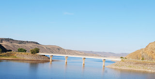
Just as we entered the Curecanti National Recreation Area, a series of three gorgeous reservoirs in the Upper Gunnison River Basin, we turned south on CO 149.
This is one of our favorite highways to ride because it's a smooth, winding, curving, always fun road plus in a gorgeous part of Colorado.
We rode through
Lake City, today a favorite of tourists and folks riding off-road vehicles in the surrounding San Juan mountains with a history as a supply center for regional mining operations in the late 1800's to early 1900's.
Once south of Lake City, we crossed the
Slumgullion Earthflow on our way up the twisting hairpin turns to Slumgullion Pass at 11,361'.
There are two major earthflows here - the first occurred 700 years ago when a mass of volcanic rock 4 miles 4 miles long and 2000' wide flowed into the valley. The second earthflow started 300 years ago and is still moving about 23' per year.
After cresting
Slumgullion Pass - with 9% grades this is the steepest maintained road in Colorado - we descended a bit to the
Spring Creek Pass at 10,898' and crossed the Continental Divide.
This section of Colorado 149 is the
Silver Thread Scenic Byway named for the silver mining in this area. It's amazing to think about how these 2-lane paved highways came to be: starting with Ute Indian hunters who followed game trails, then European explorers on horseback widened the trails, and enterprising people built toll roads - first charging 25 cents for a horse and rider or $1 for a wagon and team of horses. Railroad tracks were laid in the early 1900's and the dirt roads were paved for car traffic. The section between Lake City and Creede wasn't paved until 1968!
The road between Lake City and
Creede, once a booming mining town and now another tourist favorite, runs along the Rio Grande through fields and canyons with the ever-present San Juan mountains as a backdrop.
A few miles later we turned west onto US 160 in South Fork, riding over
Wolf Creek Pass at 10,856' and once again crossed the Continental Divide. Click here for a
map of the Continental Divide in Colorado.
We wound our way down toward Pagosa Springs, enjoying the curving, twisting descent.
One more highway today - US 84 south from Pagosa Springs to our home in Chromo, CO. We rode 4200 miles through five states (Colorado, Wyoming, Montana, Idaho and Utah) and three Canadian provinces (British Columbia, Alberta and Saskatchewan).
Thanks to
Butler Motorcycle Maps we were able to plot our route through stunning areas, choosing as often as possible roads made for motorcycles with sweeping curves and twisting hairpin turns. The only time we had to regroup and plan a different route was in Canada because Butler doesn't make Canadian maps.
Less than 60 miles total were spent on Interstate highways, and most of the time we rode 2-lane roads that had very little traffic. Some days we saw more eagles and osprey on telephone poles along the road or soaring through the sky above us than people! Along the way we spent two days with our son in Bozeman, Montana and met friendly people every place we stopped, often talking with other motorcycle riders.
We'll plan another long motorcycle trip in 2025 - if you see us on the road, wave and smile!


No comments:
Post a Comment