Wednesday, October 23, 2019

Home through the mountains

We started the last day of our Bisbee trip in Show Low, a town of about 10,000 people at 6200' elevation in the heart of the White Mountains on the Mogollon Rim. According to local history, Show Low received its name based on the outcome of a card game. Sometime around 1876 two neighbors in the Show Low area decided the region wasn't big enough for both of them, so they played cards to decide who would leave. One of them told the other:  If you can show low, you win. Of course that led to the person with the deuce of clubs 'showing low'; he won the bet, and the town was named Show Low. If that isn't enough, the main street is named Deuce of Clubs.

This part of Arizona is known as Rim Country, and it's popular in the summer for folks in Phoenix who want to escape the baking heat in the Valley of the Sun, and also popular in the winter for the snow.


We started a bit later than usual because the temperature was in the 30's at 7am. I put on just about all of the clothes I brought with me, plus all the liners for my motorcycle jacket, and added raingear for extra warmth. It's days like this that a heated seat would be heavenly! Typical for Arizona, the bright sunshine warmed up the air so the temperature was tolerable, but I never took off any of my warm clothes as we rode from Show Low west to Payson at elevations around 7,000'.


It seemed like Monday was a popular day for people driving slowly, erratically, talking on their phone, texting - or all of the above at one time - to be on the road. Periodically we were able to take advantage of passing lanes on the curving 2-lane road through the mountains, zooming past the slower moving trucks and cars.


US 260 descends several thousand feet over a few miles into Camp Verde, giving us gorgeous long-distance views of the Mogollon Rim and the nearby grasslands.


We were close to home now, with only a short stretch south on I-17 then about 30 miles on 169 into Prescott Valley and a few final miles to our home in Prescott. We rode 930 miles this weekend on a looping trip to Bisbee, exploring twisty mountain roads with technical hairpin turns on the Coronado Trail and enjoying riding other, more familiar roads. The BMW is our favorite way to travel, and we're planning more trips soon.

Sunday, October 20, 2019

Mountains, twisties, hairpin curves, high desert from Bisbee to Show Low

We rode south from our home in Prescott, Arizona on Friday and spent Saturday exploring Bisbee, an old copper mining town built into the side of the mountains in southeastern Arizona.


We stayed at the Oliver House, a boarding house built in 1908 that today has new life as a B&B. Nothing is easy to find in Bisbee due to the narrow, winding roads and alleys. To reach Oliver House, we found a flat spot in a parking lot then climbed up the stairs and across a walkway over a concrete spillway for overflow water. Supposedly Oliver House is haunted, but we didn't see or hear any ghosts during our two-night stay.


We took a fascinating tour into the Queen Mine, the large copper mine started in 1880 and that ended production in 1975. We rode on a 100 year old train 1,500' under the mountain to learn about the dangerous and hard work of mining.

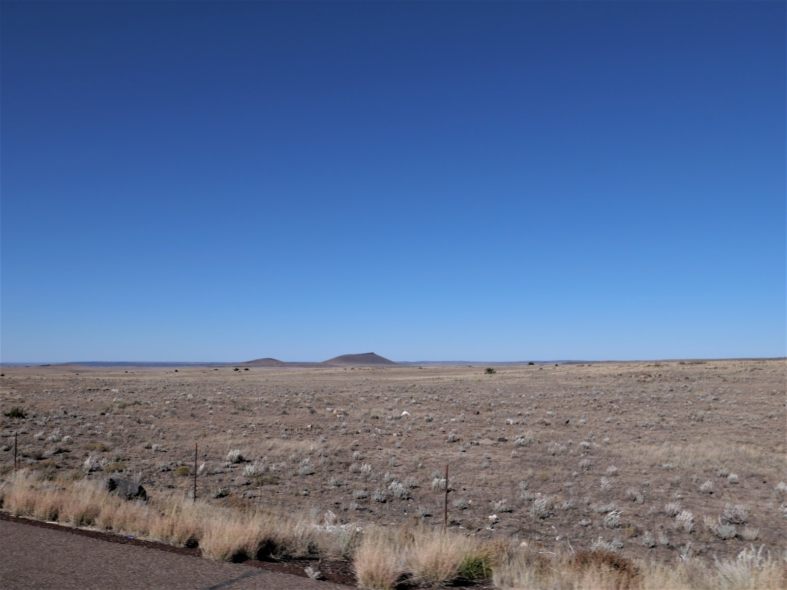
Today we started our trip back home, riding north most of the day on US 191. Just outside Bisbee we rode past corn, hay, and pecan farms in a wide valley between the Chiracahua Mountains to the East and the Dragoon Mountains to the West.


This was Apache country and the home of Cochise, a prominent Native American leader in the mid-1880's.

We rode about 20 miles on I-10 then continued our trip north on US 191 toward Safford, retracing our route from Friday. Once in Safford we continued north on 191 into a part of Arizona new to us. The highway changed from a ruler-straight path to wide sweeping turns as we headed into the mountains that surround Clifton and Morenci. These two towns are home to the Morenci Copper Mine, the largest copper producer in North America. It's an absolutely huge mine that produced 902 million pounds of copper in 2015.


We've ridden past many mines in Arizona, but the size of this mine astounded us. We watched large dump trucks that hold over 200 tons of rock each drive around the mine.


We left the copper mine behind us and saw a sign warning that there are no services for 90 miles. Mike said this is why we bought a GSA with an 8 gallon tank; so we don't have to worry about running out of gas during long stretches between towns. Not only did we have 90 miles to travel before the next gas station, these were 90 twisting miles with tight and technical hairpin turns, sheer drop-offs with no guard rails along the side of the 2-lane paved road, and jaw-dropping views across the White Mountains. We haven't had this much fun on Arizona highways in months!

US 191 between Clifton and Springerville to the north is known as the Coronado Trail named for the route used by the Spanish explorer Francisco Vasquez de Coronado in 1540 as he searched for cities of gold.


We had the road to ourselves as we zoomed through the twisting mountain curves. Signs warned about cattle, deer, elk, and bighorn sheep, but all we saw were 4 deer and a bunch of squirrels. The odometer rolled over to 16,000 miles as we came out of a tight hairpin turn, and then the elevation climbed even higher to 9,000'.

We kept seeing signs for Hannagan Meadow, and while our stomachs had been growling for a couple of hours we didn't hold out hope for a restaurant in the middle of the Apache National Forest. We were pleasantly surprised to find the Hannagan Meadow Lodge where we not only enjoyed a hot lunch, but also had fun talking with Brian from Tucson. He was riding a Royal Enfield Himalayan scouting out a route for a bicycle trip.


Hannagan Meadow is named after a Nevada miner who also did cattle ranching in this area. The Lodge opened in 1926 and is the only place to stay or eat between Clifton and Alpine.

As we continued north on 191/Coronado Trail, the views opened up and instead of tight hairpin turns we spend around wide sweepers. Over 550,000 acres of this forest burned in 2011 and signs warn of flash flooding.

Once we rode through Springerville, we were officially off the Coronado Trail and rode through grasslands at around 6000' elevation on the Mogollon Rim toward Show Low.


We rode almost 8 hours today and covered 351 miles through some of the most beautiful and remote parts of Arizona we've yet explored. Tomorrow is a short day of 190 miles from Show Low, a town named for a card game.


Friday, October 18, 2019

Traveling south to Bisbee, AZ

It's hard to believe that today, October 18th, is the first overnight motorcycle trip we're taking in 2019. We've been on several day trips, but a combination of bad weather and work have made longer trips impossible this year. Riding through the changing Arizona landscape, from high desert to pine-tree covered mountains, past a huge reservoir, watching the fluffy clouds over the rocky mountains, seeing swirling sand dervishes in the distance, marveling at the fields of cotton made us promise to not let so much time go by before another overnight trip on the BMW.


It was 56 degrees when we left Prescott, and I wore all my motorcycle liners to stay warm as we rode east up and along the pine-tree covered Mogollon Rim to Payson where we turned south on AZ 87, the Beeline Highway. After a few miles riding south and descending 3000' in elevation we stopped to shed the warm liners as we rode through the Tonto Forest in the bright Arizona sunshine. We were reminded about how large Arizona is as we looked far in the distance in every direction and rode 400 miles, all in Arizona. The Tonto Forest itself is over 3 million acres, and is the 5th largest forest in the United States.


Soon after turning south onto AZ 188 we started to see the northern edge of Theodore Roosevelt Lake, formed by a dam on the Salt River in 1911.


Every time I see large lakes in Arizona I get excited because we here in the arid Southwest there simply isn't much water. I started daydreaming about swimming and boating as we rode along the 8 mile long lake.

We turned east onto AZ 70, riding through the San Carlos Apache Indian Reservation that encompasses over 1 million acres of mountains, forest and scrubby desert.


We watched rain clouds in the distance, and then saw pools of water along the sides of the highway. The last time we rode through this area 3 years ago we were stuck in a torrential downpour. Today we were lucky and missed the rain completely, although we could smell rain in the air. We stopped in Pima at Taylor Freeze, a family owned ice cream and burger spot that's been in business since 1968.


We rode past fields of pima cotton, which gets its name from the Pima Indians who worked with the US Department of Agriculture in the early 1900's to perfect this specific type of high quality cotton.


We continued south on US 191 then rode 50 very windy miles west on I-10 because there simply aren't that many paved roads in this part of the country. Once off I-10 we rode past the Boot Hill cemetery and OK Corral in tourist-crazy Tombstone where you can walk the dusty dirt streets of the old West and watch actors re-enact the famous gunfight.

Finally we came to our destination:  Bisbee, founded in the late 1800's as a copper, gold and silver mining town in the Mule Mountains just 11 miles north of the Mexican border.


We're staying in Bisbee for the weekend, walking the steep, winding, narrow old streets that are now home to a wide variety of restaurants, shops and art galleries.

Sunday, June 30, 2019

250 mile BMW motorcycle ride for lunch

Only people who love riding motorcycles will ride 250 miles round trip for lunch. We haven't ridden with our friends Steve and Kim for several years, and finally everything fell into place for a ride today to Payson, AZ. In the summer we ride north into the cooler mountains, and we were rewarded with a low temperature of 83 degrees today as we rode up in elevation to about 7100' on the Mogollon Rim, an escarpment that forms the southern edge of the Colorado Plateau. It's an area covered in pine trees and high, craggy rock outcroppings.

We've ridden this route so many times we've lost count:  east out of Prescott on AZ 169 for a quick 6 miles north on I-17, then east again on AZ 260 through Camp Verde, site of pueblos built into the sides of canyons by Sinagua around 1000 AD. The Spanish came through this area in the late 1500's, and it was the site of a military fort in 1871. Camp Verde is at about 3500' elevation, and it's always the hottest spot on our rides; today it was 106 degrees on our way home.

Thankfully after we pass through Camp Verde AZ 260 starts to wind its way up the Mogollon Rim, giving us long views over the valleys. Steve and Kim rode in front of us, zooming through the sweeping corners as the weather became cooler.


We headed south on AZ 87 through the Rim towns of Strawberry and Pine, doing our best to pass as many of the slow-moving RVs as possible. We crossed the East Verde River, a tributary of the Verde River, about 5 miles from Payson. The East Verde has flowing water and we saw several people jumping into the river to stay cool.

As we came through a roundabout toward the Payson Airport and our lunch destination, a lab-size dog ran out from a gas station on our right and tried to zip across the road in front of us. Mike braked hard to miss the dog as our heart rates zoomed up. The dog kept running down the street as we pulled over to catch our breaths. A man from the gas station walked over and said the dog was a stray and he was afraid something like this would happen, then praised Mike for his superb bike handling skills to keep us upright.

We continued a couple of miles up the road to the Crosswinds Grille at the airport where we watched some small planes land and take off, and saw a large red helicopter, a Sikorsky S64, that's used to fight forest fires. On our way to Payson there were several signs warning about heavy smoke from a forest fire in the area, but the air was clear today. Fire danger is at a high level in this part of Arizona due to hot temperatures and windy, dry conditions.

After lunch we retraced our route back home, vowing to get together more frequently for motorcycle trips in the Southwest.

Follow our route here


Thursday, June 6, 2019

New Viking motorcycle jacket

The folks at Viking Cycle sent us a Viking Cycle Ironside Textile men's motorcycle cycle jacket for Mike to review. He's always looking for any excuse to ride the BMW, so he happily put on the jacket and took a ride to run errands and enjoy some time zooming around our area.


He's always worn a high visibility, bright yellow jacket riding the motorcycle to do everything he can for motorists to see him, and he wasn't sure about the black jacket. However, when he came back from the ride he was ecstatic about the fit and function of the Viking jacket. It's early June here in Arizona with bright sunny skies and temperatures in the mid to high 80's, and  he was surprised that the high-grade mesh ventilation system in the Viking jacket kept him pleasantly cool.

look closely and you'll see the mesh fabric that does a fantastic job of keeping the rider cool

He also loved all the pockets and appreciates the protective armor on the elbows, shoulder and spine. The PU coated Cordura jacket looks like it will be really durable. There are plenty of ways to adjust the fit, although he felt the jacket runs a bit small and recommends ordering up one size.


Watch our video of Mike showing off the jacket's features

A big thanks to Viking Cycle for this very affordable, highly functional, and great-looking jacket!

Sunday, May 26, 2019

224 miles on the BMW on familiar roads with some surprises


I'm going to start by describing the end of our 224 mile trip today, from our home in Prescott to Wickieup, AZ for lunch (there's a surprise here) and home on some of our favorite roads. As we were heading into Skull Valley getting close to Prescott Mike told me he had a surprise:  the largest cottonwood tree in Arizona. To be exact, this is a Freemont cottonwood, named after John Freemont who was an explorer and governor of Arizona in 1878. This particular tree was planted in 1917 along with 3 other cottonwood trees to mark the corners of a 2-acre plot of land. You can see Mike, who is 6' tall, standing in front of the tree with his arms outstretched. This tree is almost 47' around, so it would take Mike and 8 other similar-size people to join hands and circle this tree.

Back to the beginning of our trip. The weather is cooler this year than usual, so we decided to ride in an area that is usually too hot the end of May:  Wikieup in the Big Sandy Valley in the Mohave desert. Wikieup is the Mohave Native American word for shelter or home. It's a small, fairly bleak stopping point on US 93, the major road between Phoenix and Las Vegas. Our reason for riding to Wikieup was to finally enjoy lunch at Lucia's, famous for homemade food and pie. First surprise of the day - Lucia's is closed on Saturdays.

We started our ride heading south out of Prescott, through the Bradshaw Mountain twisties on AZ 89. We were thrilled at the lack of traffic in front of us so Mike could zoom around the hairpin turns. As we continued south we rode out of the pine forest and through rocky countryside.


Even though we're in the desert, because of all the rain and snow this Winter and Spring there is a lot of green and blooming desert flowers and cactus. One of our favorites is the ocotillo, a shrub with spiny stems which is not a surprise because every plant in Arizona seems to have spines or spikes.


Look carefully and you'll see the bright red flowers on the ocotillo.

We rode 89 south down in elevation to Congress where we turned onto AZ 71 which took us to US 93 North. We celebrated with a little motorcycle dance when our odometer rolled over to 14,000 miles. Eventually this will be all 4-lane divided highway, but currently there are large sections of 2-lane paved roads. We rode through the Joshua Tree scenic byway where both sides of the highway are covered with the iconic Joshua trees.


The Mormon settlers named these spiny trees because it reminded them of the bearded biblical leader Joshua. Governor Fremont - the same one I mentioned earlier about the cottonwood tree - called them "the most repulsive tree in the vegetable kingdom". We love that they're only found in the Mohave desert and have adapted beautifully to the desert environment.


When we discovered Lucia's was closed on Saturdays, we backtracked to Dazzo's Chicago Style Eatery which Mike thought featured German food. It turns out they feature Chicago-style hot dogs.


We came home on one of our favorite roads, AZ 96 East which is a sweeping 2-lane paved road with several sections of roller coaster hills that make my stomach go up and down. It's been recently repaved, and the riding was fantastic. This part of Arizona is covered with saguaro cactus.

We followed AZ 96E to Yavapai County 15 to Kirland, and then north on Yavapai County 10 through Skull Valley and more twisties in the Prescott National Forest. I lost count of the number of cattle guards we rode over; you know you're on little-traveled roads basically in the middle of nowhere when cattle guards are a regular feature.

We love to ride to new places and explore areas we've never seen, but it's also fun to enjoy a ride close to home on familiar roads. You never know what surprises might lie around the next bend in the road.


Follow our route here:  https://drive.google.com/open?id=1VjDGSYOt630NB0ktEeSOb9qJrzgfIw5M&usp=sharing  To find the cottonwood tree, in Skull Valley turn east onto Old Road N at the railroad tracks, and the tree is about 1/2 mile down the road.

Sunday, May 5, 2019

A spontaneous motorcycle ride

While we were leisurely enjoying Sunday morning we decided to be spontaneous and go for a motorcycle ride. The big question:  where should we go? Last weekend we took a longer ride to Flagstaff, and wanted to go somewhere different. It was going to be in the mid-70's so we didn't want to go south to a lower elevation and more heat.

That left heading north to Ash Fork. Ash Fork is the kind of place that you go through; it's not usually a destination. At the intersection of Arizona 89 and Interstate 40, it's a spot to stop and fill up your gas tank on your way to someplace else. In our minds, there are two things in its favor:  it's on part of the old historic Route 66 and it is home to a fantastic BBQ restaurant: Lulu Belle's.

There's basically only one paved road from our home in Prescott north to Ash Fork:  Arizona 89. It's a straight, 2-lane paved road with no twisties, sweepers, or mountains to climb. It's a zen-like ride north as we watched the grasslands meld into pinyon pine forests, with the hint of mountains to the east, north and west backing up all the high desert grassland.


Because of the wet winter and spring, the normally brown grasslands flaunt bright green colors, making the grazing cows and horses extremely happy. One of things we love about riding the motorcycle is that we're closer to nature than riding closed up in a car. The cliffrose bushes are blooming, making the air fragrant with hint of sweet perfume. On a walk this morning before the motorcycle ride I sniffed each blooming cliffrose bush along our path but couldn't detect a specific scent. Yet riding along the highway, every breath was filled with their fragrance.

We had heard about Lulu Belle's BBQ from many of our friends, and this was our first time there. What a treat!


Most of the buildings in Ash Fork are old and crumbling, but Lulu Belle's is big, bright, airy and comfortable. The wooden tables are anchored with lacquered tree trunks and the high ceilings offer a lot of space for Western memorabilia.


Mike had the pulled pork sandwich and I enjoyed a BBQ chicken sandwich - both were spicy, hot, and incredibly delicious. The buns and bread even come branded!


After lunch we rode on the old Route 66 through Ash Fork, which was founded in 1882 as a siding for the Atlantic and Pacific Railroad, which later became the Sante Fe Railroad. It takes its name from the confluence of three forks of Ash Creek. Ash Fork has a sad and tortuous history:  the original town burned to the ground in 1893 which wasn't uncommon in the West. The Sante Fe Railroad moved it's main line 10 miles to the north in 1960, and approximately half of the town's population relocated along with it. A fire known as "The Big Fire" in 1977 destroyed most of the downtown, Interstate 40 opened not long after and rerouted travelers away from the town, and another fire in 1987 destroyed most of the remaining buildings.

There are a few decaying buildings left in town, along with a building that was originally a Texaco gas station with an early 1960's Chrysler DeSoto on the roof. According to a Route 66 guide, this car was driven by Elvis at one point. Truth, local lore, or advertising? You be the judge!


We retraced our route home, enjoying the bright Arizona sunshine and zooming along with very little traffic to get in our way. Today's ride wasn't filled with exciting riding or an opportunity to explore new areas. But as Mike likes to say:  any motorcycle ride is a good ride!

Monday, April 29, 2019

230 mile loop to Flagstaff and home

Everything came together today for a gorgeous ride:  sunny skies, warm temperatures, and the pollen count was down. After a colder and snowier winter than usual, we've been waiting for a day like this! We were hungry for long stretches of road with no traffic in sight, winding our way through the mountains, twisting through canyons, and enjoying the sunshine on our faces.

We decided on a familiar and favorite route for our first day-long trip of 2019 to Flagstaff for lunch and then home. We started northeast from Prescott to Camp Verde, then east on AZ 260 through the pine forests.


Even though it was a beautiful Sunday, we had the road basically to ourselves as we climbed up into the cooler mountains.


We were hoping to see elk, but only spied the occasional hawk floating on the updrafts.


We turned onto Lake Mary Road, excited to see the higher water levels in the Upper Lake due to the heavier snowfall this winter. A dam built on Walnut Creek in 1905 led to the development of Upper Lake Mary, used as a water reservoir for Flagstaff.


You can see the snowy peaks of Mt. Humphrey's in the far distance, and as we road north toward Flagstaff the mountains loomed larger.


Lower Lake Mary often has less water than it's larger sister, but today the lake was a beautiful blue color due to the higher water levels.

We stopped at The Tourist Home Cafe in Flagstaff, a favorite lunch spot for the homemade bread and huge dessert display. Skip the chain restaurants and fast food places, and check out the funky south side of the train tracks in Flagstaff for great food.

Our route home led us through the 12 mile long scenic drive on 89A through Oak Creek Canyon, a 2-lane paved road that twists, turns, and snakes around hair-pin turns with steep red rocks on both sides on the way to Sedona.


Oak Creek Canyon is 2000' deep, and the popular Slide Rock State Park. This land was once an apple orchard homesteaded by the Pendley family in the early 1900's and became a state park in 1987. In the summer hundreds of people come here to slide through the water on the slick rocks.


We enjoyed sweeping through the canyon without much traffic until we came to an abrupt stop. For the next mile into Sedona it was stop and go traffic, giving us time to look out over the canyon and search for the elusive wildflowers that bloom in the desert. Sedona is always crowded, and what seems like hundreds of roundabouts and the slow moving traffic make us anxious to get through town as quickly as possible.

We continued south on 89A through Cottonwood into the historic old copper mining town of Jerome, perched high on the mountain ahead of us. We were lucky that there wasn't much traffic on the steep and narrow streets in Jerome, and we quickly left the quirky town behind us.


Coming down 89A from Jerome toward Prescott we got stuck behind a few slow-moving cars, and once they pulled over Mike took advantage of the open space, leaning into the twisties and zooming our way down the mountain.

Our 230 mile ride over 5 1/2 hours today made us hungry for more motorcycle riding and the opportunity to savor familiar routes plus explore new territory on the BMW.

Here's a map of our ride today. Have fun!