Wednesday, July 31, 2013

Ending the day with Paul Newman

I never imagined we'd end Day 6 of our trip from Vermont to Arizona with Paul Newman.


The Movie Manor Motel in Monte Vista Colorado combines a Best Western motel with a drive-in movie theater. Each room in the motel boasts large windows that face the drive-in movie screen. All we had to do was open the curtains and flip the switch for sound, and we watched Despicable Me 2 without stepping foot outside our room - named for Paul Newman.

Before breakfast with Duncan and Nate, we went for a walk on the 4 Mile Creek trail in Boulder. The trail winds through a prairie dog village and even though I'm sure the local residents view them as annoying pests, we enjoyed watching them running around their burrows.


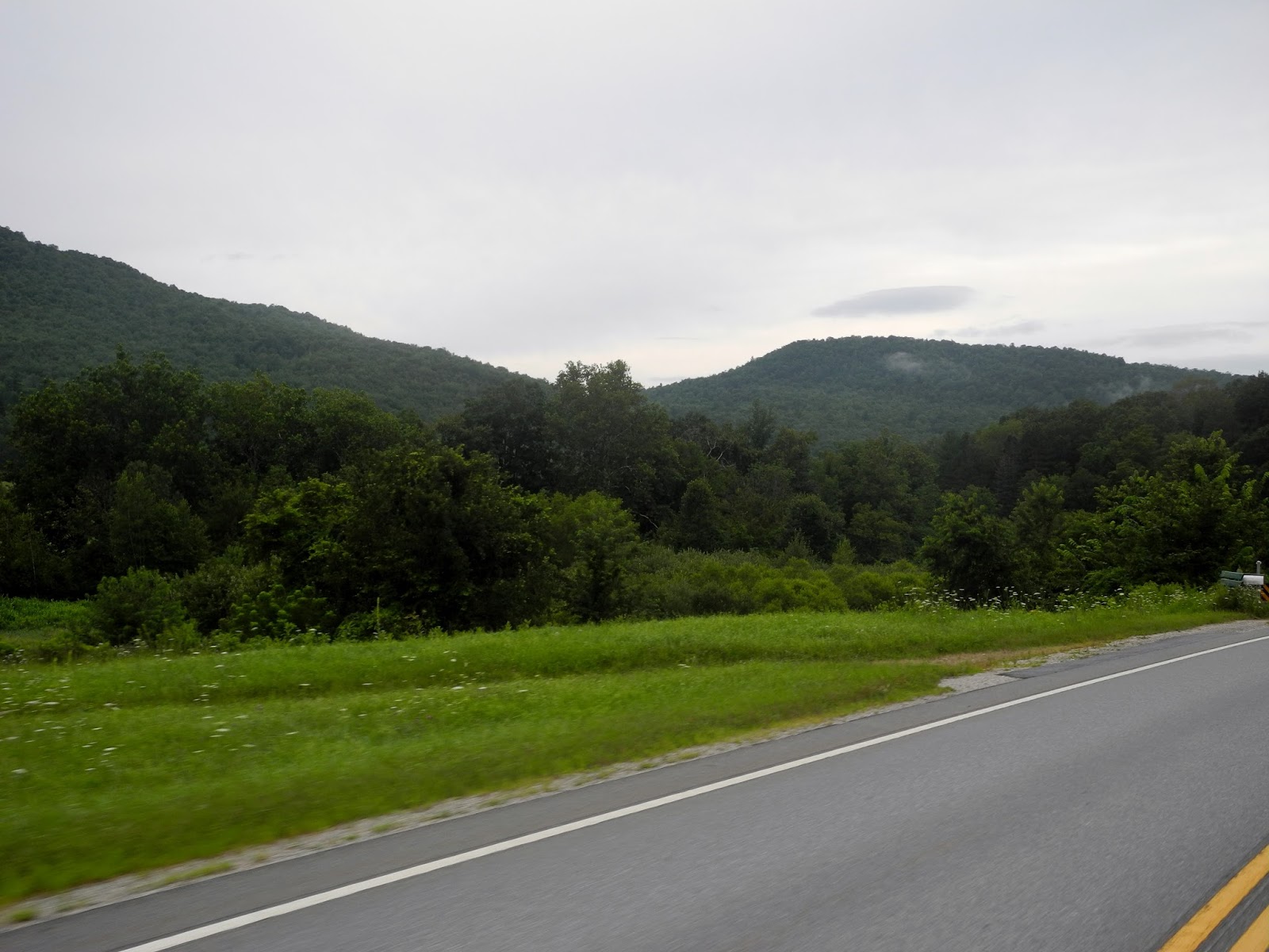
This was the first - and only - day of our trip that we spent entirely in one state. We expected roads that snaked through the Rockies but we forgot about the flat and wide open high plains that are part of the Rocky Mountain area.


We were hoping for twisting hairpin turns through the mountains, but instead enjoyed sweeping vistas and wide curves as we followed Route 285 for the majority of the day. We rode past Red Rocks Park that houses a large outdoor amphitheatre built by the Civilian Conservation Corps in 1941.


The highest elevation of today's trip was 10,000' at Kenosha Pass where we had views of mountains topping out at 14,000'.


As we crossed over the top of the pass, the 1000 square mile South Park grassland basin spread out in front of us.


Prospectors looking for gold crossed Kenosha Pass in the late 1800's, leaving ridges of gravel from the mining operations behind. The small towns are spread far apart and we felt like we were riding through Nebraska or Iowa again - except for the mountains that ringed the grassland on all sides.

The Collegiate Peaks, a large wilderness area that boasts several mountains higher than 14,000', came into view as we headed toward Buena Vista. Mt. Harvard at 14,421', Mt. Yale at 14,202' and Mt. Oxford at 14,160' are three of the peaks in this Sawatch Range of the Rockies.


We stopped for gas and chatted with the owners of a restored chuck wagon used by pioneers as they traveled West in the late 1800's. They told us about chuck wagon competitions, where particpants dress in period constume and use historic cooking utensils to prepare authentic meals. Their chuck wagon was on a flatbed trailer today, but it's usually pulled by mules. We decided chuck wagon competitions are the Western version of Revolutionary War re-enactments that occur in New England, and we're looking forward to attending one in the near future.


We ended the day riding through the 122 mile long San Luis Valley, a high desert basin at about 7,000' elevation. Route 285 stretched flat and straight in front of us as we passed small herds of cattle and mile after mile of dry grassland interspersed with irrigated green fields of potatoes, barley for the Coors brewing company, and quinoa.


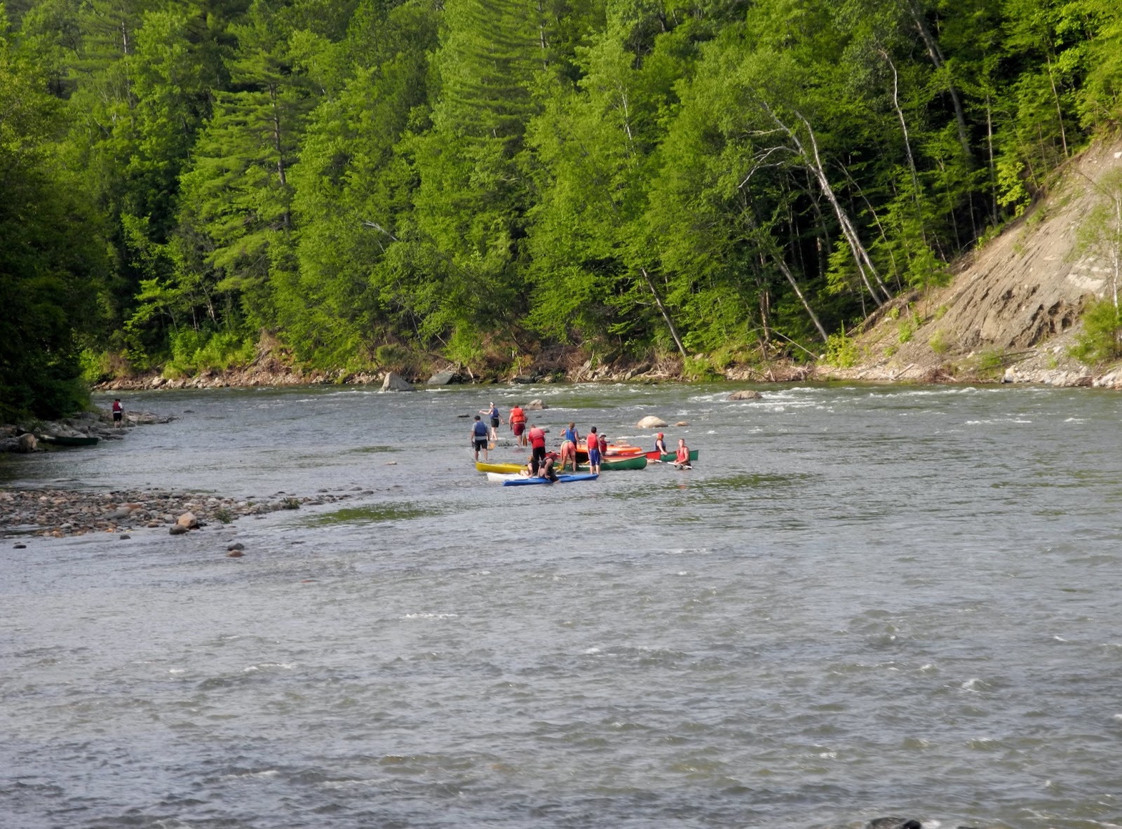
It seemed like every time we wound our way up through the mountains, the landscape changed. We rode through dense green pine forests, gravel and sandstone rocky mountain sides, dry desert plains, river valleys lined with aspens, and cultivated fields. We spent 5 hours on the motorcycle today, all within the state of Colorado and most of the time over 7,000' elevation. There's a lot more of Colorado to explore tomorrow.


Tuesday, July 30, 2013

Farmland to mountains

The fifth day of our motorcycle trip from Vermont to Arizona started off cold and gray but the weather forecast promised sunshine and warmer temperatures so we took a chance and packed the raingear. We left Grand Island, Nebraska with the GPS telling us we had 130 miles heading straight west on Route 30 until our first turn.


We amused ourselves on the long, flat road through cornfields and soybeans by counting the cars on the numerous trains that sped by heading east. The longest I counted was 146, or about 1.3 miles long. Mike pumped his arm in the air to encourage the engineers to blow the train whistle, and most of them complied. It reminded me of when I was a little girl and we would take a walk with our grandmother down her dirt road in Indiana farmland to stand on the bridge over the toll road to wave at the truck drivers.

About 3 hours into the ride I felt like someone flipped a switch:  the fog lifted, the sun came out in a cloudless blue sky, and the Nebraska landscape changed from lush green fields to rolling grassland. Mike spotted a small yellow cropdusting plane swooping over the fields like a large bird.


Route 30 took us west through the Sand Hills, the largest area of sand dunes in North America. Parts of this ecosystem have never been plowed, and I kept expecting to see a herd of buffalo thundering across the plains.


Mike had the GPS set to show the elevation as we gradually climbed from 1860' in Grand Island, NE to 5430' in Boulder, CO, our destination for the day. Western Nebraska and eastern Colorado are part of the Great Plains that stretch from Canada into Texas east of the Rockies. As we rode west and climbed higher, we watched clouds of dust follow tractors in the brown fields and herds of cattle grazing in the sparse grasslands.


As we kept pushing west, we both scanned the horizon for the first glimpse of the Rockies. I wondered what the pioneers felt as they slowly made their way through the Plains, knowing they had the Rockies to cross. We're looking forward to twisting, curving, steep mountain roads after 3 days of traveling on straight and flat highways, but I'm sure the folks in covered wagons had different thoughts about the Rockies.


We haven't been in a busy city like Boulder yet on this trip, and it was a shock to go from riding lonely miles with the road to ourselves to busy highways.


We're meeting our kids for dinner, looking forward to shooting pool and catching up with their lives. Tomorrow we're continuing our trek west into the Rockies. The flat, straight roads are behind us and the mountains promise a challenging and fun ride.

Monday, July 29, 2013

Straight roads heading west

The biggest difference between riding a motorcycle in the Midwest vs in the Northeast are the straight roads. Much of the Midwest is laid out in a grid pattern with ruler-straight roads. Today we spent over 200 miles heading straight west on Route 2 in Iowa, giving Mike lots of opportunity to count the cars coming toward us. At one point, we went 20 miles without meeting another vehicle, and overall we saw an average of 1 car every mile.


I expected flat fields stretching out in all directions, and was surprised that southern Iowa was so hilly. The hills were formed as the glaciers receded after the last Ice Age and rivers and streams cut into the soft soil leaving low, rolling hills. Even with the rolling hills, Iowa produces more corn and soybeans than any other state.


 West Point, IA sweet corn festival

We started the day early, leaving Burlington, IA at 7am. I wore all of my rain gear because it's still cold - only 59 degrees - and once again the weather forecast is for rain. When we stopped for gas at 10am Mike put on his raingear as well, and soon after the rain started. I started noticing road signs for the Mormon Pioneer Trail soon after we crossed the Des Moines River. Brigham Young led a group of 3000 Mormons from Illinois to Salt Lake City beginning in 1846, traveling through Iowa and Nebraska.


We stopped for lunch just after crossing the Missouri River, the longest river in the United States and the border between Iowa and Nebraska. It was raining so hard I couldn't take pictures, and Mike didn't even notice the river until I pointed it out to him.

Soon after lunch the rain let up and the landscape flattened out as we rode another 150 miles west into Nebraska to Grand Island. Mike commented that 'Grand Island' is a strange name for a town in a land-locked state, and our waitress at dinner explained that the name stems from the name given to an island in the Platte River by French fur traders:  Le Grand Island.

Most of those 150 miles we rode through pancake-flat land planted in fields of corn and soybeans. We rarely saw farmhouses and the towns were spaced even farther apart than usual. The landscape was dominated by huge grain elevators, enormous buildings that we assumed were research and development facilities for seed companies, and long sprinkler irrigation systems.


Wet clothes are hung in every available spot in our hotel room, and I cranked up the heater to try and dry out my waterproof gloves, which of course are once again completely soaked through. We're due for another day of sunshine tomorrow as we continue west through Nebraska and into Colorado. We're now farther West than we've ever been on a motorcycle, and I'm looking forward to watching the Rocky Mountains appear in the distance, and then get closer and closer until we stop tomorrow night in Boulder in the Front Range. An added bonus to leaving the flat plains and entering the mountains:  we get to see our kids!

Sunday, July 28, 2013

Wind tubines, straight roads, and lots and lots of corn fields


Thank you Val for a wonderful dinner and evening! We spent last night in Valpo, IN where I grew up, enjoying Val's hospitality before we started on Day 3 of our trip to Arizona.

We covered about 300 miles today, and the majority of the time we rode through cornfields in Indiana and Illinois. According to the Illinois Department of Agriculture 80% of the state's total land area - more than 28 million acres - is devoted to farmland, mostly corn and soybeans.


We left Valpo at 9am during one of the coldest July weekends on record - the temperature was 58 degrees. Thank goodness for raingear, because it cuts the wind and adds an extra layer of warmth. Last summer we rode to Missouri for the BMW motorcycle rally with temperatures over 100 degrees most days. This year we're lucky to see 70 degrees.

As we headed west from Dwight, IL we spotted wind turbines in the distance. As the day wore on, we saw more wind turbines near Henry and Kewanee. Illinois has 3,568 MW of wind power, enough to power 1.1 million homes and ranks fourth in wind capacity behind Texas, California and Iowa.

 
wind farm near Kewanee IL


The wind turbines stand about 400' tall; that's like stacking Mike on top of himself 66 times (he's 6' tall). When we stopped by the side of the road I could hear the gentle swooshing sound the turbine makes as the blades turn.

We crossed two major rivers today, first the Illinois River in Henry before it joins with the Mississippi, and then at the end of the day the Mississippi River as we crossed into Iowa. As we neared the Illinois River, the road started to bend and twist through gentle hills making us smile as we leaned into the curves.


Illinois River
 

Mississippi River
 
 
It's the unexpected that makes riding a motorcycle fun. Because the small, rural towns in northern Illinois are spread so far apart, Mike veered from our planned route to find the closest gas station, arriving in Bradford with only enough gas to travel 12 more miles. It was after 1pm and we were both hungry, so I asked a man pumping gas for a place to eat lunch. He recommended the Sip and Zip just down the road, which turned out to be the only restaurant in town.


Fueled by sandwiches and homemade onion rings, we headed back on the road with directions to Kewanee from the friendly waitress. Back on our planned route, we ended the day with an ice cream cone in Burlington, IA, the 7th state in our trip to Arizona.


Saturday, July 27, 2013

1000 miles into our trip

Time doesn't move at the same speed on a motorcycle vs driving a car. We spent 11 hours Friday and 10 1/2 hours Saturday on the BMW but it doesn't feel like we spent almost half of the day riding.  My legs may get tired from sitting in the same position, but while we're riding it almost feels like time is suspended as I watch the scenery and the road speed by.

470 miles today took us from the steep forested hills and sweeping turns of the Allegheny Plateau in Pennsylvania to the straight and flat roads through fields of corn and soybeans in Indiana. Inbetween we endured 3 hours of hard rain in Ohio before the skies cleared and the sun came out just after we stopped for lunch.

hilly roads in Pennsylvania
 
Ohio fields

I've almost forgotten what it's like to ride for hours on a road that rarely swerves from a straight path. Some people think that the scenery in the Midwest is boring:  mile after mile of farmland interspersed with a small town every 15-20 miles. Yet riding through the Green Mountains or the twisting roads of the Adirondacks involves repetition:  mile after mile of forests, mountain climbs and descents, and a small town every 15-20 miles.

Perhaps because I grew up in the Midwest, I love riding along flat roads where the horizon stretches miles in front of me. I watched the sun move in and out of the clouds, hoped the dark and foreboding rain clouds stayed far to our north, and saw the shadows from the clouds move across the fields. Because I can see so far into the distance, I could watch the grain elevators that mark a town's location gradually come into view, looming larger as we got closer and then flashing by too quickly for me to read the name of the company on the side of the buildings.

Mike said the roads were so straight, he felt like he could put the BMW on autopilot. He did anything he could to amuse himself: checking the tire pressure, switching screens on the GPS, counting the farmhouses, passing as many cars and trucks as possible.

Mike was the first to spot a row of wind turbines in the distance, and as we rode closer to Van Wert, OH there were too many turbines for me to count. The strong wind that buffeted us on the motorcycle powered wind turbines stretching out on both sides of the road. The Blue Creek Wind Farm generates 304 megawatts of electricity with its 152 wind turbines that tower 476' above the ground, dwarfing even the tallest grain elevators.


We turned north on Route 421, riding through towns familiar from my childhood traveling to high school basketball games with my father as he scouted teams, and eating countless fish dinners at school fundraisers with my family:  LaCrosse, Wanatah, San Pierre, Kouts, Knox. Signs on the road pointed to LaPorte where I worked for 5 years and our youngest son was born; Westville where my grandparents lived and we built our first house; Michigan City where Mike worked at B&E Marine and our oldest son was born. Route 30 heading into Valparaiso is almost unrecognizable, even though I was born and raised here and Mike and I lived in this area for 7 years before moving to Vermont 22 years ago. It's disconcerting to feel like a stranger in the town where I rode my bicycle, learned to drive, and graduated from high school.

At the end of the day's miles my raingear was dry from the wind and the sun but my supposedly waterproof gloves were still soggy. Mike's t-shirt and shorts never did dry out since he takes the full force of the rain. We pulled the BMW into my stepmom's garage and spent the evening catching up with Val and enjoying her company.

Next up:  Illinois and on to Iowa!


Friday, July 26, 2013

Moving from Vermont to Arizona on our BMW


We're off! After weeks of 'lasts':  last lunch with a friend, last run on familiar roads, last volunteer meeting, last day of work, last night in Vermont; we're ready to start logging in some 'firsts', beginning with the first day of our move to Prescott, AZ.

We sold our cars, hired a moving company to pack and ship all of our household goods, and we're making the trip into a motorcycle adventure. This is the perfect opportunity to ride the BMW across the country as we transition from Vermont to Arizona.

For a summer filled with hot temperatures, high humidity, and lots of rain today was perfect:  blue skies with a few fluffy clouds and temperatures hovering in the high '70's as we wound our way along county roads and state highways through Vermont, New York, and into Pennsylvania.


As we rode through Manchester early in the morning, I tried to print all of the familiar sights on my memory one last time:  the new library that Mike worked so hard on, Hand Motors where he worked and where we purchased all of our cars, the view of the Green Mountains on Wilcox Flats that never ceases to amaze me with it's beauty, the soccer field in Arlington where the boys played hundreds of games, and the BattenKill River where we tubed and swam.


As we headed west through New York we spotted horse and buggy signs, and then passed an Amish horse and buggy, reminding us that it's still possible to travel slowly and live simply. Most of the time we had the winding, curving roads to ourselves as we passed by fields of corn, hay, and wheat.


Our route took us for a few miles through heavy traffic from Chenango NY to Athens PA on busy routes 17 and 220. I was glad to leave the trucks behind as we traveled through the 265,000 acre Susquehannock State Forest on Route 6, the longest continuous  highway in the continental United States. The roller coaster hills and steep hillsides covered with forests reminded me of Vermont. We could stay on Route 6 all the way to our stop tomorrow night in my hometown, Valparaiso, IN but we want to take our time and explore other roads.

We're spending tonight in Oil City, PA in the foothills of the Allegheny Mountains after an 11 hour trip. Tomorrow we leave mountains behind as we head into Ohio and Indiana. We moved from northwest Indiana to Vermont 22 years ago, and it seems fitting to spend one night on this move West back in Indiana.


Sunday, July 7, 2013

A Saturday without rain? Hop on the bike!

We've had over 19 inches of rain the past month, making a day-long bike ride a potentially wet and soggy slog. Saturday the skies were dark grey and overcast, but the forecast told us we had several hours without rain so we crossed our fingers and set out on the BMW.

It seems like the 4th of July celebrations are spread out over a few days. Manchester had fireworks on the 4th, and as we rode through Londonderry we saw people lining up on both sides of the road, waiting for their day-after-the-4th-of-July parade to start.


Parades in small Vermont towns are an opportunity to chat with neighbors, visit friends, and catch up on the latest local news, and no one minds that the main roads are closed for a few minutes.

We rode up Route 100, one of the state scenic byways and a twisting, curving road that hugs the Green Mountains and several rivers and lakes along its north/south route through the middle of the state. Headed toward Woodstock, we turned right up steep Route 100A, riding past the Calvin Coolidge Homestead. President Coolidge was born here on July 4th, 1872 and he took the presidential oath of office in the same house on August 3rd, 1923 when  he became the 30th President of the United States.

Mike opted to turn north onto Route 12, where we enjoyed open roads with little traffic through Barnard and Bethel into Randolph. We stopped for lunch at Randolph Depot, the train station built in the 1870's for the Central Vermont Railroad that now houses a cafe/bakery/coffee house with a creative menu.


We continued north on Route 12 until we saw signs warning the road ahead was closed just north of East Braintree. We've had so much rain the past few weeks, and the torrential downpours have washed away several roads.


The only option was a dirt road to the left, and I was glad we ride a GS to handle the rough, bumpy, gravel road filled with ruts and bordered with steep wash outs.


It's always fun to take an unexpected detour, never knowing exactly where we'll end up. Mike likes to say that all roads lead someplace, and West Braintree Road turned into Steele Hill Road and ended up back on Route 12 in East Roxbury.

We continued on to Mike's parents' camp on Curtis Pond near Montpelier, the state capitol. The pond was busy with speed boats, kayaks, and swimmers (both human and canine) on this hot and surprisingly sunny July day.


We always like to ride back home on a different route, and this time Mike turned onto dirt roads that led back to East Montpelier where we picked up Route 14 through Barre and down to Bethel.


A sunny summer day on the motorycle isn't complete without a stop for ice cream, and our choice today was Tozier's, a Bethel institution for over 60 years. Mike had a maple creamee, a soft serve ice cream that relies on local maple syrup for it's sweet taste while I opted for a scoop of caramel ice cream. We sat at a wooden picnic table, watching a toddler attempt to eat a rapidly melting ice cream cone and young children running around the grass.

Back on the bike for the final miles south toward home, we rode along the White River, spotting people rafting on the swiftly running river. All of the rivers in the state are close to flood stage, making rafting and tubing challenging.


The rain held off until later in the evening, after we were home with the bike safely in the garage. Even though we've been on most of these roads more times than I can count, the day offered up surprises and the opportunity for new experiences. That and a ride without rain combined for a perfect day.