Monday, November 18, 2013

Rock 'n Roll in Las Vegas by motorcycle

It's mid-November and we're still having fun riding the BMW. This weekend we headed north to warmer weather in Las Vegas. We live at about 1 mile elevation in Prescott, AZ, and Las Vegas is about 2000' and in the Mojave Desert, hence the warmer weather.

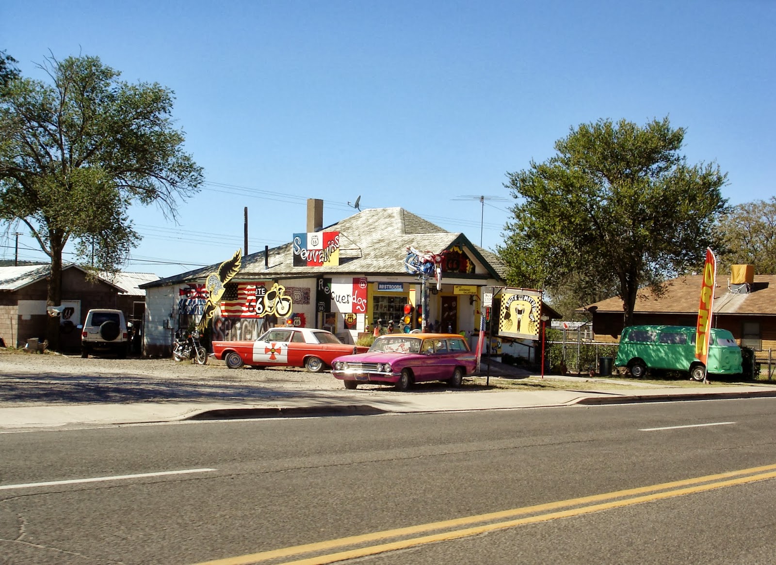
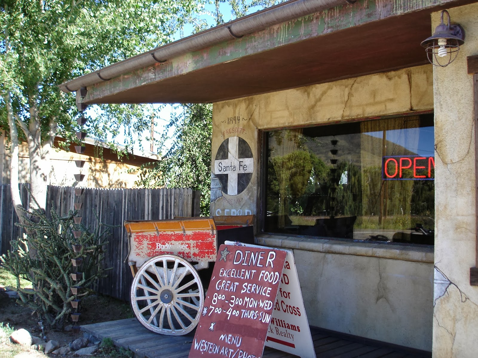
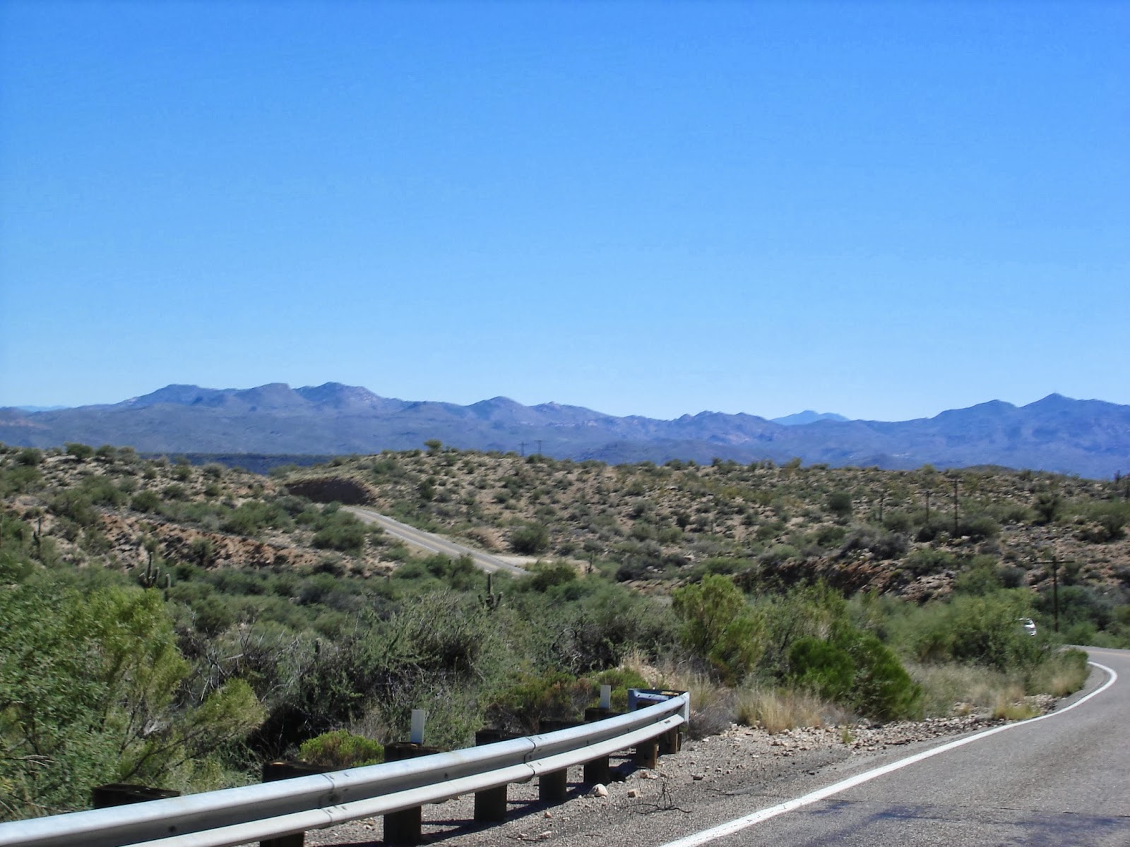
After riding north on Arizona Route 89, we headed west on the longest original stretch of Route 66 from Seligman to Kingman. Interstate 40 takes the majority of the east-west traffic through this part of northwestern Arizona, and we rarely saw other cars or even populated towns along Route 66.


What we did see were miles of desert, tumbleweeds blowing across the highway, and the famous Burma Shave signs that encouraged us to slow down, read each line of the jingle, and try to guess the last, rhyming line.

If Daisies are
Your Favorite Flower,
Keep Pushing Up
Those Miles Per Hour.
Burma Shave.
 
Cattle Crossing
Please drive slow
That old Bull
Is some cow's beau.
 
You can drive
A mile a minute
But there is no
Future in it.


From Kingman we headed north on Interstate 93 into the mountainous 2337 square mile Lake Mead Recreational Area formed by two dams on the Colorado River.


at the scenic overlook


We rode over the new bridge at the Hoover Dam into Nevada, with sweeping views of Lake Mead as we headed closer to Las Vegas.


After riding through the Mojave Desert and down through the mountains into Las Vegas with miles of little to no traffic, it was jarring to ride through stop-and-go traffic in congested Las Vegas. We parked the bike at Harrah's for the next two days, walking or taking the monorail instead of riding.


We spent two days wandering through lavish casinos, watching the amazing Cirque de Soleil Beatles Love show, and at the Rock 'n Roll marathon before we loaded up the BMW and rode south, retracing our route back home. We decided that we both prefer fresh air and the quiet open roads to loud and crowded cities, and that if we're going to spend time in Vegas, it's far more fun to get there by motorcycle.


Sunday, October 27, 2013

A motorcycle trip through Arizona's Fall Foliage

Oak Creek Canyon between Sedona and Flagstaff in northern Arizona is one of the premier Fall destinations in the state. Outdoor Sports in Prescott Valley hosted a BBQ, open house and 2014 product launch event followed by a ride to Oak Creek Canyon organized by the Prescott STAR 511 motorcycle club. Riders from the Phoenix area and Flagstaff enjoyed a fantastic BBQ, checked out the new 2014 Yamaha and Star bikes, and then headed out to Oak Creek Canyon.


bikes ready to go at Outdoor Sports
 
14 bikes went on the 150 mile round-trip ride to Oak Creek Canyon, riding north on I-17 and then 179 into Sedona. As we headed north, the Mogollon Rim that stretches 200 miles across Arizona came into view.


Sedona is always busy with tourists eager to see the red rock monoliths that surround the town. A series of roundabouts slow down the traffic, which gave me a good opportunity to take photographs.


Once through Sedona, we turned west onto 89A and entered the 12 mile Oak Creek Canyon. Oak Creek is one of the few streams in northern Arizona that has water all year, and aspen, sumac and maple trees grow abundantly along the creek. Fall foliage in Arizona is mostly golden yellow, with a few bright red trees. The backdrop of the red and white sandstone cliffs that tower 7200' on the western rim and the bright colors of the trees that form a canopy over the twisting 2-lane road make this a fun trip on a motorcycle.


The group stopped at the Indian Gardens Cafe but since we were short on time, we turned around and headed back home. The late afternoon sun cast shadows on the red rock formations, and I watched hikers winding their way around the paths that snake up the rocks.


We moved to Arizona from Vermont three months ago, and while the Fall foliage in the Southwest doesn't come close to the masses of vividly colored trees covering the Vermont mountains, a ride through Oak Creek Canyon on a sunny October day is a good substitute.

Monday, October 14, 2013

Saguaro cactus, cotton, and blueberry pie

The last day of a motorcycle trip sometimes is just about getting home, but today's ride, thanks to Brad and George of the Prescott STAR 511 motorcycle club, took us through twisty roads that bumped up and down like a rollercoaster, past irrigated fields of cotton, and several stops for ice cream, lunch, a cold drink, and even blueberry pie.

We started off heading north from Tombstone, leaving behind the tourists and the gunfights for a ride through rocky canyons and bluffs in the Sonoran Desert.


Brad promised we'd see saguaro cactus, but I didn't expect the thousands of cactus covering the mountainous landscape in the Rincon Mountain District of the Saguaro National Park just east of Tucson. The 91,000 acre park was first created in 1933, and since the saguaro can live for 150 years, some of the ones we saw today were already 80 years old - and just growing 'arms' - back in the 1930's.


We followed the winding road up and down through the saguaros to Old Tucson in the western part of the Saguaro National Park where hundreds of western movies, TV shows, and commercials were filmed. Brad said we could easily spend a day walking through the old movie sets and watching musical revues and gunfights. We drank cold water and took pictures of the outer buildings and cactus, and I peeked over the top of the wooden fence to get a glimpse of the town.


As we continued north toward home, I was surprised to fields of cotton growing in the middle of the desert between Tucson and Phoenix. Cotton is one of the 5 C's that were the driving force of Arizona's economy:  cotton, cattle, climate, citrus and copper. In fact, in the 1920's cotton replaced almost all other agricultural crops in Arizona. Due to urban development taking over the fields and water concerns, less cotton is grown today but it's still a significant crop.


George led the way to one of his favorite lunch spots, the San Tan Brewing Company in Chandler, one of the Phoenix suburbs. We sat outside in the shade and enjoyed lunch while we listened to music from the Indian Market taking place in the town square across the street. George continued to his home in Phoenix, while Brad led us further north to our final stop of the trip at the Rock Springs Cafe in Black Canyon City. The Cafe was founded in 1918 as a general store and today is famous for its pies - they sold over 50,000 in 2007. We did our part by sharing a slice of blueberry pie before we put on warm layers of clothing as the elevation climbed and the temperature dropped from the high 80's to the low 60's.


I took the last photo of our 3-day trip, capturing our shadow on the grassy plains with mountains in the background. We rode 700 miles from Prescott to Tucson, on to Tombstone, and back home on a trip that introduced us to southern Arizona. I'm learning just how big our new home state is, and we already have more motorcycle trips planned to explore other areas.

Saturday, October 12, 2013

Tombstone: The Town Too Tough to Die

Today we went from 21st century aircraft at the Pima Air & Space Museum in Tucson to the gunfights of the mid-1800's in the Old West town of Tombstone while traveling 120 miles on our BMW R1200 GS motorcycle, riding the little-used 2-lane highways in southern Arizona.


Mike loves airplanes and flight, and the Pima Air & Space Museum with its collection of more than 300 aircraft spread both inside hangars and parked outside on the hot and dusty grounds was a fantastic way to start the day. We saw airplanes that flew missions in WWII and VietNam, nuclear bombs (without a warhead) still in use today, scores of helicopters, the oldest existing SR-71 Blackbird (longrange Mach 3+ reconnaissance aircraft), and several seaplanes. We didn't cover the entire 80 acre museum, which means we'll be back to Tucson for another visit.

Brad and George planned a fun motorcycle route to Tombstone that stayed off the Interstate, giving us the opportunity to ride through the changing southern Arizona landscape. We saw mountains, rocky bluffs, flat sandy desert that stretched out to the horizon, and wavy golden grassland where I half-expected to see herds of buffalo.


We pulled into Tombstone in time for lunch at the OK Cafe where the ceiling was raised to accommodate a large stuffed buffalo head mounted on the wall over our table. I've never been to a town where people dressed in clothing from the 1880's enthusiastically told us to "don't miss the bank robbery at 3pm!" and a stagecoach was the only traffic along the main street.
 

Tombstone citizens dressed in 1800's clothing


A cowboy told jokes before the diarama/movie about the history of Tombstone narrated by Vincent Price where we learned how the town earned its name. According to the town's website:
 
Tombstone was founded in 1877 by a prospector named Ed Schieffelin. Ed was staying at what was then called Camp Huachuca as part of a scouting expedition against the Chiricahua Apaches. During his time there he would venture out into the wilderness "looking for rocks", all the while ignoring the warnings he received from the soldiers at the camp. They would tell him, "Ed, the only stone you will find out there will be your tombstone". Well, Ed did find his stone. And it was Silver. So, remembering the words of warning from the soldiers, he named his first mine The Tombstone.
 
The town was founded to support the thousands of miners prospecting in the mountains, but Tombstone really became famous for the gunfight at the OK Corral where Wyatt Earp and his brothers, in the name of bringing law and order to the wild town, gunned down three cowboys known for steading horses, robbing stagecoaches and shooting up the town. It sounds odd to say that the live re-enactment of the gunfight was fun, but watching the actors play out scenes I've seen countless times in Western movies really was great entertainment. At one point the actors adlibbed and started laughing so hard it took them a few minutes to compose themselves and finish the play.

Big Nose Kate, Doc Holliday, Wyatt Earp and Virgil Earp
 
Big Nose Kate's Saloon still serves food and drink to a rowdy crowd, the Bird Cage Theatre is a museum full of old posters and memorabilia advertising singers and plays from over 100 years ago, and the Crystal Palace Saloon that started life as a brewery in 1879 still serves dinner.
 
Our hotel was just down the road from the Boothill Graveyard where the cowboys killed in the gunfight at the OK Corral are buried along with several other people whose white crosses on their graves piled high with rocks proclaim they were "hanged", "shot", "murdered" or every once in a while "died a natural death".


 I can imagine Tombstone on a Saturday night in the 1880's, with hundreds of cowboys and miners going in and out of the saloons, horses tied up along the wooden sidewalks, and loud music spilling out into the street. Tonight was a quiet night in Tombstone except for the sound of our motorcycles as we rode out of town to our hotel.


Friday, October 11, 2013

Motorcycle travel with a group

Since moving to Arizona we've met several people who ride motorcycles, and they've been kind enough to share some of their favorite routes with us. Today we headed south on a 3-day trip to Tombstone, stopping for the night in Tucson. Brad and George from the Prescott STAR 511 group took us under their wings, stopping at some of their favorite places to eat and showing us sites we never would have found on our own.

The temperature was in the high 30's when we started out, which meant layers:  fleece-lined turtleneck sweater, fleece sweatshirt, and all three layers of my motorcycle jacket:  warm inner layer, windblocker layer, and the jacket itself. Celtic Rider neck gaiter pulled up over my ears and head, thermal tights, thermal motorcycle pants liner, and warm motorcycle pants. The heated Gerbing motorcycle gloves completed the package. I couldn't move easily because of all the layers, but I was warm!

As we rode south on I-17, the elevation sloped continuously downward and the temperature went up. People in Prescott talk about going to "The Valley" when they go to Phoenix, and today I understood why. Phoenix is in the Salt River Valley at the northern edge of the Sonoran Desert. The temperature in the Valley is typically 15-20 degrees warmer than Prescott, which is why we ride South this time of year. We stopped to shed some of the clothing layers and then kept going into Phoenix to meet George.

We spent the next hour in heavy Phoenix traffic before we turned south onto Route 60 and then Route 79. We rode through desert landscape with distant views of the mountains as the temperature climbed into the 80's.


Brad suggested lunch at the Old Pueblo Restaurant in Florence, where the two guys sitting at the end of the table told us their favorite menu items and the waitress chatted about the local high school's homecoming parade.


George is Greek, and he took us to St. Anthony's monastery in Florence. Established by six monks in 1995, the monastery today contains the main St. Anthony's Church along with four chapels, each dedicated to a different saint.  Stone paths wind through beautifully landscaped gardens, and past the lemon and olive orchards.


Because this is an active monastery, I was asked to wear a head scarf and skirt. Mike, George and Brad wore hats and long-sleeved shirts. The monks greeted us with a traditional kerasma (water and something sweet, which today was Chips Ahoy chocolate chip cookies) before we wandered around the grounds.
 
Lynn with George at the monastery

We continued south toward Tucson with the Santa Catalina mountains to our left. Tucson is in the Sonoran Desert, but Mt. Lemmon, at 9,157' actually gets 180" of snow each year. Mt. Lemmon Ski Valley is the southernmost ski area in the United States, and Brad and George promised another trip to ride up the twisty mountain road.


One of George's friends invited us to his home in a high canyon east of Tucson for dinner. We ended the day riding down the twisting, curving and steep road into Tucson at 10pm, with the lights of the city competing with the stars. Tomorrow we ride further into the old West for a day in Tombstone.

Sunday, October 6, 2013

Route 66 in Seligman, Arizona

I bet when you read "Route 66" a picture pops into your mind of the old Route 66 highway that stretched from Chicago to LA over 2,448 miles. Two-lane paved highway, family-run motels along the side of the road, big billboards advertising food, gas, and local attractions; and small, dusty towns separated by miles of scenery that vary from corn and soybean fields in the Midwest to the brown, dry hills of the Southwest.


While the majority of the old Route 66 that first opened in 1926 has been swallowed up by the interstate highway system, pockets of the old road still exist. Today we rode north from Prescott to Ash Fork, then turned west to Seligman where 80 miles of the original Route 66 head west to Kingman.

I rarely see trains in northern Arizona, but today we spotted several. Seligman was originally called Prescott Junction since it was founded as an intersection on the railroad line from Sante Fe to Prescott - where we live. 


Route 66 seems to define Seligman, at least the part of town lined up along Route 66 where we saw a pink 1959 Edsel in front of the Rusty Bolt store, old Fords, a purple Pontiac wagon with an orange roof, a lime-green VW bus, a rusty cabover truck sitting in a field, and a group of Harley motorcycles riding down the road.


We stopped for lunch at Westside Lilo's Cafe where the walls were decorated with Route 66 signs, photos, and newspaper clippings; a mounted elk head, stuffed mountain lion, and hundreds of German beer mugs.

Thanks to Mike's Garmin GPS, we discovered 17 miles of the old Route 66 heading east from Seligman until it joined up with I-40. We had the road to ourselves except for a couple of pick-up trucks, and we slowed down to read the Burma Shave signs along the road. These advertising signs with rhyming poems originated in the 1920's, and at one point there were over 7,000 signs spread throughout the United States. The signs are spaced along the right side of the road, with 2-5 words on each sign that add up to a pithy phrase. The first series we saw was:

The angels that guard you
while you drive
always retire
at 65
Burma Shave
 

followed by this second, tongue-in-cheek series:

Just one time
just for fun
you can finish
what we've done
??????
 
We only rode 146 miles, but we experienced enough highway history and kitschy tourist attractions to make it a full and interesting day.
 
If you ever plan to motor west
Travel my way, the highway that's the best.
Get your kicks on Route 66!
 

Sunday, September 29, 2013

Ride to Bagdad - Arizona

Every time we talk with motorcylists, they run through a list of places to ride in Arizona and ask us if we've been there. We probably haven't been there - yet. I count the places we've ridden in Arizona on one hand, and today thanks to the friendly and fun Prescott Star 511 touring group we added two more amazing locations to our list:  Skull Valley and Bagdad.


We met George who rides a BMW K1300S and Brad on a Yamaha FJR1300 at Starbucks and pulled out of the parking lot onto Iron Springs Road heading toward Skull Valley at about 9:30am. The sky was what I've started to call "Arizona blue", an intense bright, cloudless blue color that varies from a deep to a lighter hue depending on the angle of the sun.


I love learning about Arizona and the history behind the names of the towns and roads. Skull Valley, according to the Sharlot Hall Museum archives of the oral history project conducted by the WPA in the 1930's, was originally named by the Yavapai and Pima native Americans who fought a battle in this area. The dead were left unburied, which resulted in skulls and bones left in the valley for the white settlers to discover when they arrived in the mid-1800's.

I didn't see any skulls on our 15-mile ride down Iron Springs Road to Skull Valley (population around 743), but we did enjoy a large and spicy Mexican-inspired breakfast at the Skull Valley Diner.


We sat outside in the warm sunshine and told stories about motorcycle travels that involved riding through the Alps, Badlands, and New England; and breaking down in the brutally hot Arizona summer.

I was glad for temperatures in the 70's as we continued to our next destination:  Bagdad, about 60 miles west of Prescott. Like so many Arizona towns, Bagdad was founded by miners looking for gold and silver. Today the townsite and the Bagdad copper/molybdenum mine are owned by Freeport-McMoRan Copper & Gold which continues its mining operations.


We climbed up and down through the rocky countryside, rarely seeing cars or motorcycles, or even houses. As we descended closer to Bagdad and the temperature climbed into the high 80's, I saw tall saguaro cactus covering the landscape. Saguaro are found primarily in the Sonoran desert, and Prescott is at too high elevation for this type of cactus.


The paved county road ends in Bagdad, where we stopped for an ice-cold drink (the bottle of water from the convenience store refrigerator actually had chunks of ice in it) before we headed back toward home.


palm trees in Bagdad, Arizona
Even though there's only one road in and out of Bagdad, everything looks a bit different going in the other direction. We ended our ride heading north on Route 89, riding through the Pondersa pines in the Prescott National Forest. This road is made for motorcycles, and we twisted our way through the hairpin turns and switchbacks, stopping a few times to look back at the pavement across the valley.


I want to go back to Skull Valley, stop in the train museum and eat another meal at the diner. Bagdad offers tours of the mine, and I'd like to explore some of the smaller roads that wind through the mountains north of Prescott. We've heard October is a beautiful month for motorcycle travel in the southwest, and we're ready to go.


Sunday, September 22, 2013

Windy ride to Payson, AZ

 
The first official day of Fall greeted us with a strong, cold northwest wind. On a motorcycle, a windy day takes on new meaning. Mike says the wind moves the bike sideways while we're going forward,  and we felt like bobbleheads during most of the trip.
 
Today Steve and Kim on their Kawasaki Concours and Tom and Christine on their Victory joined us for a ride to Payson on the Mogollon Rim.


Steve and Kim


Tom and Christine
 
Payson was founded in 1882 and became well-known in the early 1900's due to  books and movies about the area by Zane Grey. We were more interested in the limestone and sandstone cliffs that rim the valley, and the twisting roads that climb through Ponderosa pine forests.  


We like to ride through the changing countryside in northern Arizona, where in the space of an hour we travel through flat, dry high desert plains with mountain peaks a shadow in the distance; scrubby pines that dot the rolling hills, towering Ponderosa pines that crowd thickly together, dry creekbeds and washes, canyons that zigzag through the valleys; and steep, sharp rocky cliffs. Payson is only 100 miles mostly east and a bit south from Prescott, giving us plenty of time to stop for lunch at the Crosswinds Restaurant at the Payson airport.
 
The wind didn't let up during the ride back home, and the bright sun made the limestone cliffs stand out stark and clear against the clear blue sky.

 
I like riding in a group, stopping to talk and stretch our legs, chatting at a stoplight, and pointing out a passing helicopter as we ride down the highway. We have hundreds of miles of roads to explore, and I'm looking forward to future trips.
 
Mike and Lynn on the road - thanks for the photo Christine!