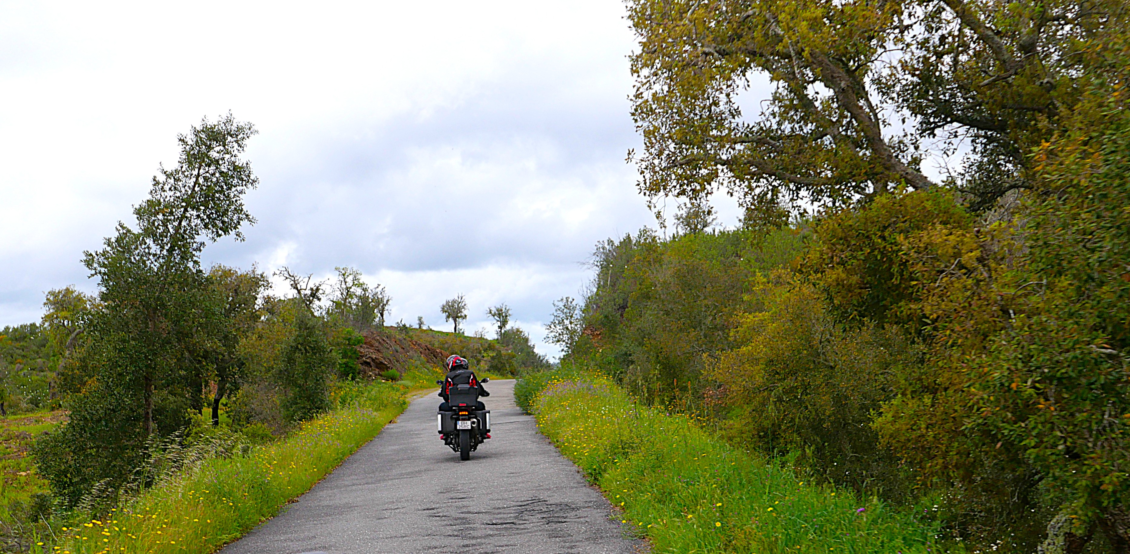
Sunday, October 22, 2023

Colorado/New Mexico Loop on a late Fall day

 It was a beautiful late October day yesterday, so we decided to ride 194 miles looping south into New Mexico. Thanks to Butler motorcycle maps we chose a road marked in red, meaning lots of elevation changes and twisties.

To get to the twisty road, we first headed south on US 64/84 through the Chama River Valley. This was our first time riding the BMW on this route that is bordered by ranch land.


We headed east when US 64 split off from US 84 an started to climb up Brazos Summit, the second highest paved road in New Mexico.


What a fun road on a motorcycle - 77 miles with lots of curves and twisty turns, stunning long views with Fall foliage colors, and almost no other vehicles on the road.


The highway tops off at 10,528' and then winds down to about 8,000' in Tres Piedras at the junction of US 64 and US 285 where we turned north on US 285.

What a change in landscape as we rode on a straight road through a high altitude valley with wide open plains and far-off views of the Rockies.


We rode past the Rio del Norte National Monument, an important wildlife corridor and home to people for thousands of years. 

We crossed back into Colorado and turned west in Antonito on CO 17, one of our favorite drives as it twists and turns through the San Juan Mountains over the Cumbres Pass at 10,022'.


We had a beautiful afternoon with perfect Fall weather, gorgeous scenery, and fun motorcycle roads straddling Colorado and New Mexico.


Tuesday, September 5, 2023

Tour of the San Juans - Day 2

 We woke up to a clear, crisp morning in Montrose, Colorado and enjoyed breakfast at the Backstreet Bagel Company. Having lived in Vermont for several years we love excellent bagels, and they're extremely difficult to find in the West. Backstreet Bagels is a huge hit!

The first day of our 2-day Labor Day weekend ride in the San Juan Mountain range in the Rockies was filled with twisting roads complete with hairpin turns up and down the mountains with so many amazing mountain vistas. Today was even better!

We started off south on US 550 and almost immediately saw the high, jagged mountain peaks in the distance ahead of us. Yesterday we rode north on CO 149 on the eastern side of this same mountain range.


We rode past Ridgway State Park and reservoir, built in 1978-1987 for flood control and irrigation.


We turned southwest on CO 62, riding into the mountains past irrigated fields.


We turned south onto CO 145, riding along the San Miquel River toward Telluride.


Our route today didn't take us into Telluride, although we caught glimpses of the ski runs. CO 145 continues it's winding way through the San Juans complete with hairpin turns as we climbed and then descended over and over, always with one amazing view of the high mountains that rise above the treeline after another.


We stopped at the Sunshine Mountain scenic overview where we saw Wilson Peak (14,017'), Sunshine Mountain (12,930' where it really does look like the sun shines on it even on a day with lots of fluffy clouds) and several other peaks that were first protected in 1932 as the Wilson Mountains Primitive Area, and then expanded in 1980 as part of the larger Lizard Head Wilderness.


Soon after the stop we rode over Lizard Head Pass at 10,246' through open meadows. This area must be even more spectacular in the summer when the wildflowers bloom.


CO 145 dropped down out of the mountains as we neared Dolores (Spanish for 'sorrows' and named for the river where it's located).


We picked up CO 184 south in Dolores, riding past small clusters of houses and ranch land to US 160 in Mancos, just outside Mesa Verde National Park. 

Until now we saw only a few cars and motorcycles, but once on US 160 heading east to Pagosa Springs there was a lot of traffic and larger groups of motorcycles.

We rode 251 miles today on roads perfect for motorcycles, traveling the San Juan Byway through southwestern Colorado.


Monday, September 4, 2023

Tour of the San Juans Day One

It's Labor Day weekend so we decided to hop on the BMW and do a circular loop of the San Juan Mountains, part of the Rockies located in SW Colorado and NW New Mexico. There are over 28 peaks in this mountain range, and 6 of them are over 14,000' high. The San Juans are the largest mountain range by area in Colorado, covering 13 different counties - including our own Archuleta County. 

These mountains were created as the continental plates slammed into each other, and then volcanic activity and glaciers carved the steep mountains and U-shaped canyons. The Ute people lived here for hundreds of years, and the Spanish were the first Europeans to explore this area, naming many of the mountains and rivers.

It's an absolutely gorgeous spot for motorcycle riders and we took full advantage of the opportunities literally in our back yard.

We started our trip heading northeast on US 160 from Pagosa Springs, riding once again over Wolf Creek Pass on the Continental Divide at 10,857'. On the eastern side of the pass we turned north onto CO 149 at South Fork, at the confluence of the South Fork and Rio Grande rivers.


South Fork is start of the 117 mile Silver Thread Scenic Byway and we thoroughly enjoyed winding our way along the Rio Grande river. We passed through Creede, which bears the distinction of being the town with the most people (257 in the 2020 Census) AND the county seat of Mineral County. It's hard to believe that in 1891 more than 10,000 people lived in Creede due to the silver mining boom.

Our first stop of the day was at Clear Creek Falls, where the water shoots over the plateau down the rocks of the 100' canyon. From the highway you have no idea that the canyon or the waterfall is just a few hundred feet away - so be sure to stop.


 Not long after riding past the waterfall we started climbing up the first of two passes:  Spring Creek Pass at 10,898' along the Continental Divide.


The 2-lane paved road winds and twists, complete with some U-shaped hairpin turns up Slumgullion Pass at 11,530'. Some of the climbs are 9% grade, and we had a lot of fun zooming along, looking at the mountain peaks in the distance.

Our second stop of the day was at Windy Point overlook where we could clearly see several high peaks of the Umcompahgre Wilderness only 15 miles away.


The highest peak (the pointy one that leans to the right) is Uncompahgre Peak, at 14,321'.

We could also see the Slumgullion Earthflow Natural Landmark that started 850 years ago when a huge chunk of rock, dirt and forest broke off and slid 4 miles down the side of the mountain.


The earth continues to move about 20' each year, and as we rode past the 'toe' of the earthflow, I wondered when it will slide over the highway.

 
CO 149 took us into Lake City, another town that grew during the mining years to 5000 people, and today is home to about 430. In 1978 the Lake City Historic District was listed in the National Register of Historic Places, and the town is gorgeous. We stopped for lunch and then rode through the original downtown area, now home to galleries and shops.

We continued north on CO 149, riding through a gorge formed by the Lake Fork of the Gunnison River.


The landscape opened up as we rode through grasslands with far off views of more of the San Juan Mountains.


The Silver Thread Scenic Byway ends at Blue Mesa Reservoir, where CO 149 meets US 50.


The Blue Mesa Reservoir is the largest body of water in Colorado, 20 miles in length with over 96 miles of shoreline. It's impressive to ride for miles along the lake, and we were surprised that there weren't more boats on the water on a beautiful Labor Day weekend. 

We've ridden on US 50 several times over the last 10 years, and there is always construction. This year was one of the only times we didn't have to stop and wait for several minutes as the traffic was reduced to one-way only for a few miles - but there was a section that was loose gravel, always challenging on a motorcycle.


We finished the day in Montrose after riding 241 miles through the stunning San Juan Mountains, looking forward to another day as we continue our 2-day ride.


Sunday, August 6, 2023

Sunday morning loop into New Mexico

 It's a beautiful early August day, not too hot and no clouds in the sky - perfect for a morning motorcycle ride. We decided to ride a loop to Navajo Lake and explore some new roads. We started off riding south on US 84, turning west onto US 64 after we crossed from Colorado into New Mexico.


We rode through the Jicarilla Apache Nation that covers almost 880,000 acres in the upper San Juan River Basin and Rio Chama.


There was almost no traffic as we zoomed along the straights and through the gentle curves.

Our destination was Navajo Lake, the second largest lake in New Mexico and home to two state parks - one in New Mexico, and the other in Colorado. Navajo Dam was built in 1962 on the San Juan River to provide water storage for use on the Navajo Reservation.

We decided to turn north onto NM 539, a twisting, winding 2-lane paved road that provided lots of motorcycle fun as well as beautiful views.


The road goes over the dam, providing views in all directions.


NM 539 ends at the junction with NM 511, and we continued north along the lake.


We crossed back into Colorado, riding into the Southern Ute Reservation as the landscape between more green and mountainous.


We turned east onto CO 151 in Ignacio, home to the Southern Ute government. CO 151 is part of the Tracks Across Borders Scenic Byway which travels 89 miles from Durango, CO in the west to Chama, NM in the east. We caught glimpses of the northern edges of Navajo Lake, and then rode past Chimney Rock National Monument. 


Chimney Rock is the site of over 200 homes and ceremonial buildings of the Ancestral Puebloans who lived in this area from about 600-1125 AD. We hiked here last month when our oldest son and his girlfriend visited, and it's a fascinating stop.

CO 151 ends at US 160, and we turned east toward Pagosa Springs and then home. We rode about 3.5 hours today, covering 185 miles through northern New Mexico and southern Colorado, still home to the descendants of the Ancestral Puebloans and an important part of our history.

A perfect way to start an August Sunday.


Tuesday, July 25, 2023

Riding home: familiar and new Colorado roads

 We started off the third and last day of our motorcycle trip Monday morning in Leadville, looking forward to more high mountain passes and a road we haven't yet ridden. We started off riding south on US 24, looking out over the snowy Rockies.


Soon the highway started curving and winding along rocky cliffs cut by the Arkansas River that starts near Leadville and ends 1469 miles later at the Mississippi in Arkansas.


We saw a few fly fishermen but no rafts on the river. Soon after we started riding along the Collegiate Peaks, a 57 mile stretch of the largest concentration of mountains over 14,000' in the United States.


We've ridden this way many times, but I'm always awed by the sight of these towering mountains, and even more impressed with hikers who climb them.

South of Buena Vista US 24 meets up with US 285, continuing south past more of the Collegiate Peaks.


In Poncha Springs we turned west onto US 50 and started winding our way up Monarch Pass our highest point for today at 11,312'. There's a ski area just east of the summit, and the gondola is open in the summer to take visitors for a sky-high view of the area.


After riding out into a broad valley, we turned south onto CO 114 - a road we had never been on. To our delight, the first 23 miles were freshly paved, and with no other traffic in sight we zoomed along the road.


We knew more fun was in store when we started seeing road signs warning about twisting curves.


The ride through Cochetopa Canyon is beautiful, with sharp turns through the rocky canyon.


We started seeing signs warning about road construction, and soon came upon the end of the newly paved section of highway. We crossed another pass - this time North Pass at 10,010' that travels along the Continental Divide. This was one of the original routes through the Continental Divide as it's a relatively gentle climb and descent - for a motorcycle, but not for someone with a horse and wagon!


CO 114 ends at Saguache where we turned once again onto US 285 south. We rode this route through the San Luis Valley in reverse on the first day of this trip, and started thinking about where we might stop for lunch as we passed bright green irrigated fields bordered by dusty brown desert.


We stopped in Del Norte on US 160W for lunch. It's often challenging to find a restaurant open on a Monday, and we were lucky to find the Three Barrel Brewing Company open 7 days per week. Leaving Del Norte we had about 90 miles left on our trip, riding over Wolf Creek Pass at 10,856'. This is a busy highway with trucks and RVs, and because the road has several tight turns and steep elevation changes, there are runaway truck ramps - just in case.


Riding down the Pass into Pagosa Springs we were just a few miles from home. We rode through incredibly beautiful areas over these past three days, yet the final stretch toward home is one of the most gorgeous areas in the entire state.