Sunday, July 20, 2014

Primitive dirt road on the way to Crown King

52 miles on a primitive dirt road, riding two-up on our BMW R1200 GS took over two hours.

In the last year that we've lived in Arizona, we've heard a lot about Crown King and the roads leading into this tiny town located high in the Bradshaw Mountains. The gold and silver rush of the 1870's led people to this part of Arizona, with the first claim of the Crown King mine in 1875. Soon after followed a post office, saloon, and a company store. Over $2 million in gold was mined from this area, and once the mines closed in the 1950's tourism took over as the primary source of revenue. Today Crown King is popular with people wanting to escape the brutal summer heat in Phoenix, and we saw more ATVs than cars.

We turned off I-17 at exit 248 toward Bumble Bee, originally a stagecoach stop on the road between Phoenix and Prescott, and now home to 19 people and 161 cattle. We saw a few of the cattle lounging in the shade under trees, and a couple right next to the road in this open range territory.


After 1.5 miles the pavement ended and a sign announced that we were now on a primitive road - as if we couldn't tell by the washboard effect that rattled my teeth, large rocks scattered across the road, and deep sandy spots in the low areas where water rushes through during rainstorms.


There was more pickup truck traffic than we expected on this twisting dirt road, but when we passed through Cleator about 14 miles into the ride, we understood why:  the James Cleator General Store and Bar looked packed.


The dirt road follows the path of what was known as the Impossible Railroad that served the mines in the early 1900's. The road climbs, descends, and then climbs again through the high desert terrain.


As we got closer to Crown King, we entered a series of four, 180 degree switchbacks that look like the letter "Z" on the map. The combination of loose dirt, rocks, steep drop offs and tight turns on a narrow road caused us to slow down even more from our cruising speed  of 25 mph. 


The views were incredible, and Mike stopped a few times so I could take a picture. When we were moving, the ride was so bumpy and dusty taking photos was impossible.


26 miles and over an hour after we turned off I-70 we crested the final hill and turned into the pine forest that surrounds Crown King. 


We were sweating in 100 degree temperatures during  most of the ride, but at 5770' elevation and in the pines the temperature dropped to the mid-80's. We stopped at the General Store, which celebrated its 100th birthday in 2004, for a sandwich and a very welcome ice-cold bottle of water.


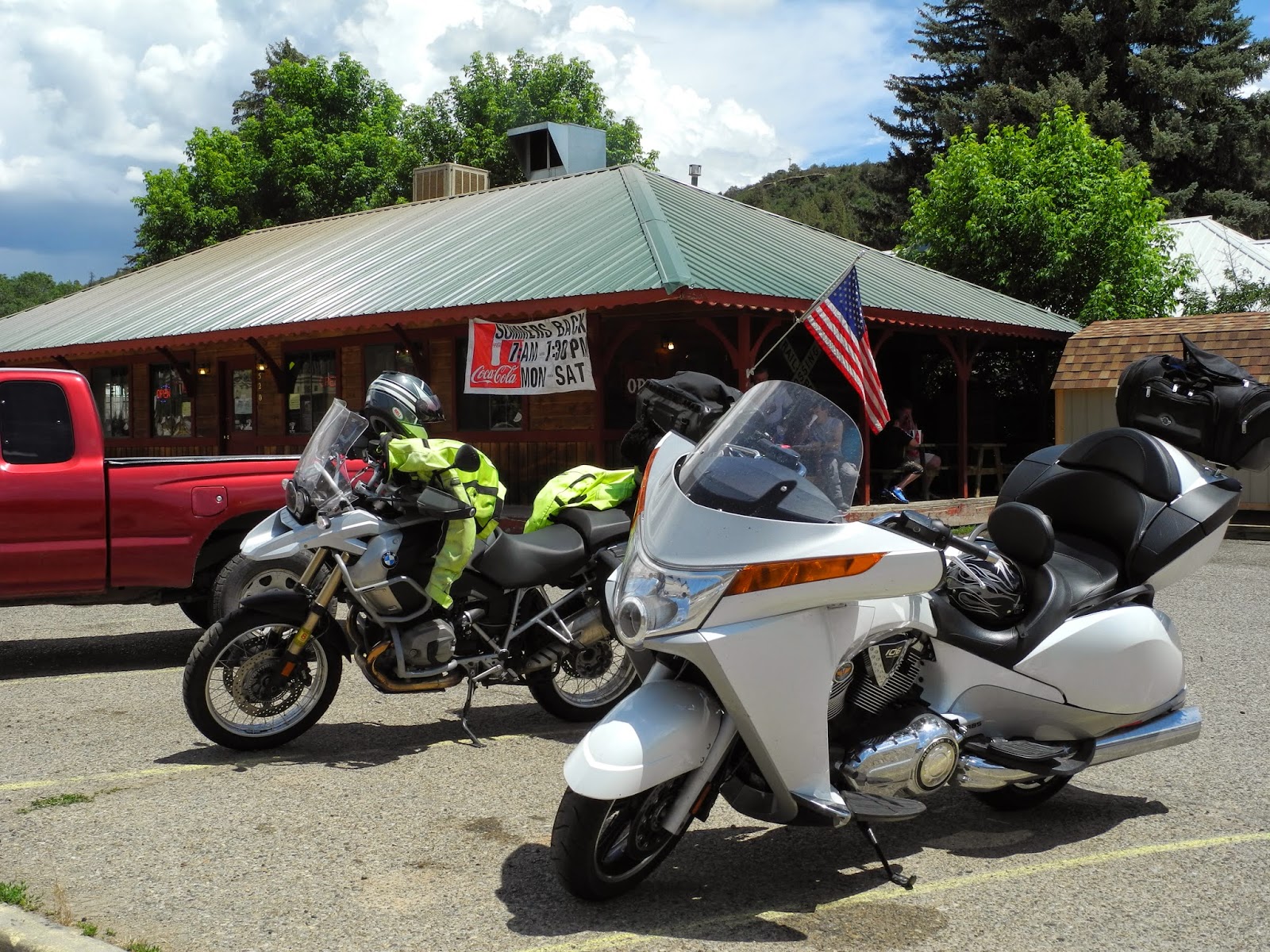
As we waited in line to pay for lunch, Mike was surprised to see Jeff from MotoGhost, the independent BMW motorcycle repair facility in Phoenix where Mike gets our bike serviced. We saw several ATVs and a few dirt bikes on the bumpy ride to Crown King, and Jeff was the only other motorcyclist braving this road today.

It's possible to reach Crown King via the Senator Highway, a toll road originally built between 1866 and 1867 linking Prescott to the mining camps in Crown King. We hoped to travel back home that way, but were told that recent monsoons washed out part of the road, which in the best of times is only passable by mountain bikes and ATV's, but not by motorcyclists riding two-up. 


We retraced our route back down toward I-17, this time bypassing Bumble Bee and taking the cut-off toward Mayer. It was a jolt to ride off the dust and dirt and onto 4-lane pavement, switching from riding 25 to 75 mph.

We rode 150 total miles today in 4.5 hours through rough and beautiful terrain that while close to Phoenix and I-17, seems another world away. Our bike is a GS - Gelände-Strasse - which means off-road/street and is designed for this type of rough riding. There are many more rough dirt roads in Arizona waiting for us to travel them.

Tuesday, July 15, 2014

The last day of our Colorado motorcycle adventure

We rode 1,789 miles in the past week through Arizona, New Mexico and primarily in the Rockies in Colorado with our friends and neighbors Tom and Christine who used to live in Aspen and have ridden most of the area before. Bill and Cynthia rode with us from Grand Junction to Aspen and shared their knowledge of favorite roads and restaurants. Doug joined us from Aspen to Gunnison, and showed us the best places to stop and view the canyons and distant peaks along numerous mountain passes. The next day his wife Karen surprised us by joining the group on the spur of the moment as we rode the amazing Million Dollar Highway from Ouray into Durango. Part of the fun of a motorcycle trip is the time we spend together off the bikes, and this trip was even more special because we met new friends.


During the past week on our trip through Colorado I've spent the hours on the motorcycle thinking about the history of the area, remote mining towns hidden deep in the mountains, world-class ski areas, bear wandering through the streets of mountain towns, engineering marvels in the dams and bridges that cross the difficult landscape. I never know what is around the next corner, or what I'll see as we crest a steep hill.

Today's 193 miles were a short ride on familiar roads from Show Low to home in Prescott, Arizona under a constant threat of rain and thunderstorms. Because we've ridden these roads often, I found myself thinking about the ride in a different way.

Where do the hundreds of single-track or narrow dirt roads lead? They snake off from the paved highway, disappearing into the pine forests or dropping out of sight over the next hill. Were they made by settlers in covered wagons in the 1800's, or are they game trails, or favorites for people riding ATVs? One day I want to head off down these types of roads and see where they lead.


Who decided the route for the paved roads we're traveling along? Do they follow old Indian trails, or perhaps trading routes for miners and trappers? The roads today wound around canyons and swept down the Mogollon Rim into the Verde Valley. Yesterday we rode on ruler-straight roads through the Navajo, Hopi and Zuni reservations - were these roads laid out by engineers to get from one point to the next as quickly as possible?

I notice the changing plants:  the pine tree forests between Show Low and Payson through the Sitgreaves National Forest; areas with blackened, dead trees and bright green new plant growth that looked to be the site of recent forest fires near Show Low; tall thin plants with clusters of bright orange or bright yellow flowers springing up alongside the highway between Pine and Camp Verde; the first prickly pear cactus I've seen since we left home last Tuesday as we rode down from Camp Verde; low, pale green scrub bushes widely scattered over the rolling hills as we came closer to Prescott.


It's monsoon season and the weather report called for rain by mid-day so we put on raingear before we left Show Low. Even though the skies turned black and we saw rain falling in the distance, we didn't get wet until we rode up the steep hill in our subdivision and turned into the driveway.

There are three stages to motorcycle travel:

  • planning the trip, dreaming about where we'll ride and what we'll see
  • the actual trip where we settle into the routine of packing up the bikes in the morning, enjoying the ride during the day, unpacking and relaxing in the evening, and then repeating the routine the next day
  • after the trip when we look through the photos, talk about a favorite lunch stop or the 16% grade in Black Canyon, or suddenly remember the thrill of standing at the Continental Divide feeling like we're on top of the world
We won't be in the third stage for long, because we're already dreaming about the next trip. Stay tuned!

Monday, July 14, 2014

Riding out of the mountains and into the high desert on our BMW

We left the green mountains and rivers of Durango and headed south toward New Mexico, winding our way along county roads with hazy views of distant mountains to the west and south. The landscape changed rapidly from steep mountains and twisting roads that snaked through the high passes to straight 2-lane highways that crossed wide valley farmland.

We crossed into New Mexico and the landscape changed even more drastically to what reminded me of a washed-out watercolor painting:  instead of bright green we saw sparse, dusty green shrubs; the bright blue sky was covered with hazy white clouds; even the buildings were a uniform light sand color.


Outside Farmington, NM we entered into the large Navajo Nation and passed by acres of irrigated fields that seem out of place in the high desert.


The land here is so flat that the power lines and water towers dominate the landscape. A few miles later as entered into the Bisti/De-Na-Zin Wilderness, miles of badlands formed by wind and water erosion in the sandstone, shale, mudstone, coal and silt that give various colors to the rock formations.


It seemed we could travel for miles without seeing a house or vehicle on the roads that headed straight for the distant horizon. Periodically I'd spot a couple of horses or a small herd of cows, but the majority of the time we had the road to ourselves.

We stopped for lunch in Gallup, NM which is the center of several Native American tribes including Navajo, Hopi and Zuni. It was a favorite location for Hollywood filmmakers in the 1940's and 1950's and the old Route 66 passed through town. We didn't see any movie stars when we stopped for lunch at Anthony's Taste of the Southwest.

We continued south through the Zuni reservation where the landscape was covered with pine trees. Perhaps the recent rain and warm temperatures made the scent of the pines stronger, but I could almost smell the trees before I could see them. As we passed through the town of Zuni, we saw round beehive-shaped red clay kilns that are used in firing traditional pottery next to many of the homes.


We crossed from New Mexico into Arizona, watching storm clouds gather to the south. The monsoons bring thunder, lightning, and sometimes torrential rain to this area almost every day from July into September. Because of the years-long drought we welcome the rain, yet hope to reach our destination before the worst of the storm hits. We stopped in St. John's to put on rain gear, and minutes later rode into the storm as the temperature dropped 20 degrees and the wind whipped up.

I huddled behind Mike the last 20 miles of today's ride into Show Low. After we unpacked the bikes the full strength of the storm hit, and then passed before we walked next door to dinner.

We experienced thrilling rides the last few days in Colorado, twisting around hairpin curves up and down mountains and riding to over 10,000' elevation with patches of snow remaining on the highest peaks. Today's ride was quiet and serene, with miles of ruler-straight roads and long vistas to the distant mountains broken only periodically by a few canyons or sandstone cliffs. Tomorrow we ride familiar roads home to Prescott, the end of our 8-day journey.

Sunday, July 13, 2014

Discovering Colorado canyons, high mountain passes and mining history on the BMW motorcycle

Rivers, dams, reservoirs, waterfalls, canyons, tunnels, mountain passes, old mining operations, and vibrant mountain towns.

I think we saw just about every type of feature possible in Colorado on our 197 mile motorcycle ride today from Gunnison to Durango. I took more than 150 photos and several videos to try and capture what I saw from my pillion seat on our BMW.

We left Gunnison at 8:30am and headed west on Route 50 into the Curecanti National Recreation Area, a series of three reservoirs along the Gunnison River.


The road sweeps around the reservoirs with views of high mesas and steep, craggy canyons. We turned off onto twisty and winding Colorado 92 at the 390' tall Blue Mesa Dam, the first dam completed on the Gunnison River in 1945. The turbines that provide hydroelectricity are remotely controlled from the Glen Canyon Dam in Page, Arizona.


Route 92 hugs the edges of the canyon to one side and rocky cliffs to the other, occasionally interspersed with meadows, hiking paths, and dirt ATV roads.


Route 92 continues on to the north, out of our way for today's trip. We turned around at an overlook and retraced our route back over the dam, and then continued on Route 50 west to Black Canyon of the Gunnison National Park. As we entered the park I thought that this really wasn't anything special:  green fields with distant views of high mountain peaks. As we drove along the East Portal road, we saw a sign warning about 16% grades and tight turns, and the fun began.


The 2000' tall canyon walls drop at 90 degree angles to the Gunnison River that twists along the bottom of the canyon. We stopped at the lake created by the Crystal Dam and marveled at the Gunnison Tunnel, an 11' by 12' tunnel built between 1905 and 1909 that travels 6 miles from the Gunnison River to provide a reliable source of drinking water to communities in the valley.


We climbed out of the canyon and continued on Route 50 to Montrose, then south on Route 550 to Ouray where we ate lunch on the third floor outside deck of the Ouray Brewery.


 Ouray is located in the San Juan mountains and bills itself as the Switzerland of the US. Originally settled by the Ute Indians, and named for the famous Chief Ouray, miners flocked to the area in the 1870's as part of the gold, silver and zinc mining boom. Unlike mining towns we've visited in Arizona where frequent fires destroyed blocks of buildings year after year, many of the original brick buildings in Ouray still survive.

Ouray is the jumping off point for the thrilling ride up and over the Red Mountain Pass on Route 550, known as the Million Dollar Highway through the Uncompahgre Gorge to the summit. Parts of the road were originally built by Otto Mears in 1883, a remarkable engineering feat in this steep, craggy canyon.


As we twisted and turned around the hairpin curves, we spotted the town of Ouray far below.


Red Mountain is actually a series of three rust-red peaks that get their name from the iron oxide in the rocks.


A few hairpin turns later we came to the viewing area at Bear Creek Falls, where Bear creek drops down to the canyon floor. Look closely and you'll spot hikers sitting next to the cliffs at the bottom of the Falls.


We continued winding our way up the 11,018' pass, passing twisted remains of more than 100 old mining operations along the way. The Idarado Mining Company has been conducting remediation projects in the area since the 1980's to divert water around the toxic tailing piles to keep the streams clear and clean.


It's amazing that this steep, narrow, and twisty pass is kept open all winter. The road reminded us of mountain passes in Europe:  no guardrails, amazingly steep drop-offs from the road to the valley below, and tight hairpin turns.


Once we crested Red Mountain Pass, we had two more passes to cross - Coal Bank and Molas - before we dropped down into Silverton at 9,318' elevation. Silverton plays up its mining history with many original and restored buildings and an old-West ambiance.


We continued on Route 550 into Durango, a busy town on the Animas River where we walked through the historic downtown and watched the narrow gauge train steam in from Silverton. Tomorrow we head south toward home, leaving the green mountains of Colorado behind for the high desert of Arizona.

Saturday, July 12, 2014

Colorado mountain passes and rivers on the BMW motorcycle

Day 5 of our motorcycle trip in Colorado started with a bear.

Mike and I went for a walk before breakfast, headed for the path along the Roaring Fork River in Aspen. Just before we reached the path Mike spotted a large black bear leisurely crossing the road. Deciding caution was in order, we walked through the streets of Aspen instead of following the path.

We didn't see other bear as we headed up Independence Pass but we did see sweeping views of the Sawatch Range as the narrow road twisted and climbed through the aspens at lower elevations and pine trees as we neared the top.


On the way to the top of the pass we stopped to see the ghost town of Independence, founded in 1879 when gold was discovered in the area. At one point over 300 people lived in this remote mountain area at 10,000' elevation, but when the gold ran out the settlement couldn't survive. According to legend, during the worst recorded storm in Colorado history in the winter of 1899, the remaining 75 people made wooden skis and escaped down to Aspen when they ran out of food.


The road kept climbing until we reached the Continental Divide at 12,095'. We walked on a paved path through the alpine tundra above the treeline with views of Mt. Elbert, at 14,440' the highest mountain in Colorado and the second highest in the contiguous United States behind Mt. Whitney in California.


We zoomed down the Pass around hairpin turns and long sweeping curves into the town of Twin Lakes.


Less than 200 people live at 9200' elevation in this beautiful area at the base of Mt. Elbert.


We turned onto Colorado Route 24, but didn't leave snow-topped mountains behind as we traveled the Collegiate Peaks Scenic Byway, with views of several of the fourteeners (mountains over 14,000' elevation).


We continued on Route 50 into Salida, with the Collegiate Peaks to our right and the Arkansas River to our left. We sat outside on the deck of the Boathouse Cantina watching kayaks navigate the river rapids and mountain bikers climb the surrounding hills.


As we left Salida dark storm clouds formed overhead and we stopped to put on rain gear. The temperature dropped and a light rain fell as we climbed Monarch Pass at 11,312'. We saw several motorcycles throughout our ride today, but I was surprised to see two heavily packed Ruckus scooters slowly winding up the road at 20-25 mph.

After we descended the 7% grades the sun came back out and the rain gear came off. We rode the last few miles through wide valleys into Gunnison, arriving at our hotel at 2:30 pm. Our son Nate recommended that we ride up Cottonwood Pass through the Gunnison National Forest, so we unpacked the bike and headed back out.


The Taylor River rushes next to the road on the way up to Cottonwood Pass, and we saw people in bright-orange rubber rafts navigating the rapids and fisherman wading in the shallow areas.


Our luck ran out when the sky turned black and lightning lit up the sky nearby. We turned around before we reached the Taylor Reservoir at the top of the Pass and retraced our route back to Gunnison.


We rode 145 miles today through some of the highest mountain passes in the United States. Tomorrow we continue through the Rockies to Durango. Hopefully the day won't start with another bear sighting.

Friday, July 11, 2014

Mountains, marmots and creeks in Aspen

After three days on the motorcycle, we spent today off the bike in Aspen. Aspen, originally called Ute City after the Ute Indians who lived in the area, was founded during the silver mining boom in the 1880's. The ski area was developed in the 1940's, John Denver and Hunter Thompson lived here in the 1970's, and today Aspen is home to some of the most expensive real estate in the United States.

After a morning run along the Rio Grande River path, Mike and I took the RFTA bus to Maroon Bells, two fourteeners (mountains higher than 14,000' elevation) in the Elk Mountains near Aspen.


The bus driver told explained how glaciers formed the U-shaped valley, told us about the wildlife in the area, gave tips on the best hikes in the area, and made us laugh with stories about the area. We hiked around Maroon Lake,


and headed down the Maroon Creek trail over rocks and scree where we saw three marmots, past wildflowers, through stands of pines and aspens and along narrow trails lined with wet, green grass and bushes.


The bus driver warned everyone to stay a safe distance away from the several moose who live in the area. We didn't expect to see the moose, but as we walked down the access road, we stopped and watched a moose standing in the creek.


After a bus ride back into busy Aspen, we rode the gondola to the top of the mountain. The town of Aspen is located at just under 8000', and after a 15 minute ride the gondola took us to the Sun Deck at 11,212'. We looked out over the snowy mountains in the White River National Forest and waited out a rain/thunder/lightning storm before riding the gondola back into town.


Tomorrow we're back on the motorcycles, headed south through the Rockies to Gunnison. We're ready for high mountain passes and more amazing mountain views.

Thursday, July 10, 2014

Sunny ride into Aspen

Bright blue skies and a hot sun greeted us this morning in Grand Junction, Colorado.  At around 60,000 people, it's the largest city on the Western Slope, which is all of Colorado west of the Continental Divide. Its name comes from the junction of the Colorado and Gunnison rivers, which to our amazement are both fairly large moving bodies of water. We're used to 'rivers' in Arizona, which typically are dry and sometimes have a trickle of water. No wonder there is so much green here, even in a high desert climate.

Tom and Christine's friends Bill and Cynthia joined us for today's ride to Aspen and led us on a route that started off heading east on Interstate 70 through the Grand Valley that is bordered by the Grand Mesa, the world's largest flat-topped mountain, on one side; and the red rock cliffs of the Colorado National Monument on the other. We rode past vineyards and fruit orchards in the green valley along the Colorado River, an area originally the home of the Ute people with white settlers arriving in the 1880's. 


Usually I dislike riding on busy Interstates, but the scenery trumped the semi-trucks on the 20 miles we were on I-70. We left the interstate at exit 49 onto Colorado 65, the Grand Mesa Byway, that twisted and turned through the dry landscape.


We turned off on 45 1/2 road to enjoy more sweepers before rejoining I-70 and continuing east.


We stopped in Rifle for lunch at the Shooter's Grille where many of the waitresses wore a holstered pistol on their belt. I'm always curious about the history of names of towns, and legend has it that Rifle got its name from an old cowboy surveyor who left his rifle leaning against a tree and after that referred to the area as 'Rifle'.

We finished the day riding on I-70 to Glenwood Springs, then on busy 4-lane Colorado route 82 into Aspen. The road bisects mountains covered with pine trees, with intermittent vistas of snow-capped peaks in the distance. Our odometer turned over  to 24,000 miles just outside Aspen, and we slapped a high-five and did a little dance on the bike celebrating the mileage.

This was the first day of the trip we didn't need our raingear, surprising since July and August are known for rain and thunderstorms. Tomorrow we spend a full day in Aspen, and we're looking forward to exploring the town and mountains.

Wednesday, July 9, 2014

Riding into Colorado mountains, snowy passes, and high desert

Our motto on motorcycle trips is to be flexible and enjoy the journey. We needed that motto this morning when Tom, riding with us on his Victory Vision Tour, discovered his rear tire was flat. We thought of all the potentially disastrous scenarios if he'd had a flat yesterday while riding in mid-90 degree temperatures through remote areas of the Hopi or Navajo reservation; or twisting up and down the hairpin turns on Buffalo Pass.

Not only was he lucky the tire went flat overnight, but his luck held when the Farmington, NM Four Corners Harley-Davidson  dealer had a tire that fit Tom's bike and was willing to change the tire right away. Tom raved about the service and the friendly folks who took care of his bike. Holding true to our motto, Mike, Christine and I went for a walk while Tom was getting the tire repaired and discovered the gorgeous trail system along the Animas River behind our hotel.

We started our trip northwest to Grand Junction, Colorado 4 hours later than planned, but that gave us the opportunity to ride into Grand Junction just before dusk with views of the almost-full moon over the high mesa and a cooler ride for the end of the day.

We started the ride in hot and dry New Mexico, riding along route 170 through irrigated farmland.


About 30 miles later we crossed into Colorado, and the scenery immediately changed to lush pine forests and rolling hills covered with green grass.


We saw a herd of elk and not far down the road a herd of buffalo. I've been looking for buffalo since we moved to Arizona last year, and these are the first I've seen. As we rode through Mancos, CO we caught our first sight of the Rockies towering in the distance.

We stopped for lunch in Dolores, CO, a small western town on the banks of the Dolores River that flows out of the San Juan Mountains.


The Depot Restaurant advertised the best burgers in Colorado, and also offered elk and buffalo burgers - perhaps from the same herds I saw earlier? I opted for the regular cheeseburger.

Mike talked with a motorcycle rider who was heading out of the mountains. He told us that the black clouds we'd been watching all morning were in fact a rainstorm coupled with cold temperatures, so we put on extra layers of clothing and rain gear before we started north on Colorado 145.

Since the raincover on the waterproof bag the Bennies borrowed from us flew off in the wind yesterday, they jerry-rigged a black plastic garbage bag cover that stayed put for the rest of the windy, cold and rainy ride.


Less than 10 miles later the temperature dropped - and kept dropping into the high 40's as we climbed toward Telluride on the San Juan Skyway through the heart of the San Juan Mountains. The road twisted and swooped around the corners with foggy views of the snowy (snow in July???) peaks all around us.


We rode into the Telluride ski resort for a very welcome cup of hot chocolate and a rest out of the cold rain.


We parked the bikes at 9300', our highest elevation for today. I added another clothing layer before we got back on the bikes and headed down toward the intersection of Colorado 145 and 141 where the rain finally ended and we were surprised by the amazing Unaweep Canyon.

Until this point my camera was safely tucked under my jacket liner, motorcycle jacket, and outer raingear. Even with a few scattered drops of rain I couldn't resist pulling out the camera to take pictures and video of the towering redstone cliffs that rose vertically on both sides of the road.


We've ridden through the red rock canyons in Sedona, AZ but this canyon kept going for almost 100 miles of jaw-dropping scenery. The canyon cuts across the Uncompahgre Plateau, often with a small stream keeping us company along the side of the road. We saw fewer than 5 vehicles through the entire canyon, which meant we could zoom on the sweepers or slow down to look around to all sides to take in the views.


We finally dropped out onto Route 50, and spent the last half-hour of our trip riding into Grand Junction and watching the sun start to set.

The day started off on a potentially negative note with a flat tire on Tom's bike, and ended with a ride through an unbelievable canyon. What will tomorrow bring?