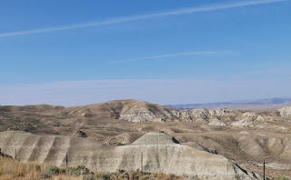
We're in the thick of fire season in the West and even though there aren't any fires near us, the skies are hazy and smoky. We still had a wonderful ride today from Riverton, Wyoming just across the Colorado border to Craig.
Our day started riding south on Wyoming Highway 135, designated by Butler Motorcycle Maps as a lonely highway.
Usually when we're on a Butler lonely road we see perhaps 1 or 2 vehicles per hour. Perhaps because today is a Saturday there were several cars, trucks, and even a few motorcycles on the road. It's a beautiful route with long views across empty land except for a few scattered cattle.
We then turned onto US 287 continuing south and east. This section of the highway is the Chief Washakie Trail, named after a chief of the Eastern Shoshone Indians of Wyoming in the mid 1800's.
This section of US 287 is also part of the California Historic Trail (over 5000 miles long in 8 states that over 250,000 people used in the 1840's and 1850's looking for gold and farmland), the Mormon Pioneer National Historic Trail (1300 mile route from Illinois to Utah used by Mormons in 1846-1847), the Oregon National Historic Trail (more than 2000 miles of wagon trail from Missouri to Oregon from 1836-1846) and the Pony Express National Historic Trail (it only took 10 days for mail to go from Independence, Missouri to Sacramento, California over a 1800 mile trail between April 1860 and October 1861).
Riding along the 2-lane highway today it was difficult to imagine hundreds of people walking and riding their way west through this area. We rode past Split Rock, an imposing and crucial landmark for the western-bound travelers.


No comments:
Post a Comment