Wednesday, July 31, 2024

Straight roads through the prairie

 We started today in Cardston, Alberta and thought we had a plan to get to the Wild Horse border crossing to get back into the United States. Like other aspects of this trip, we had to regroup and be flexible mid-way through today's ride.

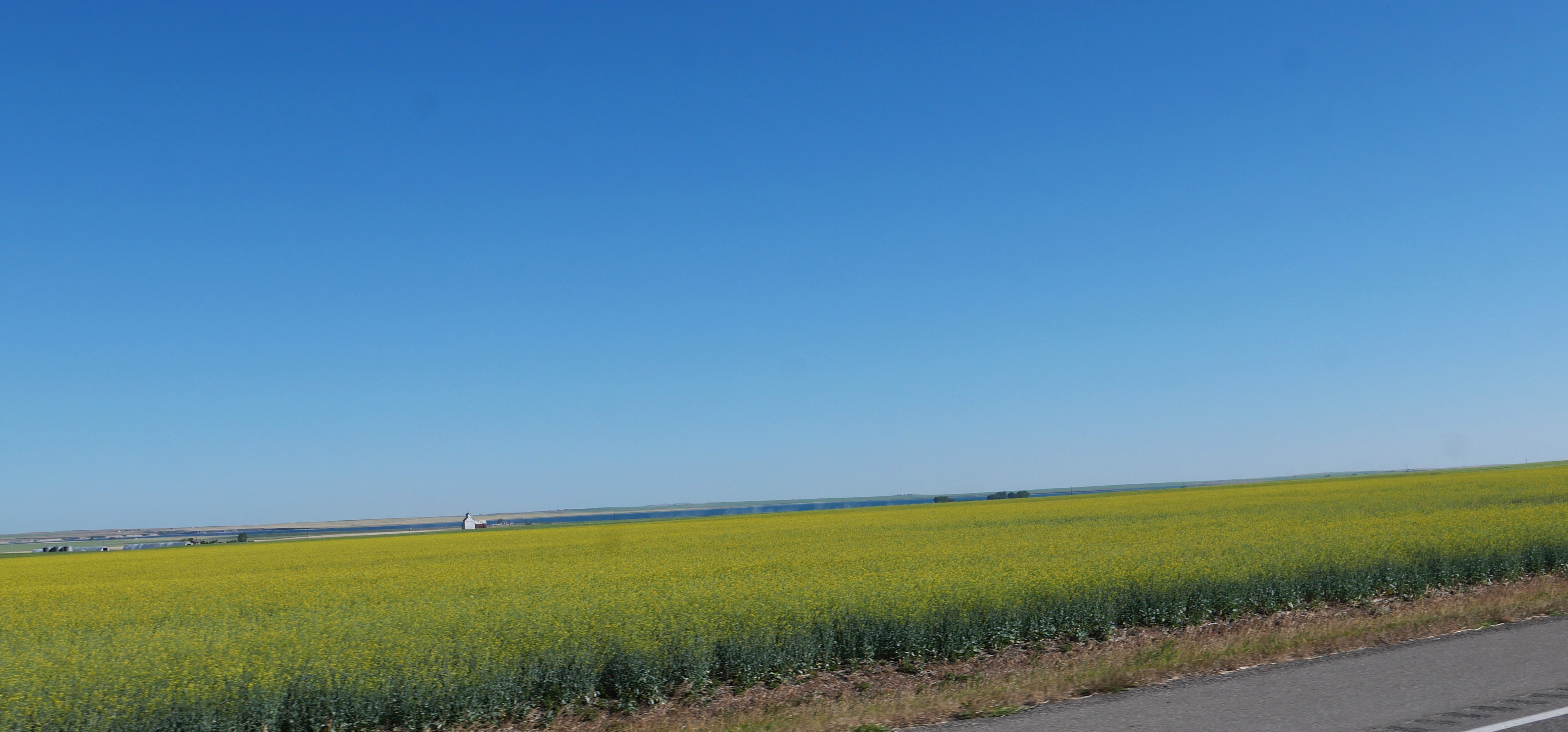
Today was all about riding through wide open land planted with wheat, hay and other crops.


Unlike riding through the mountains, today the roads were straight and the views endless, broken every now and then by very distant, shadowy mountain ranges and windmill farms.


The day started as planned, riding on Alberta highway 5 east, to 52 east, and then onto the 4-line divided highway 4 for a short period of time.

We then turned onto Alberta highway 501 east and for the first few miles everything went to plan.


Then all of a sudden the road went from paved asphalt to gravel/dirt - not a lot of fun when riding 65 mph. It was a short stretch of gravel and as we hit the next section of pavement we thought everything was OK - until we reached another gravel/dirt section.


We had no idea how long the gravel section would last so stopped, looked at our older Canadian map, and decided to use the Garmin GPS to guide us to our hotel in Havre, MT. That meant about 80 additional miles riding, and since any mile on the BMW is a great mile, we enjoyed the rest of the trip.

The Garmin took us on Alberta 879 north, then 61 east, part of the Red Coat Trail, an 800 mile route that approximates the path taken in 1874 by the North-West Mounted Police as they marched west to bring law and order to the Canadian West. We rode past several large windmill farms today, and in this wide-open country they look even more imposing.


We then turned onto Alberta highway 3 east, following a very slow moving truck loaded with hay bales for part of the way.


We stopped in Medicine Hat, named for the eagle tail feather headdress worn by Blackfoot medicine men. We had been on the BMW for almost 4 hours and needed both a gas station and lunch - and were thrilled to find the Rosewood Bistro and their menu using locally sourced food. The friendly waitress pointed out a gas station just around the corner, and we got back on the road ready for the next part of the day.

We rode on Trans Canada Highway 1  for a short period of time, long enough to see a very long train waiting at a grain elevator.


We then turned onto Alberta 41 heading south toward the Wild Horse border crossing. The next 68 miles to the border we saw only 2 other vehicles which surprised us since we expected more traffic crossing the border.


The prairie was broken up by rolling hills and stands of pine trees in the Cypress Hills Interprovincial Park


Once we passed through the park, it seemed like the straight road in front of us went on as far as we could see to the horizon.


It was windy all day, but now the wind got even stronger and at times we were buffeted by an especially strong gust. 

We crossed into the United States with just one car in front of us, and for the next 44 miles rode on Montana highway 232 into Havre - again seeing only 2 other vehicles.


The temperature rose into the high 80's, and between the wind and the heat we were ready for an air conditioned hotel room in Havre. Based on a suggestion from the hotel staff we ate dinner at the absolutely fantastic Bow and Marrow Steakhouse - by far the best meal we've had not only on this trip, but since we moved to Colorado 18 months ago. Meals on motorcycle trips are hit or miss, and we'll remember this meal for months. It's worth a stop in Havre just to eat here!


Tuesday, July 30, 2024

Canada!

 We finally made it into Canada!


It rained throughout the night and the forecast was for rain at least at the beginning of our ride, so we put on raingear. We were lucky - it only rained for a short period of time. We started the day riding west on US 2 out of Hungry Horse, MT.


We were surprised to see a sign on US 93N from Whitefish that we were in Tobacco Valley because we though tobacco was grown in the South. An explorer named this area when he passed through in 1808 and discovered the local Kootenai used a form of wild tobacco. No longer known for tobacco, but rather for logging, the name stuck.


As we rode into Eureka three deer crossed the road, and as we rode north out of town we saw a turkey crossing the road. A few miles further north we crossed into Canada at the Rooseville border crossing and continued north on British Columbia route 93.


We turned east on British Columbia Highway 3, riding along the Crowsnest River on a curving, sweeping valley through the Rocky Mountains.


We stopped in Sparwood for a quick snack and were delighted to see the world's largest truck - the Terex Titan, a 350 ton truck that was used in the local coal mining district. 


Sparwood is on the British Columbia/Alberta border, and we continued north on Crowsnest Pass across the Continental Divide.


Crowsnest Pass is considered a low elevation pass at only 4455' which is over 3000' lower than where we live in southwest Colorado - yet it feels much higher due to the rocky mountain peaks everywhere we could see. The skies continued to clear and made this a super fun ride.

We stopped at Frank Slide, the site of Canada's deadliest mountain slide in 1903 when 110 million tons of limestone broke away from Turtle Mountain and buried a large part of the Frank coal mining town.


As we continued east we left the mountains gave way to rolling prairies and the wind picked up. We weren't surprised to see dozens of windmills as we were buffeted by the strong winds.


We turned south on Alberta Highway 6 and stopped in Pincher Creek for lunch at the Hut Cafe. Meals are often hit or miss when we're on a motorcycle trip and the Hut Cafe offered a variety of delicious options.

As we rode south through the ranches and fields we saw the Rocky Mountains in front of us and to the west - a long string of craggy mountain peaks.


Our next stop was Waterton Lakes National Park which borders Glacier National Park to the south. When we planned this trip we thought we would visit Jasper and Banff first, ending our time in the Canadian Rockies here. Due to the devastating wildfire in Jasper last week we had to shift our plans and were thrilled to spend some time in the Waterton Lakes area on a smoke-free day.


We walked along the rocky beach and enjoyed learning about the area in the visitor center. We originally hoped to spend the night here but had to cancel the reservations earlier in the trip and now there were no rooms available. Instead we rode another 25 miles east to Cardston where we will spend the night. The 275 mile trip today is a highlight of the trip so far. 

Monday, July 29, 2024

Riding through Glacier National Park

 We did it! Wildfires in Jasper, Alberta dashed our plans to ride through the Canadian Rockies, and the air quality has been moderate at best with hazy, smoky skies the past few days so we waited until yesterday to make the final decision - it's a go to experience the Going to the Sun Road through Glacier National Park

We left the lovely Coffey House bed and breakfast in Choteau, MT at 7:30am, headed north on US 89.


US 89 north goes through wide open fields, entering the 1.5 million acre Blackfeet Nation just north of the intersection with Montana Highway 44. The Blackfeet Nation borders the eastern edge of Glacier National Park and Canada to the north.


As we rode further north, we started to see the Rocky Mountains in Glacier National Park in front of us.


Although the scenery was beautiful, the road (freshly paved in many sections) was smooth, and we saw very little traffic - the winds from the west were relentless, buffeting us from the side. When we saw a road sign warning about strong crosswinds, we thought - how much worse can get it? It got worse.

Luckily once we turned off US 89 through the St. Mary's entrance into Glacier National Park and were now officially on the Going to the Sun Road the mountains blocked much of the wind. We usually like to ride fast, but took our time today so that we could take in the amazing views.


Riding along 10-mile long St. Mary Lake was a fantastic introduction to Glacier: almost no traffic and plenty of opportunities to stop at a pull-off to really take in the pockets of snow and glaciers - and take photos of the BMW!


We started climbing toward the Logan Pass Visitor Center, at 6646' the highest point on the Going to the Sun Road. We were thankful there were several parking spots just for motorcycles because otherwise the parking lot was full and people were parking on the road then walking up to the visitor center.


The west side of Going to the Sun road is much steeper than the east side, plus the road is right on the edge of sheer cliffs. It took 23 years to build this road, and once you ride along it you'll understand why - it's an amazing engineering feat.


We were disappointed that there was no motorcycle parking, and no open parking spots at all, at Avalanche Creek where we had hoped to walk the Trail of the Cedars. It's impossible to hike wearing motorcycle boots, and this trail is a raised boardwalk that is wheelchair accessible - perfect for motorcyclists. We opted instead to stop at two different turn offs along McDonald Creek that required minimal walking on the trails.


Luckily we were able to find parking at the Lake McDonald Lodge, built in 1913. We enjoyed lunch in the dining room and then walked along the rocky beach along the lake in front of the lodge.


The water is absolutely clear - the rocks in the front of this photo are under water. The lake, and in fact this entire valley, were carved by glaciers.

We had only 10 short miles left on our ride through the park before we turned onto US 2 heading west toward Hungry Horse where we are spending the night. We had originally planned to ride through Glacier in 2020, but the eastern entrance was closed during the pandemic. This year everything is open and even with hundreds of wildfires in the West, we enjoyed a day without smoky skies in one of the most beautiful spots in the world.

Sunday, July 28, 2024

Scenic rural roads in central Montana

 We left Bozeman, MT mid-morning after spending the weekend with our youngest son, heading toward Glacier National Park. This is our first time on the BMW in this part of Montana, and it was a gorgeous ride on gently curving, 2-lane paved roads through mountains, forests, and acres of wheat as far as we could see. Unfortunately the skies are still hazy from wildfire smoke but not nearly as bad as two days ago.

We left Bozeman riding northeast on Montana Highway 86 through the Bridger Mountains, named after Jim Bridger, a famous trapper and Army scout from the late 1800's.


Montana Highway 86 ends at US 89 just north of Wilsall, MT and we followed 89 north the rest of the day. 


As we passed through fields of freshly mown hay and wheat, we started noticing bald eagles perched on top of telephone poles, watching us as we rode by. There are very few trees in this area and the eagles sought out the highest perches available.


We stopped in White Sulphur Springs for lunch, and happened into the Jawbone which was serving a delicious Sunday brunch - not what we expected in this small western town.


A few miles north at the junction with US 12, US 89 is now the Kings Hill Scenic Byway, winding through the Lewis and Clark National Forest


US 89 joins with US 87 and skirts Great Falls, and once we were out of the city traffic we once again rode on 2-lane roads with almost no traffic.


Our stop for tonight is the lovely Coffey House Bed and Breakfast in Choteau Montana where the prairie meets the Rocky Mountains. Tomorrow we plan to ride through Glacier National Park on the Going to the Sun road - hopefully the smoky skies from hundreds of wildfires in the West will continue to improve and we'll have a beautiful day to experience Glacier.


Friday, July 26, 2024

Smoky skies

 We started off the day under clear skies with temperatures in the mid-50's which meant I wore all of the liners to my motorcycle gear to stay warm.


Instead of taking interstates from Missoula to Bozeman, our destination for the weekend, we opted for the more scenic route starting east on Montana Hwy 200. We rode through valleys with views of the mountains to both the north and south, sometimes through forested hills and other times past fields planted with corn, wheat and hay.


We turned south on Montana Hwy 141 and crossed the Blackfoot River. We crossed many smaller creeks and streams and almost everywhere saw signs pointing out fishing access points.


Hwy 141 passes by Nevada Lake, created with an earth dam in 1938.


In Avon we turned east on US 12 and climbed up 6,320' MacDonald Pass on the Continental Divide. The skies had been clear until we started down the eastern side of the pass, and for the rest of the ride it was so smoky from hundreds of wildfires in Canada that we could barely see outlines of mountains.


US 12 skirts Helena and then joins with US 287 heading south, crossing the Missouri River which starts near Three Forks Montana and ends at the Mississippi River. At 2,341 miles, it's the longest river in the United States.

We continued south on US 287 to Townsend, then diverted to a series of county roads, once again taking the scenic route into Bozeman instead of the interstate. Even though we knew there were towering mountain peaks surrounding Bozeman, we could see none of them due to the increasingly smoky skies.

We'll stay in Bozeman through the weekend with our youngest son and then based on weather and air quality conditions, decide which direction is next.