Thursday, August 6, 2020

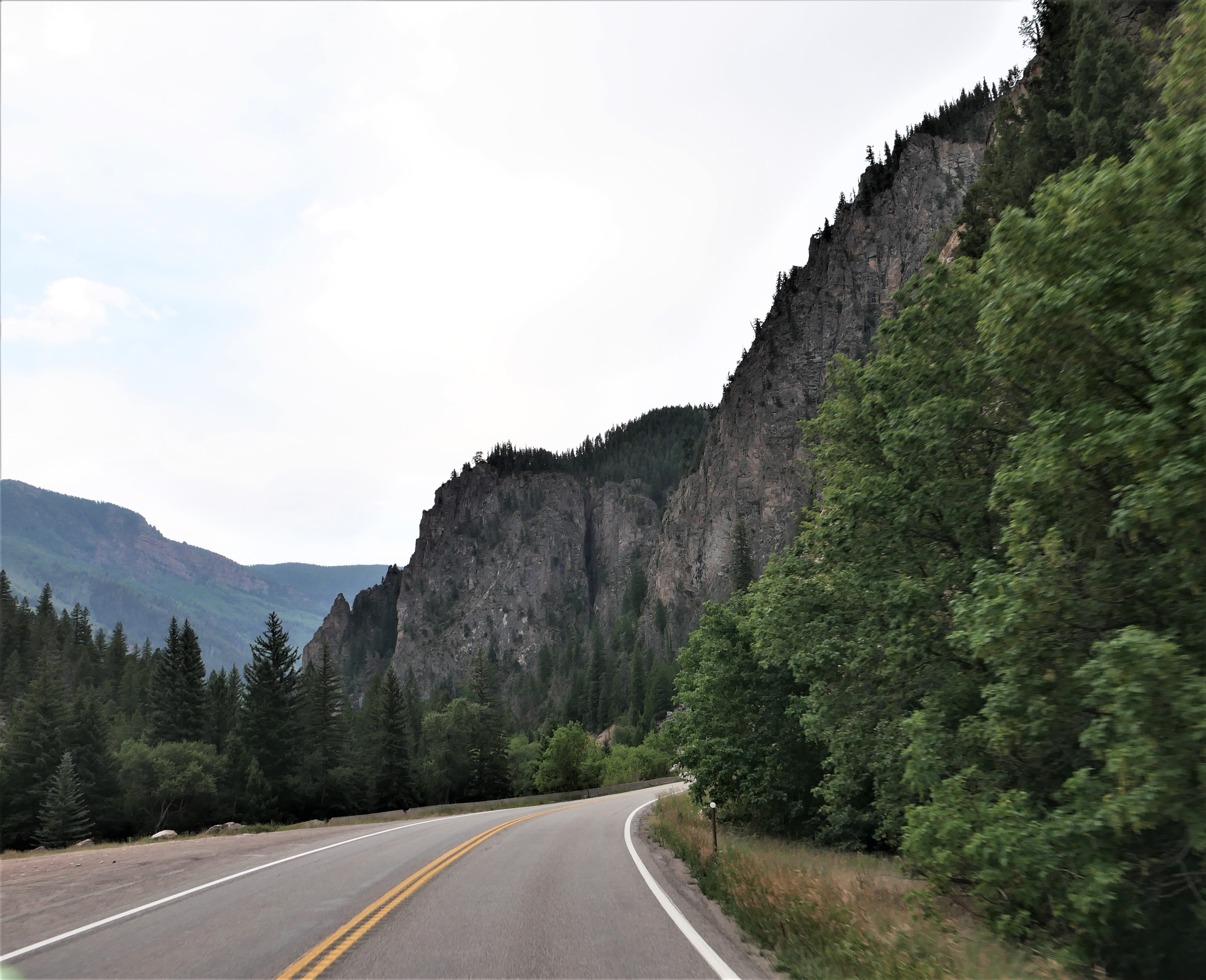
Winding roads in Colorado on the 11th day of our Summer 2020 trip on the BMW

It was another bright, sunny morning when we left Salida, Colorado and rode east on US 50. This is one of Mike's favorite roads:  steep rocky walls alternating with more gentle, rounded hills through a canyon with the Arkansas River running alongside the road. 

Train tracks run along one side of the Arkansas River, and we were surprised to see a line of empty railroad cars that stretched about 2 miles sitting on the track with no engine in sight.

We turned north onto Colorado 9 and after a few short miles continued north on County Route 11, part of the Gold Belt Tour, a scenic byway that travels through many of the towns that were an important part of the gold mining boom in the early 1890's. There was hardly any traffic and we enjoyed long views of the mountains, wide open valleys, and sweeping, twisting roads.

Our route took us through Cripple Creek, originally the site of ranches in its 9,000' elevation valley until one of the largest gold strikes was discovered in 1890. In three years the town's population went from 500 to 10,000. Today the population is around 1,200, and while gold continues to be mined here, Cripple Creek is now more of a tourist destination. Much of the town has been restored and is part of the historic district, and in 1991 gambling became legal. We rode through about 10am on a Thursday and the town appeared almost completely empty.


We continued north on Colorado 67 when we started to see far-off views of snowy Pike's Peak.

Pike's Peak is a 14,115' tall mountain in the Front Range of the Rocky Mountains, just 12 miles west of Colorado Springs. Our goal was to ride to the top of the mountain via the 19-mile Pike's Peak Highway. However, when we got to the entrance we discovered that due to construction at the summit, we could only ride up 13 miles and then would need to take a shuttle the rest of the way. We're not interested in riding in a bus filled with people, so we turned around and rode into Manitou Springs for lunch and to consult the map.

With the skies threatening rain we decided to ride a short route continuing north on Colorado 67 past Woodland Park which bills itself as the 'city above the clouds' at 8,465'.
Route 67 twists and turns through the Rocky Mountains, and when we turned west onto County Route 126 the road followed the South Platte River.

We rode through sections of the forest burned in the 2002 Hayman Fire, a haunting reminder of the damage fire causes in this dry part of the country.

The skies got darker and when we saw a flash of lightning we decided to turn around and retrace our route back to Colorado Springs where we're spending the night. While we weren't able to ride up Pike's Peak as planned, we had a beautiful day in the Rockies.

Wednesday, August 5, 2020

Exploring Colorado's mountain passes on the BMW

We've been riding around Colorado for the past few days, discovering new roads that we haven't been on before and riding favorite roads for a second time. We started off heading east from Pagosa Springs on US 160 East, riding past green fields and ranches bordered by the mountains.


Soon we started climbing up in the San Juan mountains, heading up Wolf Creek Pass. 


The steep road winds and twists up to the top of the Pass at 10,857' where we crossed the Continental Divide for the first time today before we descended down the eastern slope past the Wolf Creek ski area.


In South Fork we turned north onto Colorado 149, the first time we've been on this road and what a find! 149 is the Silver Thread scenic byway that traverses remote parts of the state that were once important in silver mining, and today is an outdoor lover's paradise. The Rio Grande River flows along the highway, which twists and turns to match the river's path.


We followed the Rio Grande through the mountains to the small town of Creede, which in the late 1800's was home to over 10,000 people due to the booming silver mining in the area.


As we continued north past Creede, we stopped at a scenic overlook and discovered we were looking at the headwaters of the Rio Grande where it starts at an elevation of over 13,000' in the San Juan mountains before it travels 1,885 miles to the Gulf of Mexico.


A couple also stopped at the overlook told us about a waterfall just a couple of miles further north, so we turned off the highway to see North Clear Creek Falls, a 100+ foot waterfall formed by volcanic activity 27 million years ago.


Back on the highway, we continued north, climbing up Spring Creek Pass and crossing the Continental Divide for the second time today at 10,889' before we descended down toward Lake City.


The mountains weren't done with us yet as we quickly ascended up the even higher Slumgullion Pass at 11,530'. 


The descent down the north side of Slumgullion Pass at times is a 9% grade, and the sweeping turns made this section a fantastic motorcycle ride. We descended down into Lake City at 8,661'. Much of the town is part of a historic district with many of the original homes from mining days restored to promote tourism. We stopped for lunch at the Lake City Cafe and enjoyed one of the best meals of our trip.

149 continues north along the Lake Fork of the Gunnison River and through Independence Gulch.


149 ends at US 50, just past the Blue Mesa Reservoir.


We turned east onto US 50, our final leg for the day. We rode through Gunnison, then retraced our route from 3 days ago up and over Monarch Pass - at 11,312' our last crossing of the Continental Divide for the day.


We're spending the night in Salida and planning an earlier start tomorrow with a goal of riding to the top of Pike's Peak - 14,115'.

Climbing over high altitude mountain passes on the BMW

After enjoying a rest day in Carbondale, Colorado, we were ready for a longer day on the BMW, and it started off with a bang as we headed south on Colorado 133 with views of 12,965' Mt. Sopris in front of us.


133 sweeps and twists alongside the Crystal River, making for a fun and beautiful start to our day.


Route 133 is part of the West Elk Loop Scenic Byway as it travels through the West Elk mountain range in the Rockies. There was hardly any traffic as we wound our way through rocky canyons and then climbed up through aspens on McClure Pass that tops off at 8,769'.


We descended into the North Fork Valley where the landscape changed completely from green mountains and rivers to dry, brown landscape that reminds us of parts of northern Arizona as we rode through Hotchkiss where we turned west on Colorado 92 toward Delta.


In Delta we turned south on US 50 that travels through the Uncompahre Valley Today this is prime, irrigated agricultural land and historically it was the home of the Uncompahre band of the Ute Native American tribe. Spaniards were the first Europeans to explore this area in the 1770's, giving Spanish names to many mountains (the San Juan range) and rivers. Gold was discovered here in 1858 which led to an influx of European settlers.


We picked up US 550 heading south from Montrose, and the real fun of the day began as we passed Ridgway, gateway to the San Juan Mountains and the start of one of our favorite motorcycle rides on the San Juan Skyway scenic byway.


We climbed from Ridgway to Ouray, named for the chief of the Uncompahre band of the Utes. Ouray is an old mining town at 7,792' elevation, founded by miners searching for silver and gold. Today it's a mecca for hiking, off-roading - and zooming around tight hairpin turns, twisties that hug the towering rock walls on one side with thousand-foot drop-offs on the other side (no guardrails!) and so much jaw-dropping scenery that we never tire of riding this fantastic road through the mountains.


There is still plenty of mining operations evidence in this area, and it's fun to try and spot the remnants of the Red Mountain Mining District tucked into the pine forest or sometimes right out in clear view alongside the road.


We crossed the top of  Red Mountain Pass at 11,018' descending with wide, sweeping turns into Silverton.


After passing Silverton, we climbed up and over Molas Pass at 10,912' followed quickly by Coal Bank Pass at 10,610' and then it's downhill all the way to Durango.


We stopped for lunch just before we reached Durango, enjoying pulled pork sandwiches at Serious Texas BBQ. Durango was founded in 1880 to serve the San Juan mining district, and is named after Durango, Mexico. It's the largest city, with about 17,000 people, in the area and we really noticed how much the city has expanded since our last visit a couple of years ago. 

We took US 160 east from Durango toward Pagosa Springs, our stop for the night. Along the way we passed Chimney Rock National Monument a protected archeological site of the Ancestral Pueblans who lived here about 1000 years ago.


Pagosa Springs is the site of several hot mineral springs, but unfortunately we don't have time on this trip to take advantage of their healing properties. We're headed over more high mountain passes in the Rockies tomorrow!

Monday, August 3, 2020

Riding around Basalt Colorado on Fryingpan Road

We rode about about 80 miles today on our rest day, heading out Fryingpan Road from Basalt, Colorado toward the Ruedi Reservoir.


Much of the history of the West revolves around trapping, mining and ranching, and this history informs some of the colorful place names we come across. Fryingpan River, and the road that runs along it, supposedly gets its name from a band of trappers who fought with Ute Indians. Two of the trappers survived, and when one left to get help for his injured friend, he tied a frying pan to a tree so he could find the spot.

Today is a Monday so there was very little traffic on the road that sweeps around tight turns as it follows the winding river.


Steep wooded or grassy mountains rise along the river on one side, and on the other side we rode past tall, red sandstone cliffs.


13 miles from Basalt we came to the Ruedi Reservoir, built in 1968 to divert water to the thirsty cities in the Front Range. 


We continued on east past the reservoir, climbing higher into the mountains. We passed the tiny settlement of Thomasville, established to support the railroad that used to run where the highway is today as well as the lime kilns that produced powdered lime from the limestone rock in the cliffs. One of the residents really wants to traffic to slow down, and placed a traffic cone with a tree branch as well as a very small child's chair along the center line in the highway - seeing these definitely made us slow down.


Continuing west, we passed Norrie Colony, a lumber camp in the 1880's that included a school, dance hall, and post office. 

I was surprised to see another dam on the Fryingpan River. Chapman Dam was built in 1934 by the Civilian Conservation Corps. This is a much smaller reservoir with a campground along the side.


Fryingpan Road continues on, climbing to 11,925' at Hagerman's Pass which is about 5,300' higher in elevation than Basalt. We turned around before the pass, retracing our way west back to Basalt.


It was a beautiful morning for a short ride, and we spent the rest of the day walking around downtown Carbondale. Tomorrow we head west toward Pagosa Springs, continuing our wandering trip through Colorado.

Sunday, August 2, 2020

7th day on the BMW riding through the Rockies

We woke up to temperatures in the mid-50's in Gunnison, Colorado at 7,703' elevation and started the day's 175 miles heading east on US 50 through ranches and farms.


Soon we started climbing as we headed up and over The Sawatch Mountain Range on Monarch Pass.


We crossed the Continental Divide - again - at 11,312'


This isn't a narrow, twisting road with hairpin turns; rather it's an industrial-strength highway with easy, sweeping turns that can carry truck traffic across the state.


After descending to the valley, we headed north on US 285 toward Buena Vista. For the next few miles we watched the towering Collegiate Peaks, each at or above 14,000' elevation to the west; and the Arkansas River to the east.


The Collegiate Peaks are named after the Ivy League colleges in the East:  Mt. Harvard, Mt. Yale, Mt. Princeton.


The Arkansas River starts near Leadville and flows south and east to the Mississippi. This section is a favorite for kayakers and white water rafters.

It was time to start climbing again, this time up the twisting Independence Pass on county route 82. We passed Twin Lakes, two large, glacial lakes at the base of Mt. Elbert, at 14,440' the highest peak in Colorado and the second highest in the Lower 48.


Since it's a beautiful Sunday in early August, there was quite a bit of traffic, including the most motorcycles we've seen in one day on this trip. That meant we rode at a slower than usual pace while we enjoyed the hairpin turns and twisties.


We saw numerous signs of recent avalanches, including one section of the highway that was recently repaired due to an avalanche sweeping across this section of the road.


As we continued climbing the road snaked along rocky cliffs so close we felt like we could touch them, with long, steep drop-offs thankfully on the other side of the road.


We finally rode above the treeline, passing isolated spots of snow as we neared the summit at 12,095'. 


We crossed the Continental Divide for the second time today and descended down even narrower sections of highway into Aspen.


We rode through vast stands of aspens on both sides of the pass, and it makes sense that the mining town of Ute City changed its name to Aspen in 1880. 


County Route 82 goes right through Aspen, and then it was only a few miles to Basalt where we stopped for lunch before continuing on to our destination for the next 2 nights:  Carbondale. We were surprised that the temperature this afternoon is in the low 90's, but then we're at the lowest elevation on our trip so far:  6,427'. Carbondale was founded as a farming community and today is a tourist and skiing center. 

We're looking forward to a shorter ride tomorrow and exploring Carbondale on foot before we continue on our wandering route through the Colorado mountains on Tuesday.