Tuesday, September 23, 2025

Mountains and aspens in New Mexico

 We woke up this morning to fog covered streets in Taos, NM so we took our time getting started. By the time we rode out of the city of Taos, the fog and clouds were clearing.


We decided to ride some out-and-back routes into the mountains, hopefully avoiding long delays for road construction that we encountered yesterday. We first rode to the Taos Ski Valley, founded in the early 1950's by Swiss skiing pioneer Ernie Blake and his family. It's mid-September, so no snow yet, but we kept spotting stands of aspens turning bright gold.


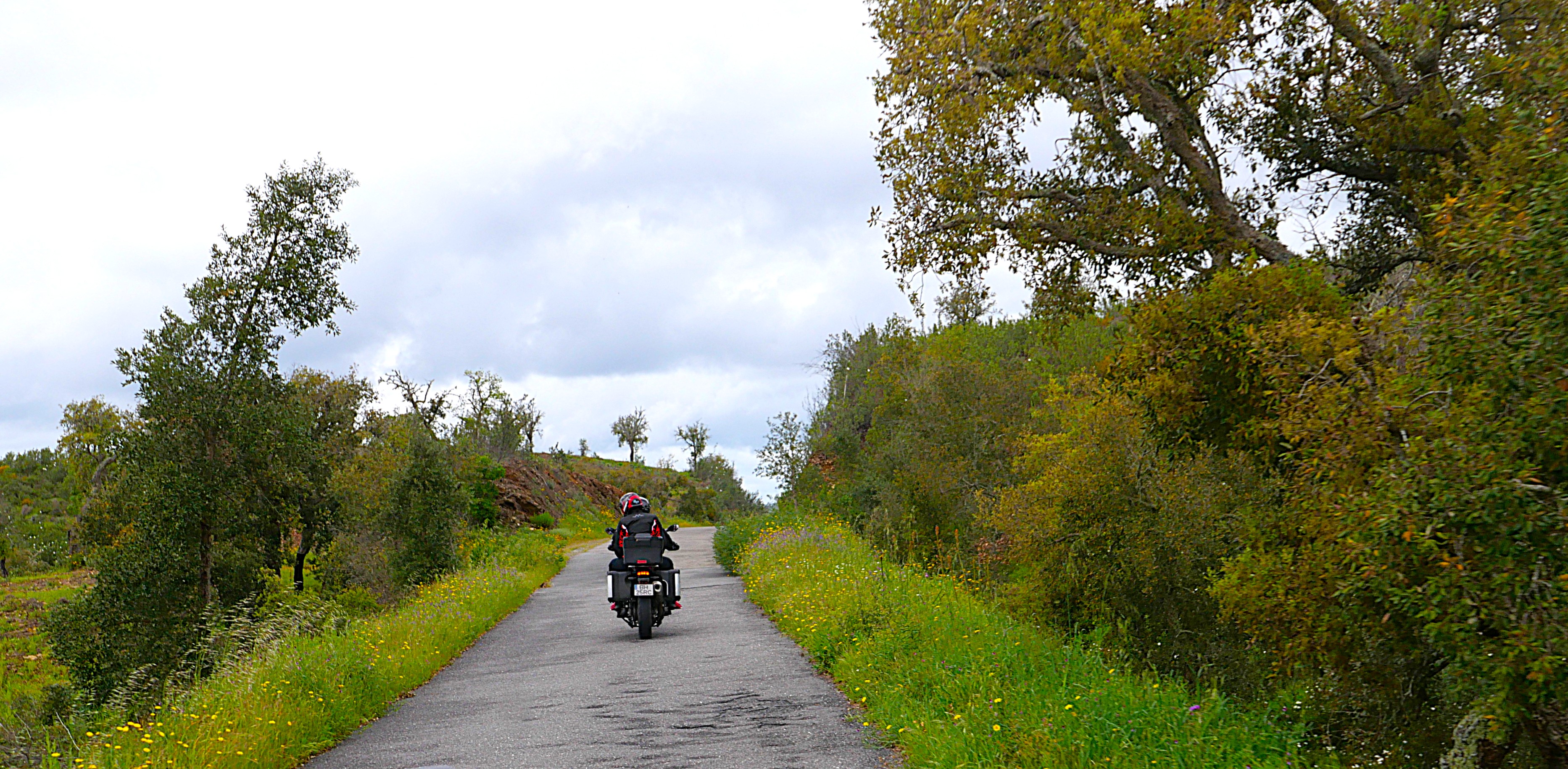
NM 150 curves and twists through canyons about 15 miles from Taos to the ski area, making for a fun and beautiful morning ride.


Back in Taos, we rode north on NM 522, a straight road with long roller-coaster hills with long views toward the mountains. This section is part of the New Mexico Enchanted Circle Scenic Byway and the Old Spanish Trail northern route.


The Old Spanish Trail was a trade route connecting Taos, Sante Fe, and other northern New Mexico towns with southern California. The area was explored by the Spanish in the late 1500's, and then used by traders until the 1850's. It's a lot of fun on a motorcycle, and we can't imagine covering this high alpine, dry area on horseback.

We turned east in Questa on NM 38 toward Red River, once more winding and curving through the mountains. 


Instead of continuing southeast and circling back to Taos on US 64 since we rode much of that route yesterday, we turned around at Red River, originally founded as a mining town and today home to a small ski area and lots of outdoor activities.


 As happens to us frequently on motorcycle trips, it was too early for lunch when we got back into Taos, and the 2 hour ride home offers no places to stop and eat. We settled for an energy bar and a bottle of water from a gas station and headed home on US 64 north. We crossed the Rio Grande River gorge, and then stopped at the beautiful rest area on the north side of the river.


The bridge was built in the 1960's and at 650' above the river, it's the second highest bridge on the US highway system (the highest is 700' over the Glade Creek in West Virginia) and the 5th highest bridge in the United States. This area is also part of the Rio Grande del Norte National Monument. We walked a short way from the rest area to look out over the gorge and the river below.


We were glad it was sunny with just a few clouds as a colder Fall wind picked up as we continued north on US 64 toward home. This is a very low traffic road that climbs over 10,000' in the Sangre de Cristos range of the Rocky Mountains. 


As we continued toward Chama, NM we had wonderful views of the Brazos Cliffs that tower over 11,000'.


Chama is only about 25 miles south of our home in southwestern Colorado, and as we got closer to home I was able to take a photo of the view we see from our windows: V Rock, Navajo Peaks and Banded Peaks.


We enjoy long motorcycle trips where the days develop a rhythm and we see something new around every turn, and yet these short, 2-day trips near home give us a welcome break from work and daily life plus the opportunity to experience more of the area where we live. We're already planning our next trip!


Monday, September 22, 2025

2-day trip into New Mexico

 We're on our first day of a quick, 2-day trip into New Mexico. We live only 2 miles north of New Mexico in southwestern Colorado, and decided to ride through the mountains in the Taos area, hoping to see some aspens starting to change colors.


Most of the trip we rode on US 64 heading southeast through the mountains, topping off at over 10,000' elevation where we saw our first aspens changing into their Fall, bright cold colors.

This is such a fun ride - twisting, winding, climbing 2-lane paved highway with almost no traffic. We rode through the Kit Carson National Forest which covers 1.5 million acres in northern New Mexico with parts of the Sangre de Cristo and San Juan Mountains and the San Juan Basin.


US 64 goes past the Taos Earthships, 600 acres of off-the-grid homes built into the earth that use solar, wind, recycled water, old tires, car batteries, glass bottles, and every type of technology available.


There is a circular route in the Taos area that winds through the Sangre de Cristo mountains, part of the Rocky Mountain range. We planned to ride part of the route each day, and today rode on US 64 East into Angel Fire, catching glimpses of colorful aspens along the way.


We stopped in Angel Fire, a small town at the base of a ski area east of Taos, for lunch and then continued south on NM 434 through a beautiful valley. Riding at about 8500' elevation, the mountains around us don't look very tall, but they're all over 10,000'.


The skies were cloudy and threatening rain all day, and as soon as we turned northwest onto NM 518 toward Taos, we stopped to put on rain gear. It was a great decision because about 5 minutes later it started to rain, and rained the next hour until we got to our hotel in Taos. The temperature dropped to 48 degrees at the highest elevation but we were prepared.

Tomorrow we'll ride through more of the mountains in the Taos area before we head north and back home. The weather is promising sunny skies - a perfect motorcycle day.


Sunday, August 3, 2025

Heading home from weekend Colorado trip

 After rain and dark, cloudy skies the past two days, today is clear and sunny with bright blue skies as we ride about 3 hours home from Salida.

Much of our ride is through the San Luis Valley, the largest alpine valley in the world at about 150 miles long and 75 miles wide. Usually we can see mountains all around us, but today the skies are hazy due to many wildfires in the West.


This is a big agricultural area known for hay, potatoes, carrots, lettuce and also ranching. Without irrigation, the area is arid with not much growing naturally.


Still in the San Luis Valley, we turned west onto US 160 from US 285 in Del Norte. We wound up Wolf Creek Pass, at 10,856' along the Continental Divide. Road construction crews have been paving the Pass all summer, and today we enjoyed riding on new asphalt without the usual bumps and cracks.


We've ridden this Pass numerous times yet have never stopped at the scenic overlook on the west side of the Pass that overlooks the San Juan River flowing into Pagosa Springs - today we stopped, looking down about 3000' to the valley below.


Before we left Salida we talked with a group of four motorcycle riders from Minnesota on their first time riding in the Rocky Mountains. We live in the Rockies and every time we jump on the BMW, we're thankful to ride in this gorgeous part of the country.  A weekend trip reminds us why we choose to live here.


Saturday, August 2, 2025

weekend trip in Colorado

 We decided to take advantage of a quiet weekend and head out on the BMW, staying in Salida for two nights. Yesterday we rode 3 hours from home to Salida and unfortunately it rained about half of the trip. That's why we have rain gear!

overcast skies along US 285 North in the San Luis Valley 

It stopped raining before we arrived in Salida, a town of about 6,000 people on the Arkansas River in the heart of the Rocky Mountains. We walked to Soulcraft Brewing for an early dinner, then enjoyed a root beer float (Mike) and chocolate malt (Lynn) from 50 Burger while we walked through town and along the paved Monarch Spur Trail that follows a section of the old Monarch Spur railroad. As we were walking down the lovely, shaded streets we passed a couple of deer, one a big 6-point buck, lounging in the front yards, not at all concerned about people walking less than 3' away from them. Salida is a friendly town where everyone says hello as they walk by.

This morning we rode from Salida to the top of Independence Pass between Twin Lakes and Aspen. Independence Pass tops out at 12,095' at the Continental Divide and is the second highest paved pass in Colorado (the highest is Cottonwood Pass at 12,116'). 

Twin Lakes


Thunder clouds started forming so we turned around before we reached Aspen and stopped in Twin Lakes for lunch.


Twin Lakes is an old mining town located right on the glacial-formed lakes at the base of Mt. Elbert, the highest mountain in Colorado and the second highest in the US (highest is Denali in Alaska) at 14,433'.


We then rode CO24 to Leadville, at 10,119' the highest incorporated town in the US. Founded during the gold rush, then mined for silver, in the late 1800's it was home to 30,000 people. The skies were overcast and it rained off and on, so we only stopped for ice cream then rode back to Salida.

We love riding on twisting, climbing mountain roads that often have a sheer drop-off with no guardrails, and had a wonderful time on today's high elevation trip in the Rocky Mountains close to home.

Friday, April 18, 2025

last day of Portugal/Spain motorcycle trip - Atlantic Ocean and more!

 It rained overnight, but the skies were starting to clear when we lift our beachfront hotel in Vila Nova de Milefontes. There was a group of hikers and another group of cyclists also heading out for the day as we loaded up the bikes for the last time.


The first two hours we road through small coastal villages to the end of the Troia Penninsula where we caught the ferry.


The Troia peninsula is basically a sandbar about 15 miles long and not quite 1 mile wide, and much of the area is a protected nature preserve.


Unfortunately, when we got closer to the ferry terminal it started to rain so we couldn't see much of anything during the short crossing to Setubal on the other side of the estuary.


We went from the quiet of the Troia peninsula to the busy city of Setubal where we stopped at the Livramento Market, a large indoor marketplace primarily dedicated to selling fresh seafood, but there are also rows of fresh fruit and vegetables, pastries, breads, and cheeses. There has been a market here for over 100 years and it's a lively place.

The rain stopped by the time we left Setubal and we rode through very hilly terrain with tight, twisting and curving roads in the Arrabida Natural Park with amazing ocean views from high above sea level.


We stopped at a viewpoint to look back out over the Troia peninsula before the fog and rain set in again as we continued to climb in elevation.


Periodically the fog would lift and we could see Lisbon off in the distance.


We curved our way down through the hills and then finished up the last few miles in the metropolitan Lisbon area, crossing the 25th of April bridge named for the 1974 revolution that led to the Portuguese democracy.


We've only been away from Lisbon for 10 days, and having spent 4 days in the city before meeting up with the motorcycle tour group, it felt familiar as we rode into the city. as we saw the Christ the King statue, picked out the arches and monuments in the old city, and looked down on the docks where we took a dolphin watching tour.


We'll spend tonight celebrating an amazing motorcycle tour through Portugal and Spain with the rest of our tour group and then fly home tomorrow. Spending time in Europe, visiting historic areas, trying local foods, attempting to say even a few words of the languages, and getting to know the other members of the group is a lot of fun and a wonderful opportunity that we cherish.

Thursday, April 17, 2025

Day 10 Portugal/Spain motorcycle trip: from Aracena Spain to Vila de Nova Milefontes Portugal

 We left Aracena Spain under heavy fog/rain wearing full raingear. It was another chilly morning with the temperature when we left at 52 degrees Fahrenheit, but within about 45 minutes the fog started to lift and we saw some sunshine.


We saw hundreds of cork trees on the first day of our ride, and started seeing cork trees again today with the distinctive removed bark on the bottom portion of the trees.


We rode today primarily on the narrow, twisty, curving roads we're getting used to, first riding through rolling hills sometimes dotted with open fields with brilliant colors.


The border crossing from Spain into Portugal is as uneventful as crossing from Colorado into New Mexico; there's a sign and nothing else since both countries as part of the EU.


One thing we did notice once back into Portugal was that the roads were even narrower and less maintained.


We stopped in the hillside fortress town of Mertola, located at the confluence of two rivers.


It's famous for Phoenician and Carthaginian ships sailing upriver from the nearby Atlantic Ocean to transport fruit and locally-mined minerals to Europe and North Africa. Later the Romans and Muslims ruled over this area, and the fortress castle was built in 1292 after the Christians retook this area. We enjoyed sitting close to the fortress wall with views of the river for a morning snack, and since we're back in Portugal couldn't resist the famous - and delicious - pastel de Nata custard tarts.

Back on the road we turned onto even narrower roads, at times no wider than an average driveway at home.


The landscape became quite steep; not quite mountains, but definitely more than rolling hills. We saw sheep, goats, horses, cows, pigs and once a Portuguese wildcat ran across the road in front of us. Just before the wildcat ran across the road we saw warning signs, similar to deer crossing warning signs.


We're staying tonight in Vila de Nova Milefontes right on the Atlantic coast at the mouth of the Mira River.


Just before sunset we walked out to the lighthouse which has gorgeous views back to the town.


We also watched big waves rolling in - no wonder this area is known for surfing.


We ended the day eating dinner at a restaurant on the beach, watching the sun set. Tomorrow is our last day of the motorcycle tour, riding into Lisbon and then flying home the next day.