Saturday, June 12, 2021

Last day of our 2-week, 2800 mile motorcycle trip through Arizona, New Mexico, Colorado, South Dakota and Wyoming

 The last day of a long motorcycle trip is bittersweet. The days fall into a rhythm: wake up, go for a walk or run, eat breakfast, pack up the bike, ride, unpack, eat, sleep. Repeat. With a small amount of baggage space on the BMW, and needing to carry raingear and cold weather gear, we're limited to just the essentials and basically one or two changes of clothing. Life is simple and we get to either explore new parts of the country or revisit favorite roads. Yet home beckons, even though the first couple of days home are filled with laundry, running errands, and catching up on work.


We started our day in Flagstaff, about 100 miles from our home in Prescott, AZ. We've ridden these roads more times than we remember, yet I'm still taken by the high desert beauty. Flagstaff is at about 7000' elevation with tall, green pine trees and tall mountains. We drop down to about 5500' elevation in Prescott, riding through dry grassland and desert scrub bushes. We watched a couple of trains heading to or from Flagstaff as we rode west along I-40, reminding us of the trains we saw in Wyoming earlier on this trip.

When we turned south on US 89 outside Ash Fork, we knew we were about 1 hour from home.


This is the driest time of year in a part of the country that typically gets only about 16" of rain per year. However, we're in the midst of a deep drought, with only .5 inches of precipitation since October 2020; normal would be 3.6". We left Flagstaff at 8am to beat the heat, and met our goal by arriving home just about 10am to 83 degree temperatures.

Riding 2800 miles over 2 weeks seems like a lot, but break it down into daily rides typically averaging around 5-6 hours and it seems like we could almost continue riding without a break. Home and work calls, but we're already dreaming about our next trip on the BMW.


Friday, June 11, 2021

376 miles on two roads from Colorado to Arizona

 Our route today was simple:  US 160 West from Pagosa Springs, Colorado to US 89 South to Flagstaff, Arizona. We started out at 8am with temperatures in the mid-50's and ended the day pushing 90 degrees. 160 West took us past Chimney Rock National Monument between Pagosa Springs and Durango.


An archaeological site that preserves hundreds of ruins from the Ancestral Puebloans who lived here over 1000 years ago, Chimney Rock is in the San Juan National Forest. Not far down the road we passed Mesa Verde, another site where the Ancestral Puebloans lived for over 700 years, building cliff dwellings that exist today. We celebrated as our odometer rolled over to 32,000 miles. 


In Durango, US 160 becomes the San Juan Skyway, twisting 236 miles through the San Juan Mountains of southwestern Colorado. We were only on this route for a few miles, continuing on 160 West while the scenic skyway turns off onto CO 184.


We rode through Cortez, just outside the Ute Mountain Tribal Park. The park is currently closed due to COVID, but we rode past Sleeping Ute Mountain. According to legend, the mountain is the sleeping Great Warrior God who battled evil, was hurt, and lay down falling into a deep sleep.


Until Cortez the scenery was green - irrigated fields of grass and hay and dark green pine trees on the mountain sides. Continuing west past Cortez brown is the dominant color as the desert takes over.


US 160 goes past the Four Corners Monument, the only place where four states meet: Colorado, New Mexico, Arizona and Utah. This is another casualty of COVID, closed by the Navajo Nation to minimize the spread of the disease. We saw several groups of horses today as we rode through the vast  Navajo Nation, and I wondered how they manage to survive on the scarce brown grass. The 2-lane paved highway stretches straight through the desert, only occasionally sweeping in wide turns.


We stopped in Kayenta for lunch at Subway, repeating our lunch stop the first day of our trip almost 2 weeks ago when we rode east on US 160. There aren't many places to stop and eat on the Navajo Nation so we made sure to take advantage of places we know are open. After lunch we continued west on US 160, riding through flat areas that stretched out to hazy cliffs in the far distance that alternated with high rock cliffs and craggy canyons.


We turned south on US 89 with long-distance views of the San Francisco Peaks in Flagstaff, AZ, in front of us.


The temperature climbed and hovered around 90 degrees even as we climbed in elevation to about 7000' in Flagstaff. After 7 hours of travel today, we were ready for an air conditioned hotel room and an early dinner followed by a walk around busy downtown Flagstaff. Tomorrow we head home, finishing our 2-week trip through the Southwest.


Wednesday, June 9, 2021

Twisting, sweeping turns through the Rocky Mountains

 We started this morning wandering around Glenwood Springs, Colorado, trying to find CO 82 East. We'd see a sign, get turned around, take a wrong turn on the extremely confusing roundabout, and finally stopped and asked directions. It was worth it, because CO 82 East heads directly toward 12,965' Mt. Sopris in the Elk Mountain Range of the Rockies just outside Glenwood Springs. 


The day just kept getting better as we turned south on CO 133, riding along the fast-moving White River on the West Elk Scenic Byway


The road climbs up 8% grades to McClure Pass, winding to the 8755' summit then twisting down the other side.


Like many of the mountain passes in Colorado, the Ute Native Americans were the first to traverse this area, followed by the Spanish in the late 1700's. It's difficult to comprehend how miners and ranchers drove their wagons up the steep grades when this was a rutted dirt road. 


CO 133 winds through Paonia, named for numerous peonies in the area (evidently the early settlers didn't know how to spell), and now home to farms, orchards, and wineries.


Staying on the Elk Loop Scenic Byway, we picked up CO 92 East, continuing through green ranches until the road started climbing, twisting, and turning in the Curecanti National Recreation Area


Steep cliffs drop down to the Gunnison River and reservoirs formed by three different dams and hairpin turns lined with wildflowers and aspens snake through the mountains.


We turned east on US 50, passing by the Blue Mesa Reservoir, then turned south on Colorado 149.


CO 149 from Blue Mesa Reservoir to South Fork through the San Juan Mountains was named the Silver Thread Scenic Byway in 1990.


We stopped in Lake City, incorporated as a silver mining town in 1875, for lunch at the Lake City Cafe, a superb restaurant in a gorgeous setting. Although home to only about 450 residents, it's a busy tourist center with over 400 buildings listed on the National Register of Historic Places.


After lunch we continued south on CO 149, twisting our way up to Slumgullion Pass at 11,530'.


With grades up to 9%, this is one of the steepest paved maintained roads in Colorado. This area is part of the Slumgullion Earthflow National Natural Landmark where about 700 years ago a large chunk of decomposing volcanic rock slid down the mountain to form a natural earth dam that blocked the Lake Fork of the Gunnison River and formed Lake San Cristobal (the lake that gives Lake City its name). 


CO 149 took us through Creede where two major rivers start:  the San Juan and the Rio Grande.


CO 149 ends at US 160, and is also the end of the Silver Thread Scenic Byway. We headed west on US 160 to Wolf Creek Pass and the Continental Divide. Traffic came to a halt right at the top of the Pass due to a truck pulling a camper that caught fire. We got off the motorcycle, walked around, and read the signs about the Pass at 10,857' for about 25 minutes before we were able to continue down the mountain.


We rode 307 miles today, almost exclusively on scenic byways through some of the most beautiful areas of Colorado. We're stopping for the night in Pagosa Springs at 7,126' above sea level in the San Juan Basin. 


At Hermit's Rest in the Curecanti National Recreation Area


Tuesday, June 8, 2021

A windy day through Wyoming into Colorado

 We left Casper, Wyoming early this morning, hoping to beat any late afternoon thunderstorms. 


After a few short miles on I-25, we turned west onto Wyoming 220, riding along the North Platte River. We enjoyed seeing water, green hills, and even mountains after yesterday's flat trip through the grasslands.


There are 7 dams along the North Platte River which which starts in Colorado, flows through Wyoming, and ends up in Nebraska where it joins the South Platte to form the Platte River. We rode past several of the reservoirs formed by the dams, designed to promote agriculture in this semi-arid region of the West.


We rode for miles along the Pathfinder Ranch, originally established in 1964 and today part of a group of professionally managed historic ranches. This is wide open countryside bordered by mountains on both sides.


We turned south on US 287 in Muddy Gap Junction, crossing the Continental Divide the first of four times during today's trip. In Rawlins we turned west on I-80 for a few miles to Creston Junction where we picked up Wyoming 789 South through the Red River Desert Basin


We saw the first glimpses of the snowy peaks of the Rocky Mountains as we sped south.


Just south of Baggs, WY we crossed into Colorado and the road is now CO 13. Every day we are stopped by road construction and today we rode approximately 5 miles on a hard-packed dirt section of the highway that was being repaired. Our route took us through Craig, CO home to three large coal-powered power plants.


The beginning of today's ride was along straight roads, and finally we were making wide, sweeping turns through the mountains. The wind was even stronger with more gusts as we rode south through Meeker, and then turned east on I-70 in Rifle where we rode along the Colorado River into Glenwood Springs.


We rode 357 miles today on ruler-straight roads through dry grasslands and then on curving, twisting roads into the Rocky Mountains. Tomorrow we continue south through Colorado, and we're looking forward to high mountain passes and twisting roads.


Monday, June 7, 2021

Black Hills, Thunder Basin National Grasslands and more

 We're back on the road today after a long weekend outside Deadwood, SD. Our route took us southwest on US 85 on winding roads with sweeping turns through the Black Hills National Forest


We crossed over into Wyoming and in Newcastle turned west on US 16 and rode out of the Black Hills. We followed train tracks for a few miles, and Mike was excited when the engineer blew the train whistle as the long train of coal cars rumbled past. Wyoming is the nation's top coal producer, and our route took us through the Powder River Basin where the top 10 producing coal mines are located. 

Just before lunch the odometer rolled over to 31,000 miles which mean we've ridden about 1300 miles so far on this trip. We were lucky today with our lunch stop - Remy's Diner in Upton, Wyoming. The owner told us today is the 21st anniversary of her business that features homemade foods, and we enjoyed fabulous chocolate malts along with our sandwiches in a friendly, inviting atmosphere. Don't miss it!


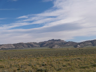
We turned west onto Wyoming 116 after looking at the map during lunch and realizing we missed our planned turn a few miles back. WY 116 took us through Thunder Basin National Grassland. The highway stretched straight out in front of us as far as we could see, occasionally taking a wide sweeping turn.


We saw cows, sheep, and plenty of deer but very few vehicles or houses.


WY 116 took us to WY 450 which was our original planned route. Listed on the Butler motorcycle map as a lost highway, or a road that has faded center lines and long miles without signs of people that make them seem lost in time. This is a semi-arid climate with few trees, and we could imagine settlers traveling west in covered wagons.


We felt lost in time until we passed huge coal mines and saw more trains ferrying cars of coal east. We took a quick jog for 3 miles on WY 59N and then turned west onto WY 387, passing a couple of small towns that support the coal and oil industry in this area. The Bozeman Trail, named after John Bozeman who established this route in the 1860's to connect the gold rush territory of southern Montana with the Oregon Trail in eastern Wyoming, crosses the highway and made us think of the vast difference between those early pioneers and us zooming down the highway on our BMW.


We picked up I-25 south for about 40 quick miles with the speed limit posted at 80 mph and unlike most interstates, very little traffic. Our stop for tonight is Casper, Wyoming, the second largest city in Wyoming with a long history of oil and cowboy culture. It was 93 degrees when we stopped late in the afternoon, glad to take advantage of air conditioning before we continue our ride tomorrow into Colorado.


Sunday, June 6, 2021

Denver to Whitewood, South Dakota

 We left Denver first thing in the morning and decided to ride north on I-25 past Cheyenne, WY since we had a long way to go and it was a hot day. I spent my time looking west to the Front Range of the Rockies while Mike navigated the traffic.


When we crossed into Wyoming the mountains disappeared, replaced by green prairies as far as we could see.


This wide-open country is known for strong winds and fierce winter storms. Luckily today we had neither, but we did see miles of snow fencing.


As we continued north, the landscape changed to rocky cliffs and hills covered with trees in this southwestern corner of the Black Hills. The Black Hills National Forest covers 1.2 million acres with only 10% in Wyoming and the rest in South Dakota. The Black Hills got their name from the dense ponderosa pines that look black from a distance, and we enjoyed the change in scenery as well as the sweeping highway turns through the area.


We're staying at a VRBO in Whitewood, SD for the weekend with our sons, their girlfriends, and dogs where we sit outside on the porch and watch the wildlife in the fields. We're back on the road Monday, continuing our trip west into Wyoming - and more hot weather.